Stories
Long-reads about the places, people, and history that make the American West worth driving across.
Each pin marks where a story takes place — tap one to read it.
Featured

The Poison Road
How the CCC built the most dangerous road in southern Utah in a single summer, and why it took seven more years before Boulder finally stopped getting its mail by mule.
In 1933, the people of Boulder and Escalante petitioned President Roosevelt for a road. They had been waiting for fifty years — Boulder was the last town in the continental United States to get its mail by mule. The Civilian Conservation Corps built the road in a single summer, across a 9,200-foot ridge and a 1,500-foot chasm, on terrain so dangerous the workers nicknamed it the Poison Road. It was an engineering miracle. It also wasn't enough. Boulder still got its mail by mule for seven more winters.

The Restaurant at the End of the Road
Hell's Backbone Grill opened in 1999 in Boulder, Utah, with three thousand dollars and a year of free rent. By every reasonable accounting of how restaurants work, it should have closed inside two years. Instead it built a farm, helped mount a legal challenge to the largest reduction of federal land protection in U.S. history, and in 2025 bought the lodge it had been renting since the start.
How a James Beard–nominated farm-to-table restaurant came to exist in a town of 250 people, four hours from any city — and what kept it there for twenty-six years.
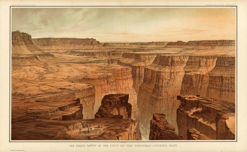
The Staircase You Can Drive
Most geology happens vertically and out of reach. Along Utah Highway 12, the entire 270-million-year stack tilts sideways into the windshield.
The Grand Staircase is the deepest readable record of geological time anywhere on the continent — and the only place you can climb it in a car. Highway 12 cuts through every layer, from 50-million-year-old pink limestone to a volcanic plateau capped by an Ice Age ice sheet.
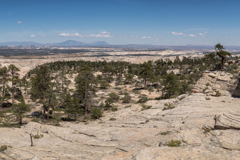
The Last Mule Mail Town in America
How Boulder, Utah went from the most isolated settlement in the lower 48 to one stop on the most beautiful drive in America — and stayed, somehow, mostly itself.
Until 1939, you could not drive to Boulder, Utah. Until 1985, you could not drive to it from the north without crossing a stretch of dirt road that local ranchers had carved over the spine of a 9,000-foot mountain. For most of the twentieth century, this small ranching settlement on the eastern flank of the Aquarius Plateau was the last town in the continental United States to receive its mail by mule pack train. It still claims that distinction today.
More Stories

The Wolves Came Back
The government spent half a century killing every wolf in the Southwest. Since 1998 it has been putting the Mexican wolf back, and the Gila country of New Mexico is now the heart of its range.
How the Mexican wolf was wiped out in the Southwest, bred back from a handful of survivors, and returned to the Gila country, where it lives uneasily beside ranchers.
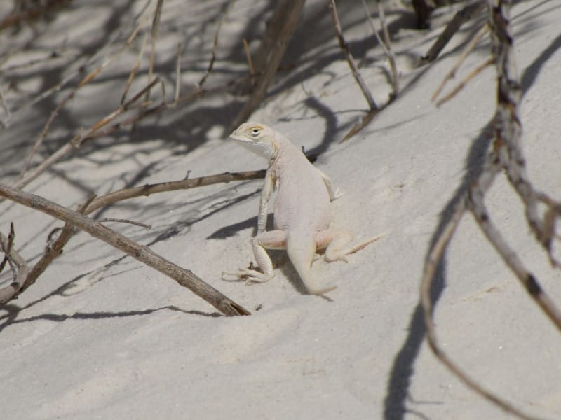
The Lizards That Turned White
Three kinds of lizard that are brown or gray in the desert around White Sands have gone white on the gypsum dunes in a few thousand years, each by a different change to the same gene.
How three lizard species evolved white forms on the young gypsum dunes of White Sands, each through a different mutation in the same pigment gene.

The Cave Beneath the Cave
For decades Lechuguilla was a dead-end hole in the backcountry of Carlsbad Caverns National Park. Cavers heard wind coming up through its rubble floor, dug, and in 1986 broke into one of the deepest and strangest caves in the world.
How cavers broke into Lechuguilla Cave in 1986, what sulfuric acid built there, and why its sealed-off microbes interest medical researchers.

The Traders of the Staked Plain
For nearly a century after a 1786 peace, New Mexican traders called Comancheros carried bread and cloth onto the Llano Estacado and came home with horses, hides, stolen Texas cattle and captive people.
The Comancheros: New Mexican traders who did business with the Comanche on the Llano Estacado from 1786 until the army broke the trade in 1874.
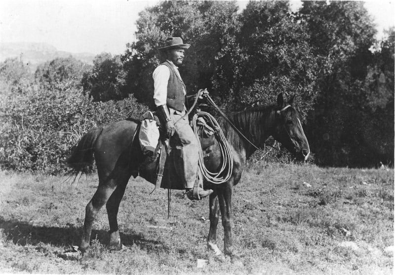
The Cowboy Who Found the Ice Age
After a flood in 1908, George McJunkin, a ranch foreman born into slavery, found giant bison bones in an arroyo near Folsom. The discovery proved people had lived in North America in the Ice Age. The scientists who published it left out his name.
How George McJunkin, a Black ranch foreman, found the Folsom bison bones in 1908, and how the 1927 dig there rewrote the human history of the Americas.
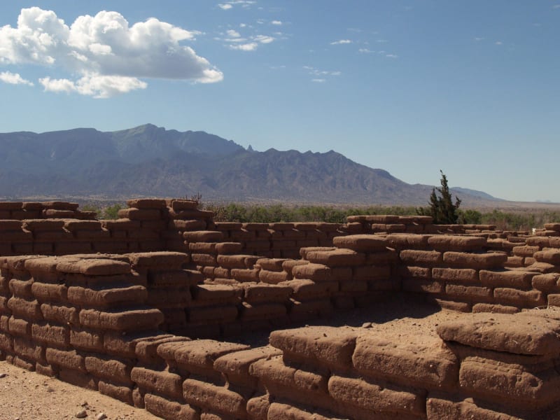
The War of the Tiwa Towns
In the winter of 1540 Coronado's army took over a Tiwa town on the Rio Grande, stripped its neighbors of food and fuel, and answered their resistance with fire. It was the first named war between Europeans and Native people in what is now the United States.
How Coronado's expedition wintered among the Tiwa towns of Tiguex in 1540 and made war on them, from the burning at Arenal to the siege of Moho.
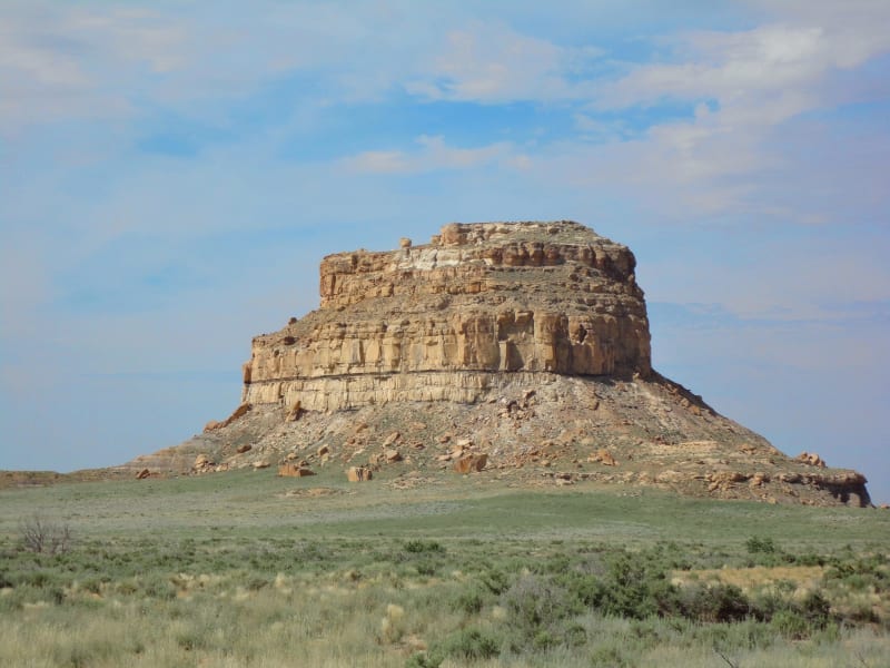
The Spiral Behind the Slabs
Near the top of Fajada Butte in Chaco Canyon, sunlight slipping between three sandstone slabs once marked the solstices on a carved spiral. Visitors' feet helped knock it out of true.
The Sun Dagger on Fajada Butte: how an artist found Chaco's solar marker in 1977, what is still argued about it, and why no one may climb the butte today.

The Lake They Would Not Sell
In 1906 the federal government made Taos Pueblo's sacred Blue Lake part of a national forest. The pueblo refused every offer of money and spent sixty-four years getting the land itself back.
How Taos Pueblo refused compensation for Blue Lake and won back 48,000 acres in 1970, the first time Congress returned land rather than money.
The Sun on the Flag
New Mexico's flag, license plates and highway signs carry a sun symbol taken from a pot made at Zia Pueblo. Nobody asked Zia, and the pueblo has spent decades asking the state to say so.
How a sacred sun symbol from Zia Pueblo became New Mexico's emblem in 1925 without the pueblo's permission, and what Zia has asked for since.
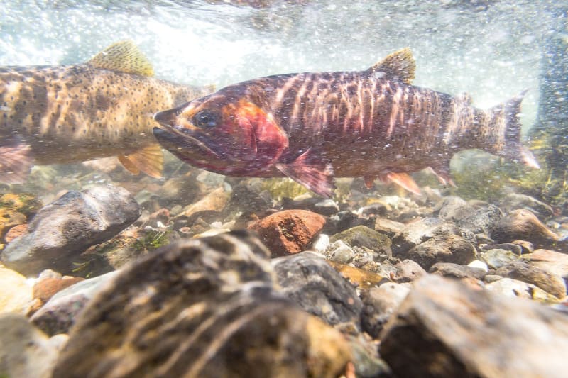
The Fish in the Wrong Lake
Someone moved lake trout into Yellowstone Lake in the 1980s, and they nearly ate out the native cutthroat that bears, ospreys and otters depended on. Three decades of gillnetting are bringing the cutthroat back.
Lake trout stocked in Lewis Lake in 1890 were moved into Yellowstone Lake in the 1980s and nearly wiped out its native cutthroat, taking the lake's ospreys with them. Millions of lake trout gillnetted since 1994 are bringing the cutthroat back.

Polo at the Foot of the Bighorns
British ranchers brought polo to Big Horn in the 1890s, then sold Wyoming horses to the British Army by the tens of thousands. On summer Sundays the game is still played under the Bighorn Mountains, free to watch.
The Moncreiffe brothers and Oliver Wallop brought polo to Big Horn in the 1890s and sold at least 20,000 Wyoming horses to the British Army for the Boer War. The game they started is still played on summer Sundays below the Bighorns.

The Bone Rush at Como Bluff
Two railroad men found giant bones weathering out of a ridge beside the Union Pacific in 1877. Como Bluff became the richest dinosaur ground yet known and the main battlefield of Marsh and Cope's Bone Wars.
In 1877 two Union Pacific men at Como Station wrote to Yale about giant bones in the bluff, and Como Bluff became the main battlefield of Marsh and Cope's Bone Wars. Its quarries gave the world Brontosaurus, and its bones built a roadside cabin.

The Ice Above Dinwoody Creek
The Wind River Range holds the largest glaciers in the American Rockies, and their melt runs down through the Wind River Reservation in late summer, when little else does. Every measurement for seventy years says they are shrinking.
Gannett and Dinwoody glaciers feed more of one stream than any other ice in the lower forty-eight, and their melt runs through the Wind River Reservation in late summer. Studies since the 1950s have measured them thinning and shrinking, faster since 2000.

The Tower in the Mashed Potatoes
In 1977 Close Encounters of the Third Kind made Devils Tower the place where people met visitors from the stars. Visitation nearly doubled, and the monolith has carried a second identity ever since.
Steven Spielberg filmed the climax of Close Encounters of the Third Kind at Devils Tower in 1976, and visitation jumped by about three-quarters after the film opened. The tower the movie made famous was already a sacred place to the Plains nations.

The Dry Lake Under Green River
Beneath the sagebrush west of Green River lie forty-two beds of trona, left by a lake that dried out again and again fifty million years ago. A wildcat oil well found them by accident, and they now supply most of the nation's soda ash.
An Eocene lake that dried out again and again left the world's largest trona deposit under the Green River Basin. A 1938 oil test found it by accident, and Wyoming now produces most of the nation's soda ash, the raw stuff of glass.

The Real Colter's Hell
Most people think Colter's Hell is Yellowstone. The trappers' Colter's Hell is a warm, sulfurous stretch of the Shoshone River just west of Cody, and it was never the geyser field its own marker describes.
Fur trappers named a hot, sulfurous stretch of the Shoshone River west of Cody for John Colter. A historian moved the name to Yellowstone in 1895, and the springs that stayed behind were never the geysers their marker claims.

The Argument at the Top of the Grand
Two survey men said they reached the summit of the Grand Teton in 1872. A Laramie surveyor said they had not, climbed it himself in 1898, and spent thirty years making the state agree.
The Grand Teton's first ascent has been disputed since 1898, when William Owen claimed it and challenged the 1872 Hayden survey climb. A 1929 legislative resolution, a vanished summit plaque and an Army surgeon's suppressed letter have not settled it.

The Rock That Named a Scandal
A sandstone knob north of Casper gave its name to an oil reserve set aside for the Navy, and the reserve gave its name to the worst federal scandal of the 1920s.
Teapot Rock gave its name to a naval oil reserve north of Casper, and in 1922 Interior Secretary Albert Fall leased it to Harry Sinclair without bidding. The bribes behind the lease sent a Cabinet officer to prison for the first time and left the name on a decade.

The Last of the Buffalo Outfit
In 1886 the Smithsonian sent its chief taxidermist to eastern Montana to shoot some of the last wild bison before there were none. He came home a conservationist, and the six he mounted are back in Montana.
William Hornaday went to the country north of Miles City in 1886 to collect bison for the National Museum and found almost none left. The twenty-five his outfit killed made a celebrated exhibit, and its six mounts, scattered across Montana in the 1950s, now stand together at Fort Benton.
The Fair That Became a Homecoming
Crow Fair began in 1904 as an Indian agent's scheme to turn the Apsáalooke into farmers. The Crow made it their own, and every August as many as 1,500 tipis go up along the Little Bighorn.
An agricultural fair meant to sell farming to the Crow became, within a few years, the place the Apsáalooke danced, raced and paraded on their own terms. More than a century later Crow Fair is one of the great homecomings of the northern plains, the self-styled tipi capital of the world.

The Sweet Pine Hills
Three buttes rise out of the wheat just south of the Canadian line. The nations of the northern plains have fasted on them for generations; in the 1990s they kept a gold mine off them.
The Sweet Grass Hills are an island range in a sea of prairie, sacred to the Blackfeet and their neighbors and taken from them in 1888. When a mining company came for their gold in 1992, the tribes' fight ended with the federal government closing them to mining for forty years.

Waiting for a Chinook
In the winter of 1886-87 a young cowhand answered a rancher's letter with a watercolor of a starving steer. The warm wind it waited for still pours off the Front, and it has set temperature records no other place has matched.
Charlie Russell made his name with a postcard-sized painting of a steer dying in the snow, waiting for the chinook that would save it. On the plains below the Rockies that wind can raise the temperature a hundred degrees in a day; in 1972, at Loma, it did.

The Herd at the North Gate
Every winter Yellowstone's bison walk down the valley to Gardiner, and Montana's cattle law meets them at the park line. A quarantine program now sends some of them on to the Fort Peck Reservation instead of to slaughter.
Yellowstone's bison are the herd the nation nearly lost, and when deep snow pushes them out of the park at Gardiner, they become a problem for Montana's cattle country. Since 2019 hundreds have gone through quarantine at Stephens Creek and on to the Assiniboine and Sioux at Fort Peck.

Others Take Notice
In the summer of 1917 an IWW organizer on crutches came to Butte to back the miners' strike. Two weeks later six masked men hanged him from a railroad trestle. No one was ever charged.
Frank Little arrived in Butte on July 18, 1917, as the miners struck after the Speculator fire. Before dawn on August 1 he was dragged from his boardinghouse and lynched, with the old vigilante numbers pinned to his body. Within months Montana had written the sedition law the nation copied.

The Vote She Cast Twice
Jeannette Rankin of Missoula was the first woman elected to Congress, and the only member to vote against American entry into both world wars. Each vote ended a career; she cast both.
Raised on a ranch at Grant Creek outside Missoula, Jeannette Rankin went to Washington in 1917 as the first woman in Congress and voted against war four days later. Twenty-four years on, the day after Pearl Harbor, she was the only member of either house to vote no.

Two Bears, One Night
On August 13, 1967, two grizzlies killed two young women miles apart in Glacier National Park. Both bears had learned to look to people for food, and the park has managed bears differently ever since.
Glacier had never recorded a fatal grizzly attack until the early hours of August 13, 1967, when it recorded two. Garbage behind a mountain chalet and a bold bear at Trout Lake had been warnings no one acted on. What the park changed afterward is what every visitor meets today.
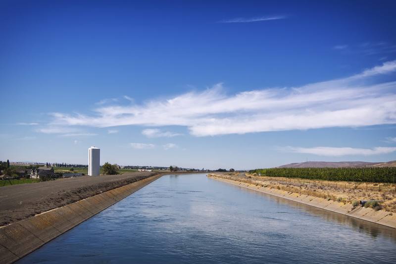
The Farm Built in a Day
To celebrate the first irrigation water from Grand Coulee in 1952, Moses Lake built a war veteran a farm in twenty-four hours, house, barn, crops and all. He sold it three years later.
On May 29, 1952, tens of thousands of people came to watch volunteers raise a seven-room house and plant sixty-three acres of sagebrush for Donald Dunn, a Kansas tank driver flooded off his land. The farm was a gift and a sales pitch for a project that never finished the job it promised.
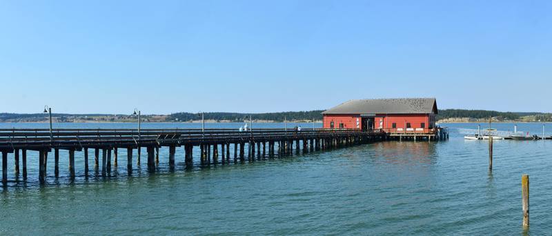
The Roundup at Penn Cove
In August 1970 a capture crew netted some eighty orcas in a Whidbey Island bay and took seven young ones to sell. The last of them died in a Miami tank in 2023, before the Lummi could bring her home.
All three pods of the Salish Sea's resident orcas were driven into Penn Cove on August 8, 1970. Five whales died and seven were sold. One of them, Tokitae, spent more than fifty years performing in Florida. The families she was taken from have never made up the loss.
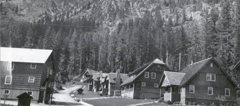
The Town Given Away by Letter
A copper town in a roadless valley above Lake Chelan closed in 1957 and was given to a Bible school because one student kept writing to the mining company. Then came the cleanup, the fires and the mudslides.
Holden was reached only by boat and a mountain road, and for two decades it mined copper on a scale no other Washington mine matched. In 1960 its owners gave the whole town away. The tailings it left took a half-billion-dollar cleanup, and in December 2025 the road washed out.
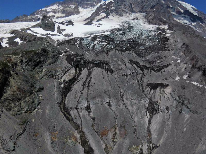
The Marines on South Tahoma
In December 1946 a Marine Corps transport vanished in a storm with thirty-two men aboard. A ranger found it the next summer, high on a glacier on Mount Rainier. The men are still there.
Six transports left San Diego for Seattle on December 10, 1946. Five came down safely. The sixth flew into Mount Rainier, and when it was found the following summer, the glacier made bringing the thirty-two Marines home too dangerous to try.
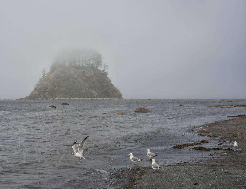
The Three Kichis
In 1834 three Japanese sailors came ashore near Cape Flattery after fourteen months adrift. The Hudson's Bay Company ransomed them and sent them around the world. Their own country fired on the ship that brought them home.
The Hojun Maru left Japan in 1832 on a coastal run of a few hundred miles and washed up on the Olympic coast fourteen months later with three of its fourteen men alive. Iwakichi, Kyukichi and Otokichi went from a Makah village to Fort Vancouver, London and Macao, and were never allowed home.
The Green Run
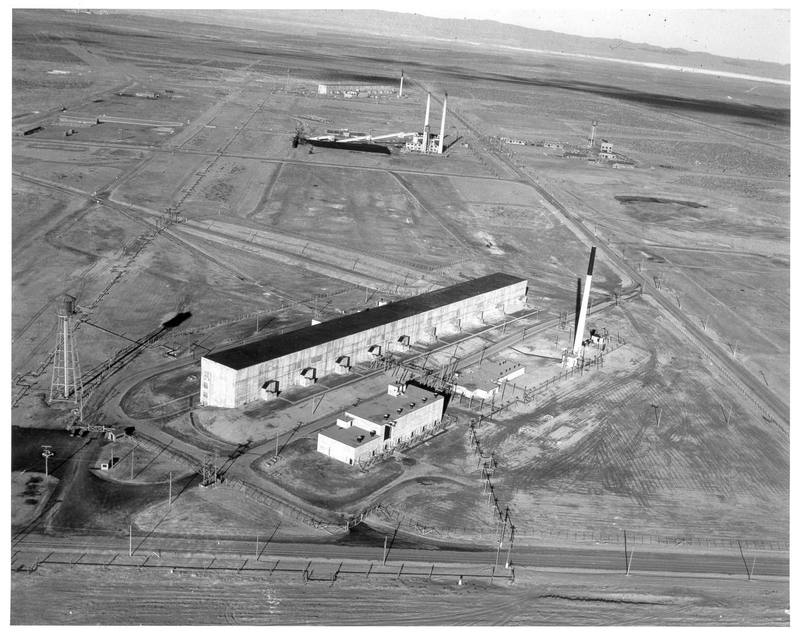
In December 1949 Hanford released a cloud of radioactive iodine over eastern Washington on purpose, to test how the Air Force might watch Soviet bomb plants. The people downwind learned of it in 1986.
On the night of December 2, 1949, Hanford processed uranium fuel only sixteen days out of the reactor and let roughly eight thousand curies of iodine-131 go up the stack, in weather that broke the conditions the plan had set. Nobody downwind was told for thirty-six years.
The Levee on Gravel
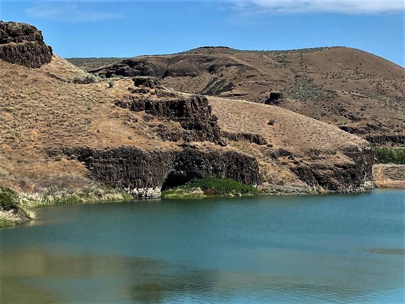
In 1968 a rockshelter above the Palouse River gave up the oldest human remains then known in the Americas, weeks before a reservoir was due to cover it. A president ordered a levee to save it. The levee stood on gravel.
At Marmes Rockshelter, where the Palouse meets the Snake, people sheltered, stored food and buried their dead for more than eleven thousand years. In 1968 a dig there made national news, and Lyndon Johnson ordered the Army Corps of Engineers to wall it off from the rising reservoir. In February 1969 the water came up through the ground.
The Spite Mounds
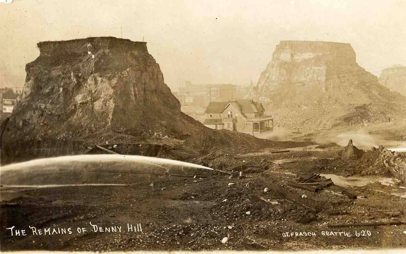
Seattle washed most of Denny Hill into Elliott Bay to make room for a downtown that did not come for half a century. The towers of dirt left standing on two lots became the regrade's most famous image, and its most misread.
Between 1897 and 1930 Seattle cut Denny Hill down by more than a hundred feet, sluicing and shoveling millions of cubic yards into Elliott Bay. Photographs of houses stranded on pillars of earth made the spite mounds famous. They were not spite.
The Soapbox on Stevens Street
In the winter of 1909 the Industrial Workers of the World set out to be arrested in Spokane, one speaker at a time, until the city gave in. More than five hundred went to jail in the first month.
On November 2, 1909, Wobblies began mounting a soapbox in downtown Spokane, each one arrested before he got past a sentence. They were fighting a ban on street speaking that the city's employment agencies had asked for. By March the jails were full, Elizabeth Gurley Flynn had published the jail's secrets, and Spokane surrendered.

The Water That Went Down
Three dams, one mountain, and a ridge line that decided all of them
Three men dammed the San Bernardino Mountains to water the orange groves below. What decided how each ended was not engineering but which way the water already ran, and a court ruling in 1913.

Fewer Than Thirty
In 1866 a state-sanctioned militia spent thirty-two days killing the Yuhaaviatam across the Big Bear country, and fewer than thirty of the clan came off the mountain alive — their kiika' brought those survivors down to the valley floor that was about to become the Citrus Belt, and in April 2025 their descendants took back the name the government had replaced.
Big Bear Valley was Yuhaaviatam country, the People of the Pines, a clan of the Maara'yam. In 1866 a militia raised in San Bernardino spent thirty-two days killing them, and twenty to thirty people survived. Their kiika' Paakuma took those survivors down to Warm Creek on the valley floor, and in 2025 the nation they became reclaimed its own name.

The Aqueduct Never Reached the City
Los Angeles spent twenty-three million dollars bringing Owens Valley water two hundred and thirty-three miles south, then delivered it to a valley that was not part of Los Angeles — and the men who had known the route in advance already owned that valley.
On November 5, 1913 the Los Angeles Aqueduct delivered Owens Valley water to a hillside in Sylmar that was not part of Los Angeles. The men who had known the route in advance already owned the valley around it, and federal law made annexation the only way anyone else could drink.
When Everyone Else Has Had a Turn
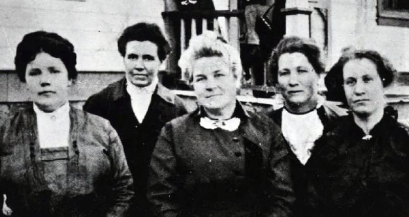
In 1911 the town of Kanab put five women on the ballot as a joke. They won, governed for two years, and the mayor signed every ordinance under a name that was not hers.
The plaque in Kanab calls them pioneer mothers who worked tirelessly for safety and sanitation. The record is harder: a joke ballot that came back serious, thirty-six children between five women, men who refused to pay their fines, opposition inside their own homes, and a mayor signing every ordinance under a false name because the federal government would have prosecuted her for who she was.

Where the Hill Went
Water cannons took a mountain apart at Malakoff Diggins and washed 1.5 billion cubic yards of the northern Sierra into the Yuba, the Feather and the Sacramento — and a hundred and forty years after the courts shut the practice down, the debris and the ten million pounds of mercury that went with it are still working their way downstream.
The pit at Malakoff Diggins is what everyone photographs. The more interesting question is where the hill that used to be there went. It went into the rivers, along with something like ten million pounds of mercury, and the U.S. Geological Survey is still watching it erode out of the banks and head for the Delta.
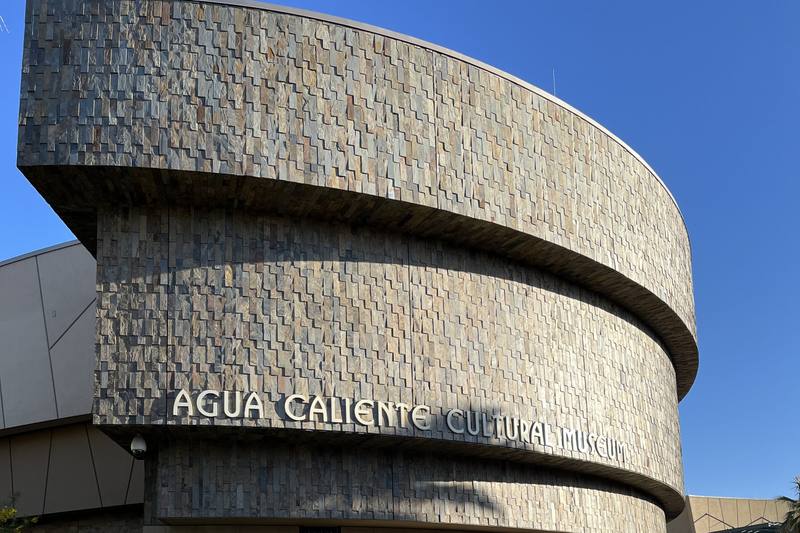
The Word They Used Was Abatement
Section 14 is one square mile of Agua Caliente land in the middle of downtown Palm Springs, and for decades it was where the city's Black and Latino families lived because racial covenants shut them out of everywhere else — until federal leasing law changed in 1959, the resort business wanted the ground, and the fire department burned 235 houses down.
A third of Palm Springs lived in Section 14 in 1950. It was one square mile of tribal land against downtown, and it was where Black and Latino families could build because racial covenants shut them out of the rest of the city. Between 1965 and 1967 the fire department burned 235 structures there, and the city did not settle with the survivors until 2024.

The Fish That Outlived the Lake
Death Valley held a lake six hundred feet deep and ninety miles long, and when it drained the fish did not all go with it — they backed into the springs, one population to a spring, and have been drifting apart ever since in water saltier than the sea and hot enough to kill almost anything else.
There are native fish in the hottest, driest place in North America. They are the remainder of an ecosystem that swam in a Pleistocene lake six hundred feet deep, now divided among a handful of springs where the water runs hypersaline and summer pushes past a hundred degrees. What has happened to them since the lake left is still happening, and last spring it nearly stopped.
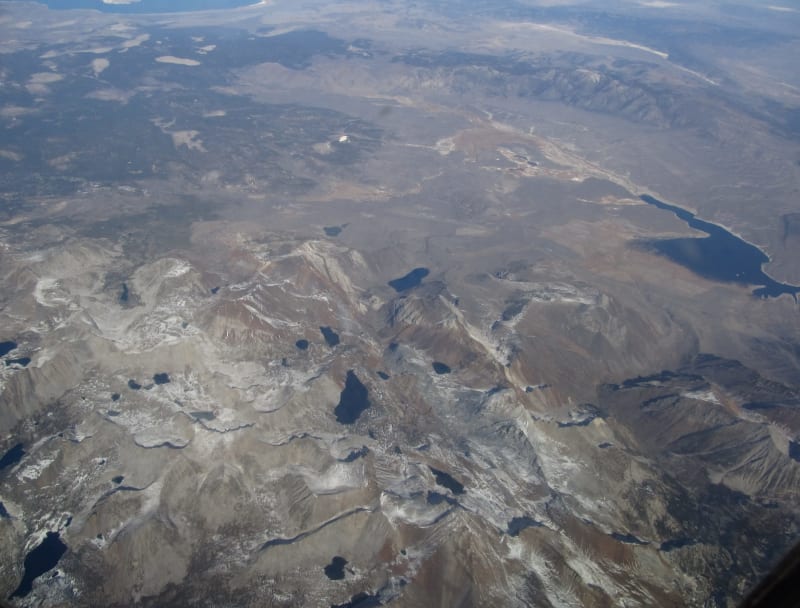
The Crater You Drive Across
Between Bishop and Mono Lake, U.S. 395 spends twenty miles crossing the floor of a supervolcano that erupted 760,000 years ago, buried the region in ash, and has been quietly swelling and shaking since 1980 — which is how a ski town ended up arguing with the United States Geological Survey.
The prettiest twenty miles of U.S. 395 run across the floor of a collapsed supervolcano. Long Valley Caldera erupted about 760,000 years ago, dropped its own roof two miles, and is still warm — and when the USGS said so out loud in 1982, the town on top of it did not take the news well.

The Year California Closed the Road
In February 1936 the Los Angeles Police Department sent 136 officers to sixteen crossings on the state line, hundreds of miles outside their jurisdiction, with orders to turn back Americans who looked too poor to enter — and Route 66 carried the people they were waiting for.
Route 66 is usually told as an arrival story: the pass, the orange groves, the ocean. For two months in 1936 it was something else. Los Angeles sent its police 300 miles to the state line to stop migrants from entering California at all, and the courts did not settle the question until 1941.
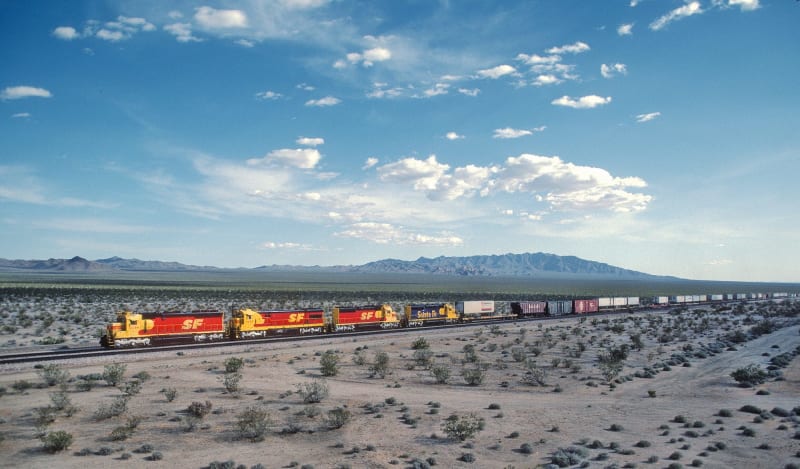
The Alphabet in the Desert
Amboy, Bristol, Cadiz, Danby, Essex, Fenner, Goffs — the ghost towns strung along Route 66 east of Barstow are not a coincidence but a filing system, laid out in 1883 by a railroad that needed water every twenty miles and named its wells in order as it went.
The near-ghosts east of Barstow spell themselves out in order: Amboy, Bristol, Cadiz, Danby, Essex, Fenner, Goffs. They are not towns that happened to line up alphabetically. They are the water stops of an 1883 railroad, named down the alphabet by its locating engineer, and Route 66 simply drank where the trains already did.
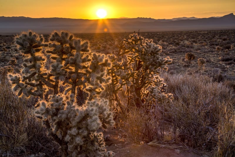
The Country That's Still Moving
US-50 crosses central Nevada at right angles to the grain of the ranges — which makes the loneliest road a cross-section of a continent being pulled apart, one tilted block and one earthquake at a time.
The loneliest road climbs a range, drops into a basin, and does it again a dozen times — monotony from the driver's seat, and a rare cross-section of active geology from any other angle. US-50 cuts at right angles across the most stretched crust on Earth, pulled to nearly double its width into tilted fault blocks and sediment-filled basins, and still moving: in 1954, east of Fallon, the ground tore open and rose some twenty feet, leaving scarps you can still visit. From Ice-Age Lake Lahontan to the exhumed deep crust at Great Basin National Park, the emptiest highway in America is the clearest window onto how the West is still being made.

The Hard Half
The Comstock's wealth is the famous half of the story; how the silver was actually won — in scalding, caving, three-thousand-foot dark — is the hard half, and it made hard-rock mining modern.
Every telling of the Comstock says the silver came out of the ground by hand, in the dark, and hurries on to the fortunes. This is that sentence opened up: the crumbling ore that forced the invention of square-set timbering, the geothermal heat and scalding water, Adolph Sutro's four-mile drainage tunnel, the Yellow Jacket fire that killed at least thirty-five men, and the miners' union that won the four-dollar day. The famous silver is the easy half of the Comstock — this is the hard half, and what it cost the men who did the work.
A Second Living from the Ghosts
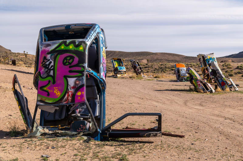
When the ore ran out, the Silver Trails was left with ruins, distance, and secrets — so it built a culture out of exactly those, from a desert full of planted cars to a highway named for aliens.
Every Nevada mining region has to answer what happens when the ore runs out. The Comstock chose respectability and Las Vegas chose neon; the empty middle of the state had neither — so it turned its ruins, its distance, and its secrets into the attraction. A forest of planted cars at Goldfield, plaster ghosts overlooking dead Rhyolite, a clown motel keeping a miners' graveyard in Tonopah, and a highway named for aliens: this is the corner of Nevada that made a second living from its own ghosts.

Bitter Water
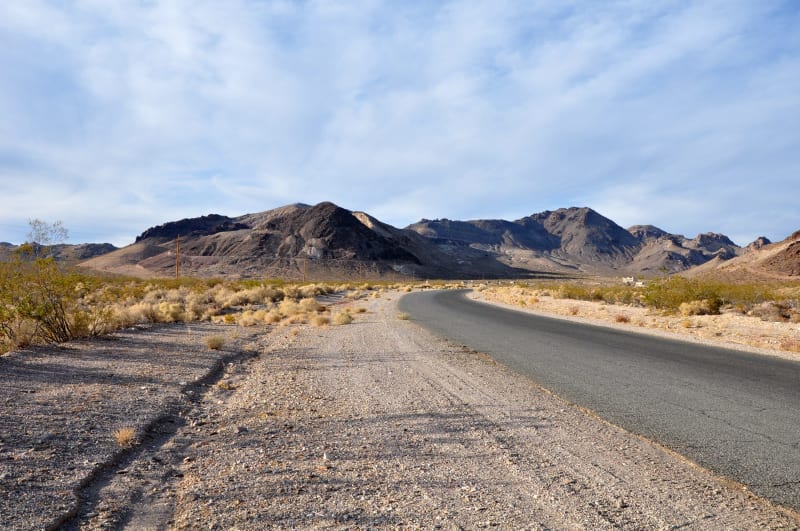
The Amargosa River crosses this desert almost entirely underground — and where it surfaces it holds creatures found nowhere else, and it decided which boomtowns lived and which died.
In the driest corner of the driest state, the Amargosa River runs almost entirely underground. Where it breaks the surface it makes rare oases — home to a toad, nine kinds of pupfish, and the rarest fish alive — found nowhere else on Earth. And that hidden water, not the gold, is what decided which boomtowns lived and which died.
The Fire Under the Silver
The Silver Trails run along the roots of an extinct volcanic arc — the gold and silver are cooled hot-spring plumbing, and one ghost town is named for the rock that carried it.
The Silver Trails are told as luck and greed and time running out. The deeper story is fire: the towns sit on the roots of an extinct chain of volcanoes, their silver and gold cooked from the crust by magma and dropped in fractures some twenty million years ago. The proof is in the ground — and in the name of the deadest town on the drive.

The Dancing Ground
The basins everyone writes off from I-80 are the sagebrush sea — the largest, most imperiled ecosystem in the Lower 48 — and the sage grouse is how you measure it.
Everyone calls the Nevada basins empty. They are the sagebrush sea — the largest and one of the most endangered ecosystems in the Lower 48 — and its keystone is a bird that gathers before dawn to dance. In Cowboy Country's sage flats the greater sage grouse still booms on grounds older than the trails, the herds, or the state.

The River That Goes Nowhere
The Humboldt reaches no ocean — and the California Trail, the transcontinental railroad, and Interstate 80 all followed it west anyway.
The only river entirely within Nevada dies in a salt sink without ever reaching the sea. Emigrants cursed it as the Humbug River and followed it west regardless — because it was the one continuous water across the Great Basin, the corridor the railroad and the interstate would later inherit.

The Mountain Turned Inside Out
Every other range in Nevada is a block of the crust's thin skin, tilted on a fault. The Rubies are the one place the crust turned over — hot middle rock welling up from ten miles down until stone that once flowed like warm wax stood in the sky, glaciered by the Ice Age and drained, on its dry side, into a vanished lake whose last water still keeps a desert marsh alive.
The Ruby Mountains are the great exception to Nevada's basin-and-range desert — the one range built by the crust turning itself inside out, lifting the deep basement into the sky, catching the Great Basin's heaviest ice, and feeding a marsh that is the ghost of an Ice Age lake.
The Man Who Came Home
Ten miles off U.S. 50 near Fallon, a man was laid to rest in a dry cave more than ten thousand six hundred years ago — the oldest human ever found in North America — and taken from his grave in 1940. It took the Fallon Paiute-Shoshone the better part of a century, a lawsuit, and finally his own DNA to bring their ancestor home — and to reveal the loneliest road as one of the most anciently traveled in America.
In 1940, archaeologists took a naturally preserved man from a cave east of Fallon; radiocarbon dating later revealed he was more than ten thousand years old — the oldest human found in North America. The Fallon Paiute-Shoshone always knew he was their ancestor. This is the story of the long fight to bring him home, and of a loneliest road that has been traveled for ten millennia.

The Island Above the Mojave
A pale ridge visible from the Las Vegas Strip, the Spring Mountains rise nearly two miles out of the desert as a true sky island — cut off by a hundred miles of sand on every side, stacked with every life zone from creosote to bristlecone, and home to some two dozen species found nowhere else on earth, from Palmer's chipmunk to an endangered blue butterfly that flies two weeks a summer on the highest ridges.
The Spring Mountains rise nearly two vertical miles out of the Mojave as a sky island — marooned by a hundred miles of desert, stacked with life zones from creosote to bristlecone, and home to roughly two dozen species found nowhere else on earth. To the Nuwuvi it is Nuvagantu, the place of creation; to a biologist it is a Galapagos of cool air, warming from the top down.

The Lake That Won't Freeze
The largest alpine lake in North America sits through every winter without freezing — a mile of stored summer heat turning the whole lake over, oxygenating its depths and keeping the shore open for wintering bald eagles — while an opossum shrimp loosed in the 1960s quietly unravels the water's clarity and, on the southeastern shore, the Washoe hold De'ek Wadapush, a sacred rock the last century tried to drill and climb straight through.
Lake Tahoe never freezes — its depth banks too much heat, and the winter overturn that keeps it open oxygenates the lake and draws wintering bald eagles to the Nevada shore. Beneath the clear surface an invasive shrimp is still rewriting the food web; above it, the Washoe hold Cave Rock — De'ek Wadapush — a sacred place reclaimed from a century of drilling and climbing.
The Bluest Water in the Driest State
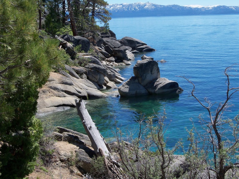
The driest state in the country holds the eastern third of the largest alpine lake in North America — a mile-deep fault block still dropping between two rising ranges, its shore once stripped bare to timber the Comstock, its clarity fading and its four-foot native trout, gone since the 1930s, only now being carried home.
Lake Tahoe's Nevada shore is the western wall of the Basin and Range — a half-graben still faulting open, clear-cut a century ago to prop up the Comstock's silver, and drained by the one river that once ran a four-foot native trout down to the desert at Pyramid Lake.

The Most Bombed Place on Earth
An hour up the highway from Las Vegas lies the most bombed ground on the planet — nine hundred and twenty-eight nuclear blasts in forty years, mushroom clouds the casinos sold as a floor show, and a fallout that drifted east into people who were never asked; the fireballs stopped in 1992, but on this ground almost nothing about them is finished.
Between 1951 and 1992 the U.S. set off 928 nuclear devices an hour from the Strip — Las Vegas sold tickets to watch, the wind carried the rest east into the downwinders, and the desert has forgotten none of it.
Islands in the Sagebrush Sea
Nevada looks like the emptiest state in the country, and it is really an archipelago — three hundred mountain ranges rising out of the sagebrush like islands, each one stranded with something the desert around it cannot hold: the oldest trees on earth, a bird from the Himalaya, a marsh full of ducks, or a butterfly that lives on a single dune.
The interstate crosses Nevada as blank space. But every range on the horizon is a sky island — cut off by an ocean of desert and marooned with life found nowhere else: the oldest living tree, a Central Asian game bird, a spring-fed marsh, and a singing dune with its one endemic butterfly.
Boom, Bust, and Back Again
A state founded on the richest silver strike in America, then abandoned, then saved by a second rush, then abandoned again — Nevada booms and busts in a rhythm so regular it might as well be weather, and the biggest boom of all is happening right now, out of sight.
Virginia City was built for twenty-five thousand people and holds fewer than a thousand — the most Nevada thing there is. From the Comstock silver and the Carson City Mint to a desert full of ghost towns, and a gold rush today so quiet you can drive right through it, the whole state runs on one long boom and bust.
The Land That Was Never for Sale
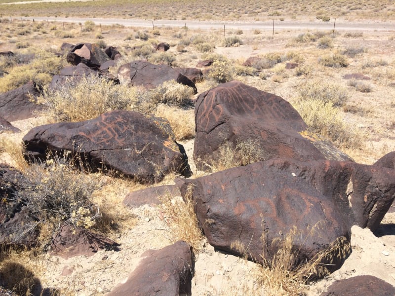
In 1863 the Western Shoshone signed a treaty that gave the United States the right to cross their country but never to own it — and a century and a half later, across the rock art, the sacred lakes, and the boarding school built to erase them, the Great Basin's first peoples are still here, and still saying the land was never for sale.
The 1863 Treaty of Ruby Valley ceded no land — the Western Shoshone granted passage across Newe Sogobia but never sold it. From eight-thousand-year-old rock art to Pyramid Lake's drained river to the boarding school at Stewart, this is the Great Basin told by the people who were here first, and are here still.

The Dead Sea That Feeds the Sky
Too salty for a single fish and nicknamed America's Dead Sea, the Great Salt Lake sounds like a void — and is in fact one of the most alive places on the continent, the brine pantry that feeds ten million migrating birds. Now it is falling to record lows, and a drying salt lake doesn't simply vanish: it becomes an arsenic dust bowl upwind of two and a half million people.
The Great Salt Lake has no fish and a nickname to match — America's Dead Sea. In fact it feeds ten million migrating birds, and as it falls to record lows it is turning into an arsenic dust bowl upwind of millions.

The Invented Legend of Mount Timpanogos
The sleeping princess everyone in Utah Valley knows was written by a track coach in 1922 — and the real story underneath is harder.
Everyone in Utah Valley knows the legend of the sleeping princess on Mount Timpanogos — the maiden, the sacrifice, the conjoined hearts in the cave. Almost none of it is old. A BYU track coach wrote it in 1922 to put his mountain on the national map. But the name Timpanogos was already Native, already real — and it remembers a people the romance was quietly laid over.

Where the Red Runs Out
Everyone pictures Utah as red sandstone. But drive far enough north and the red runs out: Cache Valley and Bear Lake are built on gray limestone twice as old — the floor of vanished tropical seas. And the same rock that makes the canyons gray is what turns Bear Lake its impossible turquoise.
Everyone pictures Utah as red sandstone, but its far northeast corner is built on something twice as old and a different color entirely — gray Paleozoic limestone, the floor of vanished tropical seas. It makes the walls of Logan Canyon gray instead of red, dissolves into caves and springs, and, most surprisingly, turns Bear Lake its impossible Caribbean turquoise. The cliff and the lake are the same rock, caught at different moments of coming apart.

The County They Named Carbon
Carbon County was named for coal — one of the forms the element takes, along with soot, graphite, and diamond. But coal is only half of what this overlooked corner of Utah has always pulled out of the ground. The other half is far older, and it has teeth.
In 1894 Utah named a county for an element — Carbon, for the coal beneath it. But coal is only half of what this overlooked corner of the state has always dug out of the ground; the other half is a hundred and fifty million years older and has teeth. The story of a county that has only ever been in one business: unearthing the ancient dead and selling them to the living — first as coal, now as dinosaurs.
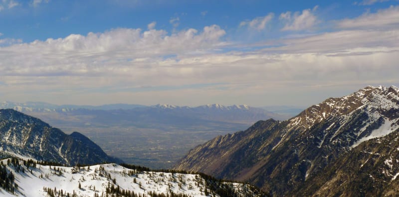
The Greatest Snow on Earth
Utah puts “The Greatest Snow on Earth” on its license plates, and the snow is real — but almost everything people believe about why is wrong. It isn't the lake, and it isn't even the driest snow in the country. It is a recipe, and the same warming that is drying the Great Salt Lake is starting to take it apart.
Utah's powder is the stuff of license plates and legend, but the lake-effect everyone credits is only about five percent of it, and Utah doesn't even have the driest snow in the country. What it has is a recipe — a high, broad wall of mountains, storms that fall cold and stack right-side-up, often and deep — that comes together best in two canyons on the east edge of Salt Lake. And it is changing.

The Fault Under Everything
Most of Utah lives on the Wasatch Front because one crack in the crust raised the mountains, dropped the valleys, cut the benches the cities are terraced onto, and warms the springs — and the same crack is the largest earthquake hazard in the interior West, quiet now for a very long time.
One normal fault built nearly everything the Wasatch Front loves and fears: it raised the wall of mountains, dropped the basin that holds the Great Salt Lake, cut the Lake Bonneville benches the cities are built on, and feeds the hot springs. It is also the longest active fault of its kind in the country — late in its cycle, and quietly waited on by two million people.

The Last of the Dark
Across the modern world the night sky has been all but erased by artificial light — most people will never see the Milky Way from home. The high, empty Colorado Plateau is the largest reservoir of real darkness left in the country, and Utah protects more of it than anywhere on Earth.
Most Americans have never seen the Milky Way from where they live, and the night sky is being erased by light faster than almost anyone notices. But out on the high, empty Colorado Plateau the dark is still intact — and Utah, starting at Natural Bridges, set out to keep it that way.

The Skin of the Desert
The black, knobby crust between the rocks and shrubs of southern Utah is alive — a community of ancient organisms that quietly holds the whole landscape together. It can take a human lifetime to grow back, and it dies under a single boot.
The lumpy black ground between the shrubs in red-rock Utah is not dirt but a living skin — cyanobacteria, lichen, and moss that fix the desert's nitrogen, hold its water, and keep its sand from blowing away. It takes decades to build and a single footstep to undo.

Where One Tree Ends
Every gold aspen hillside in Utah is a handful of giant, ancient, single organisms — and the patchwork of autumn color is a map of where one stops and the next begins. They are also quietly disappearing.
A stand of aspen is not a crowd of trees but a few enormous, cloning individuals — and every fall the color reveals their borders, gold against orange against green. It is the most alive thing on the mountain, and it is thinning one panel at a time.

The Country That Ran Out of Water
Two of the richest dinosaur quarries on Earth lie a hundred miles apart in the same Jurassic rock — one a jumbled pond, one a river of articulated skeletons — and the same thing killed both: a country that kept running out of water.
A pond that kept its dead in a jumble, a river that stacked them like driftwood — the two greatest dinosaur quarries in Utah are one Jurassic story told twice, in a land where drought was the killer and the last water was the trap.

The Sea That Never Left
Every arch, sunken valley, and crumbling spire around Moab is the work of a bed of salt left behind when an inland sea dried up — and three hundred million years later, the salt is still moving.
A sulfur-stinking creek, a town in a sunken valley, the fins of Arches, and the electric-blue ponds below Dead Horse Point are all the same story: a buried bed of salt, left by an evaporated sea, that has never stopped moving.

The Store That Tried to Secede from the Economy
Brigham Young built a network of cooperative stores to wall Utah off from American capitalism. The one in Ephraim outlived the experiment — and ended up a co-op again.
Painted over a storefront in Ephraim: a beehive and "Holiness to the Lord" — the most compact monument in Utah to the decade Brigham Young tried to secede from American capitalism.
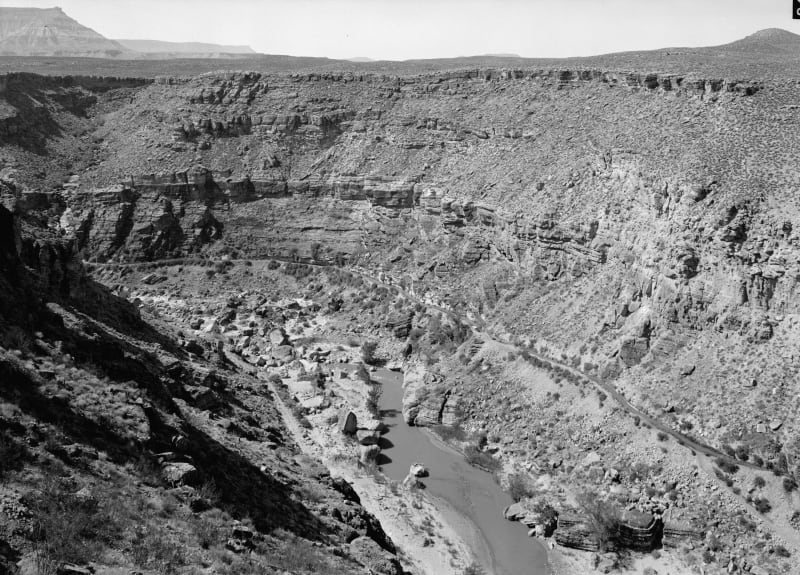
The Town They Dug Before They Built It
For eleven winters, farmers from the flood-wrecked villages of the upper Virgin River blasted a canal along a gorge wall to water a bench where nobody lived. The water arrived in 1904. The first family arrived two years later.
Hurricane is the rare Utah town that existed as a ditch before it existed as a place. For eleven winters, farmers blasted a canal along the Virgin River gorge to water an empty bench — and when the water arrived in 1904, the town it built was still two years away.

The Small Print at the Side of the Road
Utah's historical markers carry two stories: the one on the front, and the one at the bottom — a hundred and twenty-five years of daughters, sons, counties, towns, and one museum deciding what deserved bronze.
Every Utah historical marker carries two stories: the history on the front, and the small print at the bottom. Follow the erected-by lines and you meet the rememberers — Depression-era DUP camps, the Sons, small towns, counties, and a museum that turned the whole state into a marker hunt.

The Town You Were Supposed to Drive Through
Torrey, Utah exists because of the road to Capitol Reef — a farm town that became a gas-and-bed stop on the way to somewhere more famous. Then a settlement of a couple hundred people gave its name to a national publisher, won Utah's first dark-sky designation, and decided it would not be only a place you pass.
A million people a year drive through Torrey on the way to Capitol Reef, and most never stop. The couple hundred who live there built a town worth stopping in — one that publishes books, protects the dark, and refuses to be only a gateway.

The Orchard That Outlived the Town
No one has lived in Fruita, Utah, since 1969, and the town has never been better tended. How a Mormon farm settlement came to be preserved by the government that emptied it.
The greenest place in Capitol Reef is a pioneer town with no residents. Its orchards outlived the families who planted them — because the Park Service bought the families out and kept doing their work.
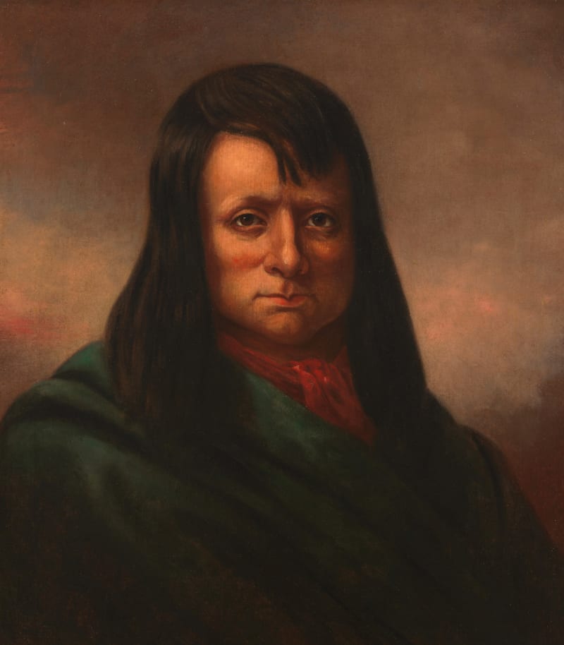
The People the Valley Was Named For
Sanpete is a settler's spelling of San Pitch — the Ute people whose homeland this was, and whose displacement set off the longest, hardest war in Utah's history.
Before it was Little Denmark, the Sanpete Valley was Ute country. This is the Black Hawk War — the longest and costliest Indian war in Utah's history — and the people the valley is still named for.
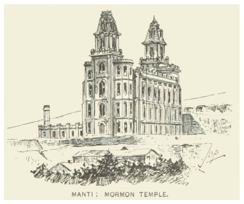
The Valley They Called Little Denmark
How a wave of Scandinavian converts settled Sanpete in the 1850s and built a stretch of Utah that still half-belongs to the old country.
For most of a century, Sanpete Valley was the most Danish place in America — settled by Mormon converts who sailed from Liverpool, walked across the plains, and rebuilt the old country in cream-colored stone.

The Roads the Depression Built
How three million out-of-work young men built the mountain roads Utah still drives on.
The Nebo Loop, the Alpine Loop, the road into Boulder — some of Utah's most beloved drives were cut by hand during the Depression, by young men earning thirty dollars a month.
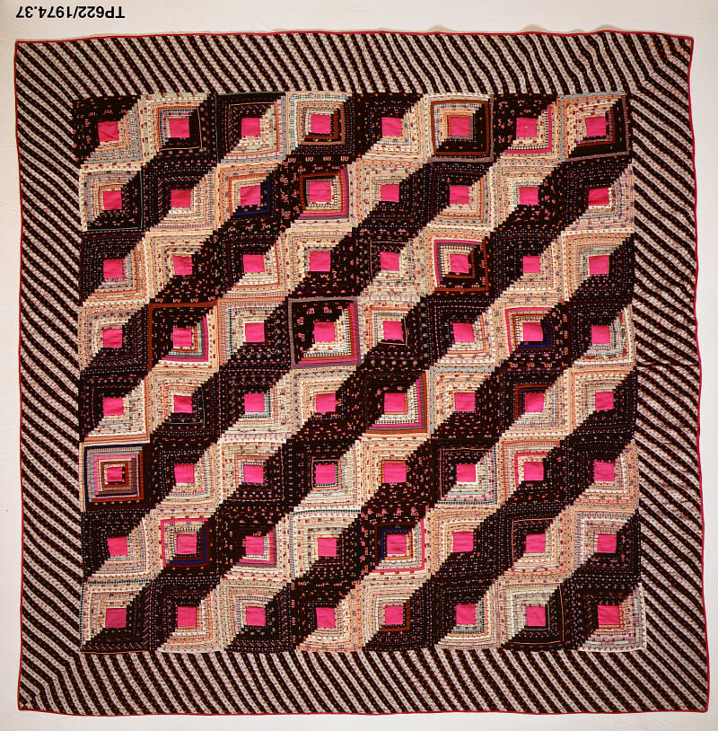
The Quilt That Named a Highway
How a desperate winter crossing in 1864 gave Utah's strangest-named scenic byway its name.
On the map it's State Route 143. Everyone calls it the Patchwork Parkway — after seven men who crossed a winter mountain on their own quilts to keep a starving town alive.

What the Mines Left Behind
Utah's greatest ski resorts were built on the wreckage of the industries that came before them — silver mines gone bust, a uranium fortune, a sheep range, a watershed logged and grazed nearly to ruin. The lifts went up exactly where the money ran out.
Before the lifts, the canyons of northern Utah ran on silver, uranium, sheep, and timber. When those industries failed, skiing moved into the vacancies — and the thing that saved each mountain was almost always an inversion of the thing that had nearly used it up.

The Beet Fields
Sugar beets made the South Platte valley rich, and the work of thinning and topping them was done, generation after generation, by whole families: Germans from the Volga, then Mexicans and Mexican Americans, with their children in the rows beside them.
How the sugar beet remade northeastern Colorado, and the immigrant families and children who did the work in the fields.

The Harlem of the West
When downtown Denver's hotels turned away Black musicians, Five Points took them in, and for half a century the Rossonian Lounge and the clubs along Welton Street made it the best place to hear jazz between the Midwest and the coast.
How Denver's Five Points neighborhood became the Harlem of the West, what urban renewal took from it, and what is left on Welton Street.

The Rings in the Beams
An astronomer studying sunspots learned to read history in tree rings, dated the cliff dwellings of Mesa Verde in 1929, and found a great drought that shaped a century of argument about why people left.
How tree-ring dating gave Mesa Verde its calendar, the great drought of the late 1200s, and why the old story of abandonment no longer holds.

The Blackest Week
In the autumn of 1918 influenza reached Silverton, high and isolated in the San Juans, and in a few weeks killed about one person in ten, perhaps the worst toll of any town in the country.
How the 1918 influenza pandemic swept through Silverton, the mining town that suffered one of the highest death rates in the United States.

The City of Sunshine
For half a century tuberculosis was Colorado Springs' biggest business. The sick came by the thousands to sleep in the open air, and the hospitals and campus they left behind still stand.
How Colorado Springs became a tuberculosis resort, from the cheap boarding houses to the grand sanatoriums, and what the health-seekers left behind.

The Big-River Fish
Four fish found nowhere but the Colorado River system were pushed to the edge by dams, diversions and introduced predators. Since 1988 a partnership of states, water users and the federal government has been trying to bring them back.
The Colorado pikeminnow, humpback chub, razorback sucker and bonytail, and the recovery program working to save them in the rivers around Grand Junction.

The Supervolcano Under the San Juans
Twenty-eight million years ago a caldera near present-day Creede blew out some 1,200 cubic miles of rock in one of the largest explosive eruptions known on Earth. The San Juans are what was left.
The San Juan volcanic field and the La Garita eruption that produced the Fish Canyon Tuff, and where to see their remains.

The Cranes of the San Luis Valley
Twice a year some twenty thousand greater sandhill cranes stop in the barley fields and wetlands of the San Luis Valley, the whole Rocky Mountain population passing through one high basin.
The Rocky Mountain sandhill cranes' stopover in the San Luis Valley, the refuge farmed for them at Monte Vista, and the whooping cranes that tried to travel with them.

Five Acres of Ice
In the winter after the silver crash, Leadville built a palace of ice on a hill above town, opened it on New Year's Day 1896, and watched it melt by the end of March.
The story of Leadville's 1896 Ice Palace and Crystal Carnival, a broke silver town's bid to sell itself as a winter resort.

The Elk That Came Back
Hunters emptied the Estes Valley of elk by the 1870s. A few dozen brought from Yellowstone in 1913 and 1914 became thousands, and with no wolves left to check them, the park has spent a century deciding what to do about it.
How Rocky Mountain National Park's elk were wiped out, restocked from Yellowstone, and grew into a management problem the park is still working through.

The Dinosaur Freeway on the Purgatoire
Below the shortgrass of the Comanche National Grassland, the Purgatoire River has uncovered North America's largest dinosaur tracksite: sauropods walking side by side along a lakeshore 150 million years ago.
How the Purgatoire River exposed more than 1,300 Jurassic dinosaur footprints in Picket Wire Canyonlands, and what they say about how sauropods lived.
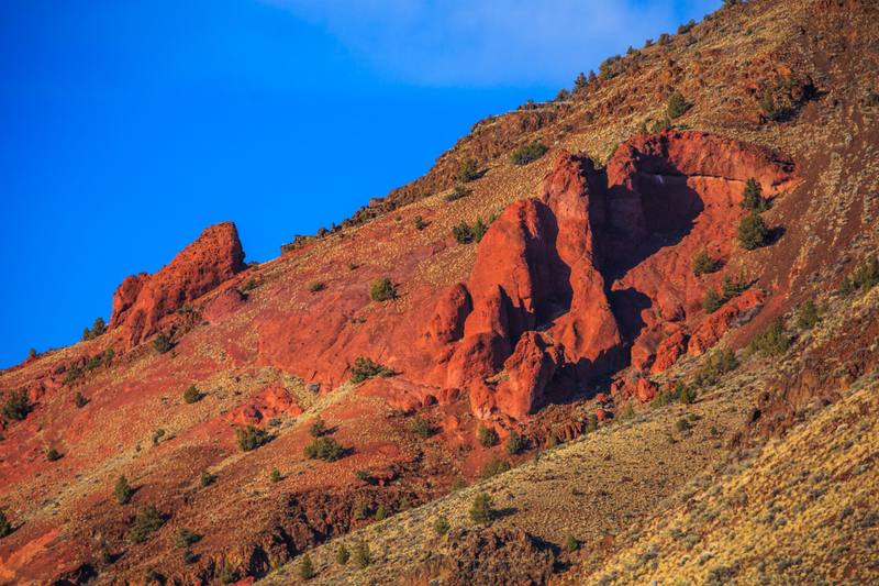
The Mountain They Took the Cattle Off
Hart Mountain was set aside in 1936 for the last pronghorn herds of the high desert. It took nearly sixty more years, and a fight with the county, before the refuge stopped being grazed.
Franklin Roosevelt set aside Hart Mountain in 1936 for the last pronghorn of the high desert, but cattle grazed it for nearly sixty more years. A 1994 plan, fought by Lake County ranchers, took them off. In 2003 pronghorn fawn survival was the highest since the refuge began.
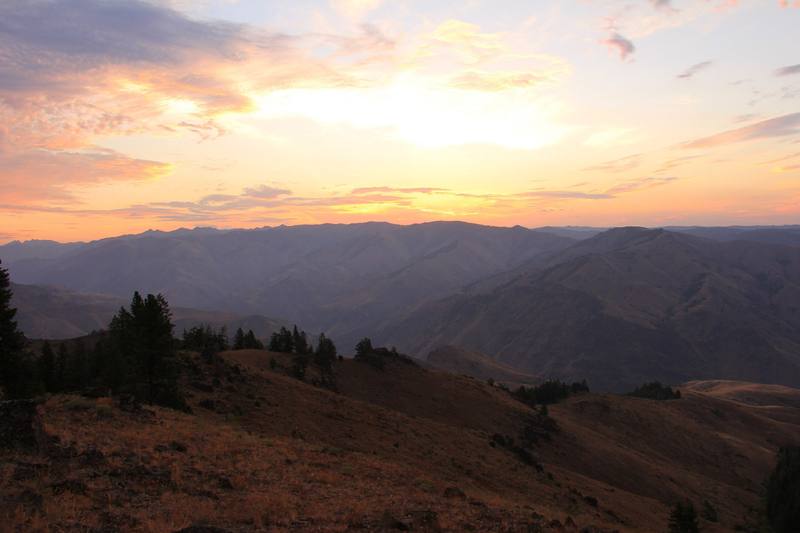
The Papers in the Safe
In 1887 a gang from Wallowa County murdered as many as thirty-four Chinese miners in Hells Canyon. No one was convicted, and for more than a century the county all but forgot. In 1995 a county clerk opened an old safe.
In May 1887 a gang of Wallowa County horse thieves and schoolboys murdered as many as thirty-four Chinese gold miners at Deep Creek in Hells Canyon. Three fled, three were acquitted, and the case was all but buried. In 1995 a county clerk found the records in an old safe.
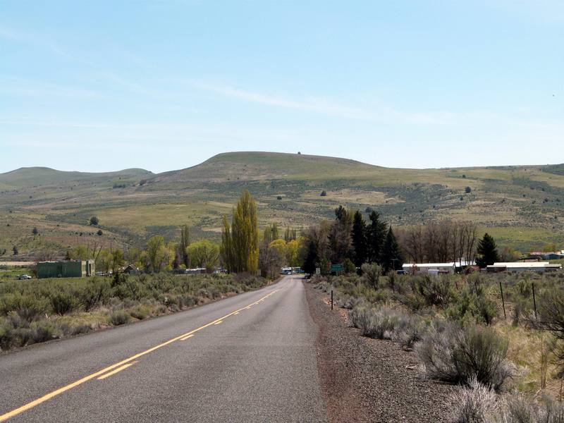
The Town That Was Renamed Rajneesh
From 1981 to 1985 a guru's commune on the Big Muddy Ranch took over the town of Antelope, bused in voters and poisoned 751 people in The Dalles. Antelope voted its name back, and the post office never noticed it had changed.
In 1981 followers of Bhagwan Shree Rajneesh bought the Big Muddy Ranch near Antelope, took over the town and renamed it Rajneesh, bused in homeless voters, and in 1984 poisoned 751 people in The Dalles with salmonella. By 1985 the commune had collapsed. The ranch is now a Christian youth camp.
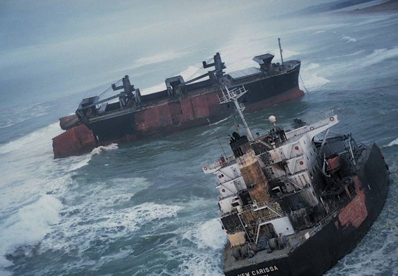
The Ship That Would Not Sink
In February 1999 a wood-chip freighter came ashore on the North Spit of Coos Bay. The government set it on fire, towed half of it to sea, shelled it and torpedoed it. The other half stayed on the beach for nine years.
On February 4, 1999, the freighter New Carissa ran aground on the North Spit of Coos Bay with 400,000 gallons of fuel aboard. The Navy burned it, split it, towed the bow to sea, shelled it and torpedoed it. The stern stayed on the beach until 2008.
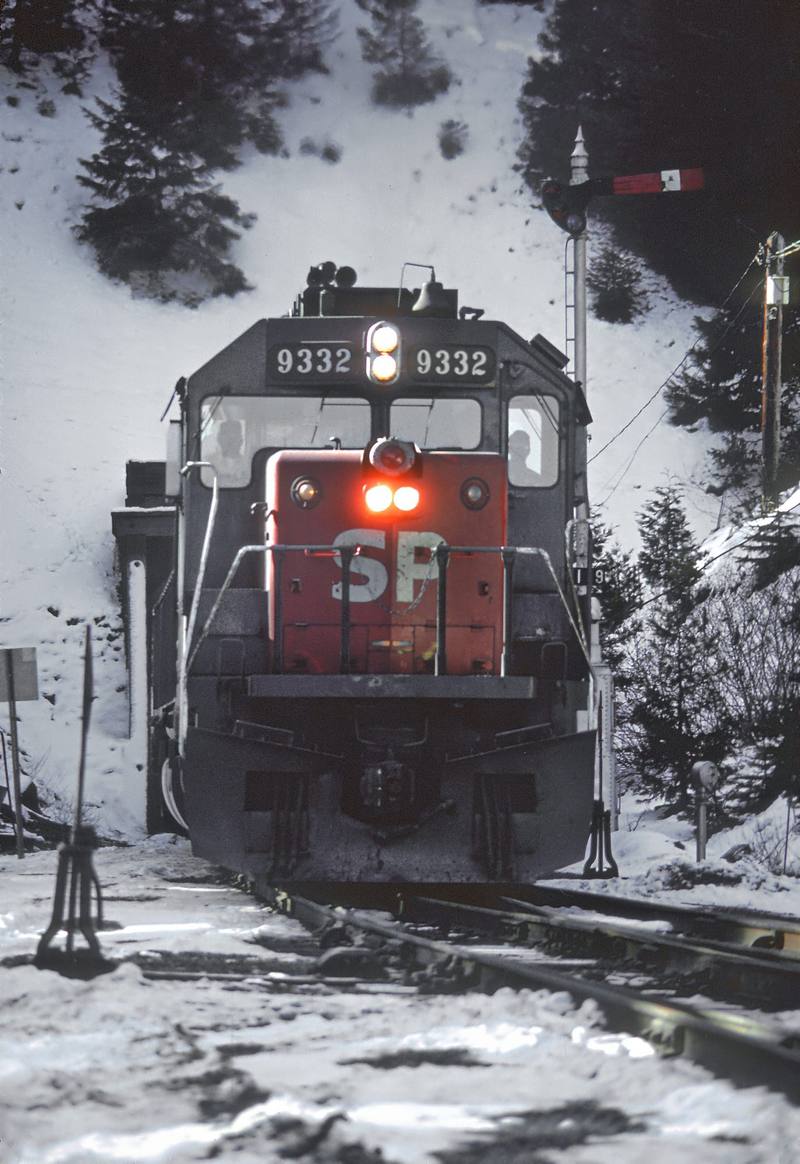
Tunnel 13
On October 11, 1923, three brothers stopped a Southern Pacific train at the mouth of a tunnel below Siskiyou Summit, killed four men and got nothing. A pair of overalls and a scientist in Berkeley found them.
On October 11, 1923, the DeAutremont brothers stopped Southern Pacific Train 13 at Tunnel 13 below Siskiyou Summit, blew open the mail car and killed four men for nothing. Forensic analysis of a pair of overalls and 2.5 million wanted posters caught them four years later.
Tomanowos
The largest meteorite ever found in North America rode an Ice Age flood into the Willamette Valley, was stolen one yard at a time in 1902, and ended up in New York. The Clackamas knew it first, and their descendants still visit it.
Tomanowos, the fifteen-ton Willamette Meteorite, rode an Ice Age flood into the valley and was sacred to the Clackamas. In 1902 Ellis Hughes stole it a few feet at a time. It ended up in New York, where since 2000 the Grand Ronde tribes hold a ceremony with it every year.
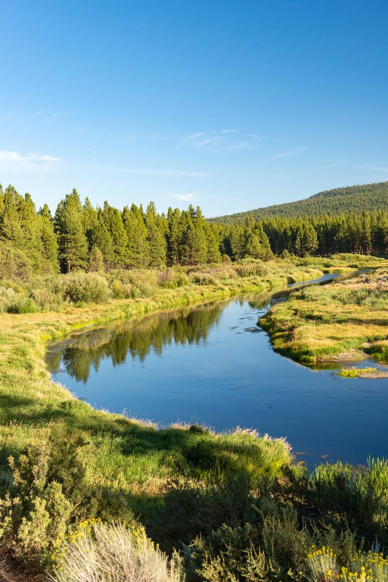
The Fire at Pla'ikni
In 1954 Congress ended the Klamath Tribes' existence as a nation and sold their forest to pay them off. One man refused the money, lit a fire at his grandfather's village and kept it burning until the government gave the land back.
In 1961 the federal government sold the Klamath Tribes' pine forest and paid most members $43,000 each to leave the tribe. In 1974 Edison Chiloquin refused his $273,000 share, lit a sacred fire at his grandfather's village and kept it burning until Congress gave the land back.
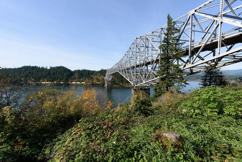
The Bridge of the Gods
In the mid-1400s the side of Table Mountain fell into the Columbia and dammed it. The people of the river remembered. It took science six centuries and several wrong dates to catch up.
Sometime between 1421 and 1455 a slab of Table Mountain about a cubic kilometer in size slid across the Columbia and dammed it. The river's peoples remembered a bridge. Geologists dated it to 1100, then to around 1700, before three dead trees settled the question.
The Burn That Came Back
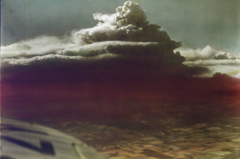
Fire took the old-growth Douglas fir of the northern Coast Range in 1933, then returned every six years until 1951. The forest that stands there now was planted by hand, partly by schoolchildren.
On August 24, 1933, a fire that had smoldered for ten days in the northern Coast Range ran across 240,000 acres in twenty hours. It came back in 1939, 1945 and 1951. The Tillamook State Forest that stands there now was planted by hand, seventy-two million seedlings, some of them by schoolchildren.
Down the Wire
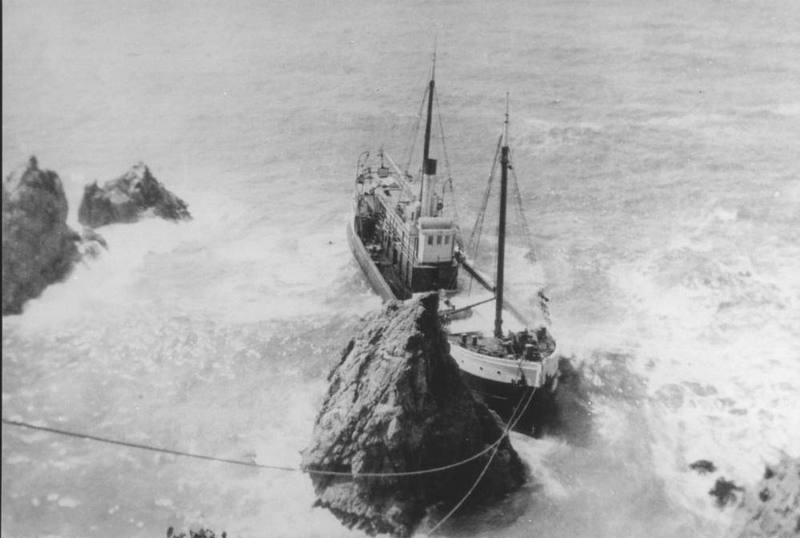
There was no harbor on the Mendocino and Sonoma coast, so for the better part of a century its lumber went out by gravity and cable: slid board by board down an apron chute to a schooner rolling under the cliff, and later sent out a sling at a time along a wire run to a ship at its mooring.
With no harbor on the Mendocino and Sonoma coast, lumber went out by apron chute, board by board, and from the 1870s by wire, a sling at a time. The last load left by sea in 1938; the iron bolts are still in the rocks.
The Debt on the Forest
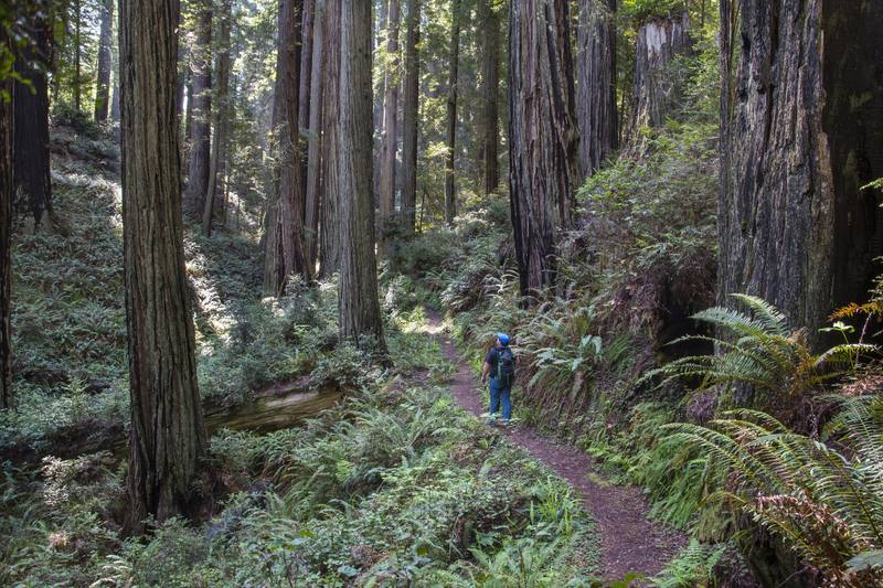
For decades Pacific Lumber cut its redwoods slowly enough to keep cutting them. In 1986 a Houston company bought it with borrowed money and roughly doubled the cut to carry the debt, and the fight over what was left ended with the public paying $480 million for Headwaters.
Pacific Lumber logged on sustained yield for decades. After Maxxam's junk-bond takeover in 1986 the cut roughly doubled to carry the debt, and a decade of protest ended with the public paying $480 million for the Headwaters Forest.
Six Days' Notice
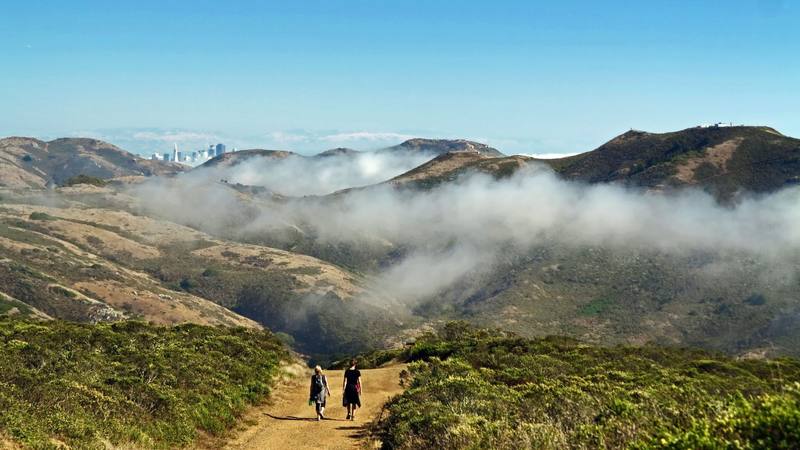
In 1965 Marin County approved a city of thirty thousand on the headlands across from San Francisco, with fifty towers, a mile of shopping and a hotel on the summit, and three lawyers working for nothing found the flaw that killed it: the public had been given six days to object instead of ten.
In 1965 Marin approved Marincello, a city of thirty thousand on the headlands across from San Francisco. Three lawyers found the county had given the public six days' notice instead of ten, and the headlands became a national park instead.
The Town Under Roosevelt Lake
Idaho's last great gold stampede built a town on Monumental Creek in 1902. In 1909 a mudslide dammed the creek, and the town went under water
In 1902 thousands of people rushed to Thunder Mountain, deep in the Salmon River Mountains, and built Roosevelt along Monumental Creek. The gold never matched the promotion, the mines closed, and on May 30, 1909, a mudslide dammed the creek below town. The water rose and did not go back down.
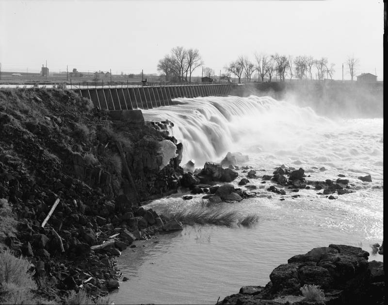
The Night Shoshone Falls Went Dry
How a canyon rancher, a Salt Lake banker and an 1894 federal law turned the south side of the Snake River into the Magic Valley in a few seasons
The Astorians gave up on the Snake at Caldron Linn in 1811. Ninety-four years later, a few miles upstream, Milner Dam turned the river onto the desert. Behind it were a rancher who had spent a decade selling the idea, one investor who stayed when the rest ran, and a law that let private money do what the government had not.
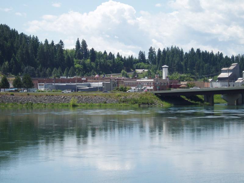
The War at Bonners Ferry
In 1974 the sixty-seven members of the Kootenai Tribe of Idaho declared war on the United States. It lasted days, nobody was hurt, and it worked
The Kootenai Tribe of Idaho had no treaty, no reservation and sixty-seven members living in deep poverty near Bonners Ferry when its chairwoman, Amy Trice, declared war on the United States on September 20, 1974. The war was drums, pickets and ten-cent donations on Highway 95. Within weeks the tribe had land of its own.
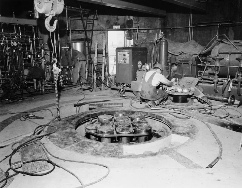
Nine O'Clock on the Third
On January 3, 1961, an Army reactor on the Idaho desert exploded and killed its three operators. Why one man lifted one rod too far is still unknown
SL-1 was a small Army reactor meant to power remote radar stations. On the night of January 3, 1961, while restarting it after a holiday shutdown, an operator lifted its central control rod about two feet instead of four inches. In milliseconds the reactor destroyed itself and killed all three men on duty.
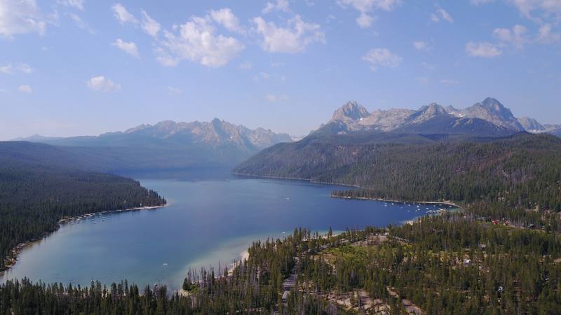
The Lake Named for a Fish
Redfish Lake's sockeye climb 6,500 feet over 900 miles to spawn. In 1992 one came home. What it took to bring them back
Redfish Lake was named for the sockeye that turned it red every fall. A mining dam blocked them for two decades, eight federal dams on the Snake and Columbia nearly finished them, and in 1992 one fish came back. The run exists today because biologists and the Shoshone-Bannock Tribes kept every last fish alive in a hatchery.
The Gate on Dearborn Street
How a governor's crackdown in the Coeur d'Alene mines in 1899 ended with a bomb at his garden gate in Caldwell, and a trial in Boise that the whole country watched
In 1899 Governor Frank Steunenberg put the Coeur d'Alene mining district under martial law and filled bullpens with union miners. Six years later a bomb at his side gate in Caldwell killed him, and the trial that followed in Boise put a labor leader, a confessed bomber turned state's witness, Clarence Darrow and William Borah in one courtroom.
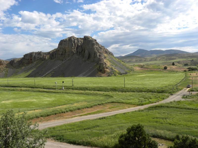
Half a Lake
About 18,000 years ago Lake Bonneville broke through Red Rock Pass and emptied half of itself across southern Idaho in a matter of weeks
Lake Bonneville filled until it reached the lowest notch on its rim, a pass at the head of Marsh Creek near Downey. When it spilled, the outlet cut down hundreds of feet and half the lake poured down the Portneuf and the Snake. The boulders it rolled are still lying where it dropped them.
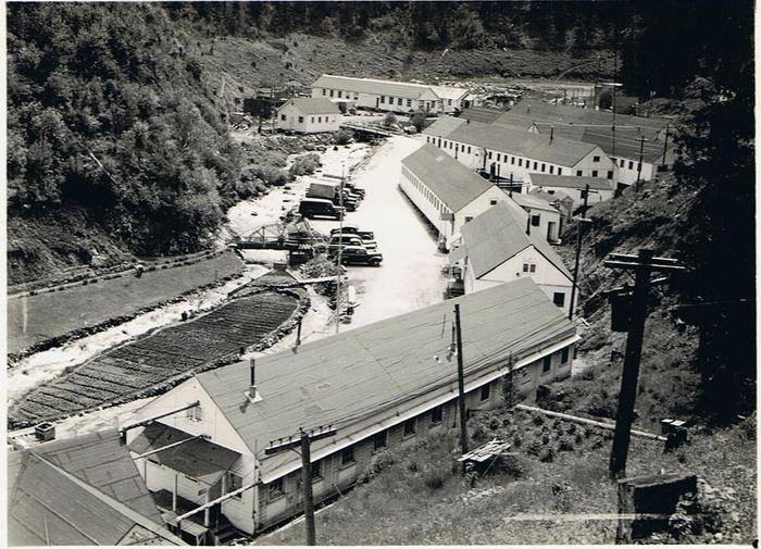
The Men Who Read the Convention
At a camp on the Lochsa, Japanese immigrant internees built a highway for wages, and used the Geneva Convention to change how they were held
From 1943 to 1945, about 265 Japanese immigrant men held as enemy aliens built US-12 along the Lochsa from a camp at Canyon Creek. They had volunteered to come. When the camp was not what they had been promised, they wrote a petition citing the Geneva Convention, and it worked.
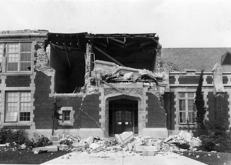
School Was Out
The 1933 Long Beach earthquake, and the law California wrote thirty days later
The 1933 Long Beach earthquake destroyed or condemned more than two hundred and thirty school buildings. It struck at 5:54 on a Friday evening, when every one of them was empty. Thirty days later California passed a law that has not let a school fall since.

The Roof That Waters the Desert
Arizona's driest cities drink from its coldest, highest corner — the volcanic White Mountains atop the Mogollon Rim, where the snow that becomes the Salt and the Little Colorado gathers on a peak the White Mountain Apache hold sacred, then runs down through a two-thousand-foot canyon into the desert below.
The most surprising thing about Arizona's deserts is that their water is made in the cold — up on the Mogollon Rim and the White Mountains, where the Salt and the Little Colorado are born of snowmelt on sacred Mount Baldy and run down into the desert that drinks them.

The Names on the Map
Almost every name in the Verde Valley — Montezuma, Prescott, Jerome — was given by or for an outsider who never belonged to the ground, in the years just after the Army marched the valley's actual people to San Carlos. Read the map closely and it becomes a receipt for a theft.
Read the Verde Valley's map slowly and it tells on itself: a ruin named for an Aztec emperor never here, a capital named for a historian who never came, a copper city named for a financier who never visited — all applied after the Army marched the valley's Yavapai and Dilzhe'e people to San Carlos in 1875.

A Guest in Two Nations
The northeast corner of Arizona is not scenery with a little history attached — it is the sovereign homeland of the Diné and the Hopi, two nations as unlike each other as either is unlike the United States, who never left this ground and still decide, on their own terms, how a visitor may enter it.
The northeast corner of Arizona is a guest's country — the sovereign homeland of the Diné and the Hopi, two living nations who never left the plateau and still set the terms of entry, from the guided canyon floor to the camera-free village.

The Desert That Stacks Itself
In Arizona's far southeast the Sonoran floor — ruled by the one giant cactus that grows almost nowhere else — rises into a scatter of lone mountains so tall and so isolated that each is a biological island, and a single day's climb carries you from the desert of Mexico to the forests of Canada.
The saguaro grows almost nowhere but here — and above the cactus floor, southeast Arizona's sky islands rise into forty lone mountains that each stack a continent's worth of climate, on ground people have farmed for four thousand years.

The City on the Canals
Phoenix is the one American metropolis that means its own name literally — it rose from the ashes of an older city, re-dug the thousand-year-old canals its builders had left, and only outgrew them when twentieth-century concrete let it take more of the river than the ancestors ever could.
Phoenix sits on the bones of an older city — a metropolis re-dug on the thousand-year-old canals of the ancestral Huhugam, whose descendants, the Akimel O'odham, never left the valley. Casa Grande still stands; Roosevelt Dam finished what hand-dug canals could not.

The Country That Builds and the Country That Cuts
Northern Arizona is where you can stand between the two opposite ways the earth makes a landscape — a mile of rock the river took away, and a field of six hundred volcanoes the earth pushed up, the youngest of them erupting inside living memory.
The Grand Canyon is an act of subtraction — a mile of rock the river carried away. Ninety miles south, six hundred volcanoes show the earth doing the opposite, the youngest erupting in 1085 with people here to watch.

The Older Country Under the Mother Road
Route 66 turns a hundred in 2026 — and its Arizona miles run the length of a far older country than the one the postcards sell.
The Mother Road turns a hundred in 2026, and Arizona kept more of it than anyone. Its celebrated miles also cross a far older country than the postcards sell — and the centennial is a good time to notice whose ground the road runs over.

The Company It Keeps
In 1986 Life magazine called US-50 across Nevada the Loneliest Road in America and warned people not to drive it — but the towns strung along it kept a Victorian opera house lit for a few hundred people, three boom-era churches for a couple hundred more, a 1910 steam locomotive under fire, and the memory of a traveling sack of flour and a hometown opera star: proof that in the emptiest quarter of the country, culture didn't thin out but distilled.
US-50 got branded the Loneliest Road in America by Life in 1986, and Nevada printed the insult on the map. But its towns — Eureka with its 1880 opera house, Austin with three churches and a legendary sack of flour, Ely with a steam railroad it refuses to retire — prove the loneliest road is really a string of the most stubbornly cultured small towns in the West.

The Remaking Ground
This northwest corner of Nevada is where people came to become someone else — a failed miner who walked into Virginia City's Territorial Enterprise and walked out Mark Twain, the tens of thousands who took Reno's six-week cure and threw a wedding ring off the bridge, a played-out silver town that survives by performing its own myth, and, four miles from the capitol, the Wašiw, Numu, and Newe children the government tried to remake by force at Stewart — whose descendants took the school back.
Reno–Tahoe is the part of Nevada built on remaking who you are: Samuel Clemens became Mark Twain in a Virginia City newsroom, and tens of thousands shed a marriage on Reno's six-week residency while a played-out mining town learned to perform its own past. Four miles from the Carson City capitol, the Stewart Indian School spent ninety years trying to remake Native children by force — and their descendants reclaimed it.
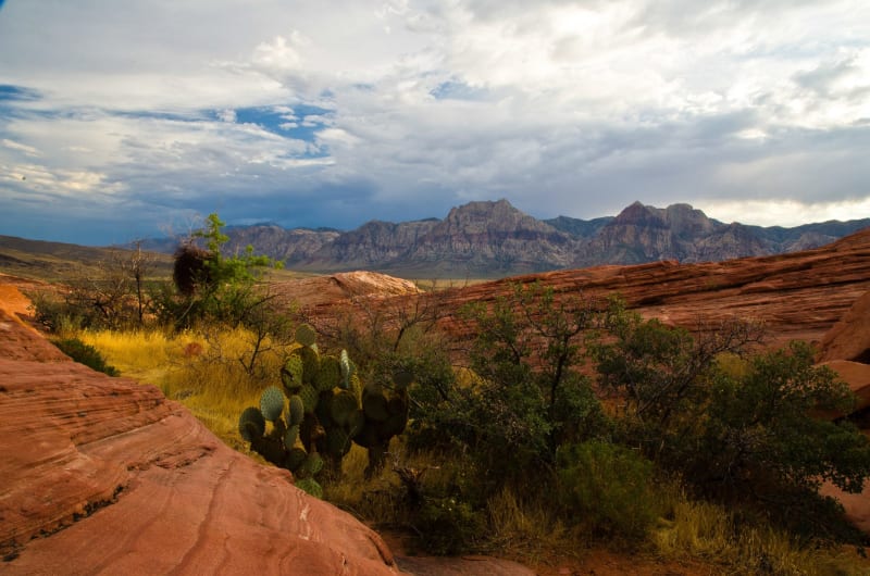
The Sea Over the Sand
Red Rock's cliffs are a petrified Jurassic Sahara; Mount Charleston's gray summits are the floor of a vanished tropical sea lifted two miles into the sky; and at the seam between them an ancient fault shoved the sea-rock up and over the desert-rock, stacking southern Nevada's deep time the wrong way up.
The red rock is fossil sand dunes, the gray peaks are an old ocean floor, and where they meet the world is stacked backwards — older stone resting on younger — in three landscapes that turn out to be one geologic story told in fire and limestone.

The City the Strip Forgot
The Las Vegas the world pictures — the Strip — sits four miles outside the city limits and implodes its own landmarks for sport; the real city is downtown, on the street where it began, and it has quietly become the one place in Nevada that bothers to remember.
What everyone calls Las Vegas isn't in Las Vegas, and it tears down its past as a tourist spectacle — but four miles north, on Fremont Street, the actual city has turned itself into a memory district, catching the falling signs and telling the buried history.

The Meadows and the River
A city named for desert grass it has long since used up, built first on a spring that ran dry and then on a river that is running low — southern Nevada's whole history, from an Ancestral Puebloan city to the wall of Hoover Dam, is a single long argument about water in a place that has almost none.
The springs that named Las Vegas "the meadows" went dry in 1962; the river that replaced them is now ringed in white and falling toward record lows — the story of a desert metropolis told through the one thing it cannot manufacture.