Nevada is the driest state in the Union — under ten inches of rain in an average year, a place that has learned to argue over every drop it gets. And yet the deepest, clearest thing in it is water. The eastern third of Lake Tahoe belongs to Nevada: sixteen hundred feet of cold blue laid against the state's western wall, the second-deepest lake in the country and the largest alpine lake on the continent. The astonishing thing is not that it is beautiful. It is that it is here at all, in the driest state there is — and that the ground holding it is still, slowly, falling away.
The hole
The lake is really a hole that filled. Between two and four million years ago the crust along Nevada's western edge began to pull apart, and as it stretched, two long blocks of rock rose while the block between them sank. The risen blocks are mountains now — the Sierra Nevada crest on the California side, and the Carson Range on the Nevada side. The sunken block between them is the floor of the lake. Geologists call the result a half-graben, a valley dropped along faults, and it belongs to the same restless machinery that built the rest of the state: Tahoe sits at the very western edge of the Basin and Range, not one of its islands but its outermost wall, the first valley in a thousand miles of ranges to give way. Volcanoes to the north later plugged the basin's outlet with lava, and Ice Age glaciers ground out the bays on the California shore — but the lake itself never held a glacier, and the Nevada side was shaped by neither. It is fault country, and the faults are still live. The ones running beneath the east shore can throw a magnitude-7 earthquake; the last one tore the lakebed about five hundred years ago. The bottom, as one geologist likes to put it, is still falling out. From Spooner Summit, where U.S. 50 crests the east rim, you stand on the lip of the deepest active hole in Nevada.
The wall and the people
The eastern wall of that hole is the Carson Range, and at its foot sits the oldest town in the state. Genoa was founded where the mountains stop dead and the desert begins, along the abrupt fault front where the range was heaved up; a few miles north, Carson City fills the valley below the same escarpment. But the people who knew this country first did not measure it from the bottom. To the Wašiw — the Washoe, "the people from here" — the lake is Da ow, the center of the world, the place their oldest stories begin and their bands returned to every summer to fish and gather pine nuts in the range above. They had kept those shores for thousands of years. When the Comstock rush arrived in 1859, the summer camps became the most valuable timber and grazing land in the territory, and the Wašiw were pushed off the water they had always tended and forbidden to manage it. The lake still carries the shape of their word for it. Almost nothing else about their claim survived the century.
The scalping
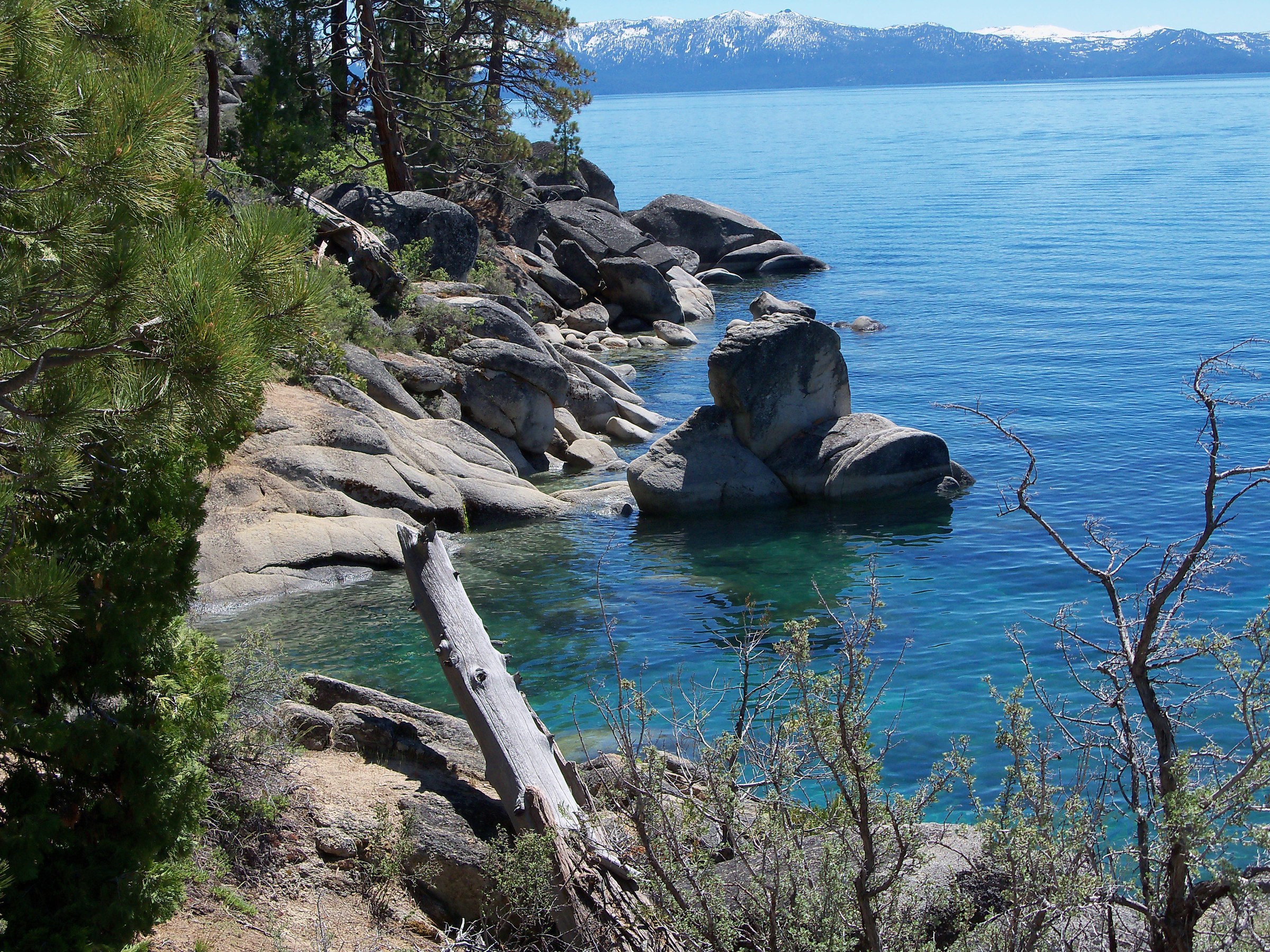
What the mines truly wanted was the forest. The silver of Virginia City came out of shafts that swallowed timber by the mountainside — square-set framing to hold the tunnels open, cordwood to run the engines, lumber to raise a city overnight — and the nearest forest was Tahoe's. For thirty years it was cut without mercy. Mills at Glenbrook, on the Nevada shore, sawed the basin's pines around the clock, and V-shaped flumes shot the lumber down the grade to the valley and up to the mines. By the 1890s the slopes above the lake had been stripped nearly bare, the sawdust and loosened soil washing into the streams. The forest you see today is second growth, younger than the mining camps that killed the first. The famous clarity has paid, too: a white disk was visible more than a hundred feet down in 1968 and barely sixty by the century's end, most of the loss now traced to runoff off roads and pavement. The blue is real, but it is not untouched — and the long campaign to hold it, the one that printed "Keep Tahoe Blue" on half the bumpers in the basin, is a rear-guard action, not a victory.
The river out
Sixty-three streams pour into Lake Tahoe and exactly one flows out. The Truckee River leaves at the northwest corner and runs the wrong way for a mountain river — east, away from the ocean, down out of the Sierra and into the desert. It passes through Reno, where the mountains finally let it loose on the flats, and keeps going until it ends, with no outlet at all, in the strange blue of Pyramid Lake out in the Numu — Northern Paiute — homeland north of the city. That thread of water once carried something remarkable between the two lakes: the Lahontan cutthroat trout, a fish that grew to four feet and forty pounds and ran the river from lake to lake to spawn. Overfishing, the logging silt, and a wall of irrigation dams finished it, and by the late 1930s the native trout was gone from Tahoe entirely. Then a lost strain of it turned up in a remote creek near the Utah line, was confirmed by genetics, and has been carried home — back into Pyramid in 2006, back into Tahoe in 2019. It is Nevada's state fish, and in 2024, for the first time in nearly ninety years, a few of them spawned in a Tahoe tributary on their own.
What the water holds
Stand on the east shore and none of this is obvious. The lake is simply, almost unreasonably, blue — a flooded fault block on the dry state's edge, its forest regrown, its trout coming back, its floor still dropping a fraction of an inch at a time. Drive U.S. 50 up over Spooner Summit and you cross from sagebrush into pine in twenty minutes, from the driest country in America to the largest alpine lake on it, and the whole improbable arrangement is held together by the fault running under your tires. Nevada keeps only the eastern third of the water. That has always been enough to make the driest state, at one edge, the bluest.