A 7-Day Itinerary
Utah's Mighty Five in 7 Days
A west-to-east week through Zion, Bryce Canyon, Capitol Reef, Canyonlands, and Arches — timed, fueled, and honest about the crowds.
7 days · 605 miles · best in spring & fall
Las Vegas, NV (arrival) → Moab, UT (depart via Salt Lake City or I-70)
Five national parks sit within a tank and a half of gas in southern Utah, strung along some of the best paved road in America. This is the week that earns the region its reputation — Zion's canyon walls, Bryce's hoodoo amphitheater, Capitol Reef's orchards and petroglyphs, and the twin red-rock heavyweights outside Moab. The route runs west to east: fly into Las Vegas, drive out through Salt Lake City, or run the whole thing in reverse. Either way, Highway 12 — the best road of the trip — lands in the middle, where it belongs. Seven days is the honest minimum. You can do it in five; you will spend the savings standing in entrance lines wishing you hadn't. Every drive below is real mileage on real roads, every overnight is a town with beds and dinner, and the permit fine print reflects what actually changed in 2026.
1
Day 1
Las Vegas to Zion — into the canyon
165 mi · about 2.8 hrs driving · overnight in Springdale
Leave Las Vegas early; the drive is about two and a half hours up I-15 and the Highway 9 Scenic Byway, and the light in Zion Canyon is better before noon anyway. Check into Springdale, leave the car, and ride the shuttle up-canyon for an afternoon warm-up: the Riverside Walk to the mouth of the Narrows, or the Pa'rus Trail if you'd rather ease in along the Virgin River. Zion National Park rewards the unhurried — the walls do the work. Dinner in Springdale, where every patio faces red rock. Go to bed early on purpose.
2
Day 2
Zion — the full day
overnight in Springdale
This is the day for the big one. If the Angels Landing lottery came through, ride the shuttle to the Grotto and start before the heat; if it didn't, hike to Scout Lookout anyway — the switchbacks of Walter's Wiggles and the view down-canyon require no permit and concede almost nothing. The alternative is the Narrows from the bottom up: rent canyoneering boots and a staff in Springdale and walk upriver as far as ambition holds, checking the flash-flood forecast first — the rangers post it daily, and they mean it. Either way you'll sleep like the canyon walls. Second night in Springdale.
3
Day 3
Zion to Bryce Canyon — through the tunnel, up to the hoodoos
78 mi · about 2 hrs driving · overnight in Bryce Canyon City
Climb out of the canyon on the Zion–Mount Carmel Highway, through the Zion–Mount Carmel Tunnel — a 1.1-mile bore blasted through sandstone in 1930 — and past Checkerboard Mesa on the east side. Turn north at Mount Carmel Junction onto US-89, then east through Red Canyon, where the hoodoos start rehearsing. Bryce Canyon National Park sits at 8,000 feet — bring the layer you didn't think you'd need. Walk the rim between Sunset and Sunrise Points in the late light, and if legs allow, drop into the amphitheater on the Navajo Loop. The Nuwuvi — the Southern Paiute — knew and named these formations long before anyone sold a postcard of them. Overnight at Bryce Canyon City or Tropic; the Bryce Canyon Lodge books out months ahead but is worth a walk-through regardless.
4
Day 4
Highway 12 — the best road of the trip
112 mi · about 3 hrs driving · overnight in Torrey
Catch sunrise at Sunrise Point — the hoodoos ignite from the top down — then give the whole day to Highway 12 Scenic Byway, the All-American Road that earns the title. Kodachrome Basin State Park is a worthy first detour. Stop in Escalante for fuel and the Interagency Visitor Center, then hike to Lower Calf Creek Falls if the trailhead lot cooperates — six miles round trip to a 126-foot desert waterfall. The road over the Hogback narrows to a spine with the world falling away on both sides; take it slow into Boulder, where Hells Backbone Grill is reason enough to time dinner right. Cross Boulder Mountain into Torrey as the light goes long. The Burr Trail Road will tempt you east — save it for the trip this itinerary talks you into next.
5
Day 5
Capitol Reef to Moab — orchards, petroglyphs, open road
145 mi · about 2.5 hrs driving · overnight in Moab
Capitol Reef National Park is the quiet one, which is its argument. Spend the morning in the Fruita Historic District, where the Fremont people farmed and carved petroglyphs centuries before Mormon settlers planted the orchards that still fruit today — pick in season, pay at the kiosk. The Gifford Homestead sells pie until it doesn't; go before noon. Drive the Scenic Drive to the Capitol Gorge spur if time allows, then point east on the Highway 24 Scenic Byway past the Fremont petroglyph panels and the moonscape around Factory Butte. Goblin Valley State Park is a worthy hour's detour north of Hanksville. Then I-70 east and US-191 south into Moab — pause at Hole N the Rock if roadside America is your genre. Two nights in Moab.
6
Day 6
Arches — early in, late out
30 mi · about 1 hr driving · overnight in Moab
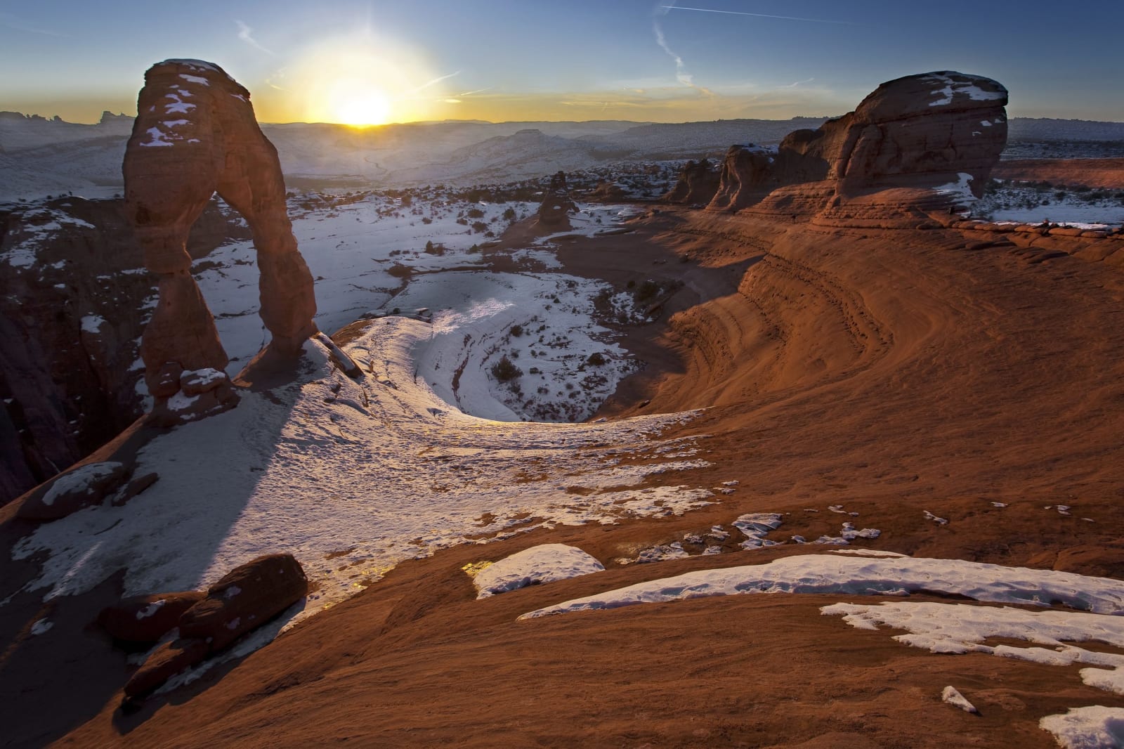
No reservation needed this year — just discipline. Be at the Arches National Park gate by 7 a.m. and drive straight to the back: Devils Garden first, where Landscape Arch stretches thinner than seems structural, then work forward against the arriving crowd — Delicate Arch from the trailhead if you have the legs (three miles round trip, no shade, worth every step), the Windows and Balanced Rock on the return. Retreat to Moab for the hot hours; the pool earns its keep. Then go back. Arches is an International Dark Sky Park and the gate never closes — the arches at dusk, then under stars, are a different park entirely, and the parking problem solves itself after dinner.
7
Day 7
Canyonlands and Dead Horse Point — the long view home
75 mi · about 2 hrs driving
Save the biggest landscape for last. Canyonlands' Island in the Sky district sits 40 minutes from town on a mesa a thousand feet above the confluence country — Mesa Arch at sunrise if you can stomach one more alarm, Grand View Point regardless. On the way back, Dead Horse Point State Park delivers the gooseneck view that launched a thousand posters, for a state-park fee and a fraction of the walking. Then choose your exit: north to Salt Lake City in about four hours, or east along the UT-128 Colorado River Road to I-70 — 44 river-hugging miles that send the trip out on a high note instead of an interstate.