The Story
Capitol Reef is the national park that most people skip, and the people who know it best would like to keep it that way. Wedged between Bryce Canyon and Canyonlands on the tourism circuit, it draws a fraction of their visitors — but those who stop discover a park that is arguably more varied, more surprising, and more intimate than any of its famous neighbors.
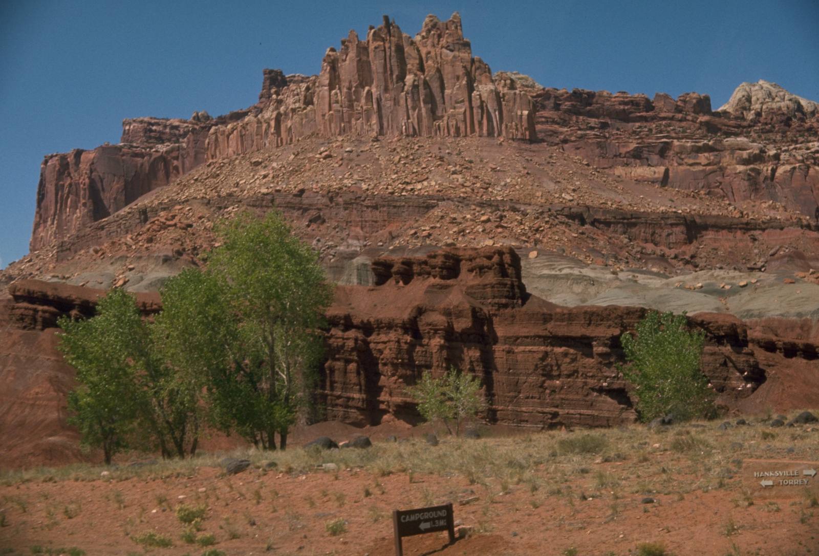
The centerpiece is the Waterpocket Fold, a 100-mile-long wrinkle in the Earth's crust where an ancient fault line buckled the rock layers into a massive step. Imagine taking a stack of differently colored blankets and pushing one end upward while holding the other flat — that is essentially what happened here roughly 50 to 70 million years ago, during the same tectonic upheaval that built the Rocky Mountains. The result is a geological cross-section sliced open and tilted on display, with rock layers spanning 270 million years visible from a single viewpoint.
The name itself tells two stories. Early settlers thought the rounded white domes of Navajo Sandstone resembled the U.S. Capitol building, and the word reef was a frontier term for any rocky barrier that impeded travel. The Waterpocket Fold was exactly that — a wall of tilted rock that blocked east-west passage for miles, forcing travelers to find the few narrow gaps where washes had cut through.
The Fruita Historic District is one of those gaps, and it is unlike anything else in the national park system. Mormon pioneers settled this narrow river valley in the 1880s and planted thousands of fruit trees — cherry, apricot, peach, pear, and apple — irrigated by the Fremont River. The orchards still stand, maintained by the Park Service, and during harvest season visitors can pick fruit right off the trees for a small fee. There is something almost disorienting about standing in a green, shaded orchard eating a warm peach while 1,000-foot red rock cliffs tower on either side. It feels like a glitch in the landscape.
The Scenic Drive south of Fruita follows the western face of the Waterpocket Fold past some of the most dramatic rock walls in Utah. Capitol Gorge, at the end of the road, is a narrow slot where pioneers once drove wagons through — you can still see their names and dates carved into the canyon walls, a pioneer register dating to the 1870s. The Golden Throne trail climbs to a viewpoint overlooking a massive dome of yellow Navajo Sandstone that glows like it is lit from within at sunset.
Hickman Bridge, a 133-foot natural bridge spanning a side canyon, is reachable by a one-mile trail that climbs through layers of Kayenta and Wingate Sandstone. The bridge frames the layered cliffs of the fold behind it, and the trail passes Fremont culture granaries — small stone storage structures tucked into cliff alcoves by people who farmed this valley a thousand years ago.
Cathedral Valley, in the park's remote northern section, requires a high-clearance vehicle and a river ford, but it rewards the effort with some of the most otherworldly scenery in Utah. The Temples of the Sun and Moon are massive monoliths of Entrada Sandstone standing alone in a flat desert valley, glowing red and gold against a sky that feels impossibly large. Few people make it out here, and the solitude is absolute.
The night sky at Capitol Reef is among the darkest in the lower 48 states. The park earned its International Dark Sky Park designation, and on a clear night the Milky Way is bright enough to read by. The Park Service runs regular stargazing programs, and the combination of dark skies and utter silence makes Capitol Reef feel more remote than it actually is.
What makes Capitol Reef special is the layering — not just geological layers, but layers of human history. Fremont people farmed here a thousand years ago. Pioneers planted orchards a hundred and fifty years ago. Their fruit trees still bear fruit. The river still flows. The fold still tilts. Everything here operates on its own timeline, and visiting feels less like tourism and more like stepping into a story that started long before you arrived and will continue long after you leave.
Visitor Info
On the Map
Stories featuring this place
Go deeper into the history and character of this stop
Nearby
The closest stops worth working into your route
Historical markers nearby
Roadside plaques and monuments within a short detour