The Story
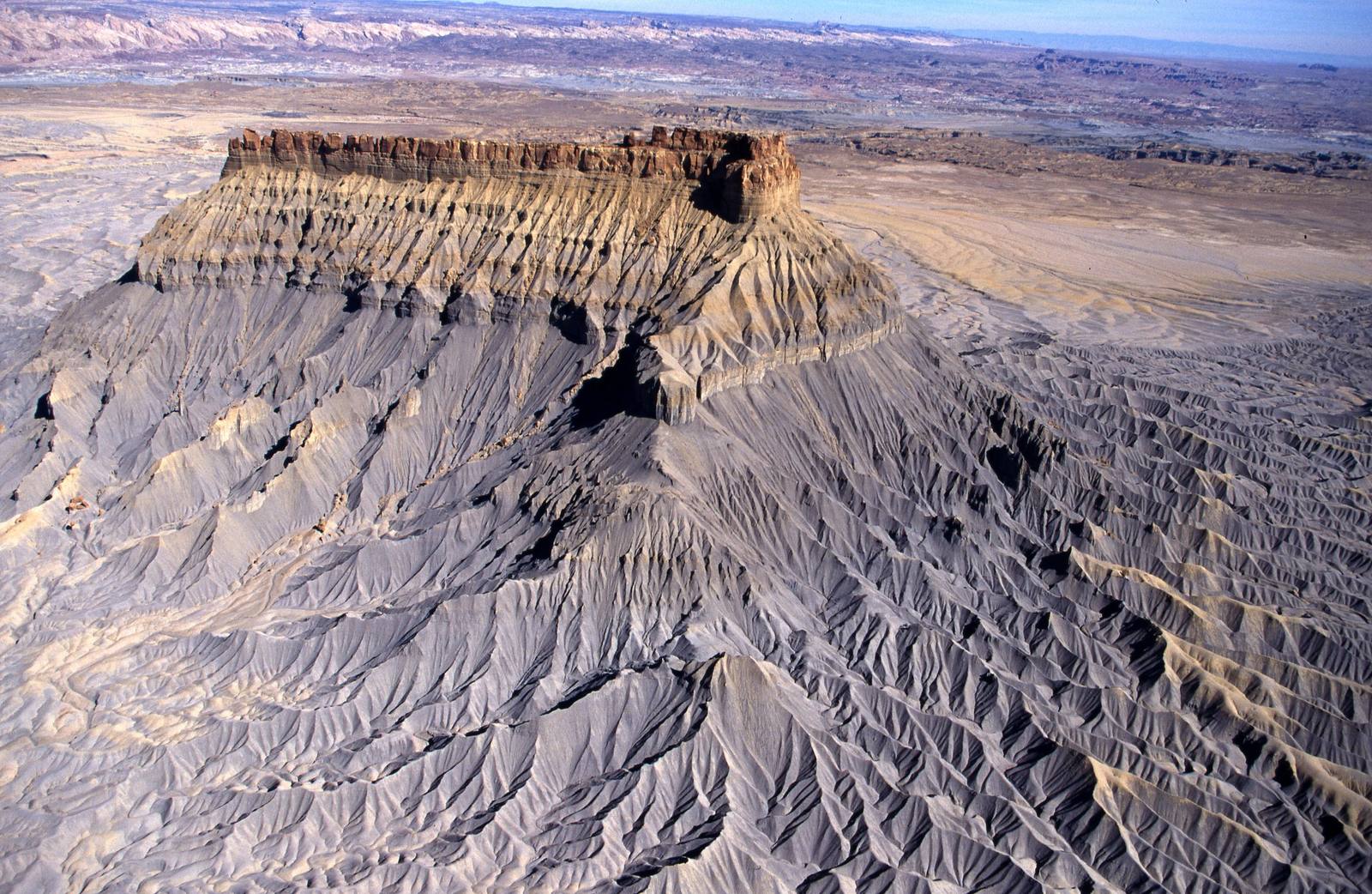
Factory Butte erupts from the desert about twelve miles west of Hanksville like something left behind by another planet. A flat-topped, grey-capped monolith rising to 6,302 feet, it stands alone above a sea of bare, rippled clay — the kind of ground travelers reach for the word "moonscape" to describe. Early settlers thought its hulking, angular profile resembled a factory building, and the name stuck. It sits just off State Route 24 north of the Fremont River, between Torrey and Hanksville and east of Capitol Reef National Park, an easy and unforgettable roadside stop for anyone crossing this empty quarter of Utah.
The butte is a lesson in geology written large. Its surroundings are Mancos Shale — soft marine mud laid down in a vast inland sea that covered Utah in the Late Cretaceous, roughly 90 million years ago — which erodes into the stark Caineville badlands at its base. A more resistant sandstone cap shields the summit while the softer shale washes away around it, leaving the butte standing as an erosional remnant of a plateau that has otherwise vanished. These same strata belong to the Henry Mountains coal field, and the dark Henry Mountains themselves loom on the southern horizon.
For visitors, the draw is the surreal scenery and the room to roam. The BLM manages Factory Butte as a recreation area, and its open badlands have long been a magnet for off-highway riders — the Swing Arm City play area sits just off the highway — though cross-country travel is steered away from the butte itself to protect a rare endemic cactus. In spring, good years bring an improbable bloom of desert wildflowers across the clay. There are no services out here, so come fueled and watered. Pair it with the hoodoo fields of Goblin Valley State Park to the south for a full day in Utah's strangest country.
Visitor Info
On the Map
Nearby
The closest stops worth working into your route
Historical markers nearby
Roadside plaques and monuments within a short detour