The Story
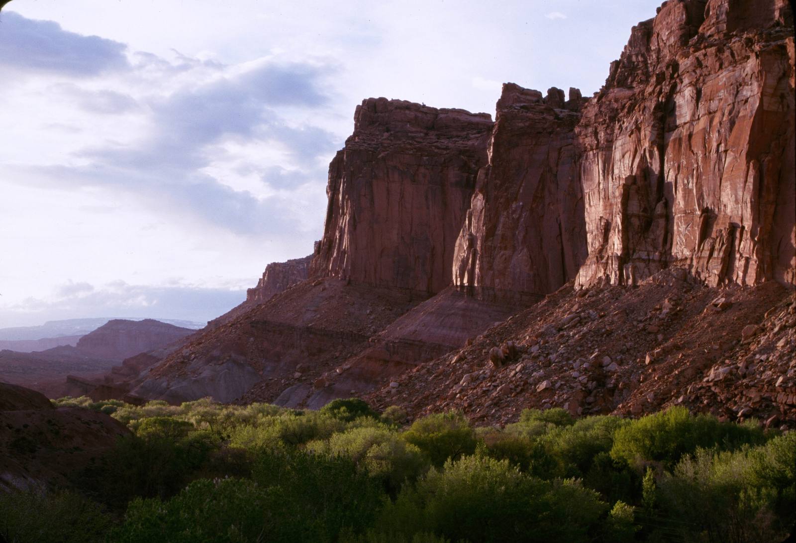
Fruita is the green heart of Capitol Reef National Park — a few hundred acres of orchard, pasture, and pioneer building tucked where the Fremont River meets Sulphur Creek, framed on every side by the burgundy cliffs of the Waterpocket Fold. Driving in on Utah State Route 24, the shift is startling: red rock and blackbrush give way to mown grass, irrigation ditches, and rows of fruit trees that have no business thriving in a high desert. That improbable oasis is exactly why people have lived here for centuries.
Mormon pioneers settled the valley in 1880, drawn by the rare combination of water and arable bottomland. The first homesteader, Nels Johnson, planted orchards from seed, and the settlement that grew up around the confluence was first called Junction before residents renamed it Fruita for the fruit that made it famous. It was always tiny — no more than ten families lived here at any one time — and remote enough that the first tractor didn't arrive until 1940 and electricity not until 1948. Families grew cherries, apricots, peaches, pears, apples, plums, mulberries, almonds, and walnuts as both cash crop and subsistence, supplementing farm income with road work and whatever else the canyon country offered. A one-room schoolhouse went up in 1896 and still stands beside the highway, its desks visible through the windows.
The town's isolation, which had defined it for ninety years, finally undid it. As Capitol Reef grew popular after World War II — it became a national monument in 1937 and a national park in 1971 — the National Park Service bought out the private holdings one by one through the 1960s. The last resident left in 1969. Most of the houses were removed, but the orchards and a handful of structures, including the Gifford Homestead farmhouse, were preserved as a living record of pioneer life. In 1974 the area was listed on the National Register of Historic Places as the roughly 200-acre Fruita Rural Historic District.
What survives is one of the only historic orchard systems maintained by the National Park Service anywhere. Roughly 1,900 heirloom fruit and nut trees remain, tended with the same techniques the settlers used — flood irrigation through ditches first dug in the 1880s, hand pruning, mapping, and the grafting of old varieties that have nearly vanished elsewhere. In harvest season, usually June through October, the orchards are open for u-pick: grab a bag, fill it from any tree marked with a u-pick sign, weigh it, and drop your payment in the honor-system cash box. The proceeds go straight back into keeping the orchards alive. The Gifford Homestead store sells pies, preserves, and pioneer-era goods a few steps away.
Fruita is also the natural base for the rest of the park. The Scenic Drive peels south toward the Waterpocket Fold's narrow gorges, and the trailheads for the Hickman Bridge Trail and Cohab Canyon are minutes away. Route 24 carries you west to the gateway town of Torrey — and on toward the Highway 12 climb over Boulder Mountain — or east toward Hanksville and the open desert beyond. To the south, the dark bulk of the Henry Mountains rides the horizon. Stop for an hour to pick fruit, or treat Fruita as the hub it has always been — but don't drive past the one patch of green in a hundred miles of stone without slowing down.
Visitor Info
On the Map
A story featuring this place
Go deeper into the history and character of this stop
Nearby
The closest stops worth working into your route
Historical markers nearby
Roadside plaques and monuments within a short detour