The Story
Kodachrome Basin got its name from a 1949 National Geographic expedition whose members thought the valley's colors were so vivid they could only be captured on Kodak's finest color film. They petitioned to name the place after it, and Kodak — a company famously protective of its trademarks — agreed. It remains the only park in the world authorized to use the Kodachrome name, and when you see the valley in late afternoon light, the decision makes perfect sense. The reds, oranges, creams, and whites shift and intensify as the sun moves, and the photographs you take here will look oversaturated even when they are not.
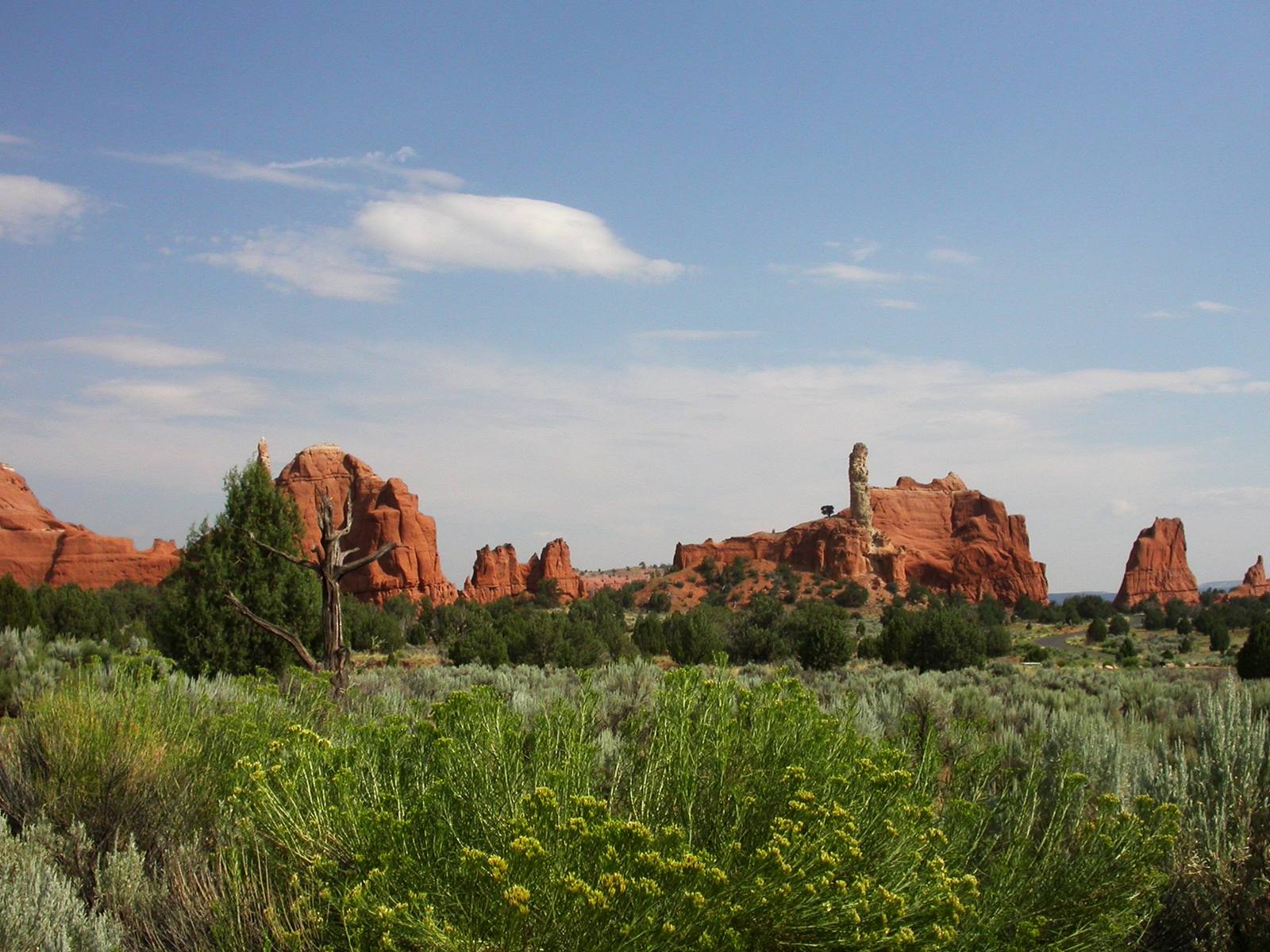
But the colors are only half the story. The defining feature of Kodachrome Basin is its 67 sedimentary pipes — tall, pale stone chimneys rising from the valley floor and canyon walls like the remains of an ancient city. These formations are unique. They are not hoodoos, not fins, not arches. They are cylindrical columns of hard calcite and sediment that filled ancient springs or geysers, and when the softer surrounding rock eroded away over millions of years, the harder pipe fillings remained standing. The leading geological theory is that these pipes mark the locations of ancient hot springs, similar to the geysers in Yellowstone, that were active roughly 180 million years ago during the Jurassic period. The mineral-rich water cemented the sediment inside the pipe channels into rock harder than the Entrada Sandstone around them. As erosion stripped away the sandstone, the pipes emerged like fossils of a hydrothermal system that has been extinct for longer than the Rocky Mountains have existed.
The largest pipes are over 50 feet tall, and several can be reached by short trails that wind through the basin. The Panorama Trail, a three-mile loop, passes through the heart of the formation field and offers the best overall introduction to the park. The trail is flat enough for families and scenic enough for photographers, winding between red rock walls and pale chimneys with views that open up at every turn. The Shakespeare Arch trail is a short spur leading to a small but perfectly formed natural arch named, with cheerful arbitrariness, by a ranger who thought it looked dramatic.
Kodachrome Basin sits at roughly 5,800 feet elevation in the Grand Staircase-Escalante region, surrounded by some of the most remote and least-visited public land in the lower 48. The park itself is small — only about 2,000 acres — but its position makes it an excellent base camp for exploring the surrounding backcountry. Cottonwood Canyon Road, a partly unpaved route running south from the park toward the Arizona border, passes through increasingly wild and beautiful terrain, including the Cockscomb, a dramatic razor-sharp ridge of tilted rock that marks the boundary between the Grand Staircase and the Kaiparowits Plateau.
Grosvenor Arch, a massive double arch named after National Geographic's founding editor, sits about ten miles south of the park along Cottonwood Canyon Road and is worth the detour. The arch stands 152 feet high and features two openings side by side — a rare configuration that gives it a cathedral-like grandeur. It is one of the most impressive arches in southern Utah and sees a fraction of the visitors that flock to Arches National Park.
The campground at Kodachrome Basin is one of the best in the Utah state park system — well-maintained sites nestled among juniper trees and red rock formations, with clean facilities and enough space that you do not feel stacked on top of your neighbors. Evenings here are quiet. The sky darkens early behind the canyon walls, the stone chimneys turn silver in the fading light, and the stars come out with the intensity that only remote southern Utah can deliver.
What makes Kodachrome Basin worth a stop is the combination of geological rarity and human-scale accessibility. The national parks demand days of your time and careful planning. Kodachrome Basin asks for an afternoon. You can drive in, hike the Panorama Trail, photograph the pipes in golden light, and be back at your campsite in time for dinner. It is not trying to compete with Bryce or Capitol Reef. It does not need to. It is doing something those parks cannot — showing you a geological feature that exists in exactly one place on Earth, in a valley colored so vividly that the world's most famous film company let it borrow their name.
Visitor Info
On the Map
A story featuring this place
Go deeper into the history and character of this stop
Nearby
The closest stops worth working into your route
Historical markers nearby
Roadside plaques and monuments within a short detour