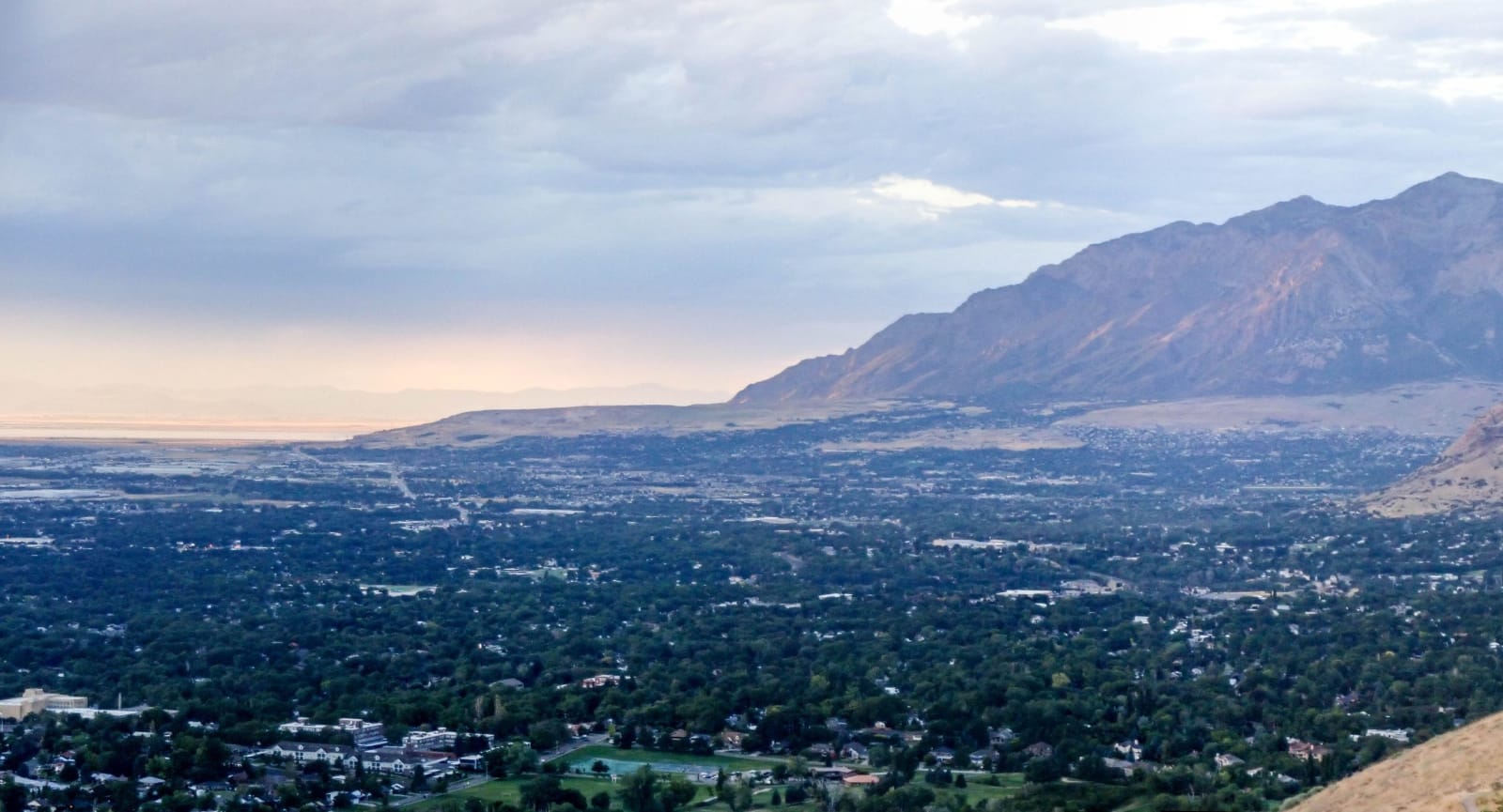
Ogden spread under tree canopy across the valley floor at dusk, the bare wall of the Wasatch rising on the right and the Great Salt Lake pale on the horizon to the left.
Thomas Wozniak / CC BY-SA 4.0 via Wikimedia Commons
Utah · Region

Salt Lake & the Wasatch Front

Utah's capital and the urban corridor along the mountains — Temple Square, the Great Salt Lake, the Cottonwood ski canyons, Ogden, and the Golden Spike.

26 places to explore

Most of Utah lives here, on the narrow shelf of land between the Great Salt Lake and the wall of the Wasatch Range. The Wasatch Front is the state's urban spine — a string of cities running north to south beneath the peaks — and its center is Salt Lake City, founded in 1847 when Brigham Young led the first Mormon pioneers down out of Emigration Canyon and declared the valley the right place to stop.

The city radiates from Temple Square, where the granite Salt Lake Temple took forty years to build and the domed Tabernacle still hosts its famous choir. Just above downtown, Ensign Peak is the knob Young climbed days after arriving to survey the new settlement; across town, This Is The Place Heritage Park marks where the pioneers first entered the valley. Between the monuments the city keeps its gentler pleasures: the aviary and gardens of Liberty Park, the International Peace Gardens, the strange and lovely folk-art Gilgal Sculpture Garden, and up on the foothills the Natural History Museum of Utah and Red Butte Garden.

West of the city lies the inland sea that named it. The Great Salt Lake is the largest saltwater lake in the Western Hemisphere, a shrinking remnant of ancient Lake Bonneville; Antelope Island rises from it with a free-roaming bison herd, the old lakeshore pavilion of Saltair sits on its southern edge, and far to the west the blinding white Bonneville Salt Flats draw the land-speed racers.

Behind the city the Wasatch climbs fast, and the two Cottonwood Canyons hold some of the deepest snow in the country — Alta and Snowbird in Little Cottonwood, Brighton and Solitude in Big Cottonwood. Out in the valley's southwest corner, the terraced pit of the Bingham Canyon Mine is so vast it can be seen from space.

North up the Front the cities keep coming: the century-old Lagoon amusement park, the warplanes of the Hill Aerospace Museum, and the old railroad hub of Ogden with its grand Union Station and the nearby slopes of Snowbasin and Powder Mountain. Farther still, history and art share the lakeshore: Golden Spike National Historical Park, where the transcontinental railroad was joined in 1869, and Robert Smithson's coiling earthwork Spiral Jetty out on the lake's lonely north arm.

What to See in Salt Lake & the Wasatch Front

26 places across the region, grouped by what they are.

Geology & Rock Formations
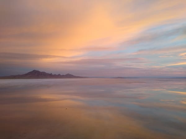
The Bonneville Salt Flats under a thin sheet of standing water at sunset, the flooded surface mirroring pink and orange cloud almost exactly, with a low dark range along the horizon at left.

Bonneville Salt Flats

Wendover

A blindingly white desert where land speed records are born

View details →

Natural Areas

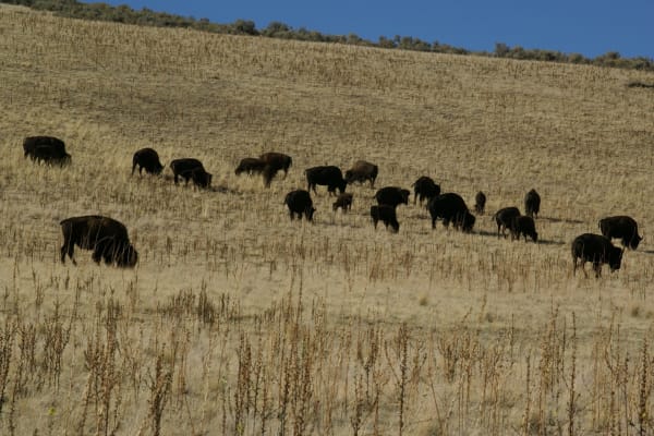
A herd of roughly twenty bison, including calves, grazing across a dry golden grass slope on Antelope Island, with sagebrush along the ridge crest above them and deep blue sky beyond.

Antelope Island State Park

Syracuse

A rugged island in the Great Salt Lake with free-roaming bison

View details →
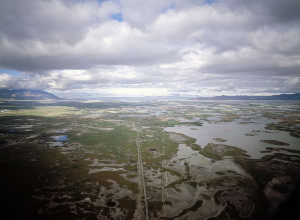
An aerial view across the marshes at the edge of the Great Salt Lake — braided shallow ponds and pale salt flats threaded by a dead-straight dike road running toward the water, with the open lake a thin bright band on the horizon and mountain ranges beyond under heavy cloud.

Great Salt Lake

Salt Lake City

The largest saltwater lake in the Western Hemisphere

View details →
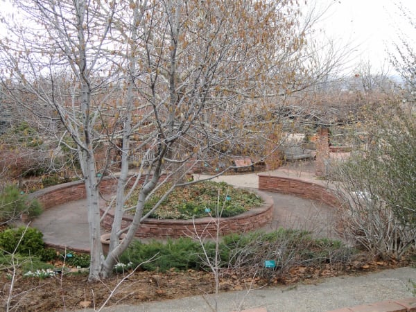
A circular raised bed at Red Butte Garden walled in red sandstone, with flagstone paths curving around it and a bare catkin-hung tree rising from its centre. Benches stand on the terrace beyond, low evergreens and labelled plantings fill the beds, fallen leaves cover the ground and the first snowdrops show at the edge, under a flat white winter sky.

Red Butte Garden

Salt Lake City

A 100-acre botanical garden with panoramic valley views

View details →

Hikes & Trails

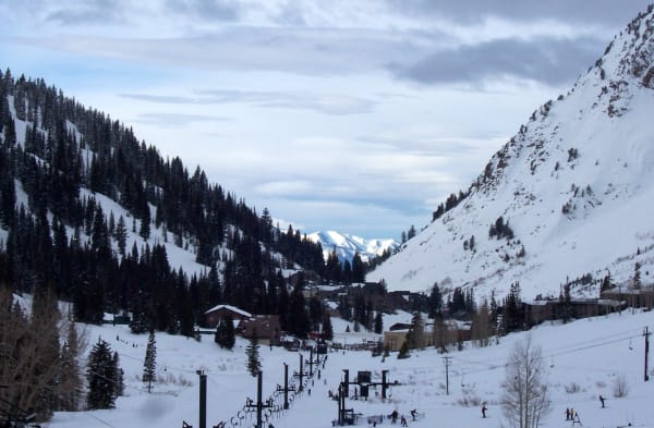
Skiers and chairlift towers on the snow-covered valley floor at Alta, dark conifers climbing the shaded slope at left, a bare wind-scoured face at right, base lodges clustered mid-valley, and distant snow peaks showing through the notch beyond under an overcast sky.

Alta Ski Area

Sandy

One of America's oldest and snowiest ski areas — ski-only, fiercely independent, and built on an old silver camp.

View details →
A skier in a black helmet, mirrored goggles and face gaiter looking out from a ridge at Brighton, with snow-covered slopes cut by tree-lined runs below, conifers in the foreground, and a pink and violet dusk sky over the peaks beyond.

Brighton Resort

Salt Lake City

The Salt Lake Valley's longtime local ski hill — big snow, lots of night skiing, and high-speed quads to everything.

View details →
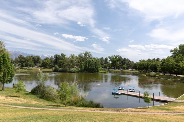
The boating pond at Liberty Park in summer — three blue pedal boats with canopies moored along a low wooden dock, a wooded island standing in the middle of the green water, and mature trees ringing the far bank. Mown lawn slopes down in the foreground, and the snow-flecked peaks of the Wasatch show above the treeline at left.

Liberty Park

Salt Lake City

Salt Lake Citys beloved 80-acre urban park since 1882

View details →
A hazy long-lens view from high on Powder Mountain, looking down a snow-covered canyon between conifer-studded slopes to the valley floor opening out below, with a road threading the canyon bottom at right and pale flats fading into haze beneath a long low range on the horizon.

Powder Mountain

Eden

The largest ski resort in the United States by acreage — a famously uncrowded "PowMow" now remaking itself under Netflix's Reed Hastings.

View details →
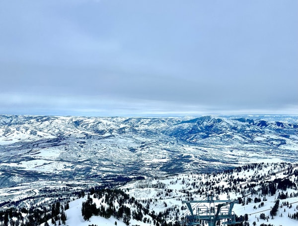
A wide view from high on Snowbasin looking out over range after range of snow-covered ridges and valleys running back to a hazy horizon, with groomed runs and scattered conifers dropping away below and the steel head of a lift terminal standing in the near corner, under flat grey winter cloud.

Snowbasin

Ogden

One of the country's oldest ski areas and a 2002 Olympic downhill venue — world-class terrain that somehow still skis uncrowded.

View details →
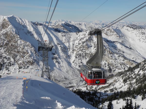
Snowbird's red aerial tram car suspended from its cables high above Little Cottonwood Canyon, skiers in helmets and goggles visible through the windows as it climbs toward the top station, with a steel tram tower standing on the ridge behind and snow-covered peaks, avalanche-scoured faces and dark stands of conifer falling away down the canyon.

Snowbird

Sandy

The aerial-tram resort of Little Cottonwood Canyon, with steep terrain, deep snow, and one of the longest seasons in the country.

View details →
The Solitude Nordic Center at Silver Lake under deep snow — a dark timber lodge standing at the treeline beyond an unbroken snowfield, with snow-laden conifers running back up the slope, cut ski runs showing on the mountainside above, and two small figures crossing the open snow. Low cloud sits along the ridge.

Solitude Mountain Resort

Salt Lake City

The uncrowded, Alterra-owned resort at the head of Big Cottonwood Canyon, with Honeycomb Canyon's bowls and a quiet village base.

View details →

Historic Sites

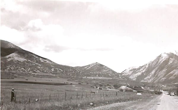
A 1946 photograph looking east up Emigration Canyon along State Road 65 — the road running away at right with a car on it, a wire fence crossing rough meadow in the foreground, a man in an overcoat and pale hat standing beside it at left, and snow-streaked ridges closing in on either side under a bright overcast sky.

Emigration Canyon

Salt Lake City

The final stretch of trail the Mormon pioneers took into the valley

View details →
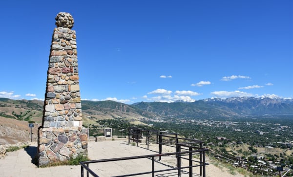
The cobblestone obelisk on the summit of Ensign Peak, standing on a paved terrace behind pipe railings with an interpretive plaque beside it, and the Salt Lake Valley spread below — downtown towers among green neighbourhoods, with the snow-streaked Wasatch Range across the valley under a clear blue summer sky.

Ensign Peak

Salt Lake City

A short hike to the spot where Brigham Young surveyed the valley

View details →
Two replica steam locomotives facing each other nose to nose on the rails at Promontory Summit — the Central Pacific's brightly painted Jupiter close in the foreground with red driving wheels, polished brass and a small US flag at its stack, and Union Pacific No. 119 standing beyond with its number legible on the plate. Sagebrush plain and cumulus cloud stretch behind them.

Golden Spike National Historical Park

Brigham City

Where East met West — the spot that connected America by rail

View details →
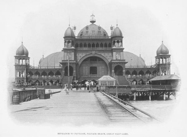
An archival photograph captioned "Entrance to Pavilion, Saltair Beach, Great Salt Lake" — the Moorish-domed resort pavilion raised on timber pilings above the water, with onion-domed corner towers, tiers of fretwork verandas, and a railway track running out along the plank pier toward its arched entrance, where a scattering of people in period dress stand.

Saltair

Magna

A haunting lakeside resort with a storied past

View details →
The This Is the Place Monument under a grey winter sky — a tall granite pylon topped by three standing bronze figures, with further bronze groups of pioneers, riders and ox teams set on the lower pedestals and relief panels worked around its base. Snow lies across the brick plaza and over the foothills behind, and the trees are bare.

This Is The Place Heritage Park

Salt Lake City

A living history village at the mouth of Emigration Canyon

View details →

Towns & Gateways

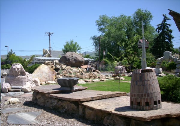
Carved stones set across the lawn at Gilgal Sculpture Garden — a sphinx with a human face at left, a brick beehive-shaped tower at right, and a stone basin resting on flagstone slabs in the foreground, with neighbouring rooftops, power lines and the foothills rising behind.

Gilgal Sculpture Garden

Salt Lake City

A surreal and eccentric sculpture garden hidden in a residential neighborhood

View details →
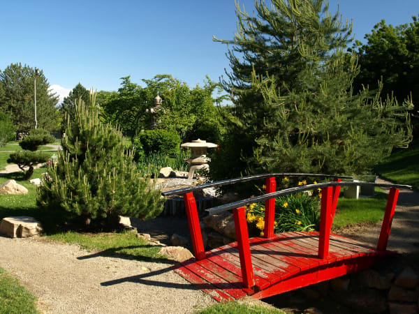
The Japanese garden at the International Peace Gardens — a red-painted wooden footbridge with peeling paint arching over a shallow stone-lined stream, a carved stone lantern standing beside the water and a taller stone figure among the trees behind, with clipped pines, gravel paths and yellow day lilies in bloom under a clear blue sky.

International Peace Gardens

Salt Lake City

A hidden garden where 28 countries are represented in miniature

View details →
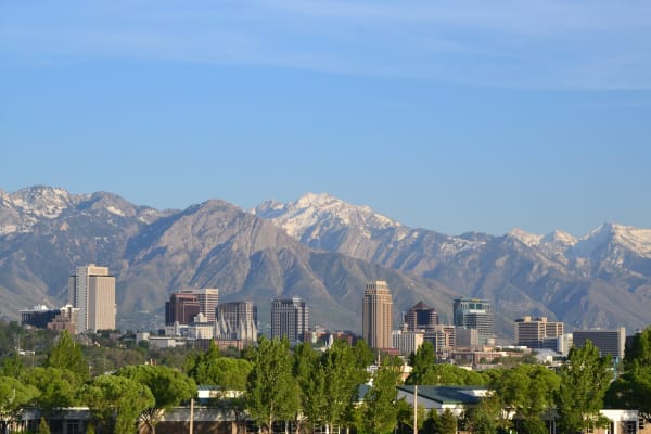
Downtown Salt Lake City's towers seen across a belt of green treetops, with the Wasatch Range rising directly behind the city and snow still lying on the high peaks and ridgelines under a clear blue sky. The white spires of the Salt Lake Temple stand among the office blocks left of centre.

Salt Lake City

Utah's capital and largest city — where the Wasatch Range meets the Great Salt Lake.

View details →
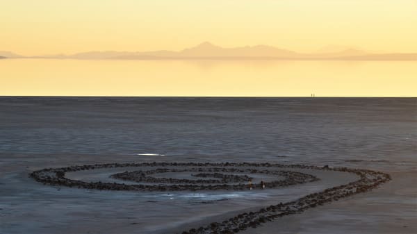
Robert Smithson's Spiral Jetty — a coil of black basalt rock curling counter-clockwise across pale, dry lakebed at the Great Salt Lake, with the water's edge lying well beyond the earthwork and low mountains on the horizon under a yellow sunset sky. Two small figures carrying buckets stand inside the innermost curve.

Spiral Jetty

Brigham City

Robert Smithsons iconic land art masterpiece on the Great Salt Lake

View details →

Architecture

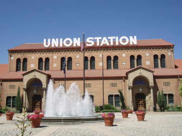
Ogden Union Station's long brick facade beneath a red tile roof, with UNION STATION spelled out in large white letters along the roofline, rows of tall arched windows set between coloured tile medallions, and twin arched entrance porches carried on stone columns. A fountain plays in the paved plaza in front, ringed by terracotta pots of flowers, with the US and Utah flags on poles alongside.

Ogden Union Station

Ogden

A grand 1924 train depot turned museum complex

View details →
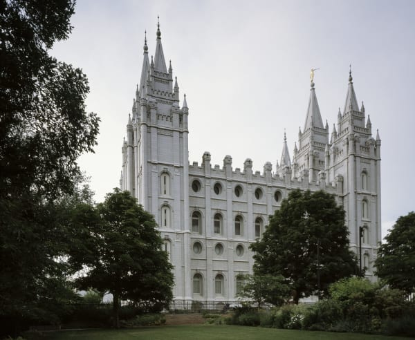
The Salt Lake Temple seen across a lawn from the south — grey granite walls with rows of oval and arched windows below a castellated parapet, six spires rising against an overcast sky with the gilded Angel Moroni on the tallest, and mature trees and a flowerbed in front of the iron perimeter fence.

Temple Square

Salt Lake City

The spiritual and architectural heart of Salt Lake City

View details →

Industry & Mining

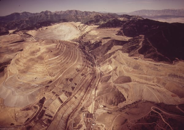
A July 1972 aerial view of the Bingham Canyon open-pit mine, concentric benches stepping down the left half of the frame, waste-rock dumps and switchbacked haul roads across the right, mill buildings on the valley floor below, and range after range receding into haze on the horizon.

Bingham Canyon Mine

Copperton

The largest man-made excavation on Earth

View details →

Attractions

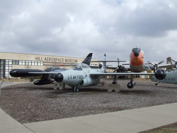
Aircraft on outdoor display at the Hill Aerospace Museum — a grey U.S. Air Force jet with wingtip fuel tanks and a black nose cone standing on a gravel apron in the foreground, propeller-driven aircraft ranged behind it including one with an orange-painted nose, and the low museum building carrying its name in raised letters across the wall beyond, under heavy grey cloud.

Hill Aerospace Museum

Roy

Over 90 military aircraft displayed indoors and on the tarmac

View details →
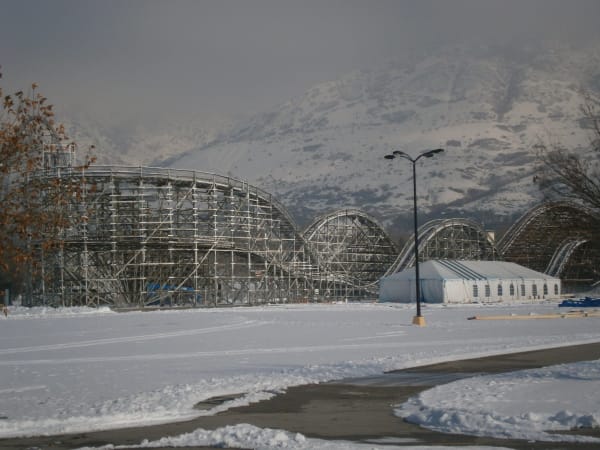
Lagoon's wooden roller coaster standing empty in winter, its white timber trestle running in a long series of humps across the frame, seen across a snow-covered lot with a marquee tent and a lamp standard beside it and the snow-dusted Wasatch foothills rising into haze behind.

Lagoon Amusement Park

Farmington

A beloved family amusement park operating since 1886

View details →
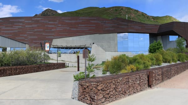
The Natural History Museum of Utah set into the Wasatch foothills — angular copper-clad walls weathered to a dark bronze, a tall glass curtain wall reflecting cloud, and board-formed concrete beneath. Gabion retaining walls of stacked rock and beds of native grasses line the approach path, and the green hillside rises directly behind the roofline.

Natural History Museum of Utah

Salt Lake City

A world-class museum built into the foothills above Salt Lake City

View details →

Scenic Drives through Salt Lake & the Wasatch Front

Scenic Byway

Interstate 80: The Bonneville Crossing

A hundred and thirty miles across the bed of a vanished sea, from Elko to the Bonneville Salt Flats — the crossing that nearly ended the Donner Party and, a century later, rehearsed the atomic bomb.

131 mi · 2 hrs

Stories from Salt Lake & the Wasatch Front

Nature

The Dead Sea That Feeds the Sky

Too salty for a single fish and nicknamed America's Dead Sea, the Great Salt Lake sounds like a void — and is in fact one of the most alive places on the continent, the brine pantry that feeds ten million migrating birds. Now it is falling to record lows, and a drying salt lake doesn't simply vanish: it becomes an arsenic dust bowl upwind of two and a half million people.

6 min read
Nature

The Greatest Snow on Earth

Utah puts “The Greatest Snow on Earth” on its license plates, and the snow is real — but almost everything people believe about why is wrong. It isn't the lake, and it isn't even the driest snow in the country. It is a recipe, and the same warming that is drying the Great Salt Lake is starting to take it apart.

6 min read
Geology

The Fault Under Everything

Most of Utah lives on the Wasatch Front because one crack in the crust raised the mountains, dropped the valleys, cut the benches the cities are terraced onto, and warms the springs — and the same crack is the largest earthquake hazard in the interior West, quiet now for a very long time.

7 min read
History

What the Mines Left Behind

Utah's greatest ski resorts were built on the wreckage of the industries that came before them — silver mines gone bust, a uranium fortune, a sheep range, a watershed logged and grazed nearly to ruin. The lifts went up exactly where the money ran out.

7 min read

Salt Lake & the Wasatch Front rewards the unhurried. Pick a base, fan out, and let the country between the headline stops surprise you.

← Explore more of Open Road Guide