The Story
Ensign Peak is a 20-minute hike that delivers the entire story of Salt Lake City in a single panoramic view. The trail climbs roughly 400 feet from a small parking lot in the foothills above the State Capitol to a modest summit where Brigham Young stood two days after arriving in the Salt Lake Valley in July 1847 and declared this the place to plant an ensign to the nations. The biblical reference — from Isaiah — was both spiritual and practical. Young was surveying his new home, assessing the valley's resources, and choosing the spot where a flag could be seen from every corner of the settlement below. The peak he chose still offers exactly that vantage, and standing on the summit today you can see why he picked it.
The view is a 360-degree inventory of everything that makes the Salt Lake Valley what it is. To the east, the Wasatch Range rises in a wall of granite and limestone, snow-capped well into June, scarred with the ski runs of Snowbird and Alta visible in Little Cottonwood Canyon. To the west, the Great Salt Lake stretches to the horizon, its surface shifting between blue, silver, and pink depending on the light and the salinity. To the south, the valley floor extends for miles — the grid of streets that Brigham Young laid out from this very hilltop still visible in the pattern of blocks and avenues, the temple spires and downtown towers rising from the center. To the north, the valley narrows toward the communities of Bountiful and Centerville, backed by the Wasatch foothills. The grid Young plotted from this summit still radiates from a single origin point — the southeast corner of Temple Square, the ten-acre block the pioneers reserved at the city's heart before a single street was drawn.
The trail itself is unremarkable — a well-maintained dirt path switchbacking up a dry, grassy hillside — but the historical weight of each step elevates it beyond a simple fitness walk. This is the exact ground that Young and a small group of pioneers climbed on July 26, 1847, when the valley below was empty sagebrush and the nearest non-indigenous settlement was over a thousand miles away. They looked out at a landscape that had no roads, no buildings, no irrigation ditches, and no fences, and they decided to build a civilization. The ambition of that decision — to look at a desert valley rimmed by mountains and see a city — is staggering, and standing on the summit you feel the full weight of what was imagined and what was accomplished.
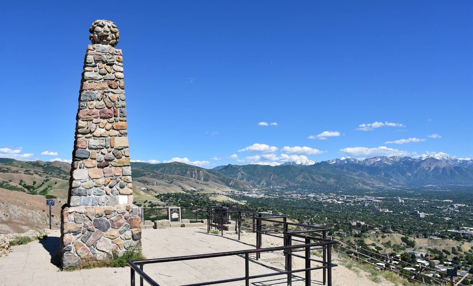
The peak has been a civic landmark since those earliest days. A flagpole was erected on the summit in the nineteenth century, and flags have flown from it intermittently ever since. A small monument marks the site, and interpretive signs provide historical context. The park surrounding the trailhead was developed by Salt Lake City and offers additional trails and viewpoints, though the summit itself is the primary destination.
The hike is popular with locals — joggers, dog walkers, families, and history buffs all share the trail — and the parking lot fills quickly on weekend mornings. The summit can be breezy, and in winter the trail can be icy, especially on the north-facing switchbacks. Summer evenings are the premium time slot — the sun drops behind the Oquirrh Mountains to the west, the valley fills with golden light, and the Great Salt Lake turns into a mirror of pink and orange. The city lights begin to flicker on below, and the transition from natural landscape to illuminated grid happens in real time, a daily reenactment of the transformation that Young set in motion from this exact spot.
The peak sits directly above the Utah State Capitol, and the visual relationship between the two is intentional. The Capitol was positioned on the hillside below Ensign Peak to create a sight line that connects the seat of government to the place where the settlement was conceived. The symbolism is layered — civic authority grounded in pioneer faith, political power anchored to a specific moment on a specific hilltop. Whether you find that symbolism inspiring or complicated depends on your relationship to the history it represents, but the physical connection between peak and capitol is undeniable.
Ensign Peak is also a quiet place to think about the people who were already in this valley when the pioneers arrived. The Shoshone, Ute, and Goshute peoples had lived in and around the Salt Lake Valley for generations, and the pioneer settlement that Brigham Young envisioned from this summit displaced communities that had their own deep relationship with this landscape. That history is increasingly acknowledged in the interpretive materials at the site and in the broader conversation about Utah's founding, and Ensign Peak — as the place where the pioneer story is most physically concentrated — is an appropriate place to hold both narratives in mind.
The hike is short, the view is enormous, and the history is foundational. Ensign Peak does not compete with the red rock country or the alpine wilderness for scenic drama. What it offers instead is context — the place where someone stood on a hilltop, looked at a desert valley, and saw the future. The city that future produced is spread out below you, and the mountains that framed that original vision have not moved an inch.
Visitor Info
On the Map
Nearby
The closest stops worth working into your route
Historical markers nearby
Roadside plaques and monuments within a short detour