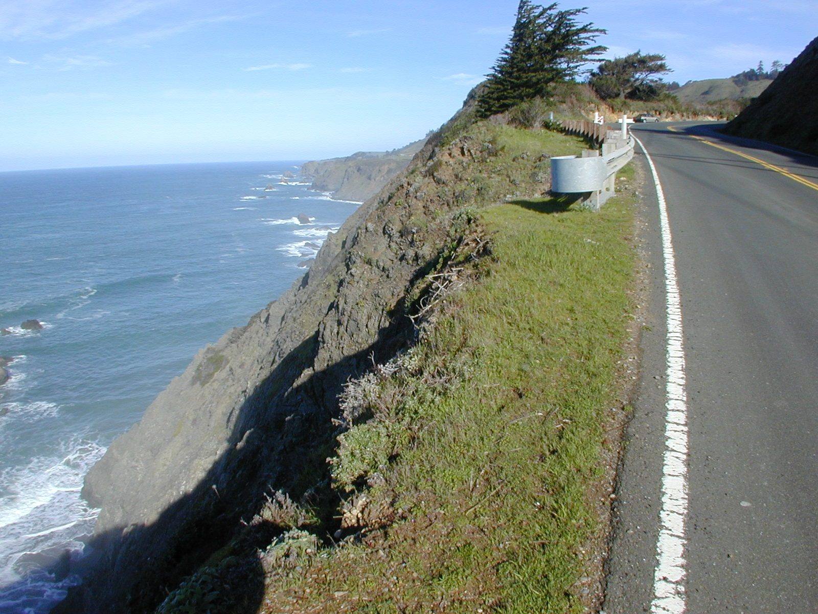
Highway 1 on the Mendocino coast running along the edge of a cliff, a guardrail on the bend ahead, the slope falling away at left to rocks and surf, with the coastline continuing south under a blue sky.
Dawn Endico / CC BY-SA 2.0 via Wikimedia Commons
California · Scenic Byway

Highway 1: The North Coast

Two hundred and fifteen miles of two-lane coast from the Golden Gate to Leggett — Muir Woods and the San Andreas rift, Point Reyes, the Russian River mouth, Salt Point's quarried cove, the Sea Ranch, Point Arena and the lumber headlands of Mendocino and Fort Bragg.

Route
Golden Gate Bridge, Marin County → Leggett, California
Distance
215 miles
Drive Time
6 hours
Best Seasons
Fall · Spring · Summer
Difficulty
Moderate

The Route at a Glance

The roadStops

The Coast Miwok held the shore from the Golden Gate to Bodega Bay, and the Kashaya Pomo and other Pomo peoples the coast beyond it, and most of what this road passes was theirs long before it was a ranch, a mill or a park. Highway 1 north of the bridge drives like what it is: two lanes, few straight miles, and an average speed that works out to under forty miles an hour.

The first hour is Marin. The road climbs the shoulder of Mount Tamalpais, passes the turn for Muir Woods, and comes out high over the ocean at the Muir Beach Overlook. Past Stinson Beach it runs straight up the San Andreas rift, with Bolinas Lagoon and then Tomales Bay filling the fault trough beside it. The Earthquake Trail near Olema shows how far the ground moved in 1906, and Kule Loklo is a short walk from it. The Point Reyes peninsula is a long detour west and worth a day of its own: the lighthouse set below the fog, the cypress tunnel at Coast Station KPH, and the elk country at Tomales Point.

North of Bodega Bay the road meets the Russian River at Jenner, where Goat Rock still shows the bite quarried out of it for a jetty that never worked. Then it climbs onto the cliffs. Salt Point is where some of San Francisco's paving stone came from, and the Sea Ranch is ten miles of meadow and cypress hedgerow planned as a town. Over the Gualala River the road enters Mendocino County, and just short of Point Arena a trail drops to Bowling Ball Beach, which shows its stones only at low tide. Beyond the town, the Stornetta lands were the first piece of the coastal national monument that visitors could walk on.

The Mendocino stretch is the lumber coast. Mills and loading chutes stood at creek mouths all along it, and the town of Mendocino began because a salvage trip after a shipwreck found redwoods instead; the wreck lies just up the road at Point Cabrillo. A mile past Caspar, Jug Handle walks up five ancient beaches. Fort Bragg has the Skunk Train depot downtown and Glass Beach on the bluffs where the town's dumps were.

North of Westport the houses thin out. The road holds the cliffs a few miles longer, then turns inland at Rockport and climbs over the ridge, about twenty miles of curves through second-growth forest, to end at Leggett on US-101.

Allow two days if you mean to stop. Fog can sit on this coast all day in summer; the clearest weather often comes in fall.

The Drive, Stop by Stop

16 stops along the route, in driving order from Golden Gate Bridge, Marin County to Leggett, California. 2 of them sit off the road itself — the distance is noted on each.

  1. 1

    Muir Woods National Monument

    Mill Valley

    A redwood canyon saved from a reservoir by a gift, and named for a man who had been there once.

    View details →
  2. 2

    Muir Beach Overlook

    Muir Beach

    A cliff edge on Highway 1, and the concrete dugouts where two-man crews watched the sea after Pearl Harbor.

    View details →
  3. 3

    Earthquake Trail

    Olema

    A short loop along the San Andreas, where a broken fence shows how far Point Reyes moved in under a minute in 1906.

    View details →
  4. 4

    Kule Loklo

    Olema

    A Coast Miwok village built in the 1970s to honour a people its builders were told had died out. They had not.

    View details →
  5. 5

    Point Reyes Lighthouse

    Inverness
    12 miles off the route

    A light set halfway down a cliff on purpose, because that was the only way to get it under the fog.

    View details →
  6. 6

    Cypress Tree Tunnel and Coast Station KPH

    Inverness
    4.9 miles off the route

    A radio company's driveway that grew into a tunnel, leading to the coast station that kept Morse code on the air.

    View details →
  7. 7

    Tomales Point

    Inverness

    The northern tip of Point Reyes, where tule elk were fenced in for forty-six years and are fenced in no longer.

    View details →
  8. 8

    Goat Rock and the Russian River Mouth

    Jenner

    A headland blasted for a jetty that never kept the river open, at the mouth where harbor seals haul out.

    View details →
  9. 9

    Salt Point and Gerstle Cove

    Jenner

    A cove where sandstone for San Francisco's streets went aboard schooners, on a point named for the salt the Kashaya Pomo came for.

    View details →
  10. 10

    The Sea Ranch

    Gualala

    A community planned around a sheep ranch's windbreaks, its first building now on the National Register.

    View details →
  11. 11

    Bowling Ball Beach

    Point Arena

    Rows of stone spheres laid out on a shelf of rock that may have travelled hundreds of miles up the coast.

    View details →
  12. 12

    Stornetta Public Lands

    Point Arena

    The first piece of the California Coastal National Monument a person could actually walk on.

    View details →
  13. 13

    Point Cabrillo Light Station

    Mendocino

    A 1909 light on the headland where a China trader's wreck set off the Mendocino lumber boom.

    View details →
  14. 14

    Jug Handle Ecological Staircase

    Caspar

    Five steps up from the beach, each about a hundred thousand years older than the last, ending in a forest of century-old trees no taller than a person.

    View details →
  15. 15

    Skunk Train (California Western Railroad)

    Fort Bragg

    A logging railroad from 1885, named for the smell of the motorcars it put on in 1925.

    View details →
  16. 16

    Glass Beach

    Fort Bragg

    Sixty years of Fort Bragg's garbage, ground down by the surf into a beach its visitors have nearly picked clean.

    View details →

That's the drive. Take your time, pull over often, and let Highway 1: The North Coast do what it does best.

← Explore more of Open Road Guide