Home / California / Golden Gate & the Marin Coast / Cypress Tree Tunnel and Coast Station KPH
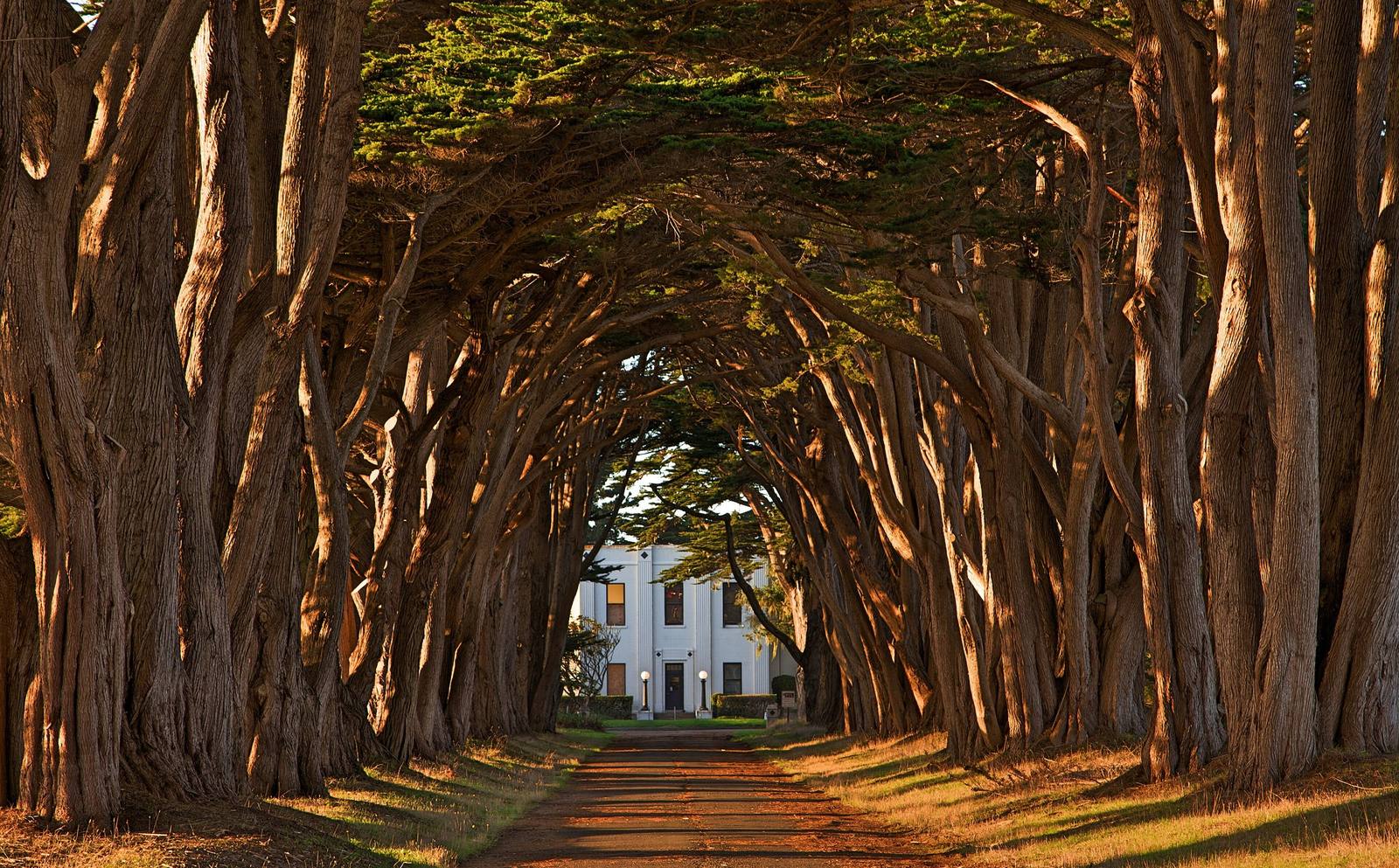
Two rows of Monterey cypress meeting overhead above a straight drive, their trunks lit amber by low sun, with the white Art Deco front of the KPH receiving station framed at the far end of the tunnel.Frank Schulenburg / CC BY-SA 3.0 via Wikimedia Commons
🏛️Historical

Cypress Tree Tunnel and Coast Station KPH

Part ofGolden Gate & the Marin Coast
On this driveHighway 1: The North Coast

A radio company's driveway that grew into a tunnel, leading to the coast station that kept Morse code on the air.

Off the Beaten PathPhotography
⏱
Duration
Fifteen minutes for the tunnel; an hour with a station tour.
🎟
Admission
Free.
📅
Best Season
Year-round; low afternoon light through the trees.

The Story

The trees were landscaping. Around 1930 the Radio Corporation of America lined the drive to its new receiving station with Monterey cypress, one of the few trees that will grow in the wind off Point Reyes Beach, and over ninety-odd years they closed over the road into the tunnel people now drive out to photograph.

At the end stands the reason for them: a white Art Deco station built between 1929 and 1931 to replace Marconi's 1914 receiving station at Marshall, on Tomales Bay. Working with transmitters across the peninsula near Bolinas, it handled ship-to-shore traffic for most of the twentieth century, and it has carried the call sign KPH since 1946. Coastal Morse stations once ran the length of both American coasts; one by one they shut down, and the Point Reyes stations were decommissioned in 1999.

They did not go quiet. Volunteers of the Maritime Radio Historical Society restored the receivers, transmitters and teletypes, some of it World War II-era equipment, and still put KPH on the air. Every July 12 they hold the Night of Nights, marking the end of commercial Morse operations in the United States. The building is the seashore's North District Operations Center, and the volunteers open the station for tours on most Saturday afternoons.

Visitor Info

⏱
Time Needed
Fifteen minutes for the tunnel; an hour with a station tour.
🎟
Admission
Free.
📅
Best Season
Year-round; low afternoon light through the trees.
🛣️
Highway
Sir Francis Drake Blvd, off CA-1 at Olema

On the Map

Nearby

The closest stops worth working into your route

natural6.6 mi away
Tomales Point
The northern tip of Point Reyes, where tule elk were fenced in for forty-six years and are fenced in no longer.
historical8 mi away
Point Reyes Lighthouse
A light set halfway down a cliff on purpose, because that was the only way to get it under the fog.
cultural8.4 mi away
Kule Loklo
A Coast Miwok village built in the 1970s to honour a people its builders were told had died out. They had not.
geological8.9 mi away
Earthquake Trail
A short loop along the San Andreas, where a broken fence shows how far Point Reyes moved in under a minute in 1906.
natural25 mi away
Muir Woods National Monument
A redwood canyon saved from a reservoir by a gift, and named for a man who had been there once.
historical25 mi away
Muir Beach Overlook
A cliff edge on Highway 1, and the concrete dugouts where two-man crews watched the sea after Pearl Harbor.

Historical markers nearby

Roadside plaques and monuments within a short detour

Marker4.1 mi away
Site of New Albion
Point Reyes Station
Marker12 mi away
Pioneer Paper Mill
Lagunitas
Marker13 mi away
Lime Kilns
Olema
Marker16 mi away
Bodega Bay and Harbor
Bodega Bay
Marker17 mi away
Site of the Lighter Wharf at Bolinas
Bolinas
Marker17 mi away
St. Teresa's Church
Bodega