Home / California / Golden Gate & the Marin Coast / Kule Loklo
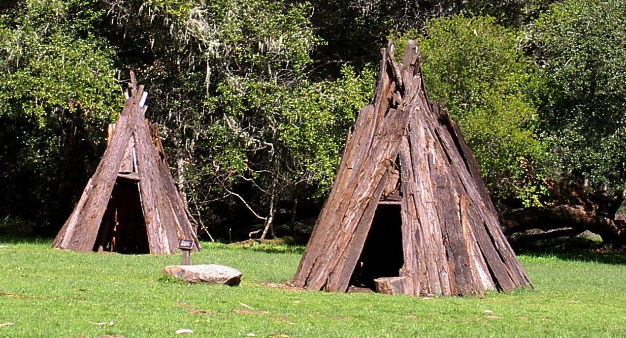
Two conical houses of leaning redwood bark slabs standing on a mown clearing at Kule Loklo, a flat stone in the grass between them and oak woodland behind.Stepheng3 / public domain via Wikimedia Commons
🎭Cultural

Kule Loklo

Part ofGolden Gate & the Marin Coast
On this driveHighway 1: The North Coast

A Coast Miwok village built in the 1970s to honour a people its builders were told had died out. They had not.

Native American Heritage
⏱
Duration
Thirty minutes; under a mile round trip from the visitor center.
🎟
Admission
Free.
📅
Best Season
Year-round.

The Story

Kule Loklo means Bear Valley. The village a short walk from the Bear Valley Visitor Center is a re-creation — bark houses, a sweathouse and a semi-subterranean roundhouse — begun in the mid-1970s by the Miwok Archeological Preserve of Marin and the Park Service with bicentennial money, and raised with digging sticks, baskets and traditional materials rather than machines.

It was meant as a tribute to a people many non-Indians in Marin believed were gone. A teacher who brought students to help build it later recalled asking whether any local Miwok had been consulted, and being told by the ranger in charge that the Miwok were extinct. A Coast Miwok elder remembered standing behind a tour group at the seashore years afterward and hearing a ranger say the same thing. The federal government had said it too: the California Rancheria Act of 1958 terminated the Graton Rancheria, and with it the Coast Miwok's standing as a tribe. Coast Miwok families had never left. On December 27, 2000, federal recognition was restored to the Federated Indians of Graton Rancheria, Coast Miwok and Southern Pomo together.

An arsonist burned the roundhouse in 1992; the community rebuilt it larger the next year. The Big Time festival held here each July, with Graton Rancheria as tribal partner, ran for decades. Organized programs have been suspended in recent years, but the village is open to walk through.

Visitor Info

⏱
Time Needed
Thirty minutes; under a mile round trip from the visitor center.
🎟
Admission
Free.
📅
Best Season
Year-round.
🛣️
Highway
CA-1 at Bear Valley Road

On the Map

Nearby

The closest stops worth working into your route

geological0.5 mi away
Earthquake Trail
A short loop along the San Andreas, where a broken fence shows how far Point Reyes moved in under a minute in 1906.
historical8.4 mi away
Cypress Tree Tunnel and Coast Station KPH
A radio company's driveway that grew into a tunnel, leading to the coast station that kept Morse code on the air.
historical12 mi away
Point Reyes Lighthouse
A light set halfway down a cliff on purpose, because that was the only way to get it under the fog.
natural13 mi away
Tomales Point
The northern tip of Point Reyes, where tule elk were fenced in for forty-six years and are fenced in no longer.
natural16 mi away
Muir Woods National Monument
A redwood canyon saved from a reservoir by a gift, and named for a man who had been there once.
historical17 mi away
Muir Beach Overlook
A cliff edge on Highway 1, and the concrete dugouts where two-man crews watched the sea after Pearl Harbor.

Historical markers nearby

Roadside plaques and monuments within a short detour

Marker3.6 mi away
Pioneer Paper Mill
Lagunitas
Marker5 mi away
Lime Kilns
Olema
Marker7.5 mi away
Site of New Albion
Point Reyes Station
Marker9.6 mi away
Site of the Lighter Wharf at Bolinas
Bolinas
Marker13 mi away
Home of Lord Charles Snowden Fairfax
Fairfax
Marker15 mi away
Camilo Ynitia Adobe
Novato