Home / California / Golden Gate & the Marin Coast / Muir Beach Overlook
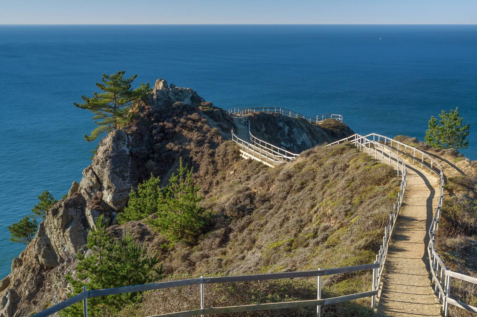
A railed path running out along a narrow rocky spine at Muir Beach Overlook, the slope falling away on both sides to the blue Pacific, with cypress and coyote brush on the rock.Frank Schulenburg / CC BY-SA 3.0 via Wikimedia Commons
🏛️Historical

Muir Beach Overlook

Part ofGolden Gate & the Marin Coast
On this driveHighway 1: The North Coast

A cliff edge on Highway 1, and the concrete dugouts where two-man crews watched the sea after Pearl Harbor.

Scenic Driving
⏱
Duration
Twenty to thirty minutes.
🎟
Admission
Free.
📅
Best Season
Year-round; summer fog often clears by afternoon.

The Story

The first long view of the open coast north of the Golden Gate comes half a mile past Muir Beach, where a narrow spine of rock runs out from the highway and falls away on three sides to the surf. On a clear day San Francisco shows to the south; to the north the cliffs of Mount Tamalpais State Park run on toward Stinson.

The concrete holes set into the slope are older than the overlook. After Pearl Harbor the Army ringed San Francisco Bay with base-end stations — small fire-control posts where soldiers watched for ships through powerful spotting scopes. Two posts sighting the same target from either end of a known baseline gave a plotting room enough to triangulate its range, speed and heading, and the plotting room turned that into firing data for the gun batteries in the Marin Headlands. Each station kept two men on duty at all times. The soldiers called them gopher holes, and four survive here. Radar made the whole system obsolete.

The posts were cold, damp and lonely work. The Park Service's own panel tells of a supply sergeant baffled that coast artillery in California was ordering Arctic clothing.

Visitor Info

⏱
Time Needed
Twenty to thirty minutes.
🎟
Admission
Free.
📅
Best Season
Year-round; summer fog often clears by afternoon.
🛣️
Highway
CA-1

On the Map

Nearby

The closest stops worth working into your route

natural2.2 mi away
Muir Woods National Monument
A redwood canyon saved from a reservoir by a gift, and named for a man who had been there once.
geological17 mi away
Earthquake Trail
A short loop along the San Andreas, where a broken fence shows how far Point Reyes moved in under a minute in 1906.
cultural17 mi away
Kule Loklo
A Coast Miwok village built in the 1970s to honour a people its builders were told had died out. They had not.
historical25 mi away
Cypress Tree Tunnel and Coast Station KPH
A radio company's driveway that grew into a tunnel, leading to the coast station that kept Morse code on the air.
historical26 mi away
Point Reyes Lighthouse
A light set halfway down a cliff on purpose, because that was the only way to get it under the fog.
natural30 mi away
Tomales Point
The northern tip of Point Reyes, where tule elk were fenced in for forty-six years and are fenced in no longer.

Historical markers nearby

Roadside plaques and monuments within a short detour

Marker3.4 mi away
First Sawmill in Marin County
Mill Valley
Marker3.7 mi away
Outdoor Art Club
Mill Valley
Marker6.2 mi away
Golden Gate Bridge
Sausalito
Marker7 mi away
Castillo de San Joaquín
San Francisco
Marker7.1 mi away
Green Brae Brick Kiln
Larkspur
Marker7.8 mi away
Site of the Lighter Wharf at Bolinas
Bolinas