Home / California / Golden Gate & the Marin Coast / Tomales Point
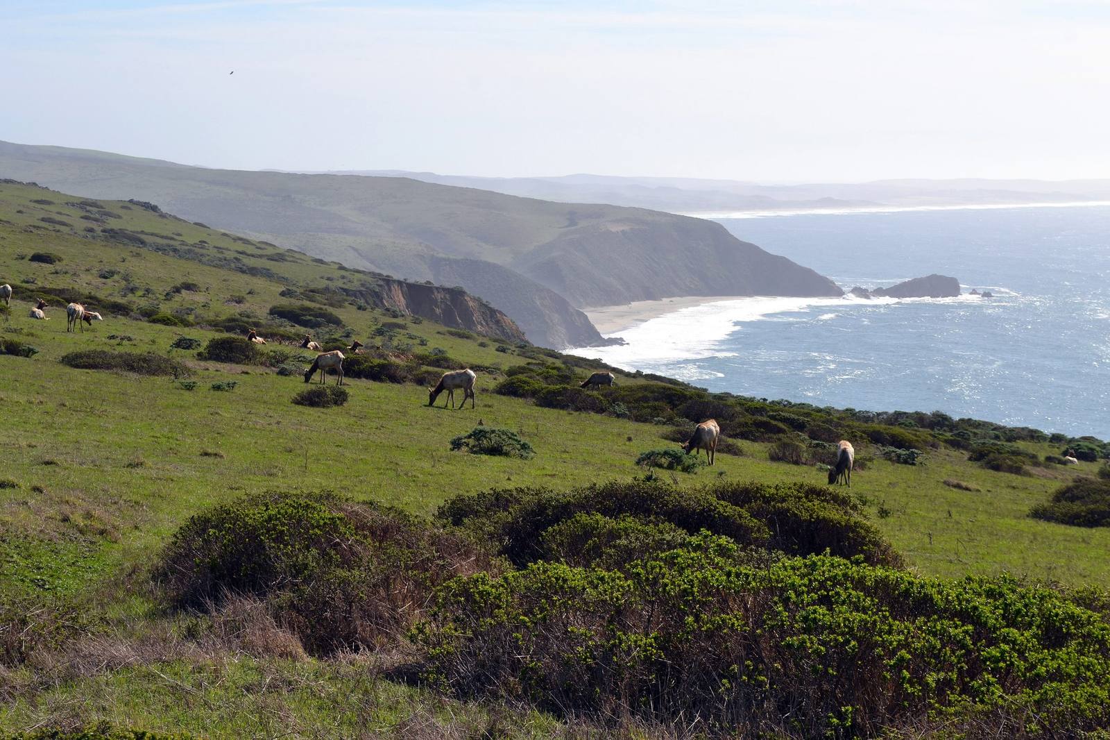
Tule elk grazing a green slope of the Tomales Point ridge, scattered among coastal scrub, with the cliffs and pale surf of the ocean shore running north to the point.Oleg Alexandrov / CC BY-SA 3.0 via Wikimedia Commons
🌲Natural

Tomales Point

Part ofGolden Gate & the Marin Coast
On this driveHighway 1: The North Coast

The northern tip of Point Reyes, where tule elk were fenced in for forty-six years and are fenced in no longer.

Hiking
⏱
Duration
Half a day for the full trail; an hour for the first miles and the ranch.
🎟
Admission
Free.
📅
Best Season
Spring for wildflowers; late summer and fall for the elk rut.

The Story

Tomales Point is the last narrow finger of the Point Reyes peninsula, open ocean on one side and Tomales Bay on the other. The trail leaves from the old Pierce Point Ranch, a nineteenth-century dairy the Park Service keeps standing, and runs north along the ridge toward the point.

Tule elk grazed this peninsula for thousands of years before hunters and ranchers all but wiped them out across California. In 1978 the Park Service brought ten back to Tomales Point and closed them in behind an eight-foot fence, about two miles long, across the neck of the peninsula, to keep them off the leased cattle and dairy ranches to the south. The herd grew, and in dry years it paid for the fence: there was not enough water or forage inside it, and in 2020 and 2021, 293 elk died there. Elk moved out of the reserve in 1998 to roam free elsewhere in the park suffered no such die-offs.

After years of lawsuits the Park Service adopted a plan to take the fence down and began cutting it in December 2024. The next month a settlement retired twelve of the seashore's ranches — six dairies and six beef operations — with buyouts funded by The Nature Conservancy, and the park committed to managing its elk as free-roaming animals.

The trail is open, windy and exposed, close to ten miles out and back to the point.

Visitor Info

⏱
Time Needed
Half a day for the full trail; an hour for the first miles and the ranch.
🎟
Admission
Free.
📅
Best Season
Spring for wildflowers; late summer and fall for the elk rut.
🛣️
Highway
Pierce Point Road, off Sir Francis Drake Blvd

On the Map

Nearby

The closest stops worth working into your route

historical6.6 mi away
Cypress Tree Tunnel and Coast Station KPH
A radio company's driveway that grew into a tunnel, leading to the coast station that kept Morse code on the air.
cultural13 mi away
Kule Loklo
A Coast Miwok village built in the 1970s to honour a people its builders were told had died out. They had not.
geological13 mi away
Earthquake Trail
A short loop along the San Andreas, where a broken fence shows how far Point Reyes moved in under a minute in 1906.
historical14 mi away
Point Reyes Lighthouse
A light set halfway down a cliff on purpose, because that was the only way to get it under the fog.
natural20 mi away
Goat Rock and the Russian River Mouth
A headland blasted for a jetty that never kept the river open, at the mouth where harbor seals haul out.
natural29 mi away
Muir Woods National Monument
A redwood canyon saved from a reservoir by a gift, and named for a man who had been there once.

Historical markers nearby

Roadside plaques and monuments within a short detour

Marker9.9 mi away
Bodega Bay and Harbor
Bodega Bay
Marker11 mi away
Site of New Albion
Point Reyes Station
Marker11 mi away
St. Teresa's Church
Bodega
Marker16 mi away
Pioneer Paper Mill
Lagunitas
Marker16 mi away
Cotati Downtown Plaza
Cotati
Marker18 mi away
Lime Kilns
Olema