Home / California / Sonoma & Mendocino Coast / The Sea Ranch
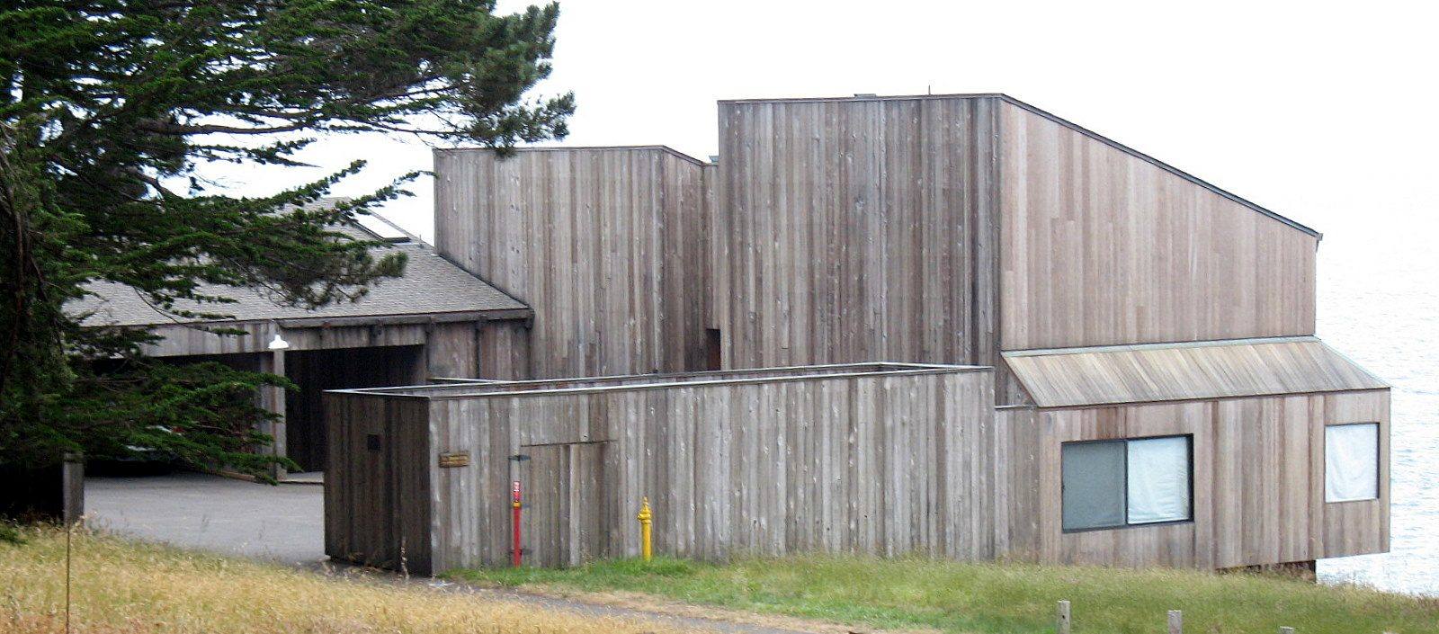
Condominium One at The Sea Ranch: a cluster of tall timber volumes clad in vertical weathered redwood boards with single-pitch roofs, set on a meadow beside cypress trees.Sanfranman59 / CC BY-SA 3.0 via Wikimedia Commons
🏛️Historical

The Sea Ranch

Part ofSonoma & Mendocino Coast
On this driveHighway 1: The North Coast

A community planned around a sheep ranch's windbreaks, its first building now on the National Register.

⏱
Duration
An hour or two.
📅
Best Season
Any season.

The Story

When Al Boeke flew over this strip of coast in 1962, scouting a site for a new town on behalf of Oceanic Properties, a Hawaii developer's subsidiary, it was an overgrazed sheep ranch. What held his eye were the hedgerows: double rows of Monterey cypress planted across the meadows early in the century to break the wind. Oceanic bought the ranch from the Ohlson family in 1963.

The landscape architect Lawrence Halprin read the land before anyone drew a house. His plan kept the open meadows as commons and set buildings against the hedgerows and the forest edge, out of the wind and out of one another's views. Two demonstration projects fixed the look. Condominium One, ten units by Moore, Lyndon, Turnbull and Whitaker finished in 1965, steps down its slope in timber walls and steep single-pitch roofs. Joseph Esherick's Hedgerow Houses sit tucked into a row of cypress, their roofs angled the way the wind has bent the trees.

The idea did not hold all the way through. With its finances failing in the 1980s, Oceanic fell back on ordinary subdivision, and the later houses show it. Condominium One was listed on the National Register of Historic Places in 2005.

The lodge is open to the public. Condominium One is private homes, seen from the lodge grounds.

Visitor Info

⏱
Time Needed
An hour or two.
📅
Best Season
Any season.
🛣️
Highway
CA-1, about 7 miles south of Gualala

On the Map

Nearby

The closest stops worth working into your route

historical9.8 mi away
Salt Point and Gerstle Cove
A cove where sandstone for San Francisco's streets went aboard schooners, on a point named for the salt the Kashaya Pomo came for.
natural18 mi away
Bowling Ball Beach
Rows of stone spheres laid out on a shelf of rock that may have travelled hundreds of miles up the coast.
natural22 mi away
Stornetta Public Lands
The first piece of the California Coastal National Monument a person could actually walk on.
natural23 mi away
Goat Rock and the Russian River Mouth
A headland blasted for a jetty that never kept the river open, at the mouth where harbor seals haul out.
natural43 mi away
Tomales Point
The northern tip of Point Reyes, where tule elk were fenced in for forty-six years and are fenced in no longer.
historical48 mi away
Cypress Tree Tunnel and Coast Station KPH
A radio company's driveway that grew into a tunnel, leading to the coast station that kept Morse code on the air.

Historical markers nearby

Roadside plaques and monuments within a short detour

Marker15 mi away
Fort Ross
Jenner
Marker24 mi away
Icaria-Speranza Utopian Colony
Cloverdale
Marker25 mi away
Italian Swiss Colony
Cloverdale
Marker25 mi away
Point Arena Light Station
Point Arena
Marker26 mi away
Frog Woman Rock
Hopland