Home / California / Golden Gate & the Marin Coast / Muir Woods National Monument
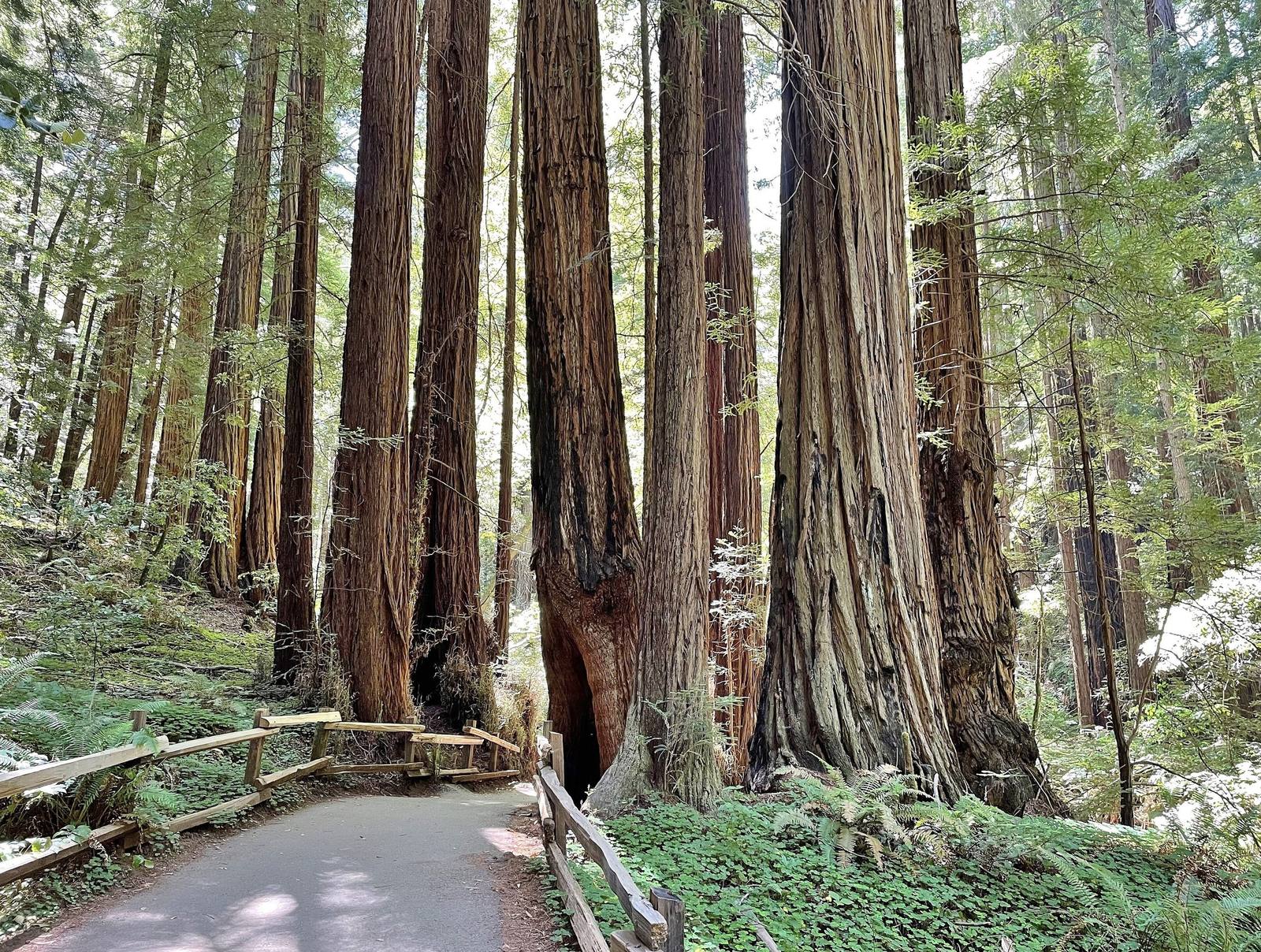
A paved path with a wooden rail curving between tall redwood trunks in Muir Woods, sword ferns and redwood sorrel covering the ground beneath them.Marty Aligata / CC BY-SA 4.0 via Wikimedia Commons
🌲Natural

Muir Woods National Monument

Part ofGolden Gate & the Marin Coast
On this driveHighway 1: The North Coast

A redwood canyon saved from a reservoir by a gift, and named for a man who had been there once.

IconicNative American HeritageHiking
⏱
Duration
One to two hours on the creek trail; half a day with the climb to Ocean View or Ben Johnson.
🎟
Admission
Entrance fee; a parking or shuttle reservation is required in advance.
πŸ“…
Best Season
Year-round; early morning and winter weekdays are quietest.
πŸ’‘
Fun Fact
The last grizzly bear in Marin County was killed in this canyon in 1903.

The Story

Redwood Canyon was Huimen country, Coast Miwok, long before it was anyone's real estate. Its trees outlived the logging that took nearly every other redwood around the Bay for a plain reason: the canyon was too steep and awkward to get them out.

The threat that finally came was water, not timber. William Kent and Elizabeth Thacher Kent bought the canyon in 1905 for $45,000, but the water rights belonged to the North Coast Water Company, which wanted Redwood Creek dammed for a reservoir. After the 1906 earthquake raised the demand for water, the company filed to condemn part of the Kents' land. The Kents answered by giving the canyon away. They deeded about three hundred acres to the federal government on December 26, 1907, and on January 9, 1908, Theodore Roosevelt proclaimed it a national monument.

Roosevelt wanted it named for Kent. Kent asked for John Muir instead, though Muir's only known connection to the canyon was a visit in 1904. The water company pressed its suit for another year and then dropped it.

The main trail follows the creek on a level path under the oldest trees. Parking and shuttle seats are reserved in advance.

Visitor Info

⏱
Time Needed
One to two hours on the creek trail; half a day with the climb to Ocean View or Ben Johnson.
🎟
Admission
Entrance fee; a parking or shuttle reservation is required in advance.
πŸ“…
Best Season
Year-round; early morning and winter weekdays are quietest.
πŸ›£οΈ
Highway
CA-1 via Muir Woods Road

On the Map

Nearby

The closest stops worth working into your route

historical2.2 mi away
Muir Beach Overlook
A cliff edge on Highway 1, and the concrete dugouts where two-man crews watched the sea after Pearl Harbor.
geological16 mi away
Earthquake Trail
A short loop along the San Andreas, where a broken fence shows how far Point Reyes moved in under a minute in 1906.
cultural16 mi away
Kule Loklo
A Coast Miwok village built in the 1970s to honour a people its builders were told had died out. They had not.
historical25 mi away
Cypress Tree Tunnel and Coast Station KPH
A radio company's driveway that grew into a tunnel, leading to the coast station that kept Morse code on the air.
historical26 mi away
Point Reyes Lighthouse
A light set halfway down a cliff on purpose, because that was the only way to get it under the fog.
natural29 mi away
Tomales Point
The northern tip of Point Reyes, where tule elk were fenced in for forty-six years and are fenced in no longer.

Historical markers nearby

Roadside plaques and monuments within a short detour

Marker1.3 mi away
First Sawmill in Marin County
Mill Valley
Marker1.7 mi away
Outdoor Art Club
Mill Valley
Marker5.1 mi away
Green Brae Brick Kiln
Larkspur
Marker6.2 mi away
Mission San Rafael ArcΓ‘ngel
San Rafael
Marker6.4 mi away
Home of Lord Charles Snowden Fairfax
Fairfax
Marker6.5 mi away
Golden Gate Bridge
Sausalito