Home / California / Sonoma & Mendocino Coast / Salt Point and Gerstle Cove
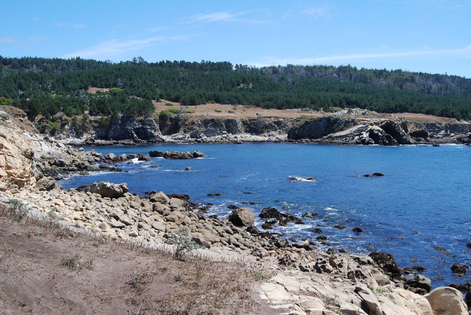
Gerstle Cove at Salt Point under a clear sky: blue water ringed by pale weathered sandstone, rocky ledges in the foreground and a line of dark conifer forest above the low bluffs across the cove.Kglavin / CC BY 2.5 via Wikimedia Commons
🏛️Historical

Salt Point and Gerstle Cove

Part ofSonoma & Mendocino Coast
On this driveHighway 1: The North Coast

A cove where sandstone for San Francisco's streets went aboard schooners, on a point named for the salt the Kashaya Pomo came for.

Native American HeritageSandstone
⏱
Duration
One to three hours.
🎟
Admission
Day-use fee per vehicle.
📅
Best Season
Late spring and summer for low tides in daylight; winter for gray whales offshore.

The Story

The name is older than the park. Seawater dries in the hollows of the sandstone here and leaves salt behind, and Kashaya Pomo people scraped it from the rock with abalone chisels, for their own use and to trade.

From the 1850s the stone itself was the export. A San Francisco company quarried the sandstone around Gerstle Cove, and it went south as paving and building stone for the city and for the navy yard at Mare Island. Walk the Salt Point Trail north from the cove and the evidence lies where the quarrymen left it: squared slabs on the terrace, and lines of drill holes in an old sea stack that the rising land has since left well back from the surf. On the rocks either side of the cove, rusted iron bolts mark where ships were held while stone, tanoak and cordwood came down to them by cable and chute.

The honeycomb weathering in the same sandstone is tafoni, carved as seawater soaks in, dries out and crystallizes, season after season.

In 1974 the cove became one of California's first underwater reserves, and nothing is taken from it now. The tide pools along its edge are worth timing a visit to a low tide.

Visitor Info

⏱
Time Needed
One to three hours.
🎟
Admission
Day-use fee per vehicle.
📅
Best Season
Late spring and summer for low tides in daylight; winter for gray whales offshore.
🛣️
Highway
CA-1, about 20 miles north of Jenner

On the Map

Nearby

The closest stops worth working into your route

historical9.8 mi away
The Sea Ranch
A community planned around a sheep ranch's windbreaks, its first building now on the National Register.
natural14 mi away
Goat Rock and the Russian River Mouth
A headland blasted for a jetty that never kept the river open, at the mouth where harbor seals haul out.
natural28 mi away
Bowling Ball Beach
Rows of stone spheres laid out on a shelf of rock that may have travelled hundreds of miles up the coast.
natural32 mi away
Stornetta Public Lands
The first piece of the California Coastal National Monument a person could actually walk on.
natural33 mi away
Tomales Point
The northern tip of Point Reyes, where tule elk were fenced in for forty-six years and are fenced in no longer.
historical39 mi away
Cypress Tree Tunnel and Coast Station KPH
A radio company's driveway that grew into a tunnel, leading to the coast station that kept Morse code on the air.

Historical markers nearby

Roadside plaques and monuments within a short detour

Marker5.5 mi away
Fort Ross
Jenner
Marker23 mi away
Icaria-Speranza Utopian Colony
Cloverdale
Marker23 mi away
Bodega Bay and Harbor
Bodega Bay
Marker24 mi away
Italian Swiss Colony
Cloverdale
Marker24 mi away
Cooper's Sawmill
Forestville
Marker24 mi away
St. Teresa's Church
Bodega