Home / California / Sonoma & Mendocino Coast / Goat Rock and the Russian River Mouth
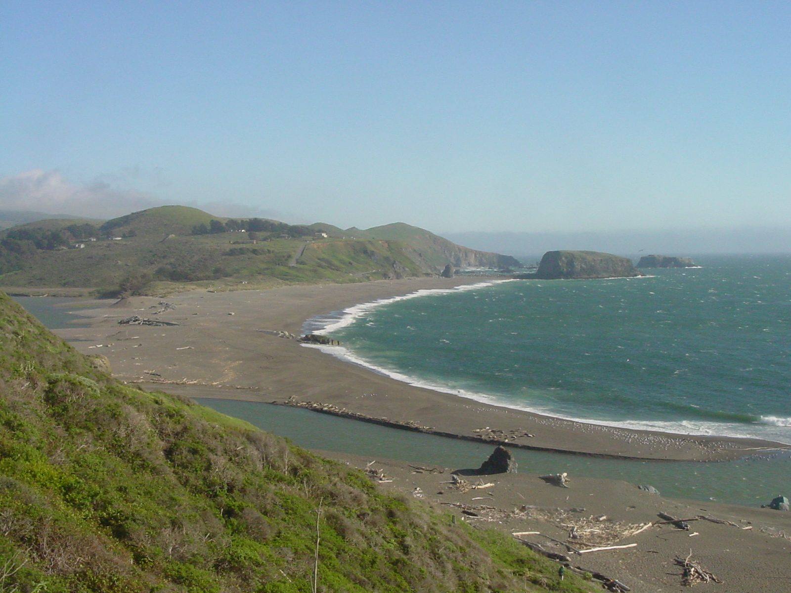
The mouth of the Russian River seen south from the Jenner cliffs: a long sandbar curving across from Jenner Beach toward Goat Rock Beach, the river backed up behind it, and the bulk of Goat Rock on the far shore with Arched Rock offshore.Xaven / CC BY-SA 1.0 via Wikimedia Commons
🌲Natural

Goat Rock and the Russian River Mouth

Part ofSonoma & Mendocino Coast
On this driveHighway 1: The North Coast

A headland blasted for a jetty that never kept the river open, at the mouth where harbor seals haul out.

⏱
Duration
An hour.
🎟
Admission
Free.
📅
Best Season
Winter and spring, when the bar is open and the river runs to the sea.

The Story

The Russian River meets the Pacific below Jenner across a sandbar that opens and closes on its own schedule. Through the dry months the waves pile sand across the mouth and the river backs up behind it into a lagoon; winter floods punch through again. Goat Rock, the big headland at the south end of the beach, is smaller than it was because people tried to change that.

Beginning in 1929, crews blasted rock out of Goat Rock and ran it on a narrow-gauge line to a jetty at the river mouth, meant to hold the channel open for barges. Storms wrecked the first rock-and-timber version, and it was rebuilt in the early 1930s in steel, rock and concrete. A seawall running north from Goat Rock came out of the same quarry, and pieces of it still break through the sand. Neither one kept the river open. The bar went on closing every summer.

Since 1995 the Sonoma County Water Agency has done the breaching with machinery, and a 2008 federal biological opinion changed what it is for. In summer the agency now tries to hold the lagoon high behind a shallow outlet channel, because young coho and steelhead grow better in fresh water than in the tide.

Harbor seals haul out on the sandspit at the mouth through the year. Watch them from a distance; a seal that lifts its head at you is already being disturbed.

Visitor Info

⏱
Time Needed
An hour.
🎟
Admission
Free.
📅
Best Season
Winter and spring, when the bar is open and the river runs to the sea.
🛣️
Highway
Goat Rock Road, off CA-1 south of Jenner

On the Map

Nearby

The closest stops worth working into your route

historical14 mi away
Salt Point and Gerstle Cove
A cove where sandstone for San Francisco's streets went aboard schooners, on a point named for the salt the Kashaya Pomo came for.
natural20 mi away
Tomales Point
The northern tip of Point Reyes, where tule elk were fenced in for forty-six years and are fenced in no longer.
historical23 mi away
The Sea Ranch
A community planned around a sheep ranch's windbreaks, its first building now on the National Register.
historical26 mi away
Cypress Tree Tunnel and Coast Station KPH
A radio company's driveway that grew into a tunnel, leading to the coast station that kept Morse code on the air.
historical31 mi away
Point Reyes Lighthouse
A light set halfway down a cliff on purpose, because that was the only way to get it under the fog.
cultural32 mi away
Kule Loklo
A Coast Miwok village built in the 1970s to honour a people its builders were told had died out. They had not.

Historical markers nearby

Roadside plaques and monuments within a short detour

Marker8.3 mi away
Fort Ross
Jenner
Marker9.8 mi away
Bodega Bay and Harbor
Bodega Bay
Marker11 mi away
St. Teresa's Church
Bodega
Marker13 mi away
Cooper's Sawmill
Forestville
Marker16 mi away
Walters Ranch Hop Kiln
Healdsburg
Marker22 mi away
Luther Burbank Home and Garden
Santa Rosa