Home / California / Golden Gate & the Marin Coast / Earthquake Trail
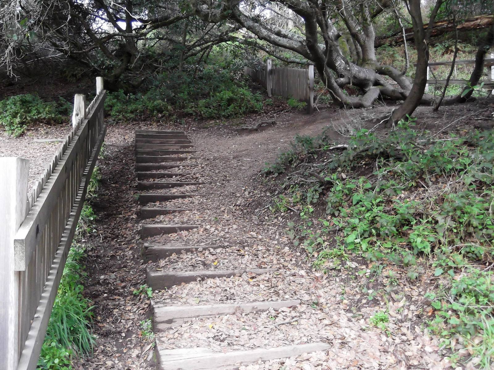
A weathered board fence on the Earthquake Trail ending beside a set of timber steps, its continuation set back among twisted trees beyond the gap where the 1906 rupture broke it.brewbooks / CC BY-SA 2.0 via Wikimedia Commons
🏜️Geological

Earthquake Trail

Part ofGolden Gate & the Marin Coast
On this driveHighway 1: The North Coast

A short loop along the San Andreas, where a broken fence shows how far Point Reyes moved in under a minute in 1906.

Hiking
⏱
Duration
Thirty to forty-five minutes.
🎟
Admission
Free.
📅
Best Season
Year-round.
💡
Fun Fact
The trail is paved and close to level, so a wheelchair can reach the line where two tectonic plates meet.

The Story

Behind the Bear Valley Visitor Center a paved loop of a little over half a mile follows the San Andreas Fault through the Olema Valley, its line marked on the ground by blue posts. Everything west of it, Point Reyes included, rides the Pacific Plate; everything east rides the North American. The two grind past each other to the northwest, and on the morning of April 18, 1906, the strain let go.

At the end of the posts stands a fence broken in two. The original fence here was offset about eighteen feet by the earthquake, one of the largest displacements found anywhere along the rupture, and the Park Service rebuilt it to show the break. Surveyors after the quake reported as much as twenty-six feet of slip in the Olema area. The state's 1908 earthquake report also carried a local story of a cow that fell into the opening crack and was swallowed but for her tail; the trail's panels tell it without vouching for it.

The fault explains the road. Bolinas Lagoon, the Olema Valley and Tomales Bay lie in one long trough along the rift, and Highway 1 keeps to it most of the way north through Marin.

Visitor Info

⏱
Time Needed
Thirty to forty-five minutes.
🎟
Admission
Free.
📅
Best Season
Year-round.
🛣️
Highway
CA-1 at Bear Valley Road

On the Map

Nearby

The closest stops worth working into your route

cultural0.5 mi away
Kule Loklo
A Coast Miwok village built in the 1970s to honour a people its builders were told had died out. They had not.
historical8.9 mi away
Cypress Tree Tunnel and Coast Station KPH
A radio company's driveway that grew into a tunnel, leading to the coast station that kept Morse code on the air.
historical13 mi away
Point Reyes Lighthouse
A light set halfway down a cliff on purpose, because that was the only way to get it under the fog.
natural13 mi away
Tomales Point
The northern tip of Point Reyes, where tule elk were fenced in for forty-six years and are fenced in no longer.
natural16 mi away
Muir Woods National Monument
A redwood canyon saved from a reservoir by a gift, and named for a man who had been there once.
historical17 mi away
Muir Beach Overlook
A cliff edge on Highway 1, and the concrete dugouts where two-man crews watched the sea after Pearl Harbor.

Historical markers nearby

Roadside plaques and monuments within a short detour

Marker3.2 mi away
Pioneer Paper Mill
Lagunitas
Marker4.5 mi away
Lime Kilns
Olema
Marker7.9 mi away
Site of New Albion
Point Reyes Station
Marker9.2 mi away
Site of the Lighter Wharf at Bolinas
Bolinas
Marker12 mi away
Home of Lord Charles Snowden Fairfax
Fairfax
Marker14 mi away
Camilo Ynitia Adobe
Novato