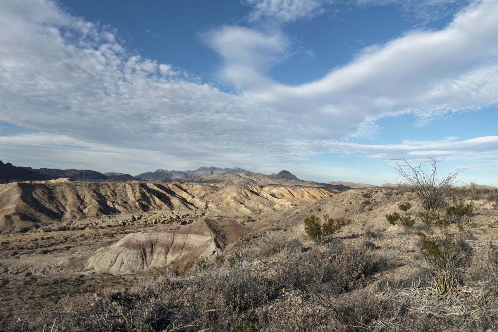
Carol M. Highsmith / public domain via the Library of Congress
A 7-Day Itinerary
El Paso, the Davis Mountains, Marfa and Big Bend in 7 Days
From El Paso across Far West Texas: the Mission Trail and the Tigua cultural center, the Guadalupe Mountains, Fort Davis and McDonald Observatory, Alpine, Marfa and its lights, Big Bend and the Boquillas crossing, and the River Road to Presidio.
7 days · 912 miles · best in fall & winter & spring
El Paso, TX → Marfa, TX
Far West Texas is big enough that the driving becomes part of the trip. This one takes seven days and about 910 miles from El Paso: down the Mission Trail through Ysleta del Sur Pueblo and Socorro to San Elizario, east to the Guadalupe Mountains, through Van Horn and around the Davis Mountains to Fort Davis and McDonald Observatory, on to Alpine and Marfa, then south through Big Bend National Park to the Rio Grande at Boquillas and Castolon, and back up the River Road by Presidio to Marfa.
The Jumano, the Chisos, the Mescalero Apache and the Comanche (Numunuu) are among the peoples who made the Big Bend home over more than ten thousand years. The Guadalupes were Mescalero country, and after the army pushed the Apache off the plains below, those mountains were among the last places they held. In El Paso, the Tigua of Ysleta del Sur Pueblo have farmed the Mission Valley since 1682 and tell their own history at their cultural center. The army came in the 1850s to guard the road from San Antonio to El Paso, and after the Civil War Black regiments garrisoned Fort Davis. The ranches, the railroad towns, the quicksilver mines and, in the 1970s, the artist Donald Judd came after them.
1
Day 1
Franklin Mountains, Chamizal and the Mission Trail
79 mi · about 2.1 hrs driving · overnight in El Paso
Be at the Tom Mays Unit of Franklin Mountains State Park when the gate opens at 8, about twenty-five minutes from downtown by the Transmountain Road, Loop 375. The range runs twenty-three miles north from downtown into New Mexico and splits the city in two, and its Precambrian rocks, a billion years old, are the oldest in Texas. Walk an hour or two before the day warms up, and keep to marked trails, since parts of the Transmountain Road cross the Army's old Castner Range. Cross back over the mountains, about half an hour, to Chamizal National Memorial on the border, where the cultural center opens at 10. The Rio Grande wandered south across farmland here in the nineteenth century, and the tract it left became a quarrel between two countries until the treaty of 1963 cut a new concrete channel; the settlement cost thousands of families in El Paso, most of them Mexican American, their homes. Then follow the Mission Trail, about twenty minutes on Loop 375 to Ysleta. The Tigua Indian Cultural Center on Yaya Lane opens its museum at 10. Ysleta del Sur Pueblo tells its own beginning there: captured by the Spanish in the Pueblo Revolt of 1680, Tigua families were forced to walk more than 400 miles south and founded the Pueblo in 1682. A mile away, the Ysleta Mission, mostly rebuilt after a fire in 1907, carries Tigua rain clouds and corn through its interior. Socorro Road leads on through irrigated fields to the Socorro Mission, its adobe walls about five feet thick at the base, and ends at San Elizario, where a walk around the plaza takes in the white chapel of 1877, Los Portales and the old county jail. El Paso is half an hour back.
2
Day 2
Guadalupe Mountains to Van Horn
199 mi · about 4.4 hrs driving · overnight in Van Horn
Fill the tank and leave El Paso by 7 on US-62/180, about two hours east to Guadalupe Mountains National Park; there is no gas within 35 miles of the park in either direction, and no lodging or restaurant inside it. The Pine Springs Visitor Center opens at 8, Mountain Time. The four highest peaks in Texas stand above it, Guadalupe Peak the tallest at 8,751 feet, and the summit trail, about 3,000 feet of climbing, is a day of its own. From the visitor center a paved path of three quarters of a mile leads to the Pinery, the highest station on the Butterfield Overland Mail, which the line used for only eleven months before moving south to the forts in August 1859; its walls are fragile, so stay off them. Drive a couple of miles to Frijole Ranch, where the Smith family planted an orchard at a spring after 1906 and the ranch house now holds the park's history museum, open when staff or volunteers are there. By noon reach McKittrick Canyon, twenty minutes on. A spring-fed stream keeps maples and oaks alive in it, and in the fall the maples turn red and gold. The trail to Pratt Cabin, the stone house the oil geologist Wallace Pratt had built in the winter of 1931 to 1932, runs just over two miles each way. The canyon is open 8 to 5, Mountain Time, and the gate on the highway is locked at 5, so be back at the car by 4. Van Horn is a little under two hours south by TX-54. Spend the night at Hotel El Capitan, the Spanish Revival hotel Henry Trost designed in 1930 and named for the great cliff at the south end of the range you have just left.
3
Day 3
Around the Davis Mountains to Fort Davis and McDonald Observatory
117 mi · about 3.2 hrs driving · overnight in Fort Davis
Leave Van Horn by 8 on US-90, about forty-five minutes southeast to Valentine. Turn north on RM 505 and east on TX-166, the south side of the Davis Mountains Scenic Loop, across open grassland until it meets TX-17 just south of Fort Davis. Be at Fort Davis National Historic Site by about 10. The army founded the post in 1854 to guard the San Antonio-El Paso Road, and from 1867 to 1885 it was garrisoned by companies of the Black regiments Congress created in 1866, the Ninth and Tenth Cavalry and the Twenty-fourth and Twenty-fifth Infantry. Over twenty of the post's own buildings survive, put back as they looked in 1880, some with period furniture, and the visitor center runs a fifteen-minute video every half hour. Leave by 12:15 on TX-118, which climbs Limpia Canyon past Davis Mountains State Park, about thirty-five minutes to McDonald Observatory. Everyone checks in at the visitors center, which opens at noon. Solar viewing starts at 1, and the guided tour of the big research telescopes at 2, lasting an hour and a half to two hours. The money came from William Johnson McDonald, a banker in Paris, Texas, whose 1926 bequest to the University of Texas was meant for an observatory; the university put it here, high, dry and far from city light. On the way down, turn into the state park for the five-mile Skyline Drive that Civilian Conservation Corps crews built in the 1930s, and look in at Indian Lodge, the white adobe they raised in 1933 with bricks made on the spot. Fort Davis is five minutes on. If you have tickets for a star party, drive back up after dark.
4
Day 4
Alpine, Marfa and the Marfa Lights
72 mi · about 1.7 hrs driving · overnight in Marfa
The Chihuahuan Desert Nature Center opens at 9, five minutes south of Fort Davis on TX-118. Its 18-acre botanical garden and a greenhouse full of cacti and succulents introduce the desert you will cross for the rest of the week, and trails climb into the foothills at about 5,100 feet; wear closed shoes with good tread. TX-118 runs on to Alpine, half an hour, where the Museum of the Big Bend opens at 10 on the campus of Sul Ross State University. Since 2007 it has been back in the native rock building that Victor J. Smith designed and former governor Pat Neff dedicated in 1937, and it covers the Big Bend of Texas and northern Mexico from prehistory through the ranching and mining years. After lunch take US-90 west, about thirty-five minutes, to Marfa. The Chinati Foundation fills the old buildings of Fort D. A. Russell with work Donald Judd and a few other artists installed to stay put, and a guided tour, booked ahead, is the only way into most of it; last entry is at 4. The artillery sheds that hold Judd's 100 works in mill aluminum are closed for restoration, but his 15 concrete works stand free to see from a trail during museum hours. In town, the Presidio County Courthouse of 1886 still carries a statue of Justice on its dome, missing her scales; local lore blames a man who shot them off, complaining that the county had no justice. It is a working courthouse, so on a Saturday admire it from the square. After dinner drive nine miles east on US-90 to the Marfa Lights Viewing Area, park with headlights off and face the Chinati Mountains. Some nights the lights appear, red, blue or white, and some nights only the stars do; point any flashlight or phone screen at the ground so your neighbors keep their night vision. Marfa is ten minutes back.
5
Day 5
Marathon, Persimmon Gap and the Chisos Basin
165 mi · about 3.8 hrs driving · overnight in Study Butte
Leave Marfa by 8:30 and fill the tank in Alpine; this drive takes US-90 on to Marathon, about an hour from Marfa, and US-385 some forty miles south to Persimmon Gap, the northern entrance to Big Bend National Park. The old Comanche Trail ran through this gap, and riders bound for Mexico after the summer rains wore it a mile wide in places. Texas got its first national park here in 1944, and it now spreads over more than 1,250 square miles of desert, mountains and river canyons. Panther Junction, the park headquarters, is 26 miles on, and the visitor center is open 8:30 to 5. Pay the vehicle fee, good for seven days, and ask about roads and the river. Then turn west up into the Chisos Basin, about twenty minutes. The park cancelled the basin's planned construction closure in April 2026, and it is open; its visitor center keeps hours of 8:30 to 4, closed from noon to 1. The restaurant is closed, so buy lunch at the food truck outside the lodge. In the afternoon walk the Window Trail through Oak Creek Canyon to the pour-off, where the desert shows through a notch in the mountains: 5.5 miles there and back, downhill all the way out and 1,000 feet of climbing on the return. Carry plenty of water. Leave the basin by about 6 for Study Butte, fifty minutes west by Maverick Drive and TX-118.
6
Day 6
Boquillas and the Ross Maxwell Drive to Castolon
150 mi · about 4.8 hrs driving · overnight in Study Butte
This is a long day, so leave Study Butte by 7:45. Panther Junction is about forty-five minutes east, and from there Rio Grande Village Drive drops about twenty miles to the river and the spur to the Boquillas crossing, an hour more. The port opens at 9 on the four days it runs, Friday through Monday, which is why this day falls on a Monday; check the park's conditions page first, and bring a passport, which you need both to enter Mexico and to return. A rowboat ferry carries visitors across for a fee, and the village of Boquillas del Carmen lies just beyond the far bank. Silver and lead mining began there in 1883, and since tourism began in the 1980s its families have built restaurants, lodging and crafts businesses for visitors from the park. Come back across by about 1 and drive west by Panther Junction to the Ross Maxwell Scenic Drive, which runs south to the river at Castolon, about two hours from the port. Cavalry troops set up Camp Santa Helena here during the Mexican Revolution, the first permanent buildings were finished in 1920 just as the troops were withdrawn, and La Harmonia Company ran a store in the barracks for families from both sides of the river until 1961. In May 2019 a fire crossed the river from Mexico and badly damaged the store, though firefighters saved the other buildings. The Castolon visitor center opens for the season on November 1. The paved road from Cottonwood Campground on to Santa Elena Canyon is closed until further notice, so turn back here; Study Butte is about an hour north.
7
Day 7
Terlingua, the River Road and Presidio
130 mi · about 3.2 hrs driving · overnight in Marfa
Start at Terlingua, ten minutes west on FM 170, where the stone and adobe ruins of the Chisos Mining Company's quicksilver camp stand on the slope above the highway. Howard E. Perry of Chicago founded the company in 1903 and seldom came to see it, and its mine produced quicksilver that state geologists later put at $12 million. Parts of the ghost town are private property; keep to public ground and do not enter the ruins. Then follow the River Road, FM 170, upstream beside the Rio Grande. Twenty minutes on, just east of Lajitas, the Barton Warnock Visitor Center is the eastern entrance to Big Bend Ranch State Park, the biggest park Texas runs, at over 300,000 acres; buy a day pass there if you mean to stop and walk. West of it the highway turns mountainous, with sharp curves, steep grades and low-water crossings that can run deep after storms, so take it slowly. Fort Leaton, about an hour and a half farther and a few miles short of Presidio, is open until 4:30. Ben Leaton's adobe trading post was dug and rebuilt to the evidence: the excavations turned up nothing earlier than the 1820s, so the tales of a Spanish mission or presidio here do not hold, and the rebuilt walls rise 18 to 22 feet. Presidio stands at La Junta de los Rios, where the Rio Conchos comes in from Chihuahua, on bottomland farmed since about 1500 B.C. The town has little lodging, so take US-67 north, about an hour, back to Marfa for the night.
The drives this trip follows
Each one is traced end to end on its own page, with every stop worth making along the way.