Home / Texas / Big Bend, Marfa & Alpine / Boquillas Crossing Port of Entry
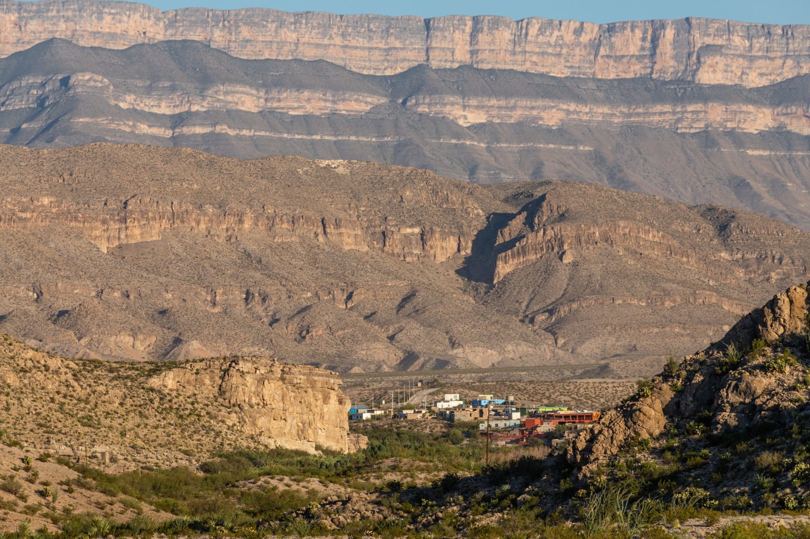
The village of Boquillas del Carmen in a desert valley below layered cliffs of the Sierra del Carmen, seen from the Texas side.NPS/C.A. Hoyt / public domain via the National Park Service
🎭Cultural

Boquillas Crossing Port of Entry

Part ofBig Bend, Marfa & Alpine

The Big Bend port of entry opened in 2013, where visitors with passports cross the Rio Grande by rowboat ferry to the village of Boquillas del Carmen, Coahuila.

⏱
Duration
Half a day.
🎟
Admission
Free to use the port; a fee for the ferry. Valid passport required.
📅
Best Season
October through April. Hours and days of operation change seasonally.

The Story

For most of its history Boquillas has been a mining town. Silver and lead mining began in Boquillas del Carmen, on the Mexican side of the Rio Grande, in 1883. The Consolidated Kansas City Smelting and Refining Company built a cable tramway to carry ore across the river to a plant on the Texas side, and the railroad at Marathon became the nearest railhead. Ed Lindsey, sent by the U.S. Customs Service in 1894 to inspect the ore, opened a store that served both banks and became the local postmaster. The Puerto Rico mine in the cliffs above the village closed before the end of World War I, and most people left.

Families came back in later decades, and when tourism began in the 1980s the village built restaurants, lodging and crafts businesses to serve visitors from the park. The Boquillas Port of Entry opened on April 10, 2013, under an agreement between Mexico and the United States that also covers the protected lands on both sides of the river.

To cross you need a valid passport for the trip into Mexico and back. A passenger ferry, a rowboat, carries visitors over the river for a fee, and the village lies just beyond the far bank. The port's days and hours change with the season, so check the park's site or ask at a visitor center before you drive down.

Visitor Info

⏱
Time Needed
Half a day.
🎟
Admission
Free to use the port; a fee for the ferry. Valid passport required.
📅
Best Season
October through April. Hours and days of operation change seasonally.
🛣️
Highway
Boquillas Canyon Road

On the Map

Nearby

The closest stops worth working into your route

natural18 mi away
Big Bend National Park
More than 1,250 square miles of Chihuahuan Desert, the Chisos Mountains and the canyons of the Rio Grande, opened in 1944 as the first national park in Texas.
natural22 mi away
Chisos Basin
The mountain bowl at the heart of the Chisos, with the park's only lodge, the Window pour-off and trails to Emory Peak, closed for rebuilding since May 2025.
historical34 mi away
Castolon Historic District
An army camp built in 1919 for the Mexican Revolution and never really used, which became La Harmonia's trading post for families on both sides of the river until 1961.
geological40 mi away
Santa Elena Canyon
The Rio Grande's 1,500-foot-deep slot through limestone at the west end of Big Bend National Park, reached by a short trail at the end of the Ross Maxwell Scenic Drive.
historical41 mi away
Terlingua Ghost Town
The stone shells of the Chisos Mining Company's quicksilver camp west of Study Butte, where a Chicago owner made a fortune from a mine he seldom came to see.
natural49 mi away
Big Bend Ranch State Park
The largest park in the Texas system, more than 300,000 acres of volcanic desert and river canyon west of Big Bend, bought from a working ranch in 1988.

Historical markers nearby

Roadside plaques and monuments within a short detour

Marker26 mi away
Black Gap Wildlife Management Area
Marathon