Home / Texas / Big Bend, Marfa & Alpine / Big Bend Ranch State Park
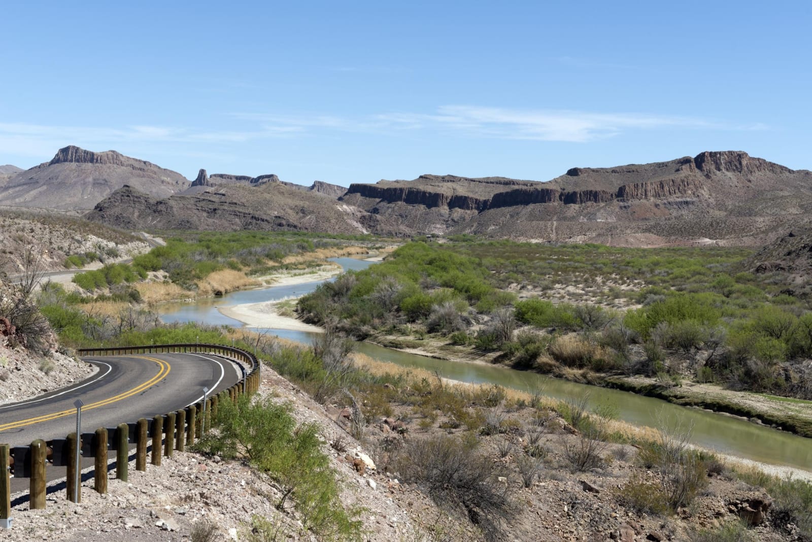
River Road FM 170 winding beside the Rio Grande in Big Bend Ranch State Park, with desert hills and mesas beyond.Carol M. Highsmith / public domain via the Library of Congress
🌲Natural

Big Bend Ranch State Park

Part ofBig Bend, Marfa & Alpine

The largest park in the Texas system, more than 300,000 acres of volcanic desert and river canyon west of Big Bend, bought from a working ranch in 1988.

⏱
Duration
A day along FM 170; several days in the interior.
🎟
Admission
Daily entrance fee; camping, river and backcountry permits at the entrances. See Texas Parks and Wildlife for current rates.
📅
Best Season
October through April. Summer heat is dangerous.

The Story

Big Bend Ranch State Park covers more than 300,000 acres of Brewster and Presidio counties, the largest park in the state system. It was a working ranch first. Andres Madrid ran sheep north of Lajitas in the 1870s, the Bogel brothers pieced small outfits together in the 1910s, and the Fowlkes brothers carried on after the Depression, until the Big Bend Ranch was among the ten biggest in Texas. Robert O. Anderson of Atlantic Richfield offered it to the state for $8 million, and after years of argument the Parks and Wildlife Commission approved the purchase on July 21, 1988, for $8.8 million. It opened on a limited basis in 1991 and fully in 2007.

The land is rough volcanic country. The park holds the crater of the long-dead Bofecillos Volcano, Colorado Canyon, popular with paddlers, and some ninety major archaeological sites. Its two entrances are the Barton Warnock Visitor Center just east of Lajitas and Fort Leaton near Presidio, linked by FM 170, the Camino del Rio, which winds about sixty miles along the Rio Grande between them, climbing and dropping past river overlooks.

Inside are 238 miles of trails for hikers, bikers and horses, 70 miles of rough dirt roads that need high clearance or four-wheel drive, primitive campsites, and the Sauceda Bunkhouse. The park is an International Dark Sky Park. Get permits at either entrance. From late spring through summer, temperatures pass 100 degrees by late morning, so carry extra water and stay off the trails in the afternoon.

Visitor Info

⏱
Time Needed
A day along FM 170; several days in the interior.
🎟
Admission
Daily entrance fee; camping, river and backcountry permits at the entrances. See Texas Parks and Wildlife for current rates.
📅
Best Season
October through April. Summer heat is dangerous.
🛣️
Highway
FM 170 (Camino del Rio)

On the Map

Nearby

The closest stops worth working into your route

historical9 mi away
Terlingua Ghost Town
The stone shells of the Chisos Mining Company's quicksilver camp west of Study Butte, where a Chicago owner made a fortune from a mine he seldom came to see.
geological11 mi away
Santa Elena Canyon
The Rio Grande's 1,500-foot-deep slot through limestone at the west end of Big Bend National Park, reached by a short trail at the end of the Ross Maxwell Scenic Drive.
historical17 mi away
Castolon Historic District
An army camp built in 1919 for the Mexican Revolution and never really used, which became La Harmonia's trading post for families on both sides of the river until 1961.
natural27 mi away
Chisos Basin
The mountain bowl at the heart of the Chisos, with the park's only lodge, the Window pour-off and trails to Emory Peak, closed for rebuilding since May 2025.
natural33 mi away
Big Bend National Park
More than 1,250 square miles of Chihuahuan Desert, the Chisos Mountains and the canyons of the Rio Grande, opened in 1944 as the first national park in Texas.
historical39 mi away
Fort Leaton State Historic Site
The adobe trading post on the Rio Grande below Presidio, where digging has rewritten the stories told about it and a self-guided walk leads through its rebuilt rooms.

Historical markers nearby

Roadside plaques and monuments within a short detour

Marker9.2 mi away
Federico Villalba
Terlingua
Marker9.6 mi away
Terlingua
Terlingua