Home / Texas / The Guadalupe & Davis Mountains / The Pinery Butterfield Station
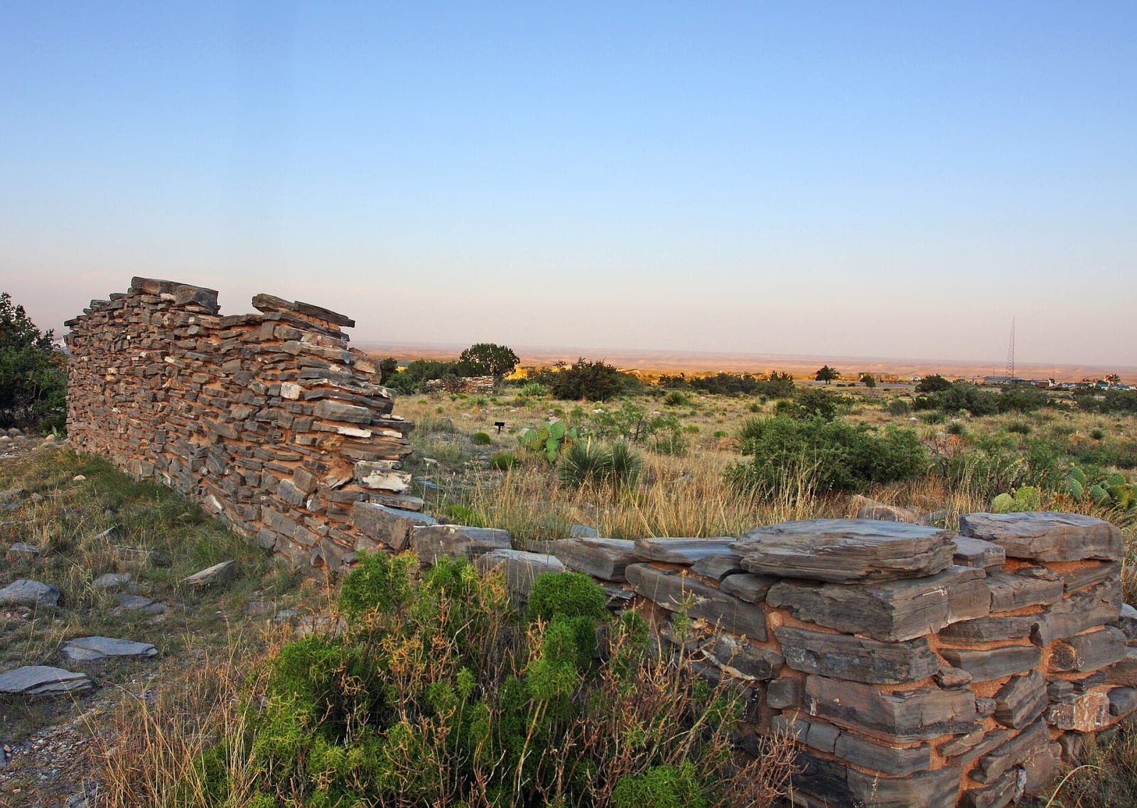
The low, crumbling limestone walls of the Pinery Butterfield stage station among grass and shrubs at dusk.Rennett Stowe / CC BY 2.0 via Wikimedia Commons
🏛️Historical

The Pinery Butterfield Station

Part ofThe Guadalupe & Davis Mountains

The stone ruins of the highest station on the Butterfield Overland Mail, used for eleven months from 1858 until the line moved south to the forts in 1859.

⏱
Duration
Forty-five minutes on foot.
🎟
Admission
Included in the park entrance fee of $10 per person.
📅
Best Season
Year round.

The Story

The Pinery was a stage station of the Butterfield Overland Mail, named for the pine forests above it and watered by Pine Spring. At 5,534 feet it was the highest station on the line. When the first coaches came through in September 1858 it was little more than a corral of heavy pine timber and a couple of tents. Within two months the station had a high-walled rock enclosure with a single entrance, three mud-roofed rooms built against the inside walls, a blacksmith shop and wagon repair shed, and a ditch bringing water from the spring to a tank inside. The walls of limestone slabs and adobe stood 30 inches thick and 11 feet high.

The station keeper was Henry Ramstein, a surveyor from El Paso, with six to eight men working as cooks, blacksmiths and herders. Four times a week the conductor's horn announced a coach with up to nine passengers, who got fresh horses and a meal. Soldiers were sometimes posted here against raids, which is why the ruin was later taken for a fort.

The line ran past the Pinery for only eleven months. In August 1859 the Butterfield moved its route south to a road by way of Fort Stockton and Fort Davis, better protected and better served by the chain of military posts, and ten stations on the Guadalupe route were abandoned. A paved, wheelchair-accessible trail of three quarters of a mile leads from the Pine Springs Visitor Center to the ruins. The walls are fragile, so stay off them.

Visitor Info

⏱
Time Needed
Forty-five minutes on foot.
🎟
Admission
Included in the park entrance fee of $10 per person.
📅
Best Season
Year round.
🛣️
Highway
US-62/180

On the Map

Nearby

The closest stops worth working into your route

natural0.3 mi away
Guadalupe Mountains National Park
The four highest peaks in Texas, Guadalupe Peak at 8,751 feet among them, on a ranch that oilmen and ranchers sold or gave to make a park in 1972.
historical1.3 mi away
Frijole Ranch
An old ranch house at a desert spring below the Guadalupe escarpment, home to the Smith family's orchard and now the park's history museum.
natural6.9 mi away
McKittrick Canyon
A spring-fed canyon of maples and oaks inside the Guadalupes, with the stone cabin an oil geologist built in 1931-32 and gave, with his land, toward the park.
geological29 mi away
Carlsbad Caverns National Park
The way into the cave has changed four times: a guano miner's bucket, a wooden staircase, a 750-foot elevator, and now a timed ticket and a switchback trail down the natural entrance.
natural50 mi away
Living Desert Zoo and Gardens State Park
A zoo and garden of the Chihuahuan Desert on the Ocotillo Hills above Carlsbad, whose animals are injured or orphaned wildlife that cannot go back to the wild.
architectural59 mi away
Hudspeth County Courthouse
The only courthouse in Texas built entirely of adobe, in the Sierra Blanca railroad town where Southern Pacific and Texas and Pacific crews met in 1881.

Historical markers nearby

Roadside plaques and monuments within a short detour

Marker0.1 mi away
Ruins of "The Pinery" or "Pine Spring" Stage Stand
Pine Springs
Marker3.2 mi away
Guadalupe Peak
Pine Springs
Marker25 mi away
Guadalupe Mountains
Whites City, New Mexico
Marker27 mi away
Carlsbad Caverns National Park
Whites City, New Mexico