Home / Texas / The Guadalupe & Davis Mountains / McKittrick Canyon
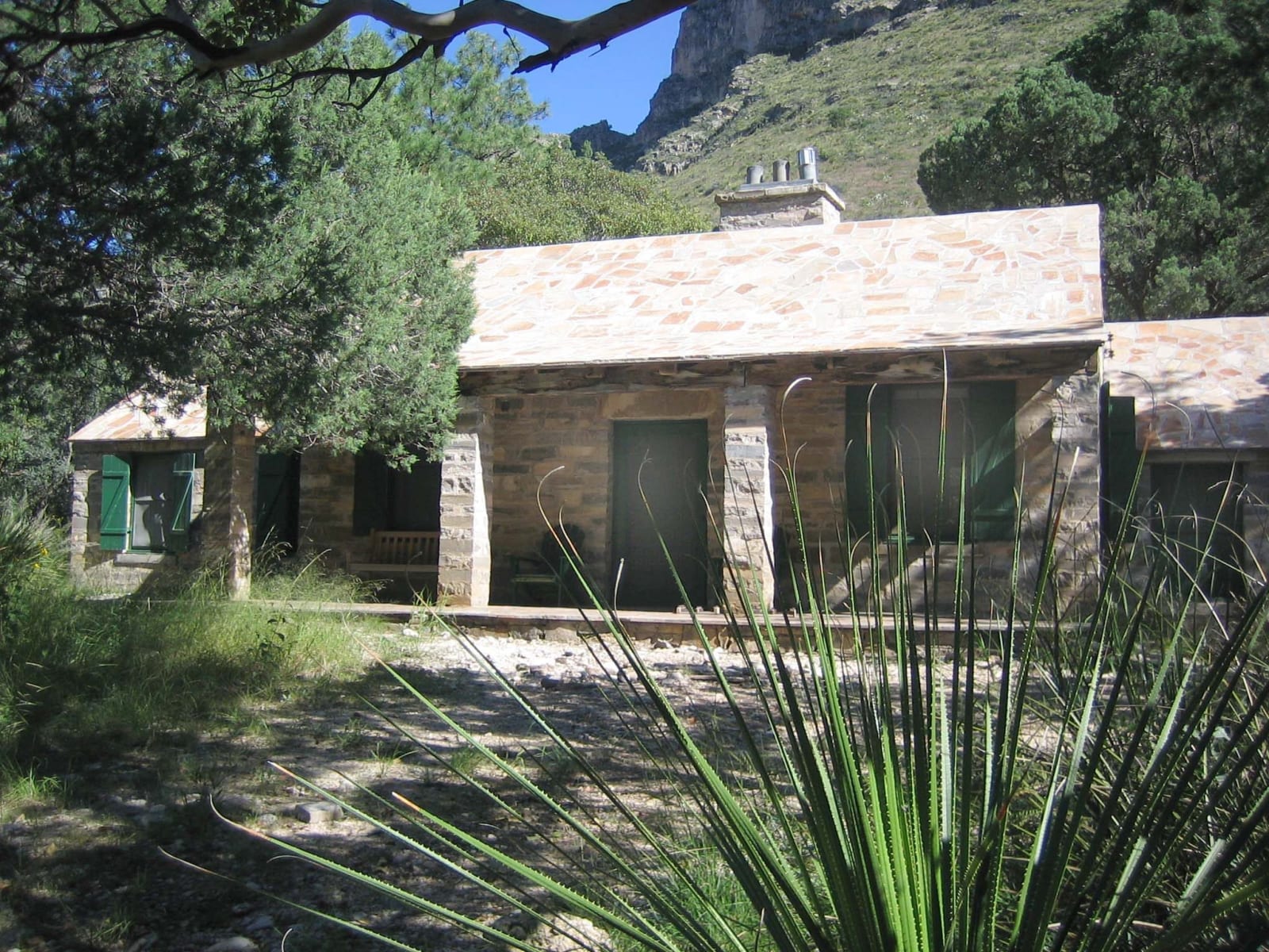
The stone Pratt Cabin with its pale roof among trees and yucca at the mouth of McKittrick Canyon.NPS / public domain via the National Park Service
🌲Natural

McKittrick Canyon

Part ofThe Guadalupe & Davis Mountains

A spring-fed canyon of maples and oaks inside the Guadalupes, with the stone cabin an oil geologist built in 1931-32 and gave, with his land, toward the park.

⏱
Duration
Half a day to Pratt Cabin and back.
🎟
Admission
Included in the park entrance fee of $10 per person.
📅
Best Season
Fall for color; spring and fall for walking. Summer is hot.

The Story

McKittrick Canyon is the green surprise of the Guadalupe Mountains. A spring-fed stream runs through it, and its walls shelter gray oak, velvet ash, alligator juniper and bigtooth maple, trees that belong to wetter country. The maples turn red and gold in the fall, and the canyon is the park's best-known place to see them. Mule deer and porcupines live here, and wild turkeys and black bears range higher up.

The canyon owes its protection to an oil geologist. Wallace Pratt first came to the Guadalupes on business in 1921, bought ranch land with partners, and by 1930 owned the lower canyon. In the winter of 1931 to 1932 a small crew built him a stone cabin where the north and south forks of McKittrick Creek meet, of limestone quarried a few miles away and yellow pine shipped from East Texas. The Pratts spent summers there until 1940, and geologists came from all over the world to study the canyon. Pratt gave his McKittrick land to the National Park Service, a gift that helped bring about the park.

The canyon is day use only. The trail starts behind the McKittrick Canyon visitor center, reached by a side road off US-62/180, and the gate closes each evening, so watch the time. Pratt Cabin is just over two miles in and makes a natural turnaround; its porch and picnic grounds are open to hikers, and the cabin itself only when a ranger or volunteer is there. Farther on are the Grotto and the Hunter Line Shack.

Visitor Info

⏱
Time Needed
Half a day to Pratt Cabin and back.
🎟
Admission
Included in the park entrance fee of $10 per person.
📅
Best Season
Fall for color; spring and fall for walking. Summer is hot.
🛣️
Highway
US-62/180

On the Map

Nearby

The closest stops worth working into your route

historical5.6 mi away
Frijole Ranch
An old ranch house at a desert spring below the Guadalupe escarpment, home to the Smith family's orchard and now the park's history museum.
historical6.9 mi away
The Pinery Butterfield Station
The stone ruins of the highest station on the Butterfield Overland Mail, used for eleven months from 1858 until the line moved south to the forts in 1859.
natural7.1 mi away
Guadalupe Mountains National Park
The four highest peaks in Texas, Guadalupe Peak at 8,751 feet among them, on a ranch that oilmen and ranchers sold or gave to make a park in 1972.
geological23 mi away
Carlsbad Caverns National Park
The way into the cave has changed four times: a guano miner's bucket, a wooden staircase, a 750-foot elevator, and now a timed ticket and a switchback trail down the natural entrance.
natural43 mi away
Living Desert Zoo and Gardens State Park
A zoo and garden of the Chihuahuan Desert on the Ocotillo Hills above Carlsbad, whose animals are injured or orphaned wildlife that cannot go back to the wild.
architectural65 mi away
Hotel El Capitan
Henry Trost's Spanish Revival hotel of 1930 in Van Horn, named for the cliff at the end of the Guadalupe Mountains, restored and back in business as an inn.

Historical markers nearby

Roadside plaques and monuments within a short detour

Marker7 mi away
Ruins of "The Pinery" or "Pine Spring" Stage Stand
Pine Springs
Marker10 mi away
Guadalupe Peak
Pine Springs
Marker19 mi away
Guadalupe Mountains
Whites City, New Mexico
Marker21 mi away
Carlsbad Caverns National Park
Whites City, New Mexico
Marker26 mi away
Carlsbad Caverns National Park
Whites City, New Mexico