Home / Texas / The Guadalupe & Davis Mountains / Davis Mountains State Park & Indian Lodge
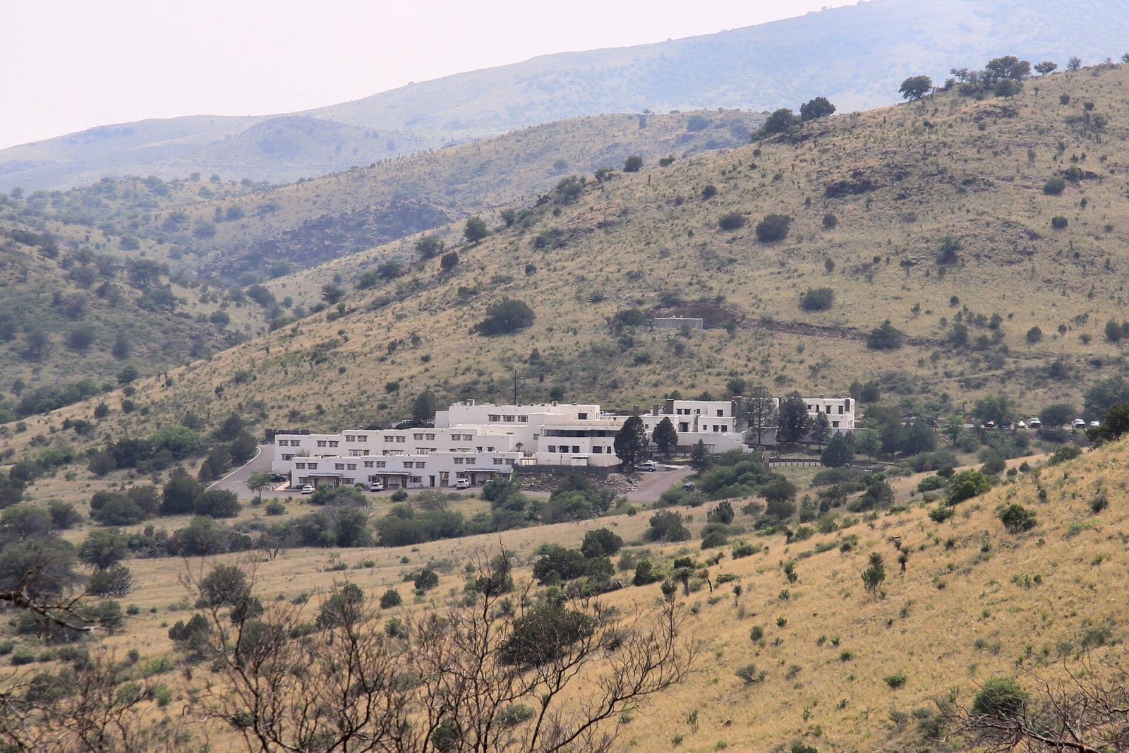
The white adobe Indian Lodge tucked into a grassy, oak-dotted canyon in Davis Mountains State Park.Larry D. Moore / CC BY-SA 4.0 via Wikimedia Commons
🌲Natural

Davis Mountains State Park & Indian Lodge

Part ofThe Guadalupe & Davis Mountains

A 1933 Civilian Conservation Corps park above Fort Davis, with the CCC's Skyline Drive, the white adobe Indian Lodge and a trail down to the old fort.

⏱
Duration
Half a day, or overnight at the lodge.
🎟
Admission
Daily entrance fee; Indian Lodge rooms by reservation. See Texas Parks and Wildlife for current rates.
📅
Best Season
Year round. Spring and fall are mildest; summer evenings are cool at this height.

The Story

Davis Mountains State Park was one of the earliest Civilian Conservation Corps projects in Texas. It was established in 1933 on 1,321 acres given largely by local ranchers, among them Jesse W. and Richard K. Merrill. CCC companies 879 and 881 built the five-mile scenic Skyline Drive, with a rock overlook building at the top, and stone picnic tables, fireplaces and steps along the way.

Their best-known work is Indian Lodge, built between June and November 1933. The men made its adobe bricks on site, cut cottonwood in Keesey Canyon for the timbers, and gathered reeds along the Rio Grande for the ceilings, while CCC workers at Bastrop State Park made the cedar furniture. The lodge began with fifteen rooms. In 1967 it was enlarged with more rooms, a pool and a restaurant, and it now has 39 rooms, run by the state as a full-service hotel.

The park's trails run up and down the ridges: the 4.5-mile Skyline Drive Trail, and a 1.75-mile CCC trail that links to a trail down to Fort Davis National Historic Site. An interpretive center has a bird blind over a watering station, and Limpia Canyon has horse trails and primitive camping. Cell service is limited. The park is also on the 75-mile Scenic Loop, which starts and ends in Fort Davis and runs on past McDonald Observatory.

Visitor Info

⏱
Time Needed
Half a day, or overnight at the lodge.
🎟
Admission
Daily entrance fee; Indian Lodge rooms by reservation. See Texas Parks and Wildlife for current rates.
📅
Best Season
Year round. Spring and fall are mildest; summer evenings are cool at this height.
🛣️
Highway
TX-118

On the Map

Nearby

The closest stops worth working into your route

historical2.4 mi away
Fort Davis National Historic Site
A frontier post of 1854 to 1891 on the San Antonio-El Paso Road, garrisoned after the Civil War by Black regiments, with its buildings restored to their 1880 look.
natural6.8 mi away
Chihuahuan Desert Nature Center and Botanical Gardens
The Chihuahuan Desert Research Institute's grounds south of Fort Davis, with an 18-acre botanical garden, a cactus museum and trails into the desert foothills.
attraction7.4 mi away
McDonald Observatory
The University of Texas observatory on Mount Locke, founded with a Paris, Texas banker's fortune, with star parties three nights a week under some of the darkest skies in the country.
architectural20 mi away
Presidio County Courthouse
Marfa's domed courthouse of 1886, a Second Empire landmark finished in time for a New Year's ball, its statue of Justice still missing the scales someone shot away.
cultural21 mi away
Chinati Foundation
Donald Judd's museum on the grounds of old Fort D. A. Russell in Marfa, where art, buildings and land are meant to be seen together, by guided tour.
roadside22 mi away
Marfa Lights Viewing Area
The roadside viewing area on US 90 nine miles east of Marfa, where people gather after dark to watch the horizon toward the Chinati Mountains for the Marfa lights.

Historical markers nearby

Roadside plaques and monuments within a short detour

Marker2.5 mi away
Old Fort Davis C. S. A.
Fort Davis
Marker2.5 mi away
Confederate President Jefferson Davis
Fort Davis
Marker2.5 mi away
Jeff Davis County
Fort Davis
Marker2.5 mi away
Hotel Limpia
Fort Davis
Marker2.6 mi away
Fort Davis
Fort Davis
Marker2.9 mi away
Pioneer Cemetery
Fort Davis