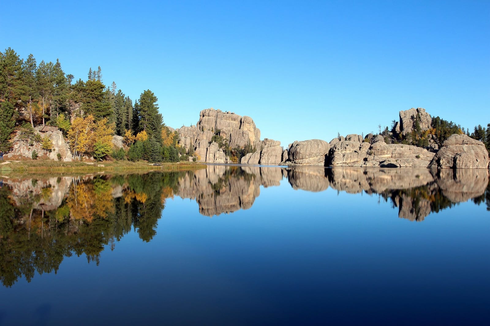
Granite boulders and autumn aspens reflected in the still water of Sylvan Lake in the Black Hills
Pahcal123 / CC BY-SA 4.0 via Wikimedia Commons
A Road Trip Guide

South Dakota

From the Black Hills east across the Missouri to the tallgrass prairie — Pahá Sápa, the hills the 1868 treaty promised the Lakota and the government seized after Custer's men found gold, Tȟuŋkášila Šákpe, the Six Grandfathers, which the maps call Mount Rushmore, the eroded walls of the Badlands, Wounded Knee, where the army massacred Lakota people in 1890, and the homelands of nine tribal nations of the Očhéthi Šakówiŋ.

44 places · 9 regions · 9 stories · 3 drives · 1 itinerary

All of South Dakota, One Map

Tap any dot to discover what makes a place worth the stop.

Architectural
Attraction
Cultural
Geological
Historical
Industrial
Natural
Roadside

Plan a Trip

Day-by-day plans — real drive times, honest overnights, and the permit fine print sorted before you leave.

4-Day Itinerary

The Black Hills and the Badlands in 4 Days

From Rapid City out to the Badlands Wall and back into the Hills: a launch control center under the wheat, Rushmore from the Iron Mountain Road, the Needles at dawn, a cave that breathes, and Deadwood's hillside graves before Spearfish Canyon.

Days
4
Distance
459 mi
Best
summer · fall
See the day-by-day →

Scenic Drives

The roads themselves — traced end to end, with the stops worth making along the way.

Scenic Byway

I-90: Sioux Falls to the Badlands

About 378 miles across South Dakota on I-90 from the falls of the Big Sioux to the edge of the Black Hills: the Corn Palace, Dignity above the Missouri, a car museum in Murdo, a Minuteman silo, the Badlands Loop and the free ice water at Wall.

Distance
378 mi
Drive
7 hrs
Best
Spring · Summer · Fall
Plan this drive →
Scenic Byway

Rushmore, the Needles and Wind Cave

About 97 miles through the central and southern Black Hills from Rapid City to Hot Springs: the presidents on Tȟuŋkášila Šákpe, the granite spires of the Needles Highway, Coolidge's summer lodge, the bison range of Custer State Park and the breathing cave the Lakota came up from.

Distance
97 mi
Drive
3 hrs
Best
Spring · Summer · Fall
Plan this drive →
Scenic Byway

The Missouri: Chamberlain to Mobridge

About 225 miles up the Missouri through the reservations of the river nations, from Dignity and the Akta Lakota Museum at Chamberlain past Big Bend Dam, the capital and the Vérendrye plate's hill to Oahe Dam and Sitting Bull's grave across from Mobridge.

Distance
225 mi
Drive
5 hrs
Best
Spring · Summer · Fall
Plan this drive →

Regions of South Dakota

Each region gathers the parks, towns, drives, and roadside stops that define one corner of the state.

Region

Custer State Park & the Southern Hills

Maka Oniye, the breathing cave the Lakota came up from, the Custer State Park bison herd, the Needles Highway, Jewel Cave, and Hot Springs' mammoth sinkhole.

5 places to explore
Explore region →
Region

Deadwood & the Northern Hills

Bear Butte where the Lakota and Cheyenne still pray, Deadwood's gold-rush gulch, the Homestake's mile-and-a-half shafts, and Spearfish Canyon.

5 places to explore
Explore region →
Region

Mount Rushmore & the Central Hills

Tȟuŋkášila Šákpe carved with four presidents, Black Elk Peak, the Crazy Horse mountain carving, and Rapid City where the creek leaves the hills.

5 places to explore
Explore region →
Region

Pierre & the Missouri River Lakes

The capital on the Missouri, the hill where the Vérendrye plate was buried, the Bad River meeting of 1804, and the dammed lakes that drowned reservation bottomlands.

5 places to explore
Explore region →
Region

Sioux Falls & the Southeast

The falls of the Big Sioux over pink quartzite, Mitchell's Corn Palace, Yankton on the free-flowing Missouri, and Spirit Mound where Lewis and Clark climbed.

5 places to explore
Explore region →
Region

The Badlands & Pine Ridge

Makȟóšiča's eroded walls and fossil beds, the Stronghold where the Ghost Dance was danced, Wounded Knee, and a Cold War missile silo off I-90.

5 places to explore
Explore region →
Region

The Glacial Lakes & the Northeast

The Coteau des Prairies and its glacial lakes, the Sisseton Wahpeton Oyate's Lake Traverse homeland, Fort Sisseton, and the Ingalls family's De Smet.

4 places to explore
Explore region →
Region

The Grand River & the Northwest

The Grand River where Sitting Bull was born and killed, his grave above the Missouri, Hugh Glass's grizzly, and the Slim Buttes on the open northwestern prairie.

5 places to explore
Explore region →
Region

The Rosebud & the South Central Plains

The Sicangu Lakota homeland of the Rosebud, Spotted Tail's grave, Sinte Gleska University, St. Francis Mission, and the long stretch of US-83 south from Murdo.

5 places to explore
Explore region →

Stories from South Dakota

The histories behind the places — the people, the disasters, the inventions, and the long memory of the land.
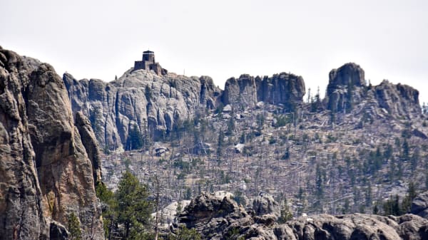
Granite spires of the Black Hills rising to Black Elk Peak, with its stone lookout on the summit
History

The Hills Are Not for Sale

In 1980 the Supreme Court ruled that the United States had taken the Black Hills unlawfully and owed the Lakota for them. The nations have never touched the money.

Open Road Guide · Oct 20, 2026 · 5 min read
A dirt track running across dry grassland toward eroded badlands under storm clouds in the Stronghold Unit of Badlands National Park
History

The Range on Pine Ridge

In 1942 the War Department took more than a third of a million acres of the Pine Ridge Reservation for a bombing range and gave 125 Oglala families until winter to leave. Some of the ground is still too dangerous to walk.

Open Road Guide · Oct 20, 2026 · 4 min read
The skeleton of Sue the Tyrannosaurus rex mounted in its gallery at the Field Museum in Chicago, with visitors beneath it
Geology

The Dinosaur in Trust

In 1990 a fossil hunter found the most complete Tyrannosaurus rex yet known in a bluff on a Cheyenne River rancher's land. Who owned it took the FBI, the courts and Sotheby's to decide.

Open Road Guide · Oct 20, 2026 · 5 min read
Lake Oahe frozen in winter, seen from the air, its icy arms reaching up the flooded side valleys between bare hills
History

The Lakes That Came Up the River

Between the 1940s and the 1960s the Pick-Sloan dams turned the Missouri in the Dakotas into a chain of reservoirs. The bottomlands they drowned were the best land the river nations had left.

Open Road Guide · Oct 20, 2026 · 5 min read
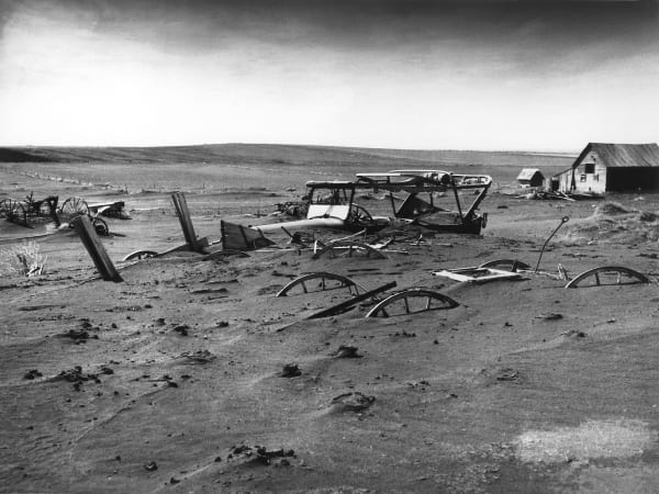
Farm machinery half buried by drifted soil in a barn lot at Dallas, Gregory County, during the Dust Bowl in 1936
History

The Land Lottery at Bonesteel

In July 1904 more than a hundred thousand people registered for a chance at 2,412 homesteads cut from the Rosebud Reservation. The drawing filled the plains with towns, and decided the shape of the reservation that remains.

Open Road Guide · Oct 20, 2026 · 5 min read
A bronze plaque on a brick building in De Smet marking the site of the Ingalls store of 1880 and 1881, where the family spent the Hard Winter
Nature

The Long Winter in the Records

Laura Ingalls Wilder's The Long Winter tells of seven months of blizzards that cut De Smet off from the world in 1880 and 1881. A meteorologist checked the book against the weather data, and found that Wilder had not exaggerated.

Open Road Guide · Oct 20, 2026 · 5 min read
All 9 stories from South Dakota →
← Explore another state