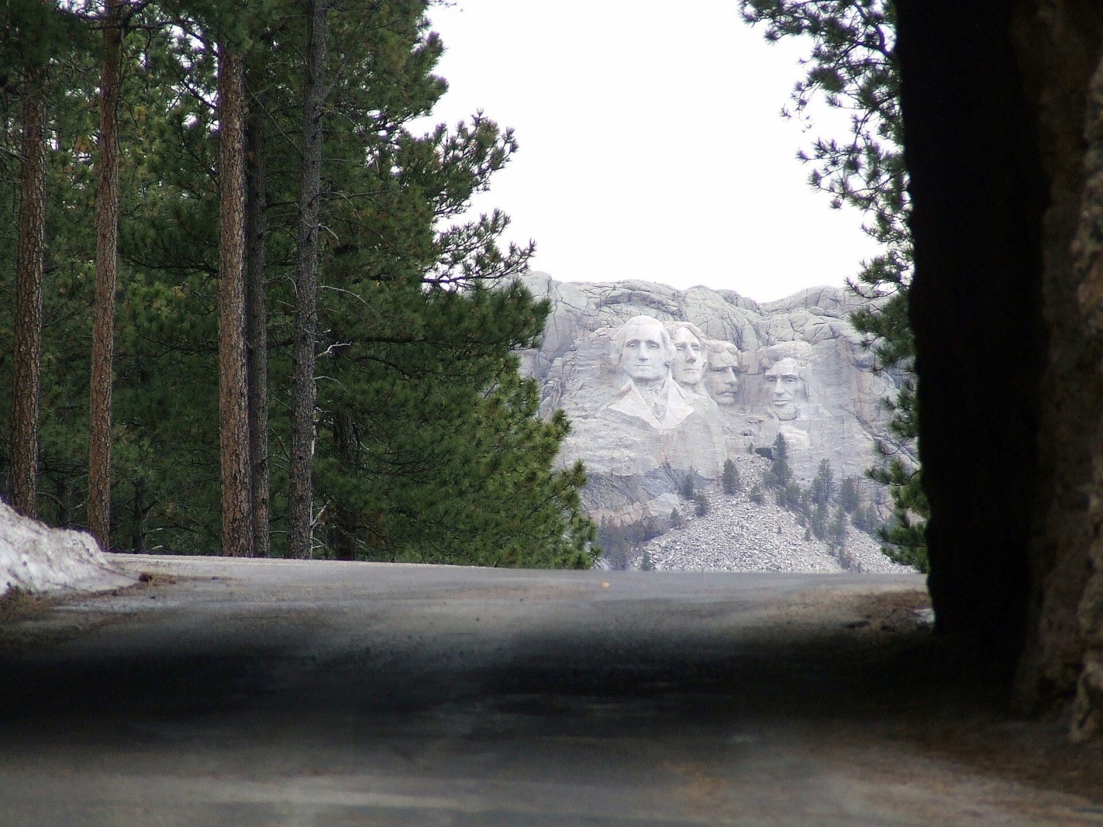
Rushmore, the Needles and Wind Cave
About 97 miles through the central and southern Black Hills from Rapid City to Hot Springs: the presidents on Tȟuŋkášila Šákpe, the granite spires of the Needles Highway, Coolidge's summer lodge, the bison range of Custer State Park and the breathing cave the Lakota came up from.
The Route at a Glance
The Black Hills rise out of the plains like an island, and this drive crosses the heart of them from north to south, almost all of it on ground the 1868 treaty guaranteed to the Lakota and the government took back nine years later. It starts in Rapid City, where Rapid Creek leaves the hills, at the Journey Museum, which lays out the rock record and the Lakota story before the road climbs into either.
US-16 and US-16A run southwest through the tourist strip of Keystone to Mount Rushmore, the four faces blasted into the peak the Lakota call Tȟuŋkášila Šákpe, the Six Grandfathers. Past the memorial, SD-244 swings west below Black Elk Peak through ponderosa forest to US-16/385, and a short run south picks up SD-87 at the north end of Custer State Park. The road reaches Sylvan Lake, where Trail 9 starts the climb to Black Elk Peak and its stone lookout, the highest ground in the hills.
From Sylvan Lake SD-87 becomes the Needles Highway, Peter Norbeck's road through the granite spires, with the eight-foot Needles Eye Tunnel near the top and the Cathedral Spires off to the west. Large vehicles should take US-16A instead. The highway comes down through pine and spruce to Legion Lake, and US-16A runs east to the State Game Lodge, where Calvin Coolidge spent the summer of 1927 and made up his mind not to run again.
SD-87 then turns south across the open grassland of the park, the range of its bison herd, where cars stop for the animals and not the other way around. It crosses into Wind Cave National Park, where the cave breathes through a small hole in the limestone and the bison graze the prairie above it, and joins US-385 for the last miles down to Hot Springs, a sandstone spa town on Fall River. The drive ends at the Mammoth Site, where a bulldozer opened a sinkhole full of mammoths in 1974.
The route runs about 97 miles and three hours without stops, and most people spend a full day on it. SD-87 through the Needles closes with the first snow and reopens in spring, and the other roads stay open all year.
The Drive, Stop by Stop
7 stops along the route, in driving order from Rapid City, South Dakota to Hot Springs, South Dakota.
- 1
- 2
- 3
- 4
- 5
- 6
- 7
That's the drive. Take your time, pull over often, and let Rushmore, the Needles and Wind Cave do what it does best.
← Explore more of Open Road Guide