The Story
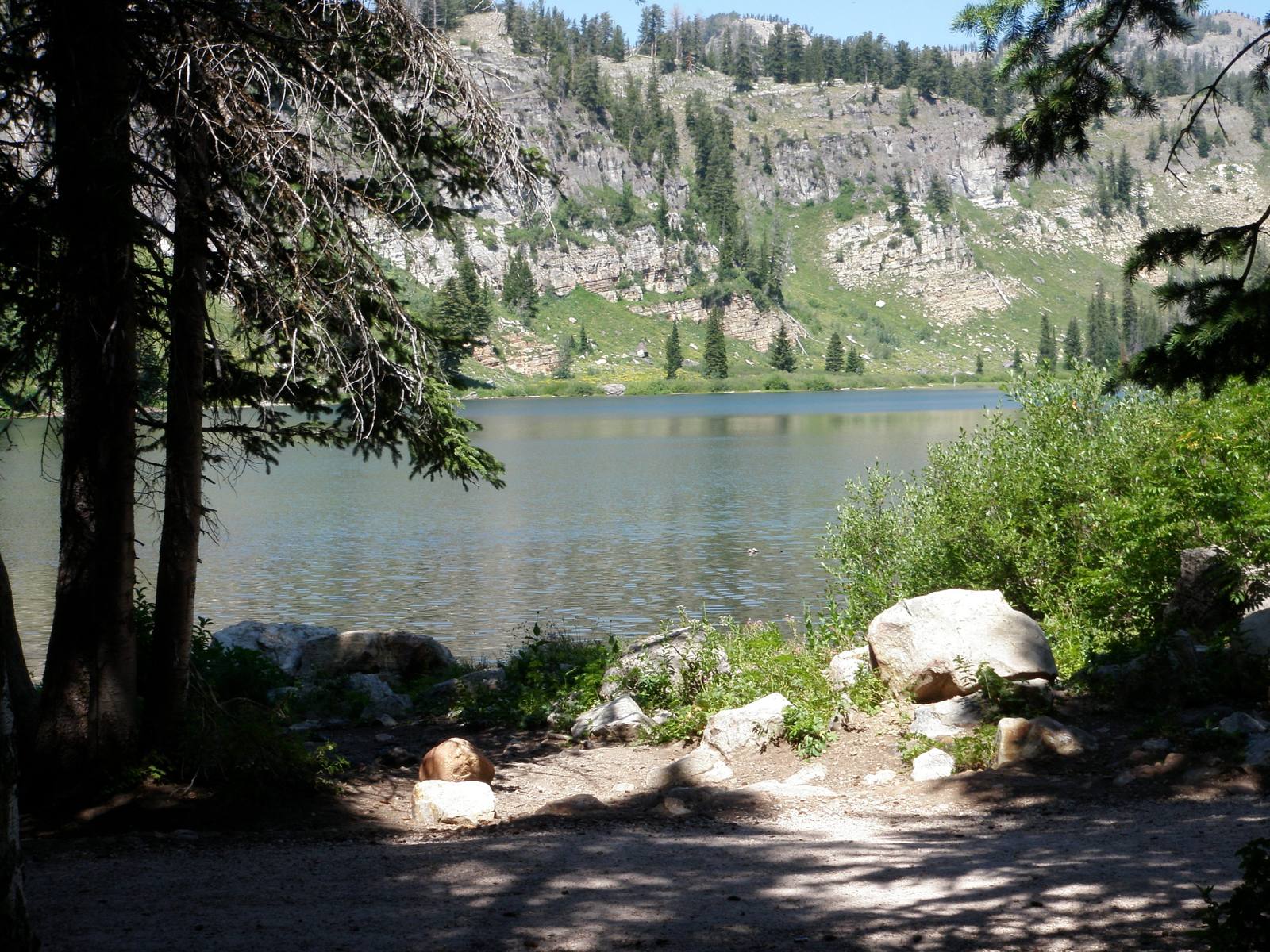
Tony Grove Lake is the alpine experience that Utah does not get enough credit for. A glacially carved cirque lake sitting at 8,100 feet in the Bear River Range, surrounded by limestone cliffs, subalpine meadows, and forests of Engelmann spruce and subalpine fir, it looks like it belongs in the Swiss Alps rather than 45 minutes from a college town in Cache Valley. A paved road gets you there — one of the few paved roads in Utah that delivers you to the doorstep of a genuine alpine lake — and an easy trail circles the water in about a mile. The accessibility is the point. This is wilderness with a welcome mat.
The lake was carved by a glacier during the last ice age, roughly 15,000 to 20,000 years ago. The glacier scooped a bowl-shaped depression — a cirque — into the limestone bedrock, and when the ice retreated, meltwater filled the basin. The cliffs that ring the eastern shore are the headwall of the cirque, rising several hundred feet in a semicircle of gray limestone that catches the morning light and reflects in the lake surface on calm days. The water is clear and cold — fed by snowmelt and springs — and the depth is sufficient to support a population of brook trout that draws fly fishermen throughout the summer.
The wildflower meadows surrounding Tony Grove are the real showpiece. In July and August, the open slopes between the lake and the surrounding forest explode with color — lupine, Indian paintbrush, columbine, arnica, larkspur, and dozens of other species blooming in densities that rival any botanical display in the state. The meadows are at their peak for roughly four to six weeks, depending on snowpack and temperature, and timing a visit to catch the bloom at its height is one of the most rewarding gambles in northern Utah. The flowers attract pollinators in corresponding abundance, and the hum of bees and the flicker of butterflies add a layer of sensory richness to the visual spectacle.
The Mount Naomi Trail begins at Tony Grove and climbs to the summit of Mount Naomi, the highest peak in the Bear River Range at 9,980 feet. The trail gains roughly 1,900 feet over about four miles, passing through meadows, forest, and rocky alpine terrain before reaching a summit with 360-degree views that encompass Cache Valley, Bear Lake, the Wellsville Mountains, and on exceptionally clear days, the distant peaks of the Wasatch and Uinta ranges. The hike is strenuous but not technical, and the summit panorama is among the finest in northern Utah.
The White Pine Lake trail, also departing from Tony Grove, leads to a smaller, higher alpine lake tucked into a cirque beneath a ridge of white limestone. The trail is about four miles each way and climbs through meadows and conifer forest before arriving at a lake that sees far fewer visitors than Tony Grove itself. The solitude, the setting, and the additional elevation make White Pine a worthy destination for hikers who want to go a step beyond the drive-up lake experience.
Tony Grove campground, situated near the lake, offers a handful of sites in a forest setting that fills early on summer weekends. The campground is basic — vault toilets, no hookups, no showers — but the location is unbeatable. Falling asleep to the sound of wind through the spruce trees, waking up to mist rising off the lake surface, and stepping outside your tent to a view of limestone cliffs glowing pink in the sunrise is the kind of camping experience that creates lifelong memories.
The road to Tony Grove is typically open from late June through October, depending on snowpack. The final stretch climbs through a series of switchbacks that offer increasingly dramatic views of the canyon below, and the transition from the canyon's dry, sun-baked lower slopes to the cool, forested alpine zone happens with startling speed. In the space of a few miles, the temperature drops noticeably, the vegetation shifts from scrub oak to conifer forest, and the air takes on the sharp, resinous scent of spruce and fir.
Tony Grove sits within the Naomi Wilderness, a small but ecologically significant wilderness area that protects the highest elevations of the Bear River Range. The wilderness designation ensures that the area remains roadless beyond the lake, preserving the alpine character that makes the higher trails and lakes feel genuinely remote despite their proximity to Logan.
Northern Utah does not make the highlight reels the way the red rock south does, and Tony Grove is a perfect example of what gets overlooked. A glacial lake, wildflower meadows, limestone peaks, cold clear water, and a trail system that ranges from a gentle lakeside stroll to a rigorous peak climb — all of it accessible by paved road from a valley with restaurants, hotels, and a university. Tony Grove is the alpine Utah that most visitors never discover, and every person who does discover it leaves wondering why it took so long.
Visitor Info
On the Map
Stories featuring this place
Go deeper into the history and character of this stop
Nearby
The closest stops worth working into your route
Historical markers nearby
Roadside plaques and monuments within a short detour