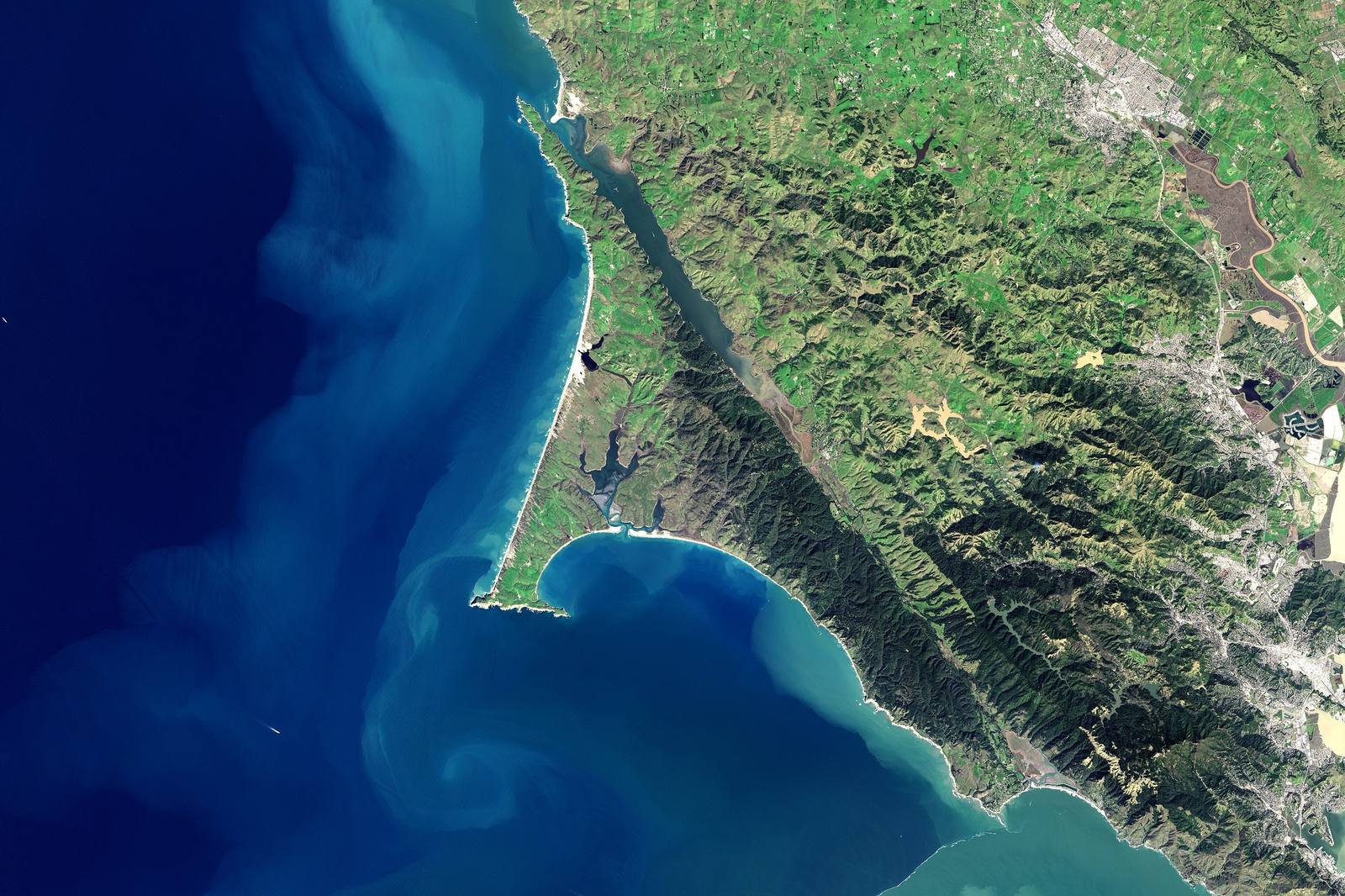
Landsat 8 view of the Marin coast on 1 March 2017. Tomales Bay runs in a straight dark line down the San Andreas Fault, the Point Reyes peninsula hooks out into the Pacific with Drakes Bay curving inside it, Bolinas Lagoon sits at the foot of the forested ridges, and a pale plume of sediment fans out through the Golden Gate at lower right.
Jesse Allen, NASA Earth Observatory / public domain via Wikimedia Commons
California · Region

Golden Gate & the Marin Coast

Coast Miwok country from the Golden Gate north — Highway 1 over Mount Tamalpais to Muir Beach and Stinson, then up the San Andreas rift through Olema and along Tomales Bay, with Muir Woods and Point Reyes saved by people who refused to sell.

7 places to explore

The Coast Miwok have been here the whole time. The Huimen lived in the canyon that became Muir Woods; villages stood along Drakes Estero and every arm of Tomales Bay; Olema is a Miwok word still on the road signs. Mission San Rafael drew the people in after 1817, the Mexican grants divided what the mission left, and the Federated Indians of Graton Rancheria — Coast Miwok and Southern Pomo — carry the nation forward today.

Highway 1 leaves US-101 just past the Golden Gate Bridge, climbs over the shoulder of Mount Tamalpais and drops to the water at Muir Beach and Stinson. Then it does something no other stretch of the road does: it stops following the coast and follows a fault. The San Andreas runs up Bolinas Lagoon, through the Olema Valley and down the whole length of Tomales Bay, and the highway keeps to the rift nearly all the way to Tomales. In April 1906 the ground on the ocean side lurched northwest in under a minute. A fence near Bear Valley was pulled about eighteen feet apart, and Point Reyes is still riding the Pacific Plate away from the rest of California.

What survives on this shore survives because somebody refused a sale. William and Elizabeth Thacher Kent bought Redwood Canyon in 1905; when a water company filed to condemn it for a reservoir, they gave it to the nation, and Kent asked that it carry John Muir's name instead of his own. Congress made Point Reyes a national seashore in 1962, the only one on the Pacific coast. The road through all of it stays two lanes, slow and curving, the whole way north.

What to See in Golden Gate & the Marin Coast

7 places across the region, grouped by what they are.

Geology & Rock Formations
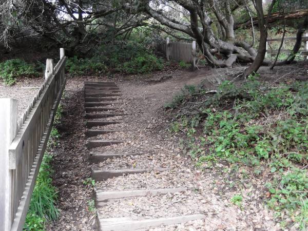
A weathered board fence on the Earthquake Trail ending beside a set of timber steps, its continuation set back among twisted trees beyond the gap where the 1906 rupture broke it.

Earthquake Trail

Olema

A short loop along the San Andreas, where a broken fence shows how far Point Reyes moved in under a minute in 1906.

View details →

Natural Areas

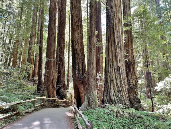
A paved path with a wooden rail curving between tall redwood trunks in Muir Woods, sword ferns and redwood sorrel covering the ground beneath them.

Muir Woods National Monument

Mill Valley

A redwood canyon saved from a reservoir by a gift, and named for a man who had been there once.

View details →
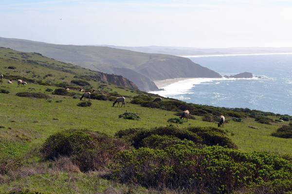
Tule elk grazing a green slope of the Tomales Point ridge, scattered among coastal scrub, with the cliffs and pale surf of the ocean shore running north to the point.

Tomales Point

Inverness

The northern tip of Point Reyes, where tule elk were fenced in for forty-six years and are fenced in no longer.

View details →

Historic Sites

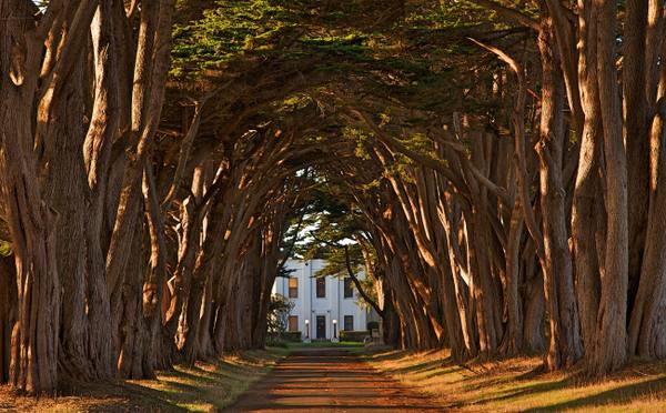
Two rows of Monterey cypress meeting overhead above a straight drive, their trunks lit amber by low sun, with the white Art Deco front of the KPH receiving station framed at the far end of the tunnel.

Cypress Tree Tunnel and Coast Station KPH

Inverness

A radio company's driveway that grew into a tunnel, leading to the coast station that kept Morse code on the air.

View details →
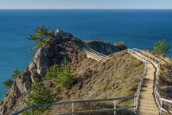
A railed path running out along a narrow rocky spine at Muir Beach Overlook, the slope falling away on both sides to the blue Pacific, with cypress and coyote brush on the rock.

Muir Beach Overlook

Muir Beach

A cliff edge on Highway 1, and the concrete dugouts where two-man crews watched the sea after Pearl Harbor.

View details →
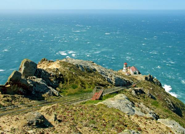
Point Reyes Lighthouse seen from the headland above: the small white tower and red-roofed building sit on a shelf low on the rocky point, a long stairway zigzagging down the slope toward them, with the open Pacific beyond.

Point Reyes Lighthouse

Inverness

A light set halfway down a cliff on purpose, because that was the only way to get it under the fog.

View details →

Towns & Gateways

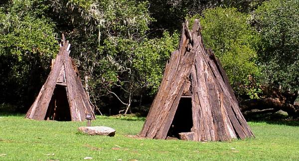
Two conical houses of leaning redwood bark slabs standing on a mown clearing at Kule Loklo, a flat stone in the grass between them and oak woodland behind.

Kule Loklo

Olema

A Coast Miwok village built in the 1970s to honour a people its builders were told had died out. They had not.

View details →

Scenic Drives through Golden Gate & the Marin Coast

Scenic Byway

Highway 1: The North Coast

Two hundred and fifteen miles of two-lane coast from the Golden Gate to Leggett — Muir Woods and the San Andreas rift, Point Reyes, the Russian River mouth, Salt Point's quarried cove, the Sea Ranch, Point Arena and the lumber headlands of Mendocino and Fort Bragg.

215 mi · 6 hrs

Stories from Golden Gate & the Marin Coast

History

Six Days' Notice

In 1965 Marin County approved a city of thirty thousand on the headlands across from San Francisco, with fifty towers, a mile of shopping and a hotel on the summit, and three lawyers working for nothing found the flaw that killed it: the public had been given six days to object instead of ten.

3 min read

Golden Gate & the Marin Coast rewards the unhurried. Pick a base, fan out, and let the country between the headline stops surprise you.

← Explore more of Open Road Guide