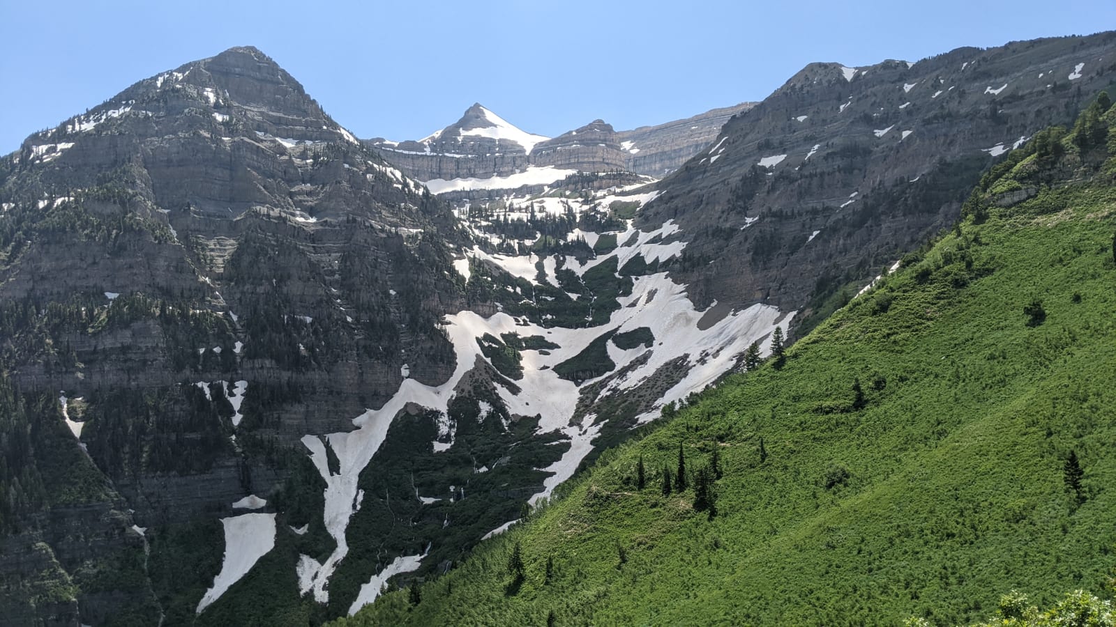
Mount Timpanogos from Primrose Cirque in early July — tiered grey limestone cliffs curving around the head of the cirque, the summit ridge notched into separate high points, and old snow still lying in long tongues and aprons across the basin below them. Steep green slopes of grass and brush climb from the right foreground toward the rock, scattered spruce and fir hold the gullies, and the sky is clear and pale. This is the far side of the peak from the valley the region is named for: Provo, Utah Lake and the valley floor lie beyond the summit ridge and cannot be seen from here.
ProvoCougar / CC0 via Wikimedia Commons
Utah · Region

Utah Valley

The valley between Utah Lake and Mount Timpanogos — Provo's canyons and waterfalls, Sundance, Timpanogos Cave, and the family attractions of Lehi.

10 places to explore

South of Salt Lake, the freeway spills into Utah Valley — a fast-growing basin of cities along the shore of Utah Lake, anchored by Provo and its university, hemmed in by the sheer eastern wall of Mount Timpanogos. It is younger and busier than it looks, a tech corridor now nicknamed Silicon Slopes, but its best places are the canyons that climb out of it into the mountains.

The valley's signature peak, Timpanogos, hides a treasure inside: Timpanogos Cave National Monument, three linked caverns of delicate, colorful formations reached by a steep mile-and-a-half trail up the wall of American Fork Canyon. To the south, Provo Canyon carries the highway past Bridal Veil Falls, a 600-foot double cascade that drops straight to the roadside, and on up the mountain to Sundance Mountain Resort — the ski hill and arts retreat the actor Robert Redford founded in the late 1960s, whose institute went on to create the Sundance Film Festival.

At the valley's north end, the town of Lehi mixes old and new: the sprawling gardens, dinosaur halls, and family museums of Thanksgiving Point sit a few minutes from the Lehi Roller Mills, a working 1906 flour mill best known to the world as a backdrop in Footloose. And up Spanish Fork Canyon lies a quieter kind of landmark — the Thistle Landslide, where in 1983 a slow-moving mountain buried the town of Thistle, dammed the river, and became one of the costliest slides in American history. The drowned remains are still visible from the highway.

Come for the canyons and the waterfall; stay for the strange mix of a college town, a film legacy, and a mountain that gave way.

What to See in Utah Valley

10 places across the region, grouped by what they are.

Geology & Rock Formations
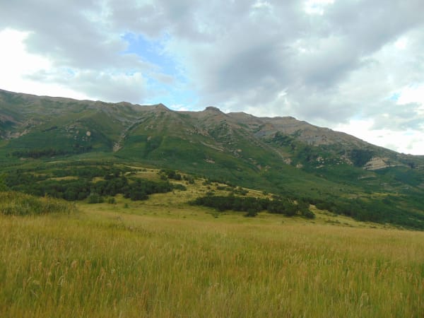
A meadow of tall summer grass at the top of the Alpine Loop, dropping away to dense green forest and oakbrush, with a long limestone-banded ridgeline rising across the frame behind it and heavy grey cloud breaking over the crest.

Alpine Loop Summit

American Fork

The 8,000-foot high point of the Alpine Loop, face to face with Mount Timpanogos

View details →
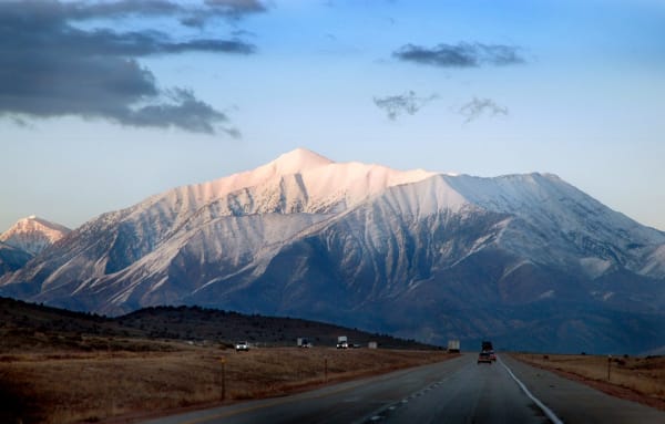
Mount Nebo under fresh snow seen head-on from the highway at valley level — the peak's long snow-covered ridge catching low pink light above dark timbered foothills, with the road running straight toward it in the foreground and a car and several semi-trailers strung out along the lanes.

Nebo Loop Summit

Payson

The byway's 9,300-foot high point, with Utah Valley spread out below

View details →
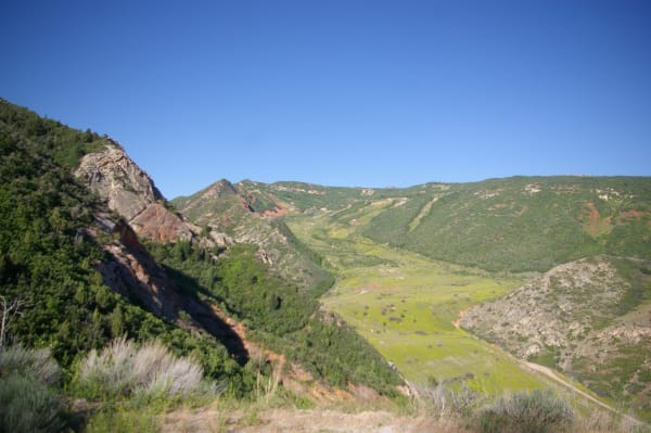
The valley at Thistle seen from the hillside above — a broad green flat where the landslide dammed the canyon, now grassed over and crossed by a dirt track, with a scarred slope of grey and rust-red rock falling away at left, brush-covered ridges closing in on both sides and a cloudless deep blue sky above.

Thistle Landslide

Spanish Fork

The ruins of a town destroyed by a massive landslide in 1983

View details →
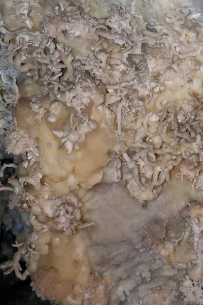
A close view of cave formations at Timpanogos Cave — a mass of pale twisting helictites growing out from the wall in every direction, over a lobed flow of cream and honey-coloured stone, with smooth grey banded rock showing behind them.

Timpanogos Cave National Monument

American Fork

Three spectacularly decorated caves connected by hand-carved tunnels

View details →

Natural Areas

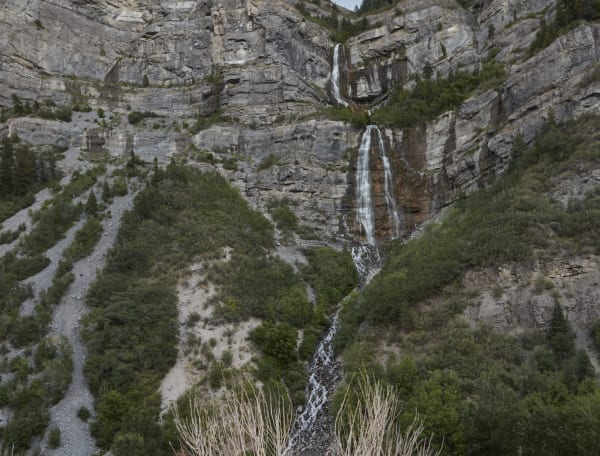
Bridal Veil Falls in Provo Canyon — the upper cascade dropping through a notch in the grey limestone cliff and the lower fall spreading in white strands down a broad rust-stained face below it, the stream running out over boulders into the trees at the bottom of the frame. A scree gully and brush-covered slopes fill the left half under flat grey light.

Bridal Veil Falls

Provo

A dramatic double waterfall cascading 607 feet into Provo Canyon

View details →

Hikes & Trails

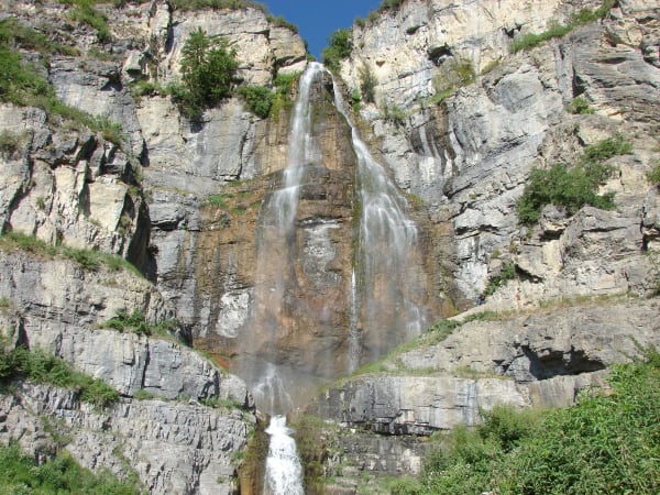
A tall waterfall fanning down a grey limestone cliff — the water splitting into several strands over a rust-stained face at centre, ledges of pale banded rock stepping up on both sides with shrubs and a lone conifer rooted in them, and a small group of hikers standing on the rock apron at the right.

Aspen Grove

Provo

The mountain-base trailhead for Mount Timpanogos and Stewart Falls

View details →
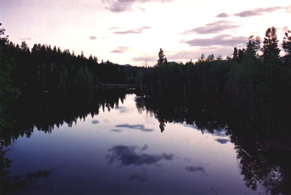
One of the Payson Lakes at dusk — still dark water holding an almost unbroken reflection of the spruce and aspen ringing it, the far shore low and wooded, and a mauve and cream sky with broken cloud standing above the treeline.

Payson Lakes

Payson

Three alpine lakes in the pines, twelve miles up Payson Canyon

View details →
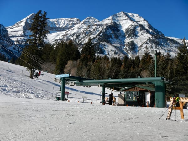
The base of a lift at Sundance — a green steel chairlift terminal under its canopy with a sign advertising complimentary guided tours, a small operator's hut with ski racks and poles beside it, a few skiers in dark clothing on the packed snow, and the snow-covered summit ridge of Mount Timpanogos rising behind the conifers under deep blue sky.

Sundance Mountain Resort

Provo

Robert Redford's intimate, arts-minded ski resort on the slopes of Mount Timpanogos, in the North Fork of Provo Canyon.

View details →

Historic Sites

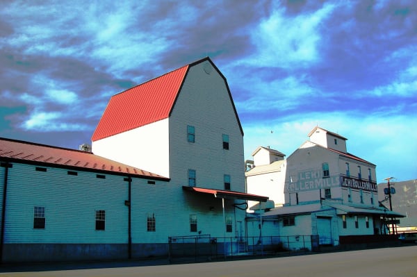
Lehi Roller Mills seen from the street — a tall white gambrel-roofed elevator with a red metal roof at centre, a long low clapboard warehouse running away to the left, and the older mill buildings beyond carrying LEHI ROLLER MILLS painted twice across their upper walls. A chain-link fence runs along the front under heavy cloud.

Lehi Roller Mills

Lehi

The flour mill from the movie Footloose

View details →

Attractions

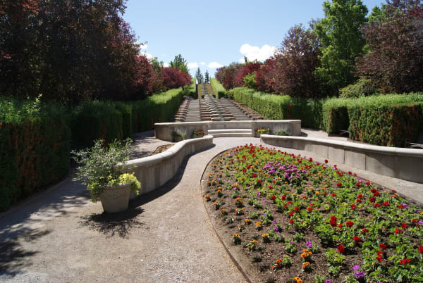
A formal garden at Thanksgiving Point — a curving gravel path between low rendered retaining walls, a crescent bed massed with red, orange and purple annuals in the foreground, clipped hedges and copper-leaved trees on both sides, and a long flight of stone steps with a water rill climbing the slope to the skyline beyond.

Thanksgiving Point

Lehi

A massive complex with dinosaur bones, gardens, and a curiosity museum

View details →

Scenic Drives through Utah Valley

Scenic Byway

Alpine Loop Scenic Byway

Twenty hairpin miles over the shoulder of Mount Timpanogos — UT-92 from American Fork Canyon into Provo Canyon, past Timpanogos Cave, Cascade Springs, and Sundance. Paved and narrow, closed in winter, unbeatable in fall.

20 mi · 1.5 hrs
Scenic Byway

Nebo Loop Scenic Byway

Thirty-eight winding miles over the back of Mount Nebo, the highest peak in the Wasatch — a CCC-built byway from Payson to Nephi, past alpine lakes, a 9,300-foot overlook, and a pocket of red-rock hoodoos. Closed in winter, unforgettable in fall.

38 mi · 2 hrs

Stories from Utah Valley

Culture

The Invented Legend of Mount Timpanogos

The sleeping princess everyone in Utah Valley knows was written by a track coach in 1922 — and the real story underneath is harder.

5 min read
Geology

The Fault Under Everything

Most of Utah lives on the Wasatch Front because one crack in the crust raised the mountains, dropped the valleys, cut the benches the cities are terraced onto, and warms the springs — and the same crack is the largest earthquake hazard in the interior West, quiet now for a very long time.

7 min read
Nature

Where One Tree Ends

Every gold aspen hillside in Utah is a handful of giant, ancient, single organisms — and the patchwork of autumn color is a map of where one stops and the next begins. They are also quietly disappearing.

6 min read
Culture

The Small Print at the Side of the Road

Utah's historical markers carry two stories: the one on the front, and the one at the bottom — a hundred and twenty-five years of daughters, sons, counties, towns, and one museum deciding what deserved bronze.

6 min read
History

The Roads the Depression Built

How three million out-of-work young men built the mountain roads Utah still drives on.

5 min read

Utah Valley rewards the unhurried. Pick a base, fan out, and let the country between the headline stops surprise you.

← Explore more of Open Road Guide