Home / California / Route 66 & the Mojave Heartland / Needles
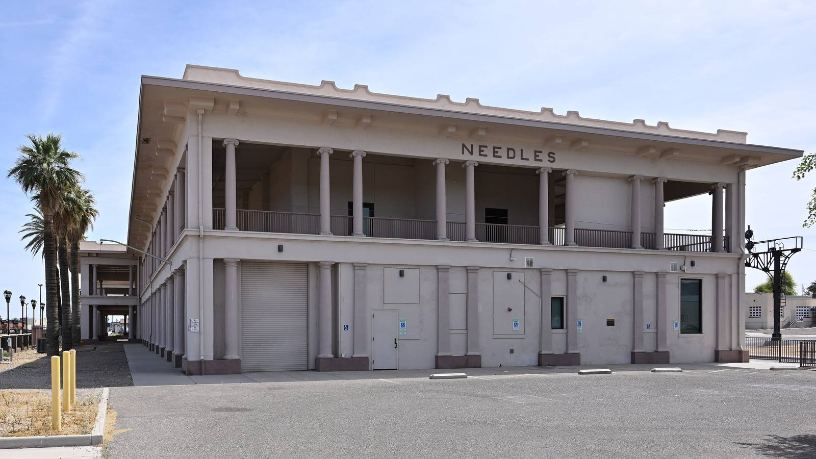
NeedlesG. Edward Johnson / CC BY 4.0 via Wikimedia Commons
🎭Cultural

Needles

Part ofRoute 66 & the Mojave Heartland
On this driveRoute 66 in California: Needles to the Pacific

Route 66's Colorado River gateway into California, anchored by El Garces, the Harvey House that Mojave hands built.

⏱
Duration
An hour for El Garces and the riverfront; longer if you are staging for the desert crossing.
πŸ“…
Best Season
Fall through spring; summer afternoons routinely run past 115 degrees.

The Story

Needles sits on the California bank of the Colorado, the first town Route 66 reaches after crossing out of Arizona, down the old grade through Oatman, and, for westbound travelers, the gate into the true Mojave. The 'Aha Makhav, the Mojave, the People by the River, farmed this floodplain for centuries before the Southern Pacific and the Santa Fe's Atlantic and Pacific line met here in 1883; the town took its name from the Needles, the sharp peaks downriver. Its landmark is El Garces, the Santa Fe depot and Fred Harvey House that opened in 1908 after fire destroyed the original wooden station. Built of concrete in the shape of a Greek temple and once called the crown jewel of the Harvey chain, it was raised largely by Mojave workers, who climbed the scaffolding to pour its walls by hand. Harvey Girls served rail passengers in its dining rooms until 1949; the Santa Fe kept offices inside until 1988, after which the building sat empty and close to demolition. The city bought it in 1999, and a long restoration reopened it in 2014 as an intermodal station. Amtrak's Southwest Chief still stops here, and the colonnades still shade the platform. Needles is also, reliably, one of the hottest towns in the country, and the Dust Bowl families in The Grapes of Wrath dreaded this crossing above all others, timing it for the cool of night. Fuel and water are easy here. West of town the road empties out fast toward Goffs and Amboy, and the next dependable services are a long way on.

Visitor Info

⏱
Time Needed
An hour for El Garces and the riverfront; longer if you are staging for the desert crossing.
πŸ“…
Best Season
Fall through spring; summer afternoons routinely run past 115 degrees.
πŸ›£οΈ
Highway
I-40 / Historic Route 66

On the Map

Stories

Stories featuring this place

Go deeper into the history and character of this stop

History
The Alphabet in the Desert
JoAnn Β· 6 min read
History
The Year California Closed the Road
JoAnn Β· 7 min read

Nearby

The closest stops worth working into your route

cultural18 mi away
Oatman
A gold camp in the Black Mountains that outlived its mines, now run by wild burros β€” reached by the wildest switchbacks left on Route 66, and named for a history worth telling straight.
historical27 mi away
Goffs
A near-ghost on the pre-1931 Route 66 alignment, keeper of a 1914 desert schoolhouse and a WWII Army camp.
cultural39 mi away
Kingman
The working hub of Route 66 in Arizona β€” a railroad town named for a surveyor, Andy Devine's hometown, and the last real stop before the road's two wildest endings.
architectural60 mi away
Kelso Depot
A grand 1920s Mission Revival rail depot standing alone in the deep Mojave, now the preserve's visitor center.
roadside62 mi away
Hackberry General Store
Looks like a junkyard, is a shrine β€” the 1934 store an artist brought back from the dead, and the Route 66 stop that inspired Fillmore in Cars.
natural63 mi away
Kelso Dunes
The Mojave's largest dune field, and one of the few places on Earth where the sand booms underfoot.

Historical markers nearby

Roadside plaques and monuments within a short detour

Marker12 mi away
Von Schmidt State Boundary Monument
Nevada
Marker18 mi away
Oatman Arizona and its Burros
Oatman, Arizona
Marker18 mi away
Fairchild, Olive and Oatman (1837 - 1903)
Oatman, Arizona
Marker18 mi away
Durlin Hotel
Oatman, Arizona
Marker18 mi away
Arizona Hotel
Oatman, Arizona
Marker19 mi away
The GarcΓ©s Expedition
Nevada