Drive east from Barstow on the old road and the place-names start behaving strangely. Amboy. Bristol. Cadiz. Danby. Essex. Fenner. Goffs. It takes most people until about D to notice, and then the desert stops feeling random. Those are not towns that happened to fall into alphabetical order. They are a filing system, imposed on two hundred miles of the emptiest country in California by a railroad that had one problem above all others out here, and solved it by drilling wells and numbering them with letters.
Nearly everything a traveler stops for on this stretch of Route 66 stands where it stands because a steam locomotive was thirsty in 1883.
The railroad drank first
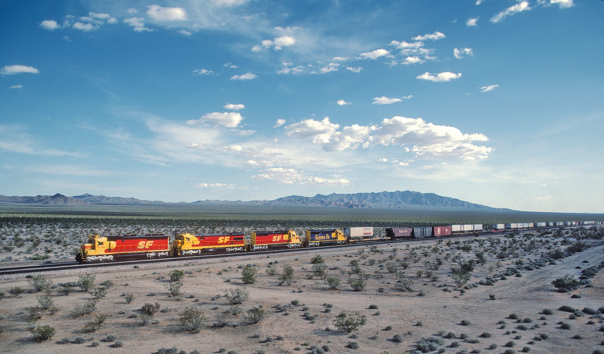
The Atlantic and Pacific pushed its line across the Mojave in the early 1880s, aiming for the Colorado River at Needles. A steam locomotive of that era could not go far without taking on water, and the Mojave offers almost none on the surface. So the line was built around wells and springs: a stop wherever water could be raised, spaced closely enough that no engine ran dry between them. Goffs had a deep well. Fenner drew from a spring in the Piute Mountains, enough to irrigate trees in open desert. Farther north at Kelso, a reliable well is the entire reason a depot and a crew town ever existed in an empty valley, as Kelso Depot still quietly explains to anyone who reads its walls.
Water dictated the spacing, the spacing dictated the stops, and the stops dictated where, decades later, anyone could buy a tank of gas.
The man with the alphabet
The naming is credited to Lewis Kingman, the locating engineer who laid out the Atlantic and Pacific's route from Albuquerque west to Needles beginning in 1880. Working east from Amboy, he ran the water stops down the alphabet in order: Amboy, Bristol, Cadiz, Danby, Essex, Fenner, Goffs, then Homer, Ibis, Java, Klinefelter and on toward the river. Several were renamed later — Essex began as Edson, Ibis as Ibex, Bristol went through more names than a witness in protection — but the sequence survived the edits.
West of Amboy, where the scheme ran out, the naming went to the other extreme and reached for the far ends of the earth: Bagdad, Siberia, Klondike. A railroad naming its dry holes after Baghdad and Siberia in the same afternoon it was working politely through the alphabet tells you something about the mood out there.
Kingman got a monument out of it, though not in California. A siding he located on the Arizona side became Kingman, which is now the biggest town on Arizona's stretch of the Mother Road. The man who named the Mojave's letters has his own name on the map one state east.
What the highway inherited
None of this would matter if the road had been free to go anywhere. It wasn't. When the National Old Trails Road was pushed across the desert in the 1910s, it followed the rail line for the same reason the rail line followed the wells — because water, fuel, and help already existed at intervals, and nothing else did. Route 66 was laid over that road in 1926 and inherited the whole arrangement wholesale: a highway shaped by the range of a steam engine two generations dead.
You can watch the inheritance shift. Goffs sat on the highway until the 1931 realignment cut six miles off the run and left it stranded; Essex, on the new line, took the traffic and grew a café, a garage, and cabins. A letter's worth of the alphabet gained a living and its neighbor lost one, on a decision made in a highway office.
When the water stopped mattering
The logic held for about seventy years, and then it dissolved twice.
Diesel locomotives killed the reason first. They do not stop for water, and the little stations that existed to fill boilers became sidings, then names on a timetable, then nothing. The second blow was the interstate. Amboy went from a full stop with a few hundred residents to almost nothing when Interstate 40 opened past it in 1972. Kelso's lunch counter served its last meal at midnight on the last day of June in 1985. What is left along Route 66 in California is a line of names with very little under them: a post office, a gift shop, a schoolhouse kept up by volunteers, a great deal of creosote.
Reading the map that remains
The alphabet is the most durable thing anybody built out here. The wells are capped or forgotten, the depots are gone or repurposed, the motels are foundations, but the letters are still printed on every map of the eastern Mojave in the order a surveyor set them down in 1883.
It is worth driving with that in mind, because it changes what the emptiness means. This country does not look like a place anyone planned. It is, in fact, one of the most rigorously planned landscapes in California — laid out on a single constraint, spaced by the thirst of a machine, and labeled in sequence by a man in a survey camp who evidently wanted the list to be easy to remember. Everything since has been improvisation on top of his outline. The towns emptied out because the constraint went away, not because the desert won.
Say them out loud on the drive east. Amboy, Bristol, Cadiz, Danby, Essex, Fenner, Goffs. It is a spelling lesson, a water map, and a century-old memo about how railroads think, all in the same seven signs.