Home / California / Route 66 West: Cajon to the Sea / Colorado Street Bridge
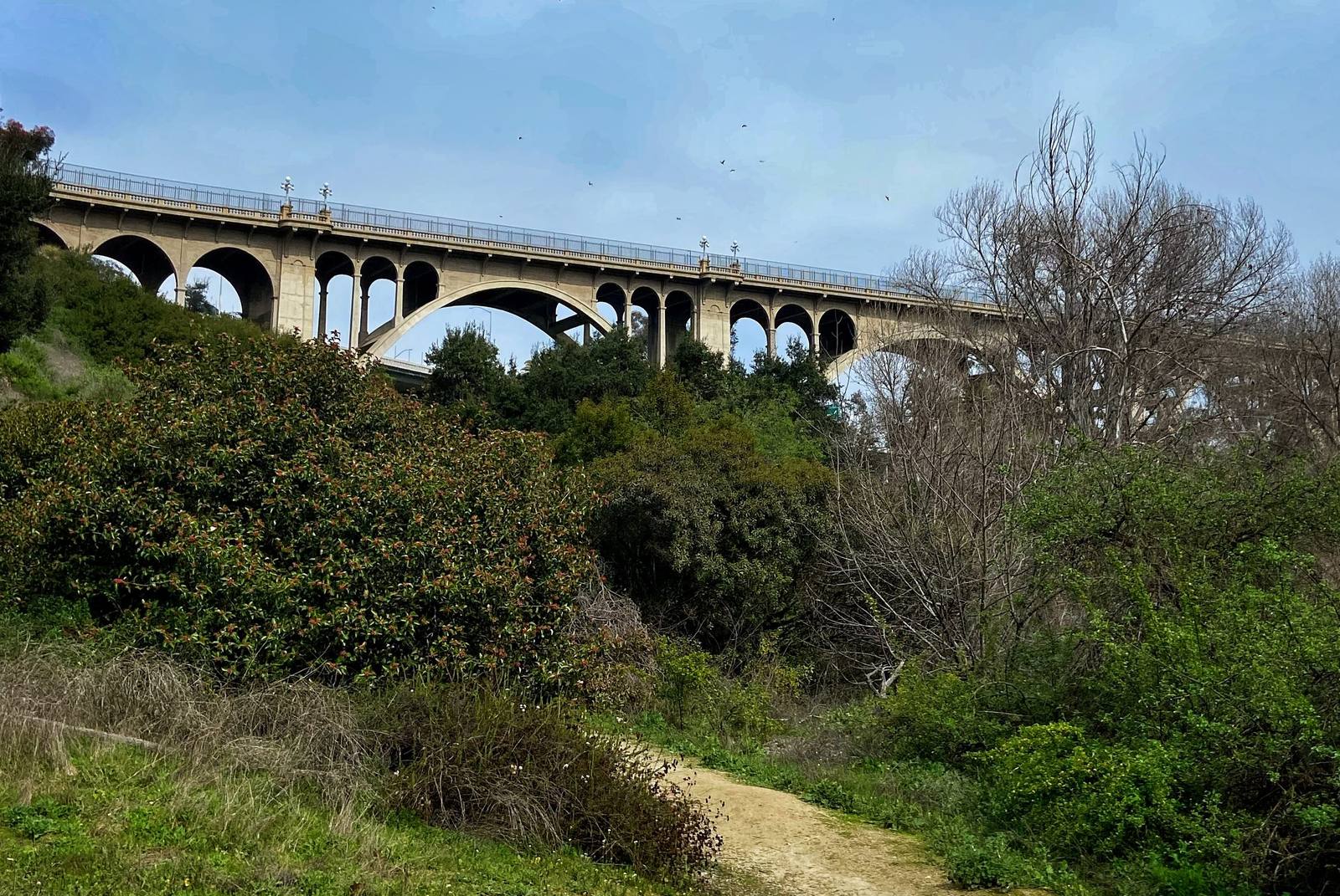
Colorado Street BridgeMcbruin12 / CC0 via Wikimedia Commons
🏗️Architectural

Colorado Street Bridge

Part ofRoute 66 West: Cajon to the Sea
On this driveRoute 66 in California: Needles to the Pacific

Beaux-Arts concrete arches curving 150 feet above the Arroyo Seco, opened in 1913 and later a link in Route 66.

Duration
Twenty to thirty minutes to walk it, more from the park underneath.
📅
Best Season
Year round; late afternoon light is best from the arroyo below.
💡
Fun Fact
Its builders curved the bridge on purpose. The bedrock they needed sat at an angle to the canyon, so the arches swing in a long bend rather than crossing straight.

The Story

Pasadena sits on a mesa that drops without warning into the Arroyo Seco, and until 1913 getting west meant descending into the ravine, crossing a trestle at the bottom, and hauling back up the other side, which horses disliked and early automobiles could barely manage. The Colorado Street Bridge solved it in one gesture. Designed by the engineering firm of Waddell and Harrington and built by John Drake Mercereau, it runs 1,467 feet on a row of open concrete arches, the longest spanning 233 feet, carrying the roadway about 150 feet above the canyon floor. It opened on December 13, 1913, and Pasadena decorated its cars and paraded across. The style is Beaux-Arts and the details were not an afterthought: balustrades, alcoves set into the railings, and tall lamp standards that still light the deck. It curves, unusually, because the sound bedrock lay at an angle to the ravine and the builders followed it. For a stretch of its life the bridge carried Route 66 across the arroyo, feeding the route onto Colorado Boulevard, which Pasadena widened in 1929 by shearing the fronts off its own buildings, and which the Rose Parade has marched down every New Year since long before that. Closed in 1989 as an earthquake risk, retrofitted, and reopened in 1993, it is on the National Register and remains open to cars and to walkers. From the park below, the arches are the whole show. West of here the route runs its last miles to the Santa Monica Pier.

Visitor Info

Time Needed
Twenty to thirty minutes to walk it, more from the park underneath.
📅
Best Season
Year round; late afternoon light is best from the arroyo below.
🛣️
Highway
Historic Route 66 (Colorado Blvd.)

On the Map

Nearby

The closest stops worth working into your route

historical4.6 mi away
Mission San Gabriel Arcangel
The fourth Alta California mission, built on Tongva land with Tongva labor, rebuilt after arson and now telling that story straight.
attraction21 mi away
Santa Monica Pier
Where the Mother Road runs out of continent, and where the End of the Trail sign gives the drive somewhere to finish.
geological44 mi away
Cajon Pass
The gap the San Andreas tore between two mountain ranges, and the doorway every westbound traveler has used for two centuries.
roadside47 mi away
Wigwam Motel
Nineteen concrete teepees on Foothill Boulevard, the last of Frank Redford's Wigwam Villages and still renting rooms.
cultural50 mi away
Original McDonald's Site
The corner where two brothers invented fast food, now an unofficial museum the corporation has never blessed.
cultural83 mi away
Barstow
The Mojave's rail-and-road hinge, where the Santa Fe yards and Route 66 meet at the Casa del Desierto Harvey House.