Home / California / San Fernando & Santa Clarita Valleys / Los Encinos State Historic Park
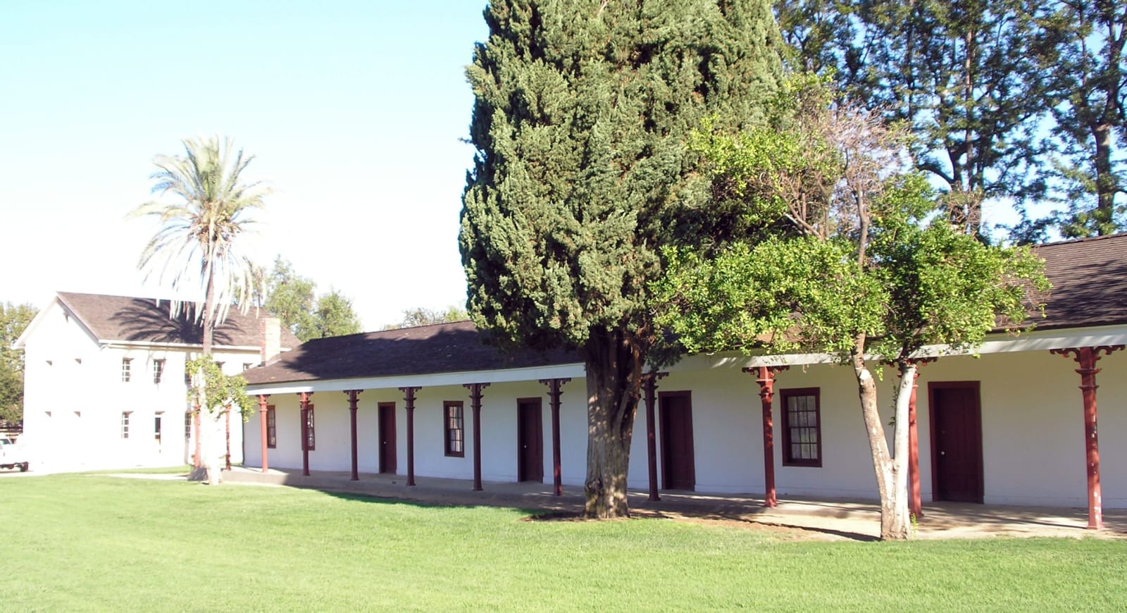
The single-story de la Osa adobe at Los Encinos State Historic Park, with the two-story Garnier house behind it.PKM / CC BY-SA 3.0 via Wikimedia Commons
🏛️Historical

Los Encinos State Historic Park

Part ofSan Fernando & Santa Clarita Valleys

A spring that never stopped running, the village it fed for thousands of years, and the rancho that took the ground away.

Duration
Forty-five minutes to an hour for the grounds, longer if a tour is running.
📅
Best Season
Year round; Valley afternoons run hot in summer, so come in the morning.

The Story

The spring here ran year round, which is why Siutcanga stood on this ground for thousands of years. The name means the place of the oaks, and the Fernandeño Tataviam Band of Mission Indians says more than three quarters of its citizens descend from this village. Chumash, Tongva and Tataviam people all used the site. The trade route they traveled to reach it is now Ventura Boulevard, a block south. Portolá's expedition camped at the spring in August 1769 and Juan Crespí wrote it down, counting roughly two hundred people living in two villages.

What happened next is on the nation's own website and is worth reading before you walk the grounds: in the Mexican period their ancestors were granted Rancho El Encino, and within a few years the land was gone, lost during the American period to the business dealings of a neighboring Spaniard named Vicente de la Osa. His adobe is the long low building at the center of the park, put up in 1849. The two-story limestone house behind it went up in 1872 for Eugene Garnier, a French Basque sheep rancher, and the guitar-shaped pond in front of it in 1874. Four and a half acres, free to enter, walled off from the boulevard traffic completely. Adobe interiors are shown by docent tour, so check the schedule before you count on getting inside.

Visitor Info

Time Needed
Forty-five minutes to an hour for the grounds, longer if a tour is running.
📅
Best Season
Year round; Valley afternoons run hot in summer, so come in the morning.
🛣️
Highway
Off US-101 at Balboa Blvd.

On the Map

Nearby

The closest stops worth working into your route

historical7.9 mi away
Campo de Cahuenga
The treaty that ended the fighting in California was signed on this ground, and the building it was signed in is now under the boulevard.
historical8.1 mi away
Leonis Adobe
Miguel Leonis left his estate to relatives in France and called Espíritu Chijulla his housekeeper; she spent sixteen years proving in court that she was his wife.
historical8.1 mi away
Mission San Fernando Rey de España
The seventeenth Alta California mission, founded at the Tataviam village of Achoicominga, with the largest adobe building in the state standing beside it.
attraction10 mi away
Santa Monica Pier
Where the Mother Road runs out of continent, and where the End of the Trail sign gives the drive somewhere to finish.
industrial11 mi away
The Cascades
The concrete chute where the Los Angeles Aqueduct arrives, and where forty thousand people watched the Owens Valley come south in 1913.
industrial15 mi away
Pioneer Oil Refinery
The first commercially successful refinery in the West, built in 1876 to take the crude coming down the pipeline from Pico Canyon.

Historical markers nearby

Roadside plaques and monuments within a short detour

Marker0 mi away
Los Encinos State Historic Park
Encino
Marker5.1 mi away
Old Trapper's Lodge
Woodland Hills
Marker6.5 mi away
Harold Lloyd Estate (Greenacres)
Beverly Hills
Marker7.7 mi away
Rómulo Pico Adobe (Ranchito Rómulo)
Mission Hills
Marker7.9 mi away
Campo de Cahuenga
North Hollywood
Marker8 mi away
Brand Park (Memory Garden)
Los Angeles