Home / California / Route 66 West: Cajon to the Sea / Mission San Gabriel Arcangel
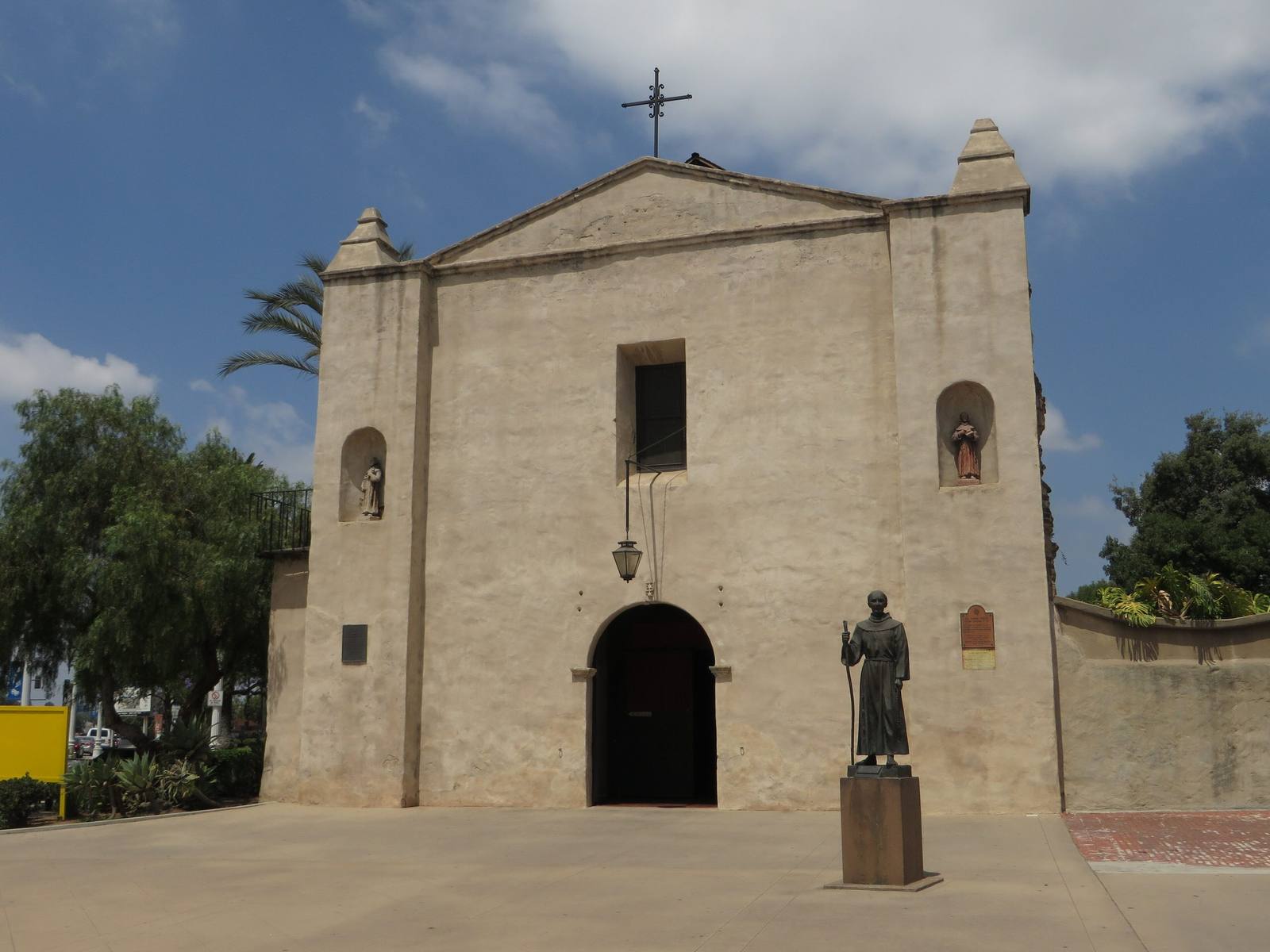
A photograph taken in June 2014 of the entrance front of Mission San Gabriel Arcangel — a pale stucco gable wall with a stepped pinnacle at each corner and a wrought-iron cross at the peak, a tall plain opening high in the centre, two arched niches holding small painted statues, a hanging lantern over an arched doorway, and two plaques on the wall. A bronze statue of Junipero Serra in Franciscan habit, holding a staff, stands on a tall plinth to the right of the door; it had stood at the entrance since the 1980s, and the mission moved it out of public view in July 2020. The roof shown intact here was destroyed by an arson fire on 11 July 2020. Pepper trees and palms rise behind the wall and a paved forecourt crosses the foreground. The six-bell campanario, the capped buttresses and the tall narrow windows of the mission's recognised façade are not in this frame, and nothing of the Tongva who were made to build and run the mission appears in it.Ken Lund / CC BY-SA 2.0 via Wikimedia Commons
🏛️Historical

Mission San Gabriel Arcangel

Part ofRoute 66 West: Cajon to the Sea
On this driveRoute 66 in California: Needles to the Pacific

The fourth Alta California mission, built on Tongva land with Tongva labor, rebuilt after arson and now telling that story straight.

Year-RoundNative American HeritagePaid Entry
Duration
An hour to ninety minutes for the church, museum, gardens, and Campo Santo.
🎟
Admission
Small admission for the museum and grounds; the church is open for worship.
📅
Best Season
Year round.
💡
Fun Fact
In 1785 Toypurina, a Tongva medicine woman, helped plan a revolt against the mission, in part because the missionaries had forbidden the people to dance their own dances.

The Story

This is Tovaangar, and this mission sits on it. The Tongva village of Toviscanga stood where the Franciscans planted the fourth of the twenty-one Alta California missions, founded on September 8, 1771 under Junipero Serra's direction and moved to this spot in 1775 after floods. What followed was not a partnership. Tongva people were brought into the mission system and made to build and run it, and the Spanish renamed them Gabrieleno after the place that took their labor; some descendants today carry the ancestral name Kizh. More Native people were baptized here than at any other mission, roughly twenty-five thousand before secularization in 1834, and about six thousand are buried in the Campo Santo beside the church, the oldest cemetery in Los Angeles, marked now by a memorial. In 1785 Toypurina, a Tongva medicine woman, joined Nicolas Jose in planning a revolt against the mission, one grievance being an order forbidding the people their own dances; the rising was stopped and she was exiled north. The church itself is unlike the other missions, a fortress of capped buttresses and a long unbroken wall, designed by Antonio Cruzado and finished in 1805, its lines borrowed from Moorish Spain. An arson fire on July 11, 2020 destroyed the roof and gutted the interior. It reopened on July 1, 2023, rebuilt, with a reworked museum that says considerably more about the people who built it than the old one did. Route 66 passed close by, on its way toward Pasadena and the Colorado Street Bridge.

Visitor Info

Time Needed
An hour to ninety minutes for the church, museum, gardens, and Campo Santo.
🎟
Admission
Small admission for the museum and grounds; the church is open for worship.
📅
Best Season
Year round.
🛣️
Highway
Off Historic Route 66 (Foothill/Colorado alignment)

On the Map

Nearby

The closest stops worth working into your route

architectural4.6 mi away
Colorado Street Bridge
Beaux-Arts concrete arches curving 150 feet above the Arroyo Seco, opened in 1913 and later a link in Route 66.
historical15 mi away
Campo de Cahuenga
The treaty that ended the fighting in California was signed on this ground, and the building it was signed in is now under the boulevard.
historical17 mi away
Domínguez Rancho Adobe
The first Spanish land grant in California contained the whole harbor, and in 1846 fifty Californio lancers turned back three hundred Marines on it.
cultural22 mi away
Puvungna
The Acjachemen and Tongva place of creation: twenty-two acres of open ground on a university campus, still not in the hands of its people.
historical23 mi away
Bruce's Beach
Willa and Charles Bruce ran a seaside resort here for Black families until the city took the land in 1924. It came back in 2022.
historical23 mi away
Los Encinos State Historic Park
A spring that never stopped running, the village it fed for thousands of years, and the rancho that took the ground away.

Historical markers nearby

Roadside plaques and monuments within a short detour

Marker0 mi away
Mission San Gabriel Arcángel
San Gabriel
Marker0.2 mi away
The Ortega-Vigare Adobe
San Gabriel
Marker2 mi away
Old Mill
San Marino
Marker2.1 mi away
Governor Stoneman Adobe, Los Robles
San Marino
Marker2.5 mi away
Savannah Memorial Park
Rosemead
Marker3.8 mi away
Pasadena Playhouse
Pasadena