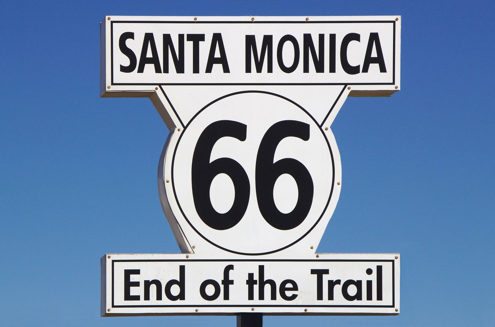
The Route 66 End of the Trail sign at Santa Monica, shot from below and filling the frame against a clear sky graduating from deep to pale blue. A white enamelled panel lettered SANTA MONICA sits above a large white shield carrying a black 66 inside a ring, and a second panel below is lettered End of the Trail. The panels are plainly bolted at their corners and lightly weathered along the edges, with the dark post showing at the bottom of the frame. Nothing of the pier, the beach or the ocean is in the picture.
John Salatas / CC BY-SA 4.0 via Wikimedia Commons
California · Region

Route 66 West: Cajon to the Sea

The Mother Road's last miles — down Cajon Pass into Tovaangar, the Tongva world, past the Wigwam Motel and Pasadena's Colorado Boulevard to the pier at Santa Monica, where the road runs out at the Pacific.

6 places to explore

Everything west of Cajon Pass is Tovaangar — the world of the Tongva, whose villages covered the Los Angeles Basin and the southern Channel Islands for thousands of years before Spain arrived. The mission at San Gabriel, a few blocks off the old road, was built with their forced labor; the Spanish renamed them Gabrieleno for it, and some of their descendants today carry the ancestral name Kizh instead. The basin's history did not begin with a highway, and this guide does not pretend it did. At the pass itself the road crosses out of Maara'yam country, dropping through the gap the railroads found first.

For the Route 66 traveler, Cajon is the arrival scene: after crossing prairie and desert all the way from Chicago, the road tips over the rim and descends toward orange groves and ocean air — the moment every Dust Bowl family had been driving toward. What follows is the Mother Road at its most urban and most mythic: San Bernardino, where the first McDonald's stood and a museum now marks the spot; the Wigwam Motel's concrete teepees, still renting rooms; Foothill Boulevard through the old citrus towns; and Pasadena's Colorado Boulevard, where the route parades past brick storefronts on the Rose Parade's own street, near the 1913 arches of the Colorado Street Bridge over the Arroyo Seco. Between the pass and the pier the old road wears a dozen local street names, and following it is half the sport.

Then the end. Route 66 runs out at the Pacific in Santa Monica, and the pier — a few blocks past the route's official terminus, though nobody quibbles — carries the sign everyone came for: End of the Trail. This region keeps to the road itself, the corridor and its roadside, not the whole metropolis. The ocean stops the highway; it is the one border on the entire route that argues with no one.

What to See in Route 66 West: Cajon to the Sea

6 places across the region, grouped by what they are.

Geology & Rock Formations
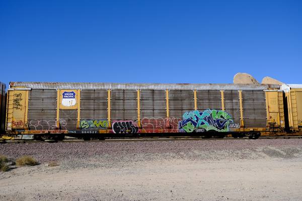
A single Union Pacific autorack railcar standing on ballast at Cajon Pass, shot square-on from trackside and filling the frame — a long enclosed car with a corrugated white roof, yellow end posts and perforated steel side panels, a Union Pacific shield decal near the left end and the reporting mark TTGX 964527 stencilled along the sill. Wildstyle graffiti in green, blue, pink, red and black runs the length of the lower panels. Bare pale dirt crosses the foreground, a low rock outcrop shows above the roofline at the right, and the sky is clear deep blue. The pass itself is not in the frame: no gap between the ranges, no San Gabriel or San Bernardino slopes, no highway and no view along the corridor.

Cajon Pass

San Bernardino

The gap the San Andreas tore between two mountain ranges, and the doorway every westbound traveler has used for two centuries.

View details →

Historic Sites

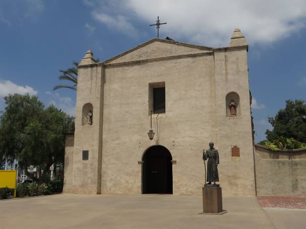
A photograph taken in June 2014 of the entrance front of Mission San Gabriel Arcangel — a pale stucco gable wall with a stepped pinnacle at each corner and a wrought-iron cross at the peak, a tall plain opening high in the centre, two arched niches holding small painted statues, a hanging lantern over an arched doorway, and two plaques on the wall. A bronze statue of Junipero Serra in Franciscan habit, holding a staff, stands on a tall plinth to the right of the door; it had stood at the entrance since the 1980s, and the mission moved it out of public view in July 2020. The roof shown intact here was destroyed by an arson fire on 11 July 2020. Pepper trees and palms rise behind the wall and a paved forecourt crosses the foreground. The six-bell campanario, the capped buttresses and the tall narrow windows of the mission's recognised façade are not in this frame, and nothing of the Tongva who were made to build and run the mission appears in it.

Mission San Gabriel Arcangel

San Gabriel

The fourth Alta California mission, built on Tongva land with Tongva labor, rebuilt after arson and now telling that story straight.

View details →

Towns & Gateways

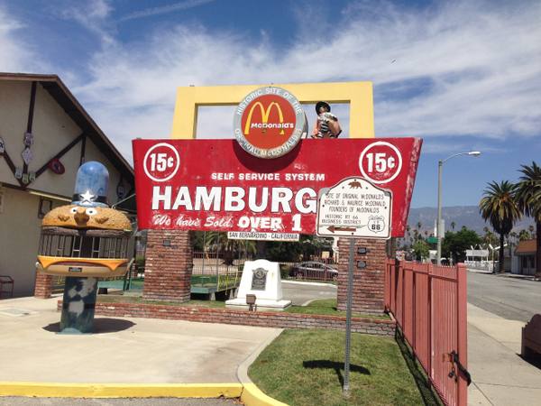
The sign assemblage at the original McDonald's site in San Bernardino — a large red board on brick piers lettered SELF SERVICE SYSTEM above HAMBURGERS, a 15¢ roundel at each end, and We have Sold OVER 1 and SAN BERNARDINO - CALIFORNIA beneath, its paint chalky and weathered. A yellow single arch stands above it carrying a disc lettered HISTORIC SITE OF THE ORIGINAL McDonald's around the golden arches, with a Speedee chef figure perched at its right. A moulded Officer Big Mac character — a hamburger with eyes under a peaked cap — stands on a post at the left, in front of a chalet-roofed building hung with Route 66 shields. A California landmark plaque names Richard and Maurice McDonald as founders and points left to the HISTORIC RT 66 BUSINESS DISTRICT, and a bronze tablet stands on a white pedestal on the lawn. Palms, a red picket fence, the street and the San Bernardino Mountains close the view.

Original McDonald's Site

San Bernardino

The corner where two brothers invented fast food, now an unofficial museum the corporation has never blessed.

View details →

Architecture

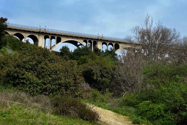
The Colorado Street Bridge seen from the floor of the Arroyo Seco, its deck curving across the upper frame on a row of open spandrel arches with one tall main arch at the centre, paired ornamental lamp standards along the parapet and a metal railing above the concrete balustrade. Green brush and a toyon in red berry fill the slope in the foreground, bare deciduous trees stand at the right, and a dirt footpath enters at the bottom corner under a pale blue sky with thin cloud and circling birds.

Colorado Street Bridge

Pasadena

Beaux-Arts concrete arches curving 150 feet above the Arroyo Seco, opened in 1913 and later a link in Route 66.

View details →

Roadside Stops

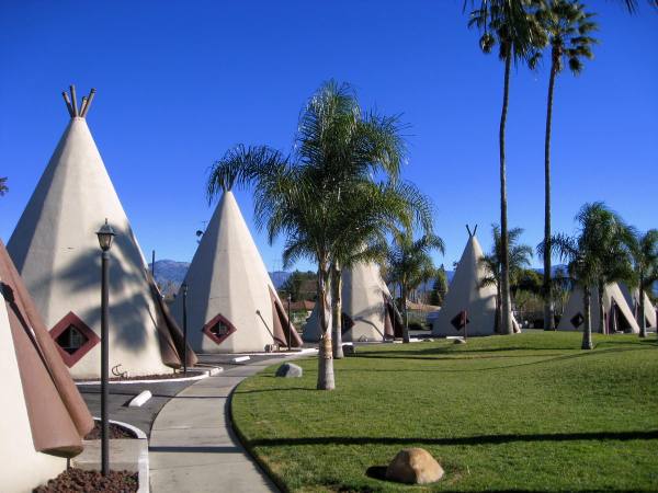
Rows of concrete teepees at the Wigwam Motel on Foothill Boulevard — cream-white cones with dark red skirting and angled fins at the base, a diamond-shaped window frame set in each and crossed pole-ends at the apex — ranged along a curving concrete walk. Mown lawn, queen palms, tall fan palms, a black lamp standard and lava-rock beds fill the ground between them, and the San Bernardino Mountains stand low and hazy across the middle distance under a deep clear blue sky.

Wigwam Motel

San Bernardino

Nineteen concrete teepees on Foothill Boulevard, the last of Frank Redford's Wigwam Villages and still renting rooms.

View details →

Attractions

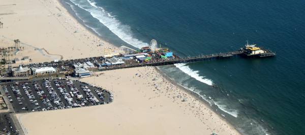
An aerial photograph looking down on Santa Monica Pier and the beach on either side of it. The pier runs out into deep blue water carrying the Pacific Park rides — a Ferris wheel, a roller coaster, and rows of small buildings and awnings — with a boat-shaped structure at the far end. The Looff Hippodrome and other tile-roofed buildings sit at the pier head above a full parking lot, palms line the promenade, and beachgoers, umbrellas and towels are scattered in a dense band along the sand and the surf line on both sides, every figure far too small to make out individually. The End of the Trail sign is not visible at this scale.

Santa Monica Pier

Santa Monica

Where the Mother Road runs out of continent, and where the End of the Trail sign gives the drive somewhere to finish.

View details →

Scenic Drives through Route 66 West: Cajon to the Sea

Scenic Byway

Route 66 in California: Needles to the Pacific

The Mother Road's last three hundred fifty miles: the Colorado River at Needles, the emptiest surviving pavement on the whole route, Cajon Pass, and the Pacific at the end of it.

349 mi · 9 hrs

Stories from Route 66 West: Cajon to the Sea

History

The Year California Closed the Road

In February 1936 the Los Angeles Police Department sent 136 officers to sixteen crossings on the state line, hundreds of miles outside their jurisdiction, with orders to turn back Americans who looked too poor to enter — and Route 66 carried the people they were waiting for.

7 min read

Route 66 West: Cajon to the Sea rewards the unhurried. Pick a base, fan out, and let the country between the headline stops surprise you.

← Explore more of Open Road Guide