Home / California / San Fernando & Santa Clarita Valleys / Campo de Cahuenga
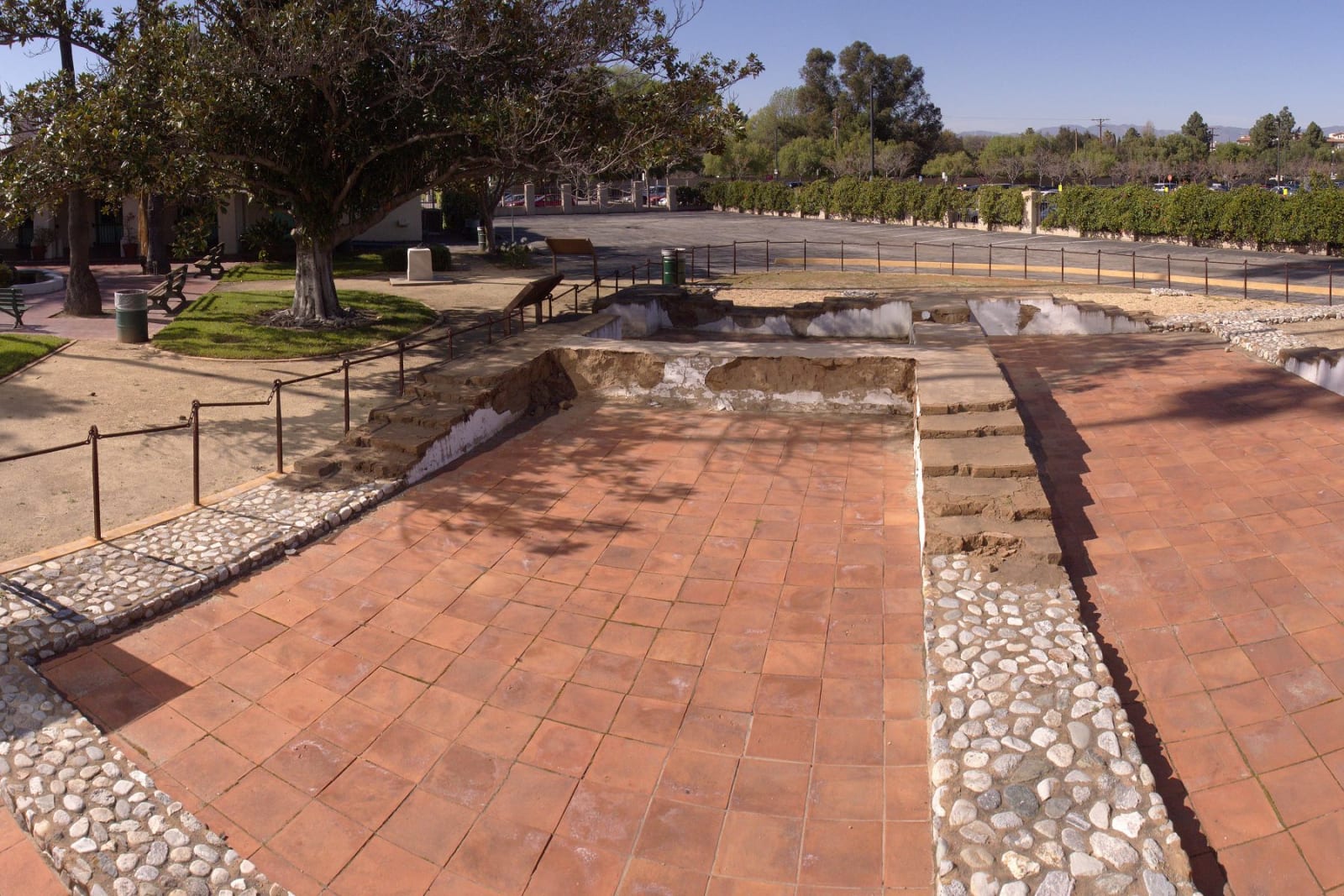
Terracotta paving and cobblestone bands at Campo de Cahuenga tracing the footprint of the original adobe, which runs on beneath Lankershim Boulevard.Junkyardsparkle / CC0 via Wikimedia Commons
🏛️Historical

Campo de Cahuenga

Part ofSan Fernando & Santa Clarita Valleys

The treaty that ended the fighting in California was signed on this ground, and the building it was signed in is now under the boulevard.

Duration
Twenty minutes for the grounds and the paving; longer if the building happens to be open.
📅
Best Season
Year round.

The Story

The building here is a replica, dedicated in 1950 and now understood to be a loose approximation of what actually stood on this ground. The real Campo de Cahuenga is underneath the street. The original adobe was gone by 1900 — Frémont came looking in the 1880s and found nothing left of it — and it stayed lost until 1995, when crews trenching for the Metro subway station struck cobblestone and floor tile a few inches down. Excavations through the early 2000s traced a stone foundation ninety-nine feet by thirty, lying crosswise to the replica and running out beneath Lankershim Boulevard. Tongva pottery came up with it, along with mission-era tile and animal bone. The foundations were reburied to protect them.

What you can see is the outline. The footprint is set into the sidewalk in decorative paving and carried on into the roadway, and it stops partway across Lankershim at the limit of what the subway dig was permitted to reach. The rest is under the traffic. Andrés Pico and John C. Frémont signed terms here on January 13, 1847 that ended the fighting in California; the war itself had thirteen months left to run and finished with the Treaty of Guadalupe Hidalgo in February 1848. A fountain on the grounds honors Bernarda Ruiz. The park sits across from Universal City, wedged between the Metro station and its parking, and the interpretive building keeps short and irregular hours — the paving is there whenever you are, the inside is not.

Visitor Info

Time Needed
Twenty minutes for the grounds and the paving; longer if the building happens to be open.
📅
Best Season
Year round.
🛣️
Highway
Lankershim Blvd. at US-101, opposite Universal City

On the Map

Nearby

The closest stops worth working into your route

historical7.9 mi away
Los Encinos State Historic Park
A spring that never stopped running, the village it fed for thousands of years, and the rancho that took the ground away.
historical11 mi away
Mission San Fernando Rey de España
The seventeenth Alta California mission, founded at the Tataviam village of Achoicominga, with the largest adobe building in the state standing beside it.
architectural11 mi away
Colorado Street Bridge
Beaux-Arts concrete arches curving 150 feet above the Arroyo Seco, opened in 1913 and later a link in Route 66.
attraction12 mi away
Santa Monica Pier
Where the Mother Road runs out of continent, and where the End of the Trail sign gives the drive somewhere to finish.
industrial15 mi away
The Cascades
The concrete chute where the Los Angeles Aqueduct arrives, and where forty thousand people watched the Owens Valley come south in 1913.
historical15 mi away
Mission San Gabriel Arcangel
The fourth Alta California mission, built on Tongva land with Tongva labor, rebuilt after arson and now telling that story straight.

Historical markers nearby

Roadside plaques and monuments within a short detour

Marker0 mi away
Campo de Cahuenga
North Hollywood
Marker2.6 mi away
Cecil B. DeMille Studio Barn
Hollywood
Marker2.7 mi away
Freeman House
Los Angeles
Marker4.3 mi away
Ennis House
Los Angeles
Marker5.1 mi away
Harold Lloyd Estate (Greenacres)
Beverly Hills
Marker5.3 mi away
Hancock Park-La Brea
Los Angeles