Home / California / Route 66 West: Cajon to the Sea / Chavez Ravine
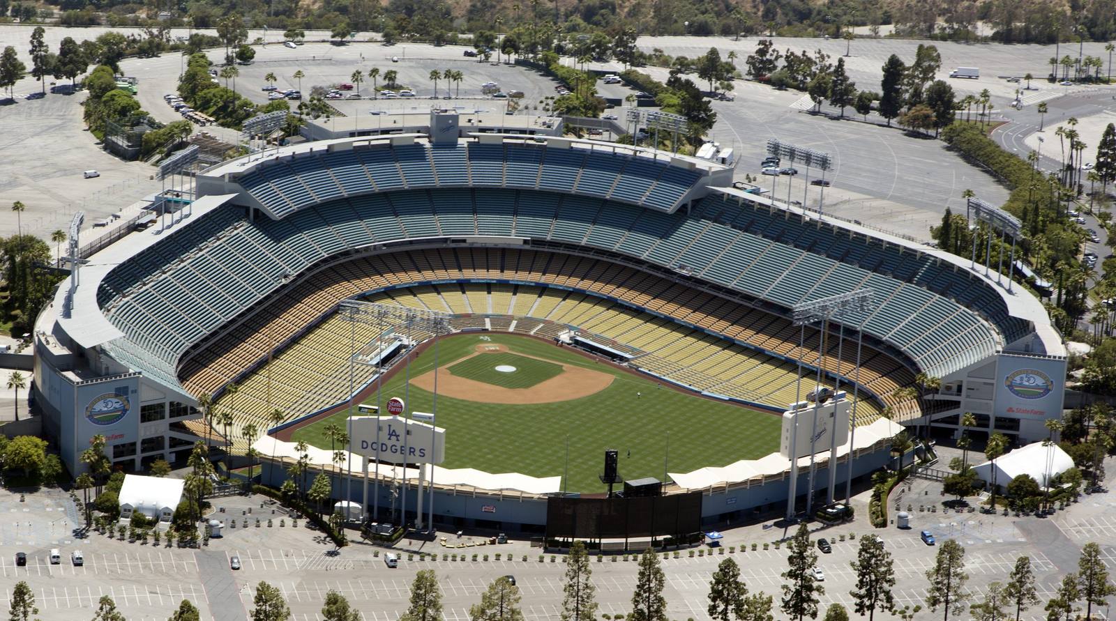
Aerial view of Dodger Stadium ringed by its parking lots in Chavez Ravine, on the ground where Palo Verde, La Loma and Bishop once stoodCarol M. Highsmith / public domain via Wikimedia Commons
🏛️Historical

Chavez Ravine

Part ofRoute 66 West: Cajon to the Sea

Three Mexican American neighborhoods cleared for public housing that was never built, then traded to a ballclub.

⏱
Duration
Half an hour on the Elysian Park roads above the stadium; a game or a tour takes an evening.
🎟
Admission
The stadium grounds open for games, events and paid tours; the roads of Elysian Park around them are free.
📅
Best Season
Year round.

The Story

Palo Verde, La Loma and Bishop sat on the ridges and in the hollows here: three mostly Mexican American neighborhoods of small houses and gardens, with a church, a grocery and an elementary school, settled by families that redlining kept out of most of the city. On July 24, 1950 every household got a letter from the city housing authority. A public housing development would be built on the site, the house they lived in was included, and they would have the first chance to move back. Richard Neutra and Robert Alexander drew Elysian Park Heights, two dozen thirteen-storey towers and 163 low-rises, and the authority bought and condemned the ravine house by house.

The housing died in a courtroom and a campaign. In August 1952 Frank Wilkinson, the authority's champion of the project, was on the stand in a Chavez Ravine condemnation case when a landlords' lawyer, working from a dossier supplied by the police chief, demanded every organization he had ever joined. He refused, and was fired. Norris Poulson won the mayoralty in 1953 running against public housing, and the project was cancelled. The city took over the cleared land on condition it serve a public purpose, and in October 1957 the council traded 315 acres of it to the Brooklyn Dodgers for Wrigley Field. Voters confirmed the deal on June 3, 1958, by 25,785 votes.

A few families never left. On May 8, 1959 sheriff's deputies carried Aurora Vargas out of her parents' house in front of news cameras while her mother, Avrana Arechiga, threw stones, and a bulldozer flattened the house behind them. Dodger Stadium opened on April 10, 1962. The neighborhoods lie under its parking lots and its outfield. Route 66 ran through the Figueroa Street Tunnels, cut through these same hills, until 1964.

Visitor Info

⏱
Time Needed
Half an hour on the Elysian Park roads above the stadium; a game or a tour takes an evening.
🎟
Admission
The stadium grounds open for games, events and paid tours; the roads of Elysian Park around them are free.
📅
Best Season
Year round.
🛣️
Highway
Stadium Way, off SR 110 (Arroyo Seco Parkway) and I-5

On the Map

Nearby

The closest stops worth working into your route

architectural6.6 mi away
Colorado Street Bridge
Beaux-Arts concrete arches curving 150 feet above the Arroyo Seco, opened in 1913 and later a link in Route 66.
historical7.8 mi away
Mission San Gabriel Arcangel
The fourth Alta California mission, built on Tongva land with Tongva labor, rebuilt after arson and now telling that story straight.
historical8.3 mi away
Campo de Cahuenga
The treaty that ended the fighting in California was signed on this ground, and the building it was signed in is now under the boulevard.
historical14 mi away
Domínguez Rancho Adobe
The first Spanish land grant in California contained the whole harbor, and in 1846 fifty Californio lancers turned back three hundred Marines on it.
attraction15 mi away
Santa Monica Pier
Where the Mother Road runs out of continent, and where the End of the Trail sign gives the drive somewhere to finish.
historical16 mi away
Bruce's Beach
Willa and Charles Bruce ran a seaside resort here for Black families until the city took the land in 1924. It came back in 2022.

Historical markers nearby

Roadside plaques and monuments within a short detour

Marker0.3 mi away
First Jewish Site in Los Angeles
Los Angeles
Marker0.4 mi away
Navy and Marine Corps Reserve Center
Los Angeles
Marker0.7 mi away
Portolá Trail Campsite (1)
Los Angeles
Marker1.2 mi away
Avila Adobe
Los Angeles
Marker1.2 mi away
Nuestra Señora la Reina de los Ángeles
Los Angeles
Marker1.2 mi away
Los Angeles Plaza
Los Angeles