Home / California / Eastern Sierra & Owens Valley / Owens Lake
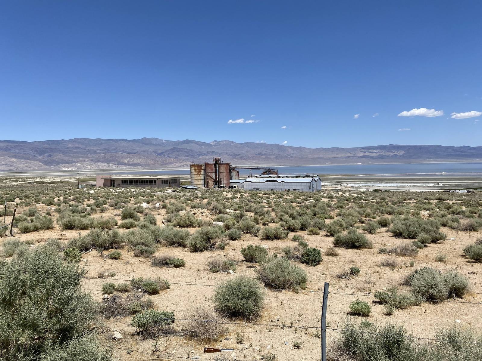
Owens LakeJengod / CC BY-SA 4.0 via Wikimedia Commons
🌲Natural

Owens Lake

Part ofEastern Sierra & Owens Valley
On this driveU.S. 395: The Eastern Sierra

Patsiata, the lake Los Angeles drank, and the most expensive dust in America.

Duration
Thirty minutes at a pullout, half a day for the birding trails.
🎟
Admission
Free; viewing areas and trails are open to the public.
📅
Best Season
October through May; birding peaks in spring migration.
💡
Fun Fact
The dust control program on the lakebed is the largest of its kind in the United States, and shallow flooding it has accidentally created some of the best shorebird habitat in eastern California.

The Story

Patsiata was a lake. It held water for most of the last twelve thousand years, ran roughly sixty miles of the valley at its Ice Age peak, and was still deep enough in the 1870s to carry steamboats hauling silver bullion across to the railhead. The Nüümü and the Newe had farmed the valley around it for centuries with irrigation ditches cut off the Owens River. Then Los Angeles opened its aqueduct in 1913, took the river, and within about a decade the lake was gone.

What replaced it was the largest single source of airborne dust in the United States. Wind coming off a dry alkali playa lifts fine particles laced with arsenic and cadmium; the valley recorded the worst PM10 readings in the country, and the people living downwind breathed it for decades before the air district forced the city to act. The remedy has cost Los Angeles more than 2.5 billion dollars across some forty-eight square miles of lakebed, most of it shallow flooding, using tens of thousands of acre-feet of water a year to hold dust down on a lakebed that water once covered for free.

The unintended result is worth the stop. Those shallow ponds have become serious bird habitat, and the Owens Lake Bird Festival now counts species on ground the city drained. Pull off US-395 south of Lone Pine and look east; the white is salt, the shimmer is the compromise.

Visitor Info

Time Needed
Thirty minutes at a pullout, half a day for the birding trails.
🎟
Admission
Free; viewing areas and trails are open to the public.
📅
Best Season
October through May; birding peaks in spring migration.
🛣️
Highway
US-395

On the Map

Stories

A story featuring this place

Go deeper into the history and character of this stop

Geology
The Crater You Drive Across
JoAnn · 6 min read

Nearby

The closest stops worth working into your route

geological15 mi away
Alabama Hills
Rounded golden granite under the Sierra wall, and Hollywoods oldest outdoor set.
geological23 mi away
Racetrack Playa
A dead-flat lakebed where rocks leave trails behind them, twenty-seven miles down a tire-shredding road.
historical25 mi away
Manzanar National Historic Site
A concentration camp on twice-taken ground, where the United States imprisoned more than eleven thousand of its own.
natural25 mi away
Mount Whitney
At 14,505 feet, the highest summit in the contiguous United States, eighty miles from the lowest point.
natural43 mi away
Mesquite Flat Sand Dunes
Fourteen square miles of dunes near Stovepipe Wells, and the easiest sand in the park to reach.
geological45 mi away
Ubehebe Crater
A half-mile-wide steam-blast crater at the north end of the valley, and one of the youngest volcanoes in the park.