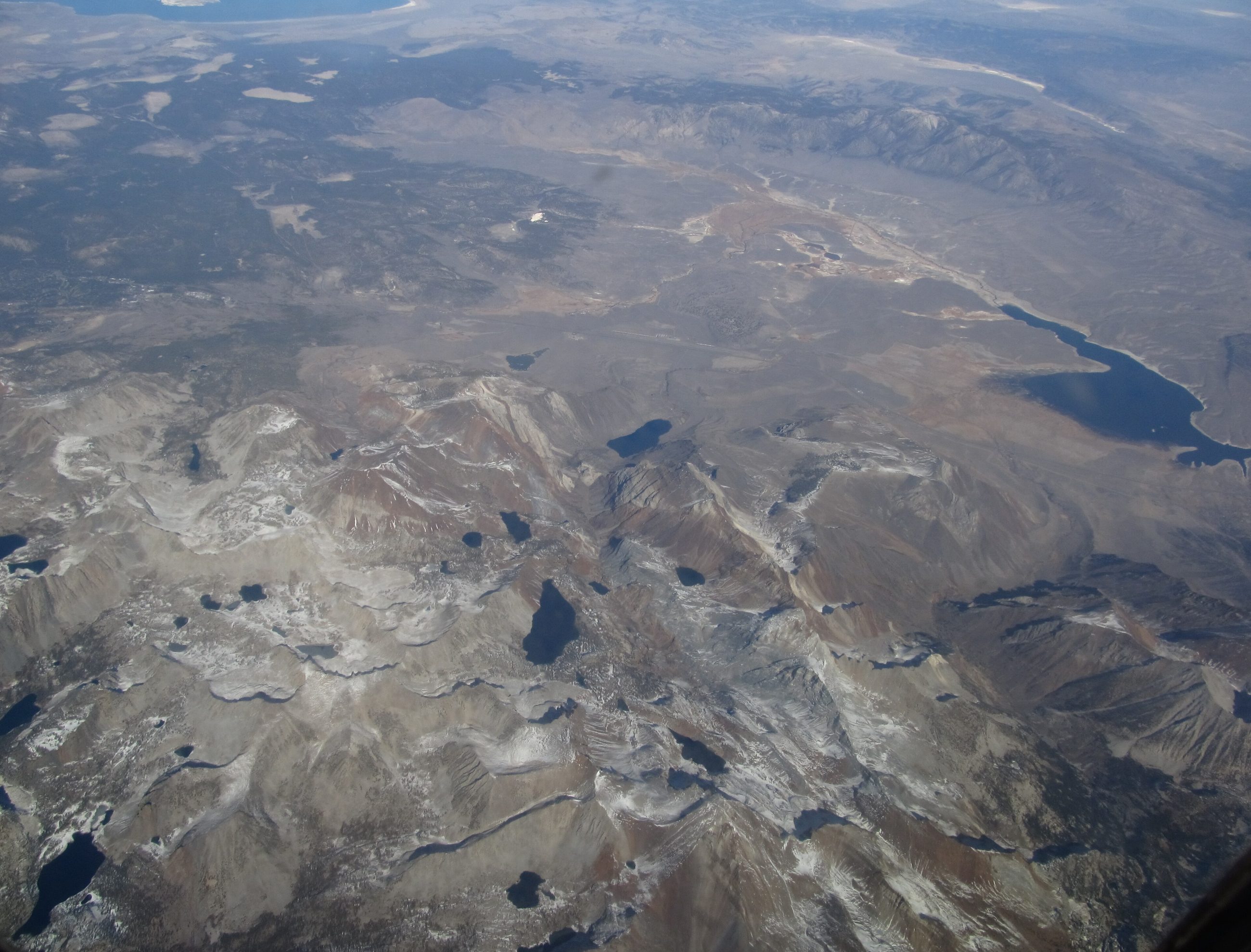
There is a stretch of U.S. 395 north of Bishop where the road climbs out of the Owens Valley, tops a rise, and runs out across a broad, oddly flat basin ringed by hills. Most people read it as a pretty high valley and keep driving toward Mammoth. It is not a valley. It is a hole, twenty miles long and ten across, left where the ground collapsed into the space a magma chamber had just vacated.
Long Valley Caldera is one of the largest volcanic craters on the continent, and the road spends about twenty minutes crossing the middle of it.
The six days that made the view
About 760,000 years ago, the magma chamber under this ground emptied itself in a cataclysmic eruption — on the order of six hundred cubic kilometers of rhyolite, roughly a hundred and fifty cubic miles, thrown out in a matter of days. Ash from it has been identified as far east as Nebraska. As the chamber drained, its roof failed and dropped a mile or two, leaving the oval depression the highway now crosses: about seventeen by thirty-two kilometers, ten miles by twenty.
The material that came out settled into a thick sheet of welded volcanic rock geologists call the Bishop Tuff, named for the town down the road. You drive through it in the gorge below Crowley Lake and see it in roadcuts as a pale, pinkish, gritty stone full of collapsed pumice. An entire regional landscape is made of one afternoon's worth of ejecta.
Afterward the caldera floor bulged back upward into what is called a resurgent dome, and the whole basin filled with a lake deep enough to leave shorelines cut into the walls. That lake eventually found an outlet and drained east through the Owens River Gorge — which is to say the river that Los Angeles would later take, and the dry bed of Owens Lake, owe their plumbing to a volcano.
It never actually went out
Eruptions continued inside and around the caldera for a very long time: rhyolite in the moat, then a chain of younger vents running north from Mammoth Mountain toward Mono Lake. The most recent eruptions in the immediate area were something like sixteen to seventeen thousand years ago, and the Mono-Inyo chain has been active far more recently than that. The basalt columns at Devils Postpile and the craters near Mono Lake are the same story continuing in smaller installments.
The system is still hot. Hot springs and fumaroles run all over the caldera, and a geothermal plant inside it generates power from the heat left in the rock. The USGS rates Long Valley's threat potential as very high — a ranking that reflects not just the volcano but how many people now live and ski on it.
1980, and the letter nobody wanted
On May 25 through 27 of 1980, four magnitude-6 earthquakes hit the caldera in three days. When surveyors went out afterward, they found that the middle of the caldera had risen about a foot. Magma was moving somewhere below.
On May 25, 1982, the USGS issued a formal notice of potential volcanic hazard for the Long Valley area. It was a scientific document doing exactly what such documents exist to do.
It landed on a resort town in the middle of a boom. Mammoth Lakes residents and business owners were furious — many blamed the notice for scaring off buyers and visitors, and the relationship between the town and the scientists took years to repair. There is a genuine lesson buried in that fight, and it is not that the warning was wrong. It is that "this volcano is restless" and "you should leave" are different sentences, and in 1982 nobody had worked out how to say the first without the public hearing the second. Volcano hazard communication in the United States is noticeably more careful since.
The unrest never stopped, exactly. Swarms of earthquakes come and go, the dome swells and settles, and in the 1990s carbon dioxide seeping up through the soil on Mammoth Mountain killed roughly a hundred acres of trees — a stand of dead pines that is, in effect, the volcano exhaling.
How to look at it from the car
None of this makes the drive dangerous. The caldera has been monitored continuously for more than forty years, more closely than almost any volcano on earth, and the current reading is a system that is restless rather than loading.
What it changes is what you are looking at. U.S. 395 through the Eastern Sierra is usually described in terms of the wall on your left — the granite, the peaks, the snow. But for twenty miles of it the more remarkable feature is the ground under the tires: a flat floor that is flat because it fell, ringed by a rim that is a rim because it stayed, hot springs steaming in the sagebrush, and the pale tuff in the roadcuts that is the ash of the event itself, welded solid.
The Sierra took millions of years to rise. This basin was made in under a week, and the thing that made it is still down there, still warm, still being watched. Pull over somewhere on the flat and look at the hills all the way around you, and let the shape of the horizon tell you what it actually is.