The Story
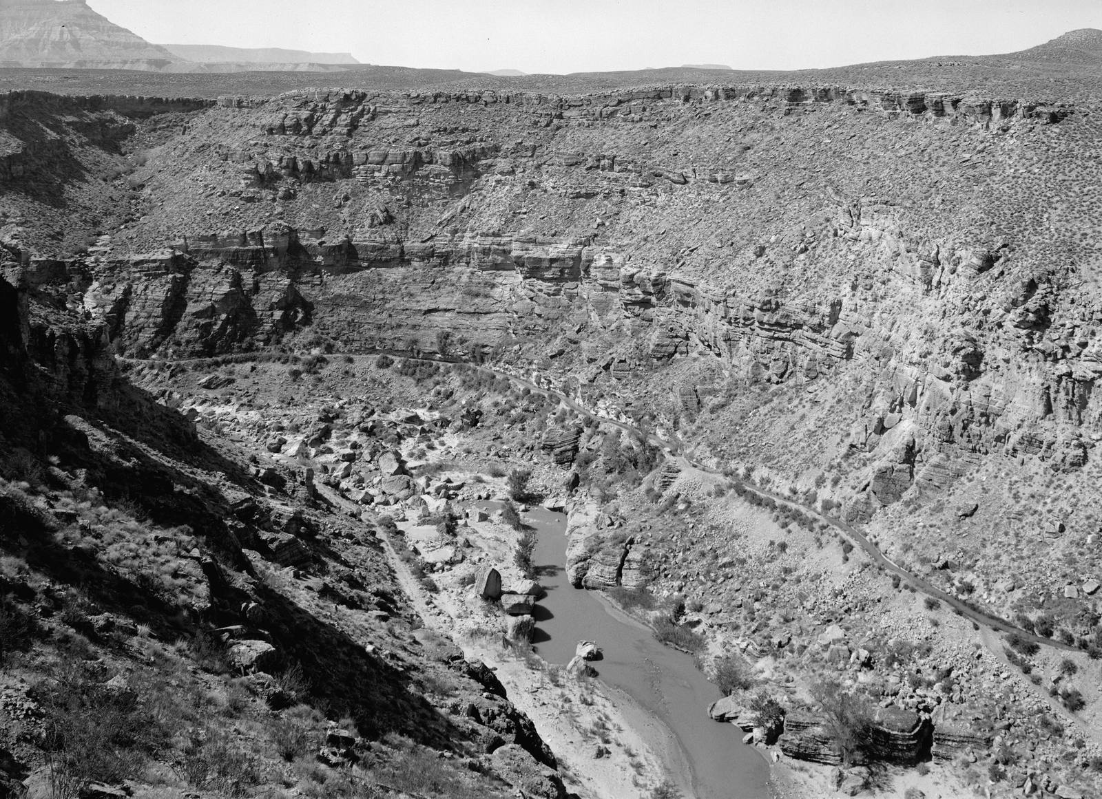
Hurricane exists because of a ditch, and the ditch is still there — clinging to the wall of the Virgin River gorge above town, dry since 1985, walkable today. In the fall of 1893, James Jepson and John Steele organized a canal company to carry the river onto the empty Hurricane Bench, and for eleven winters men worked the cliff face with picks, shovels, dynamite, and homemade wheelbarrows — November through May, when their farms could spare them — paid in company shares and the promise of twenty acres on a bench that did not yet have water. They blasted a twelve-foot shelf into the canyon wall and cut seven and a half miles of channel, eight feet wide and four feet deep, driving twelve tunnels through solid rock and hanging six wooden flumes across the gaps the rock would not hold. The first two diversion dams washed out; the third, reinforced with concrete, held. When the company went broke partway through, the LDS church put five thousand dollars into it. Water reached the bench on August 6, 1904. The first family did not arrive until 1906 — the town came two years after its water, which is the whole story of Hurricane in one sentence.
The canal watered two thousand acres of orchards and fields for eighty-one years, earned a place on the National Register of Historic Places in 1977 while it was still carrying water, and finally retired in 1985 when the Quail Creek pipeline arrived. What remains is one of the most walkable pieces of pioneer engineering in Utah.
The easiest introduction is the Bowery Trailhead at the east end of 200 North in town, where a stone monument and a pavilion of interpretive panels sit beside the canal itself — you can stand in the channel the men cut. Be honest with your expectations here: parking is a roadside spot or two, the in-town stretch threads between backyards, and the first tunnel is fenced off. It is a half-hour history stop, not a hike. The hike — the blasted shelf high above the river, the tunnels you walk through with a flashlight, the flume crossings — belongs to the BLM Canal Trail reached from the Hurricane Hill and Virgin Dam trailheads off SR-59: roughly three miles of narrow, exposed, hiking-only singletrack rated difficult for its drop-offs, with no shade anywhere on the Hurricane Cliffs, so skip it in summer. Round out the story at the Hurricane Valley Heritage Park museum at Main and State streets downtown.
Highway 9 traffic streams through Hurricane bound for Zion National Park without ever looking up at the gorge wall, but the canal is the reason there is a town here to drive through at all. And if you want the other half of the Virgin River's lesson, drive twenty minutes upstream to Grafton Ghost Town, where the same river Hurricane finally harnessed kept flooding a settlement out of existence.
Visitor Info
On the Map
A story featuring this place
Go deeper into the history and character of this stop
Nearby
The closest stops worth working into your route
Historical markers nearby
Roadside plaques and monuments within a short detour