The Story
For a hike that runs barely a mile round trip, the Canyon Overlook Trail packs in an unreasonable amount. It begins right at the east mouth of the Zion–Mount Carmel Tunnel, on the north side of the highway, and climbs a couple hundred feet up a rough bench of slickrock, sandstone steps, and ledges — past a planked walkway bolted to the rock and a damp, fern-hung alcove — before the ground simply ends at a railed cliff edge a thousand feet above the floor of lower Zion Canyon.
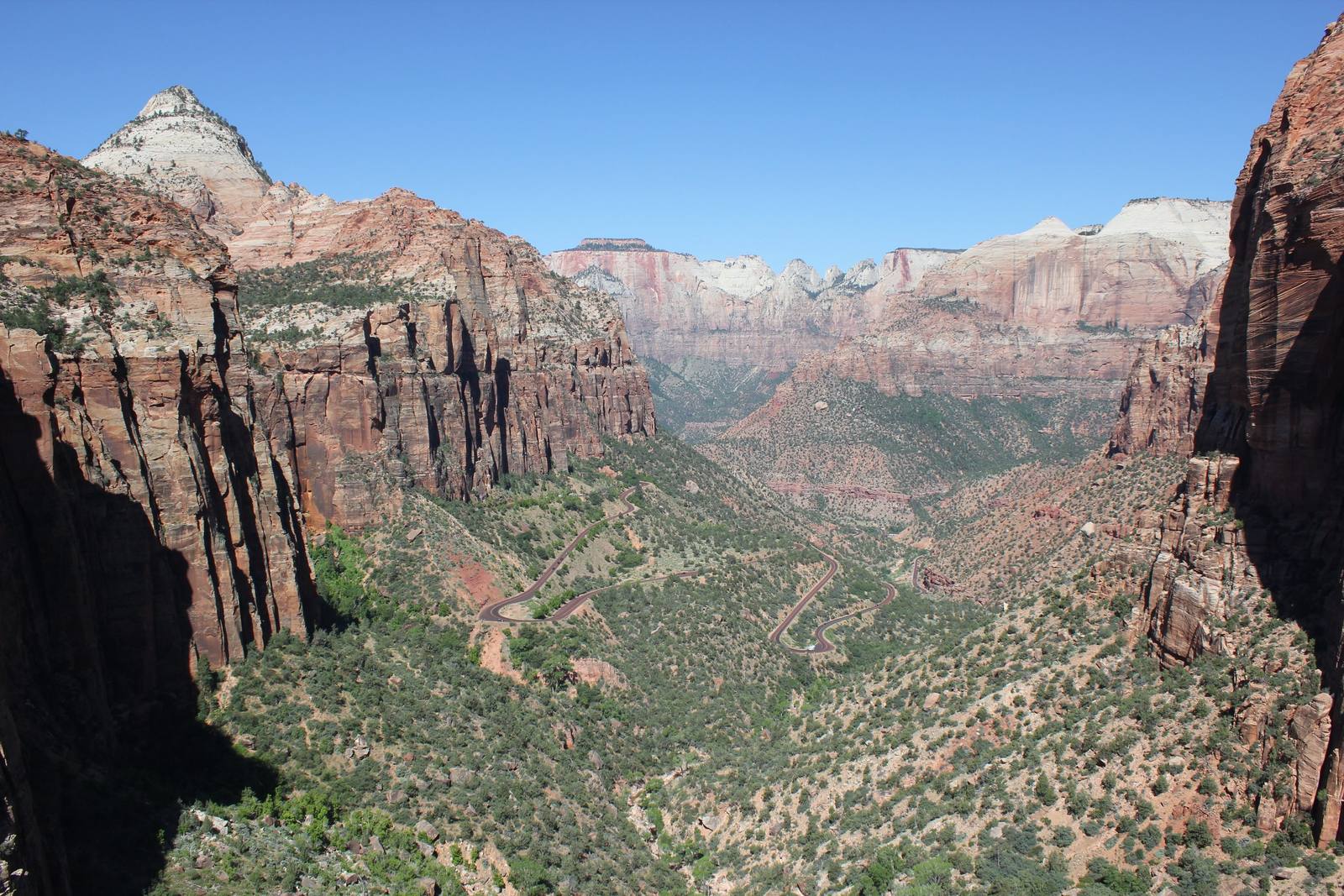
The view is the reason the trail exists. From the fenced rim you look west and down into Pine Creek Canyon and out across the mouth of Zion Canyon, with the big formations laid out in a row: the Towers of the Virgin, the West Temple, the Streaked Wall, the Beehives. East Temple rises more than two thousand feet directly above you, and the Great Arch — a blind arch recessed into the cliff — sits in the wall below. Look carefully and you can pick out the highway switchbacking up from the canyon floor and one of the tunnel's windows opening in the rock, which makes the overlook the best place anywhere to understand how Highway 9 actually threads through the cliffs.
It is short, but it is not a stroll. The trail has real drop-offs, some unfenced until the end, and the rock turns slick when wet and icy in winter, so it is hands-on-the-children territory in places. Everything here is Navajo sandstone — petrified Jurassic dunes, the same rock that builds the walls of Zion National Park itself — and the bench is dotted with piñon, juniper, and manzanita, with a fair chance of bighorn sheep on the slopes. The real obstacle is parking: the two small lots just east of the tunnel fill early and the Zion shuttle does not come here, so you have to drive in yourself and may have to circle back more than once to find a spot.
Visitor Info
On the Map
Nearby
The closest stops worth working into your route
Historical markers nearby
Roadside plaques and monuments within a short detour