 Ken Lund / CC BY-SA 2.0
The Story
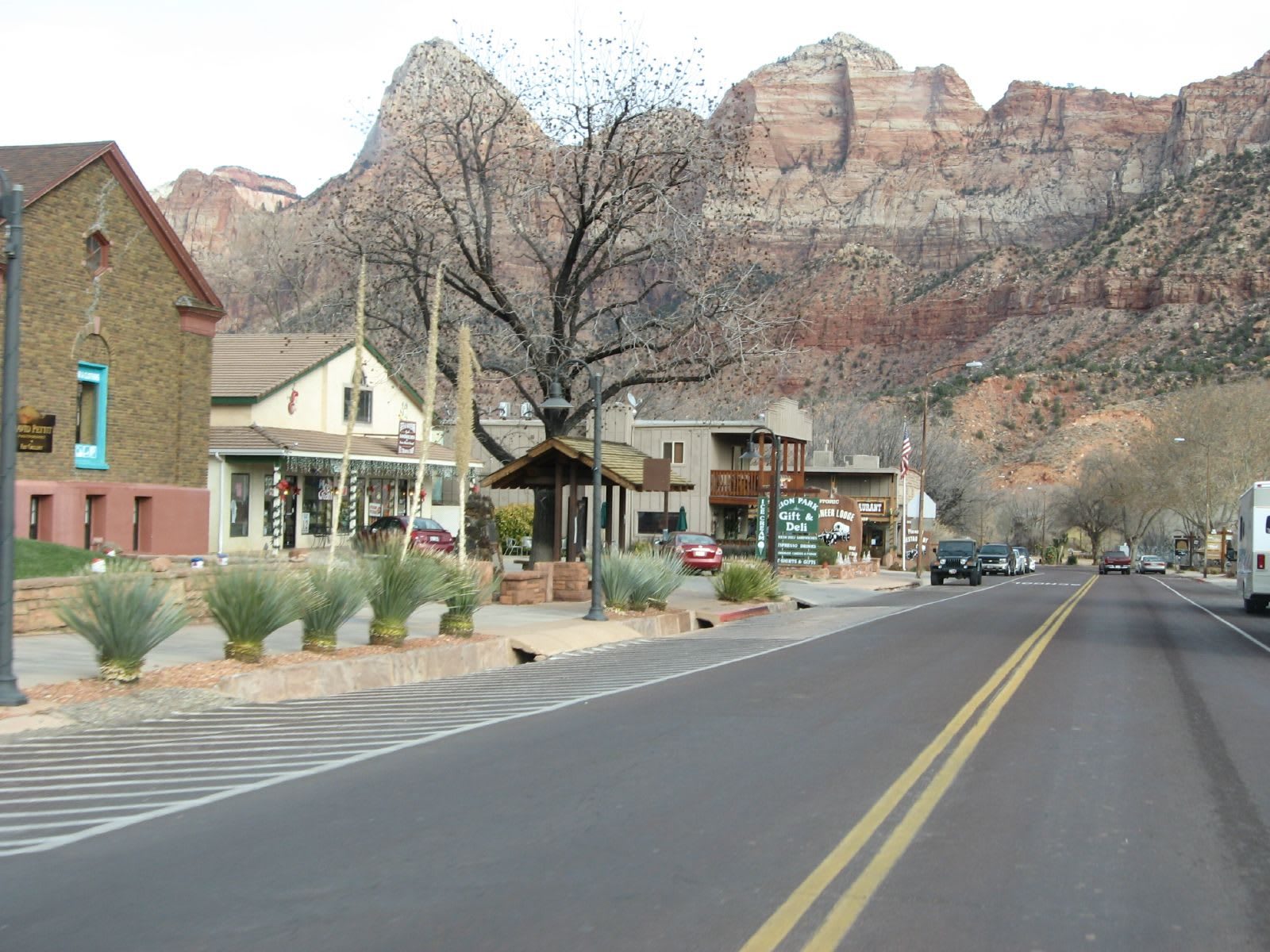
Springdale exists in the space between a river and a wall. The town runs for about a mile along the North Fork of the Virgin River at the mouth of Zion Canyon, pinned between the pointed bulk of the Watchman and Mount Kinesava, and almost everything about it — where the buildings sit, where the light falls, what people come for — is dictated by the cliffs rising straight up at the end of the street. It is the south doorstep of Zion National Park, and on most mornings the majority of people in town are about to walk through that gate.
It started as farmland. In the fall of 1862, Mormon pioneers sent south as part of Brigham Young's Cotton Mission settled the canyon mouth, dug irrigation ditches off the Virgin River, and named the place Springdale for its clear springs; for its first half-century it was a quiet agricultural settlement, a satellite of nearby Rockville, with log-and-willow houses and a few hundred people. What changed everything was the road and the park. Automobiles reached town around 1912, the first tourist camps went up by 1917, and when Zion became a national park in 1919 the transformation was fast and permanent — within a generation a cotton-mission farm town had become a hospitality strip.
That is essentially what it still is, in the best sense. A town of barely five hundred residents now absorbs several million Zion visitors a year, and it has organized itself almost entirely around being the staging ground: lodges and inns line the highway, restaurants and outfitters cluster near the entrance, and a row of galleries selling Zion landscape photography and work by regional artists gives the place more of an arts-town texture than you would expect from a settlement this small. During the busy season, when private cars are barred from the Zion Canyon Scenic Drive, Springdale becomes the place you actually start your day: a town shuttle runs its length and feeds into the park's free shuttle at the entrance, so the smart move is to leave the car at your lodging and ride in.
It is also worth slowing down for after dark. In 2023 Springdale was certified an International Dark Sky Community, the result of years of lighting rules meant to keep the glow of a tourist town from washing out the sky — so on a clear night, with the Watchman black against the stars, the same canyon that draws crowds by day empties into something close to silence. For a road tripper, Springdale is the obvious base for the western end of Highway 9: a place to sleep, eat, and stage the park, three miles up the road from the Grafton ghost town and a mile from the gate.
Visitor Info
On the Map
Nearby
The closest stops worth working into your route
Historical markers nearby
Roadside plaques and monuments within a short detour