Home / New Mexico / Chaco & the Four Corners / El Malpais National Monument
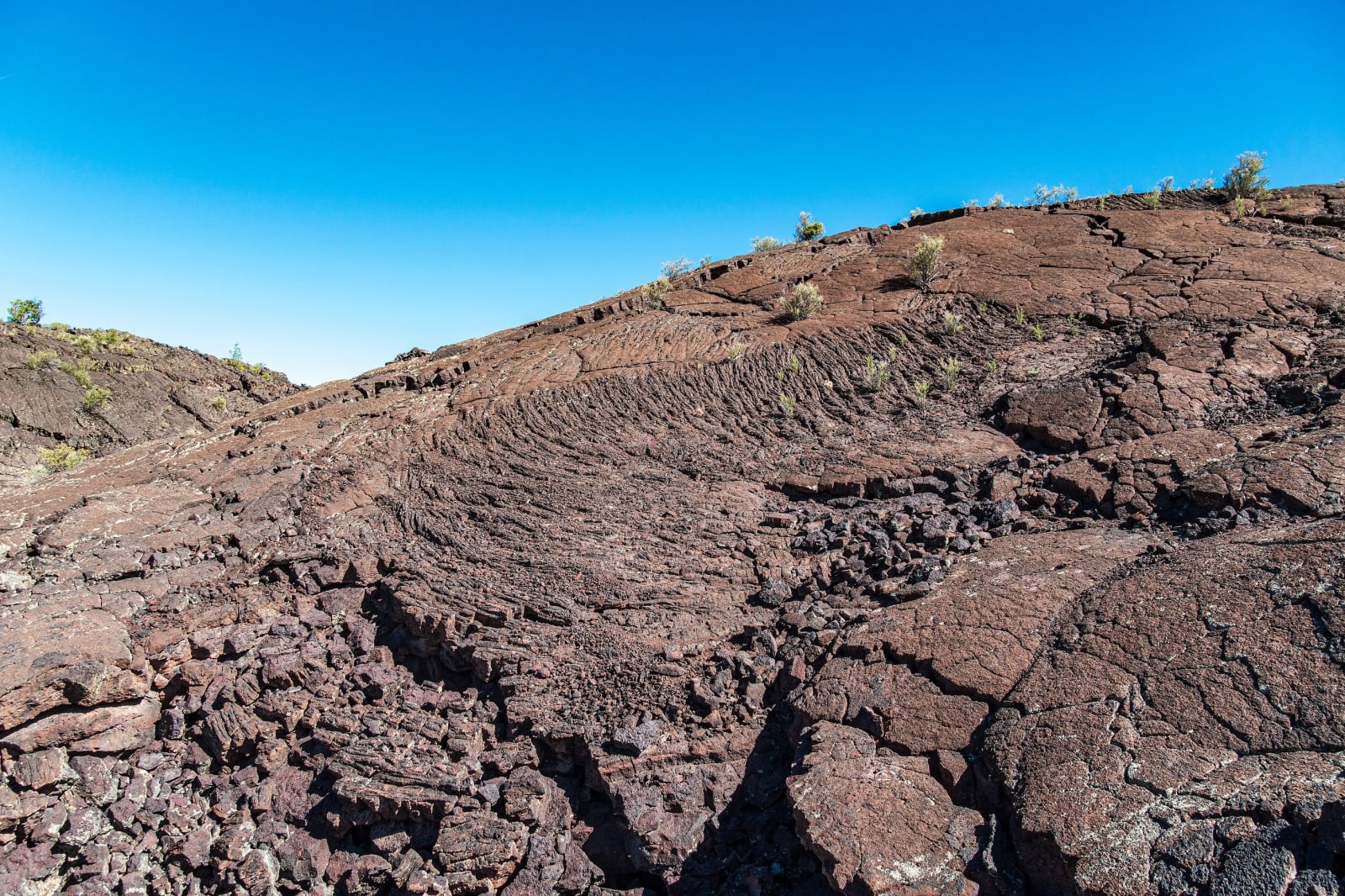
Ropy black lava with scattered shrubs at the Lava Falls area of El Malpaisdconvertini / CC BY-SA 2.0 via Wikimedia Commons
🏜️Geological

El Malpais National Monument

Part ofChaco & the Four Corners
On this driveRoute 66: Albuquerque to Holbrook

The badlands south of Grants: lava 3,900 years old from McCartys Crater, a tube system at least seventeen miles long, and an old trail across four lava flows between Zuni and Acoma.

Off the Beaten PathSpringVolcanicCavesFallFreeHiking
⏱
Duration
Half a day to a day.
🎟
Admission
Free; caves by free permit.
📅
Best Season
Spring and fall; summers are hot on the black rock.

The Story

South of Grants the black edge of a lava field runs for miles beside the highways: El Malpais, the badlands, as Spanish travelers called country that no wagon could cross. Five main flows poured from vents in the Zuni-Bandera volcanic field over the last sixty thousand years. The youngest came out of McCartys Crater about 3,900 years ago and is the youngest lava in New Mexico. Many of its forms carry Hawaiian names, pahoehoe for the smooth ropy kind and aa for the broken clinker.

Two roads frame it. NM-53, on the west, leads to the Big Tubes area, where the Bandera flow of about 10,900 years ago left a lava tube and trench system at least seventeen miles long. A few caves are open to anyone carrying a free permit, a helmet and three lights, and some hold fragile ice. NM-117, on the east, runs between the McCartys flow and pale sandstone bluffs to La Ventana, one of the largest natural arches in New Mexico, on the Bureau of Land Management's conservation area next door.

The Zuni-Acoma Trail, an ancient trade route between the two pueblos, crosses four of the flows on cairn-marked rock and makes plain how hard this ground was to travel. These lands have mattered to Acoma, Laguna, Zuni and the Ramah Navajo for thousands of years. The national monument and the conservation area were both created at the end of 1987.

Visitor Info

⏱
Time Needed
Half a day to a day.
🎟
Admission
Free; caves by free permit.
📅
Best Season
Spring and fall; summers are hot on the black rock.
🛣️
Highway
NM-53

On the Map

Nearby

The closest stops worth working into your route

historical18 mi away
El Morro National Monument
A sandstone headland with a pool at its foot, where Puebloan people, Spanish governors and American soldiers all left their marks, until carving became illegal in 1906.
cultural27 mi away
Acoma Sky City
Haak'u, the village on a sandstone mesa west of Albuquerque, seen only on the pueblo's own tours, with a mission whose roof beams were carried on foot from Mount Taylor.
attraction67 mi away
Very Large Array
Twenty-seven radio dishes, each 82 feet across and 230 tons, spread in a Y across an Ice Age lakebed on the Plains of San Agustin and moved on rails to change how sharply they see.
historical72 mi away
Chaco Culture National Historical Park
The great houses of Chaco Canyon at the end of thirteen miles of washboard dirt, an International Dark Sky Park in the middle of one of the country's busiest gas fields.
cultural74 mi away
Petroglyph National Monument
Some 24,000 images pecked into the dark basalt of Albuquerque's West Mesa, protected in 1990 and then crossed by a city boulevard.
cultural74 mi away
Window Rock
Tségháhoodzání — the sacred arch, and the capital of the Diné