Home / New Mexico / Chaco & the Four Corners / Chaco Culture National Historical Park
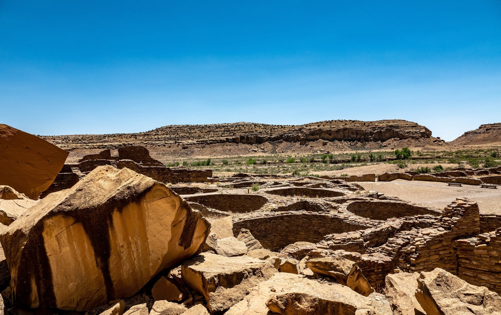
The walled rooms of Pueblo Bonito seen from above, a fallen sandstone block in the foreground and the canyon rim beyondBrendakochevar / CC BY-SA 4.0 via Wikimedia Commons
🏛️Historical

Chaco Culture National Historical Park

Part ofChaco & the Four Corners

The great houses of Chaco Canyon at the end of thirteen miles of washboard dirt, an International Dark Sky Park in the middle of one of the country's busiest gas fields.

Off the Beaten PathStargazingIconicDark SkyNative American HeritageSpringPaid EntryFallHiking
⏱
Duration
A full day; longer with the campground and night sky.
🎟
Admission
Entrance fee, or a national parks pass.
📅
Best Season
Spring and fall; check the dirt road after rain or snow.

The Story

Chaco takes some reaching. The usual way in leaves US-550 near Nageezi, and after eight miles of pavement the last thirteen, on County Road 7950, are dirt and washboard that can turn impassable when the washes run. There is no lodging, food or fuel at the end, only the visitor center and the Gallo campground.

A paved loop runs up the canyon past the great houses. Pueblo Bonito, the largest, was raised in stages over some three centuries into a D-shaped block at least four stories high with more than six hundred rooms and dozens of kivas; rangers lead walks through it year-round. Chetro Ketl and Pueblo del Arroyo stand nearby. Trails climb the cliffs behind them to Pueblo Alto and to overlooks where a Chacoan road and the steps its builders cut into the rock can still be traced.

The isolation is part of what the park now protects. It was certified an International Dark Sky Park in 2013, and its night programs draw astronomers from far away. Yet it sits in the San Juan Basin, one of the most heavily drilled gas fields in the country. In June 2023 the Interior Department withdrew federal lands within ten miles of the park from new oil and gas leasing for twenty years, a buffer the Pueblo nations had sought for years and the Navajo Nation helped shape; some Diné landowners who hold allotments and mineral rights inside it protested, and the buffer has been argued over since.

Chaco has been a World Heritage Site since 1987, together with Aztec Ruins and several outlying great houses. Check road conditions before setting out.

Visitor Info

⏱
Time Needed
A full day; longer with the campground and night sky.
🎟
Admission
Entrance fee, or a national parks pass.
📅
Best Season
Spring and fall; check the dirt road after rain or snow.
🛣️
Highway
US-550

On the Map

Nearby

The closest stops worth working into your route

historical56 mi away
Aztec Ruins National Monument
A Chacoan great house on the Animas River, misnamed by settlers who thought the Aztecs built it, with original roofs nine centuries old and a great kiva rebuilt whole.
cultural69 mi away
Window Rock
Tségháhoodzání — the sacred arch, and the capital of the Diné
historical71 mi away
Jemez Historic Site
The stone walls of a 1620s mission church standing among the ruins of Gisewa, a Jemez village named for the hot springs beside it.
geological72 mi away
El Malpais National Monument
The badlands south of Grants: lava 3,900 years old from McCartys Crater, a tube system at least seventeen miles long, and an old trail across four lava flows between Zuni and Acoma.
historical73 mi away
El Morro National Monument
A sandstone headland with a pool at its foot, where Puebloan people, Spanish governors and American soldiers all left their marks, until carving became illegal in 1906.
cultural78 mi away
Southern Ute Cultural Center and Museum
A small tribal museum of 1971 rebuilt in 2011 as a $38 million building shaped like an eagle, facing east to the rising sun.