Home / California / Death Valley & the Basin Ranges / Dantes View
Dantes ViewWolfgang Moroder / CC BY-SA 3.0 via Wikimedia Commons
๐ŸŒฒNatural

Dantes View

Part ofDeath Valley & the Basin Ranges
On this driveCalifornia 190: Across Death Valley

A 5,475-foot balcony on the Black Mountains crest with Badwater a vertical mile below.

โฑ
Duration
An hour to ninety minutes including the drive up and a ridge walk.
๐ŸŽŸ
Admission
Park entrance fee (30 dollars per vehicle, valid seven days). The park is cashless.
๐Ÿ“…
Best Season
Year-round; the elevation keeps it tolerable when the valley floor is not.
๐Ÿ’ก
Fun Fact
The final six miles are closed to vehicles twenty-five feet or longer, and the last quarter mile climbs at a fourteen percent grade.

The Story

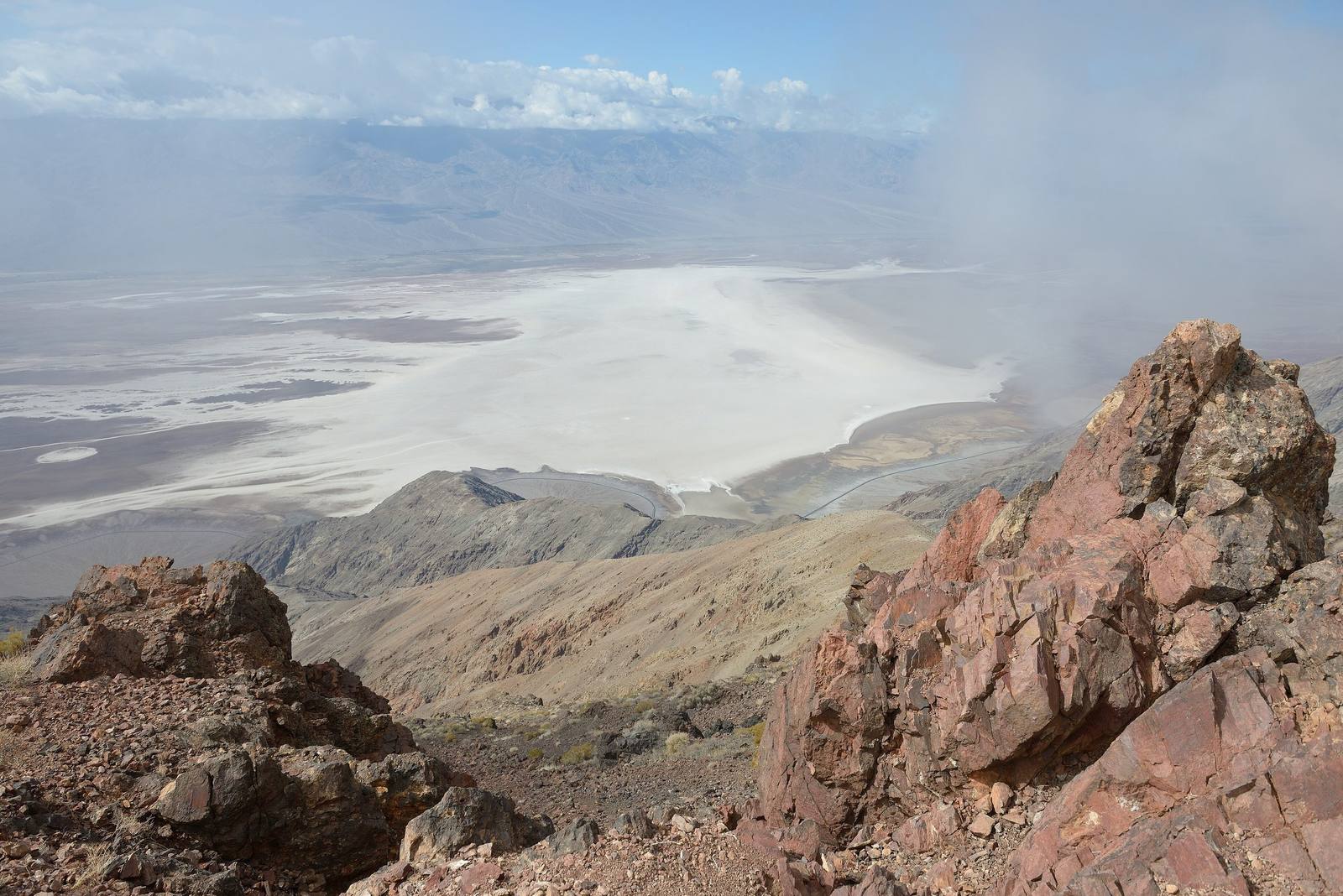
Almost nothing in the park explains itself as quickly as this overlook does. Dantes View sits at 5,475 feet on the crest of the Black Mountains, and the salt of Badwater Basin lies roughly a vertical mile directly below, close enough that the cars parked down there resolve into specks moving on white. Across the valley the Panamints carry Telescope Peak at 11,049 feet. On a clear day the frame holds both the highest and the lowest ground in the contiguous United States at once, Mount Whitney showing faintly over the Panamint crest at 14,505 feet.

The drive in runs thirteen miles south from CA-190 through Greenwater Valley, level at first and then steep, and the last stretch is closed to vehicles longer than twenty-five feet for good reason. There is a turnout partway up where trailers get dropped. Short paths run north and south along the ridge from the parking area and are worth the ten minutes; the one that leads to the brink is the one everyone takes.

Elevation buys comfort here. The overlook runs fifteen to twenty-five degrees cooler than the valley floor, which makes it one of the few places in the park that stays pleasant into the warm months, and the thin dry air and distance from any town make it a serious night-sky vantage after dark. Morning light is the classic choice, with the sun behind you and the whole basin laid out.

Visitor Info

โฑ
Time Needed
An hour to ninety minutes including the drive up and a ridge walk.
๐ŸŽŸ
Admission
Park entrance fee (30 dollars per vehicle, valid seven days). The park is cashless.
๐Ÿ“…
Best Season
Year-round; the elevation keeps it tolerable when the valley floor is not.
๐Ÿ›ฃ๏ธ
Highway
Dantes View Road (off CA-190)

On the Map

Stories

A story featuring this place

Go deeper into the history and character of this stop

Nature
The Fish That Outlived the Lake
JoAnn ยท 7 min read

Nearby

The closest stops worth working into your route

natural2.4 mi away
Badwater Basin
The lowest ground in North America, a salt pan 282 feet below sea level under two miles of mountain.
geological15 mi away
Zabriskie Point
Gullied gold badlands eroded out of an ancient lakebed, best at first light.
cultural17 mi away
Furnace Creek
The valley hub, the hottest air temperature ever officially recorded, and the Timbisha village that was here first.
cultural18 mi away
Amargosa Opera House
A dancer painted her own audience on the walls of a desert hall and performed for them for forty years.
natural34 mi away
Mesquite Flat Sand Dunes
Fourteen square miles of dunes near Stovepipe Wells, and the easiest sand in the park to reach.
historical47 mi away
Rhyolite
The most complete ghost town in Nevada โ€” a stone city with an opera house and a marble-stepped bank that rose and died inside a decade, now the most photographed ruin in the West.