Home / California / Death Valley & the Basin Ranges / Zabriskie Point
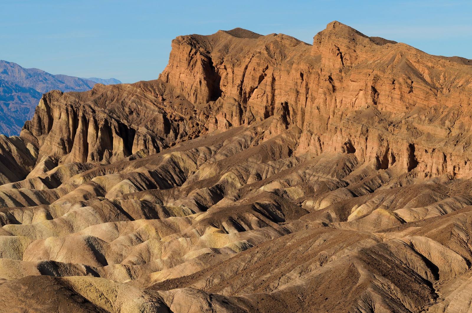
Zabriskie PointKing of Hearts / CC BY-SA 3.0 via Wikimedia Commons
๐Ÿœ๏ธGeological

Zabriskie Point

Part ofDeath Valley & the Basin Ranges
On this driveCalifornia 190: Across Death Valley

Gullied gold badlands eroded out of an ancient lakebed, best at first light.

โฑ
Duration
Thirty minutes for the overlook; longer if you walk down into the badlands.
๐ŸŽŸ
Admission
Park entrance fee (30 dollars per vehicle, valid seven days). The park is cashless.
๐Ÿ“…
Best Season
October through April. Sunrise is the light most people come for.
๐Ÿ’ก
Fun Fact
Michelangelo Antonioni borrowed the name for his 1970 film, which is remembered now mostly for its Pink Floyd soundtrack.

The Story

The hills below the overlook are lakebed. They belong to the Furnace Creek Formation, thousands of feet of mudstone, siltstone, and volcanic ash laid down on the floor of a lake that began forming roughly nine million years ago and dried out around five million years back, long before Death Valley took anything like its present shape. Afterward the valley widened and dropped, the Black Mountains rose and tilted the whole deposit, and water went to work on soft rock with nowhere to soak in. What you see is the result: a gullied, folded, gold and brown badland that changes hour by hour with the light.

Manly Beacon is the high outcrop to the right. It keeps its height because a cap of lava three to five million years old protects the softer rock beneath, and it carries the name of William Lewis Manly, who with John Rogers walked out of this valley in the winter of 1849 and came back for the emigrant party that had sent them.

The overlook itself is named for Christian Brevoort Zabriskie, vice president and general manager of the Pacific Coast Borax Company for thirty-six years. The borates his twenty mule teams hauled out of the valley came from these same lakebeds, which makes the name less decorative than it sounds. The parking lot is three miles southeast of Furnace Creek on CA-190, with a short paved ramp to the rail. Twenty Mule Team Canyon is a mile further on.

Visitor Info

โฑ
Time Needed
Thirty minutes for the overlook; longer if you walk down into the badlands.
๐ŸŽŸ
Admission
Park entrance fee (30 dollars per vehicle, valid seven days). The park is cashless.
๐Ÿ“…
Best Season
October through April. Sunrise is the light most people come for.
๐Ÿ›ฃ๏ธ
Highway
CA-190

On the Map

Stories

A story featuring this place

Go deeper into the history and character of this stop

Nature
The Fish That Outlived the Lake
JoAnn ยท 7 min read

Nearby

The closest stops worth working into your route

cultural3 mi away
Furnace Creek
The valley hub, the hottest air temperature ever officially recorded, and the Timbisha village that was here first.
natural13 mi away
Badwater Basin
The lowest ground in North America, a salt pan 282 feet below sea level under two miles of mountain.
natural15 mi away
Dantes View
A 5,475-foot balcony on the Black Mountains crest with Badwater a vertical mile below.
natural21 mi away
Mesquite Flat Sand Dunes
Fourteen square miles of dunes near Stovepipe Wells, and the easiest sand in the park to reach.
cultural24 mi away
Amargosa Opera House
A dancer painted her own audience on the walls of a desert hall and performed for them for forty years.
historical33 mi away
Rhyolite
The most complete ghost town in Nevada โ€” a stone city with an opera house and a marble-stepped bank that rose and died inside a decade, now the most photographed ruin in the West.