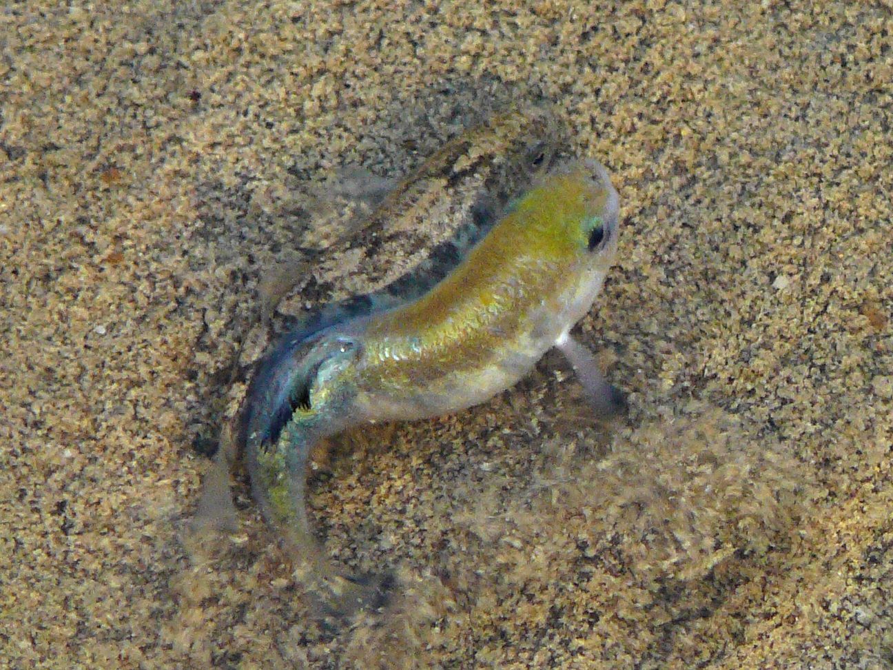
Between Furnace Creek and Stovepipe Wells, a spur off Highway 190 ends at a boardwalk laid over a creek four inches deep. Walk out on it in March and the water will be moving in a way water does not move on its own. The movement is fish — a couple of inches long, the males turned hard metallic blue for the breeding season, chasing each other through a creek saltier than the sea that will climb past a hundred degrees before summer is out.
There are native fish in the hottest, driest place in North America. They have been here longer than the desert has.
The lake that was here
Geologists call it Lake Manly, after William Lewis Manly, who walked out of this valley in 1849 after helping rescue a party of emigrants who had gambled on a shortcut. It had been gone roughly ten thousand years by the time he arrived to have it named for him. At its greatest stand, dated to somewhere around 185,000 to 128,000 years ago, it filled the valley to near six hundred feet deep and ran about ninety miles end to end, fed by the Amargosa River and, at different points in its life, by the Owens and the Mojave.
You can still read its edges from the road. The tufa spires at Trona Pinnacles grew entirely underwater, one basin up the same chain. The cracked clay polygons between the dunes at Mesquite Flat are lakebed, not dried rain. The gold badlands at Zabriskie Point are lake sediment, lifted and gullied. From Dantes View, the white floor a vertical mile below at Badwater Basin is what a lake leaves when it goes: everything the water was carrying, and nothing else.
Where the fish went
When the water withdrew, it did not withdraw evenly. It backed into the springs and seeps that fed it, and the fish went with it, each population into its own pocket, cut off from every other by miles of salt and gravel.
What is left in California is the Death Valley pupfish, Cyprinodon salinus, in two places and nowhere else on earth: Salt Creek, about 161 feet below sea level and roughly a mile of perennial stream, and Cottonball Marsh, lower still at around 260 feet below. Between winter and August the creek swings from near freezing to over a hundred and four degrees. The fish do not migrate away from that. They live in it.
The same springs are why people could live here. The Timbisha Shoshone have occupied this valley continuously, with the village at Furnace Creek at its center, and in 2000 the Homeland Act made Death Valley the only national park in the country with a reservation created inside its boundaries.
The tidy version of the fish story — the lake dried, they were stranded, they drifted apart — is mostly right and not entirely. Mitochondrial DNA work published by Echelle and Dowling in 1992 suggests these lineages had already begun separating before Lake Manly finished drying. The isolation is older and messier than one lake going away, which makes these fish not survivors of a single catastrophe but the end of a long repeated cycle of basins filling and emptying for hundreds of thousands of years.
A shelf of water with a lawyer
The most famous of these fish is not in California. Devils Hole is a detached unit of the park across the line in Nye County, Nevada — a flooded limestone cavern whose pupfish depend on a sunlit shelf near the entrance measuring about eleven feet by sixteen, the smallest known range of any vertebrate on the planet.
In 1952 a presidential proclamation reserved Devils Hole under the Antiquities Act. In 1968 a ranching operation two and a half miles away began pumping groundwater from the same aquifer, and the level in the cavern started dropping toward the shelf. Nevada granted the permits over the Park Service objection. The United States sued.
On June 7, 1976, a unanimous Supreme Court held that reserving Devils Hole had reserved with it the water needed to keep the pool at a level that preserved what the reservation was for. It was the first time the Court applied the doctrine of implied reserved water rights to groundwater, and it is now foundational to Western water law. A shelf of water the size of a small bedroom holds a water right senior to the ranch next door.
What happened last spring
None of this is settled history. In September 2022 a magnitude 7.6 earthquake in Mexico sent four-foot waves through Devils Hole and scoured the algae the fish feed on off the shelf. By late February 2025 the count was about twenty fish, the lowest ever recorded. Biologists then did something they had never done: they moved nineteen captive-bred fish from the replica tank at the Ash Meadows Fish Conservation Facility into the wild population. The spring 2026 count came back at seventy-seven.
Meanwhile the lake itself has been visiting. Hurricane Hilary in August 2023 and the atmospheric rivers of February 2024 put water back on the floor of Badwater Basin — seven miles long, four wide, about two feet deep, which is a rounding error against six hundred. It returned in November 2025 after the valley took 1.76 inches of rain in a month, breaking a record standing since 1923.
There is a version of this you can see from the road: a shallow sheet of water on the salt where an inland sea used to be, and a mile of creek off Highway 190 with the last of its fish in it. Stand on the boardwalk at Salt Creek and what you are watching is not a curiosity. It is the remainder — the part of a drowned world that found a place narrow enough to hold on in, and has held on since.