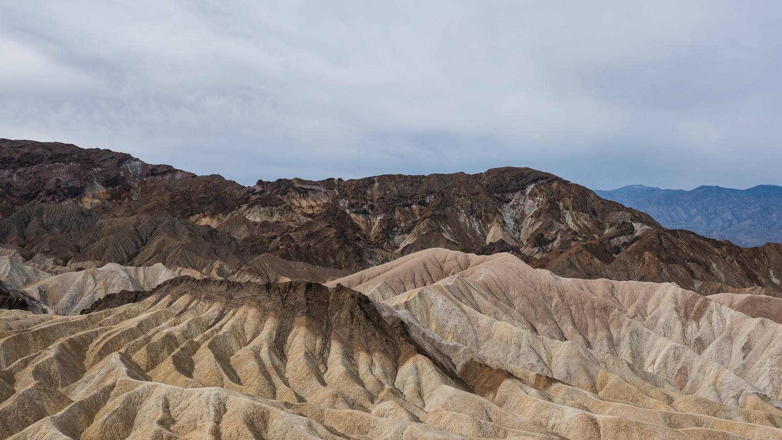
Eroded badlands in Death Valley under flat overcast light — close-packed fins and gullies of pale gold mudstone filling the foreground and middle distance, every ridge cut into fine parallel runnels by rain. Behind them a long wall of dark chocolate and purple-grey rock rises in broken buttresses streaked with cream and pale green mineral bands, and a hazy blue range stands beyond it at the right. The light is even and shadowless and the sky is white.
Christian David / CC BY-SA 4.0 via Wikimedia Commons
California · Region

Death Valley & the Basin Ranges

The Timbisha homeland the maps call Death Valley — the lowest ground in North America, the Panamint wall above it, Trona's tufa spires, and an opera house in the middle of the Amargosa desert.

9 places to explore

The people were never gone, and they are not gone now. The Timbisha — Nümü Tümpisattsi, the people of Tümpisa, named for the red ochre rock paint gathered near Furnace Creek — have lived in this valley for a thousand years and more, moving with the seasons between the salt-pan floor and the cool of the Panamints. When the national monument arrived in 1933 it took their homeland out from under them; the tribe won federal recognition in 1983, and with the Timbisha Homeland Act of 2000 got land back inside the park itself — their village still sits at Furnace Creek, where for decades before that the tribe had been confined to a forty-acre corner of its own country. Hold both names in mind as you drive: the newcomers named this place for death, but the people who know it best named it for pigment, for something the land gives.

The geography runs to extremes and does not apologize for it. The valley floor drops below sea level into salt flats that shimmer white to the horizon, while Telescope Peak stands two miles above the same spot — basin and range at full stretch, inside the largest national park in the contiguous United States. Beyond the park boundary the pattern repeats: the dry lakebed of Panamint Valley, and the Trona Pinnacles' tufa towers rising off a Pleistocene lake bottom like a set for another planet, which they have often played. On the eastern side, the Amargosa country keeps its own strange faith — date shakes and warm springs at Tecopa and Shoshone, and at Death Valley Junction the Amargosa Opera House, where a dancer painted herself an audience on the walls and performed either way.

Come in the cooler months, carry more water than seems reasonable, and let the distances do the talking.

What to See in Death Valley & the Basin Ranges

9 places across the region, grouped by what they are.

Geology & Rock Formations
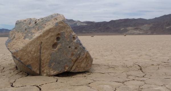
A large angular boulder sitting on the cracked mud polygons of the Racetrack Playa, its base wedged into the dried surface, smaller rocks scattered far out across the flat and a dark banded range along the far edge under a grey sky.

Racetrack Playa

Stovepipe Wells

A dead-flat lakebed where rocks leave trails behind them, twenty-seven miles down a tire-shredding road.

View details →
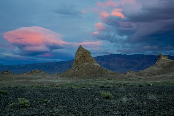
Tufa spires rising from the dark stony floor at the Trona Pinnacles in low dusk light, one tall pinnacle centred against a long dark range, lenticular cloud lit pink above it and low scrub scattered across the foreground.

Trona Pinnacles

Trona

More than five hundred tufa spires standing on a dry Pleistocene lakebed outside Ridgecrest.

View details →
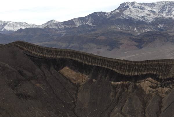
The steep inner wall of Ubehebe Crater, dark grey cinder cut by rain gullies with a pale tan bed exposed partway down and a band of layered black ash along the rim, snow lying on the higher peaks of the range behind.

Ubehebe Crater

Stovepipe Wells

A half-mile-wide steam-blast crater at the north end of the valley, and one of the youngest volcanoes in the park.

View details →
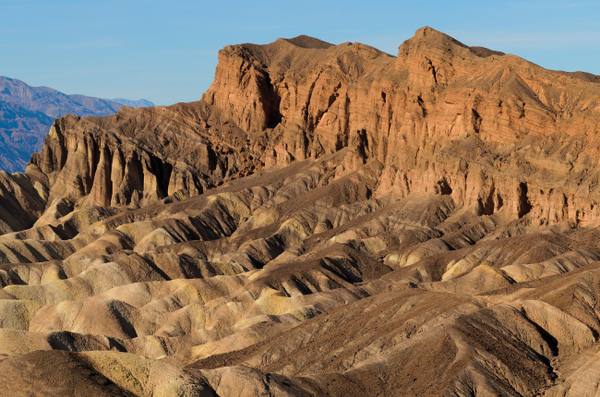
Gullied golden badland ridges below Zabriskie Point running toward the camera in parallel fins, a red-brown cliff wall rising behind them in low warm light and a blue range on the far left horizon.

Zabriskie Point

Furnace Creek

Gullied gold badlands eroded out of an ancient lakebed, best at first light.

View details →

Natural Areas

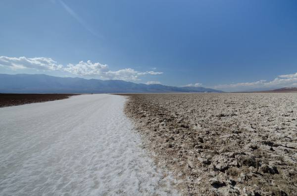
A trampled white salt path running out across the Badwater Basin salt pan, rough crusted salt breaking up the surface to the right and brown mudflat at the left edge, two walkers small in the distance and the Panamint Range low on the horizon under cumulus.

Badwater Basin

Furnace Creek

The lowest ground in North America, a salt pan 282 feet below sea level under two miles of mountain.

View details →
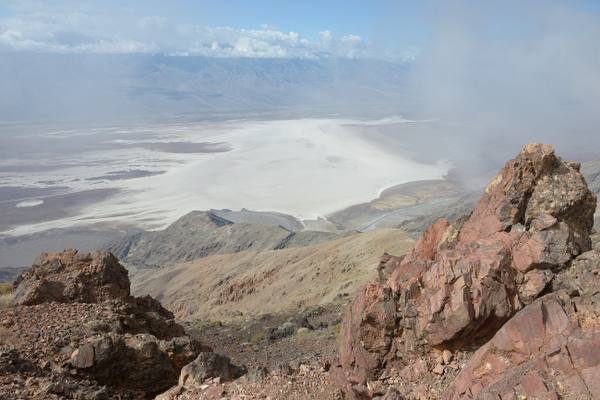
Broken red and grey rock in the foreground at Dantes View, the white Badwater salt pan spread far below with brown alluvial fans running down to its edge, a long range beyond it and cloud drifting across the right of the frame.

Dantes View

Furnace Creek

A 5,475-foot balcony on the Black Mountains crest with Badwater a vertical mile below.

View details →
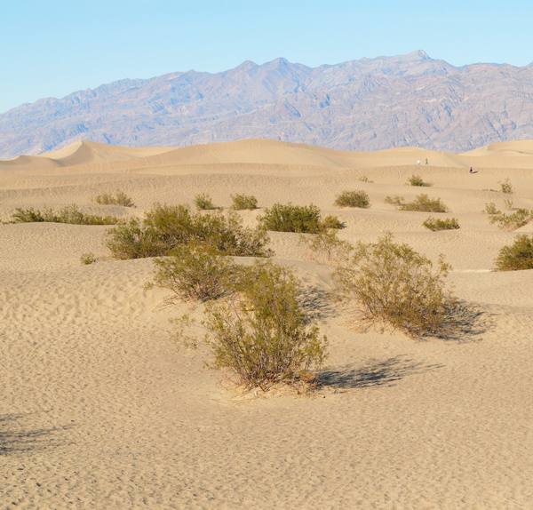
Low sand dunes at Mesquite Flat with mesquite bushes rooted in the hollows between them, one large bush casting a long shadow in the foreground, a rippled dune crest behind with three walkers tiny along it, and a long banded desert range across the horizon under a clear sky.

Mesquite Flat Sand Dunes

Stovepipe Wells

Fourteen square miles of dunes near Stovepipe Wells, and the easiest sand in the park to reach.

View details →

Towns & Gateways

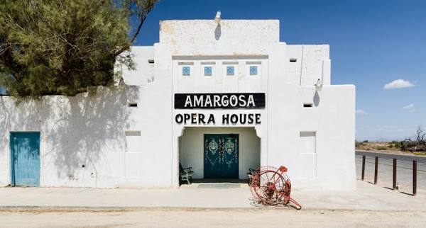
The whitewashed adobe front of the Amargosa Opera House at Death Valley Junction, a painted black sign reading AMARGOSA OPERA HOUSE above green double doors set in an arched recess, a tamarisk shading the left wall and the desert highway running past on the right.

Amargosa Opera House

Death Valley Junction

A dancer painted her own audience on the walls of a desert hall and performed for them for forty years.

View details →
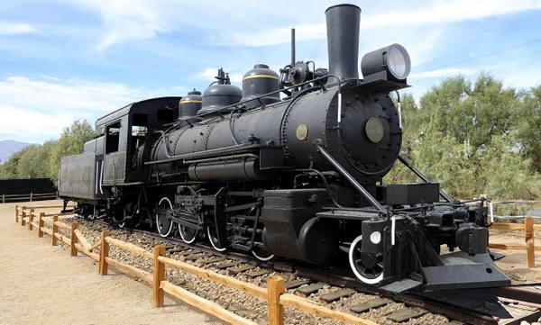
A preserved steam locomotive and tender standing on a short length of track behind a split-rail fence at Furnace Creek, a brass plate numbered 2 on the smokebox door, tamarisk trees behind it and pale desert mountains in the distance.

Furnace Creek

Furnace Creek

The valley hub, the hottest air temperature ever officially recorded, and the Timbisha village that was here first.

View details →

Scenic Drives through Death Valley & the Basin Ranges

Scenic Byway

California 190: Across Death Valley

The road across Death Valley exists because of borax: the twenty-mule-team haul, the company that sold the scenery once the mineral ran out, and the drive from Olancha to the salt.

130 mi · 3 hrs

Stories from Death Valley & the Basin Ranges

Nature

The Fish That Outlived the Lake

Death Valley held a lake six hundred feet deep and ninety miles long, and when it drained the fish did not all go with it — they backed into the springs, one population to a spring, and have been drifting apart ever since in water saltier than the sea and hot enough to kill almost anything else.

7 min read

Death Valley & the Basin Ranges rewards the unhurried. Pick a base, fan out, and let the country between the headline stops surprise you.

← Explore more of Open Road Guide