Home / California / Route 66 & the Mojave Heartland / Barstow
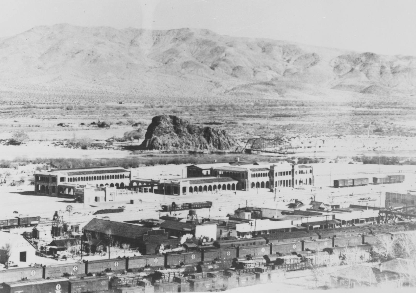
An archival black-and-white photograph looking down over Barstow. The Casa del Desierto Harvey House stands long and low in the middle distance, its arcaded galleries running the length of the frontage to a two-storey end block, with the Santa Fe yard crowded with wooden boxcars across the whole foreground. Beyond the depot a steel truss bridge crosses the Mojave River, a dark rock butte rises on the far bank, and bare desert hills close the horizon.Robert Ward, Historic American Buildings Survey / Public domain via Wikimedia Commons
๐ŸŽญCultural

Barstow

Part ofRoute 66 & the Mojave Heartland
On this driveRoute 66 in California: Needles to the Pacific

The Mojave's rail-and-road hinge, where the Santa Fe yards and Route 66 meet at the Casa del Desierto Harvey House.

Year-RoundFamily-FriendlyPhotographyKid-Friendly
โฑ
Duration
Two to three hours for the Harvey House and its museums; a natural overnight base for the region.
๐Ÿ“…
Best Season
Year round; spring and fall are most comfortable.
๐Ÿ’ก
Fun Fact
The Casa del Desierto's two museums, Route 66 and Western America Railroad, are both free, and the Harvey House also hosts a NASA Goldstone visitor center.

The Story

Barstow is a railroad town that Route 66 happened to run through, and it has been a crossroads ever since. It began as Waterman Junction, a mining and rail point, and took the name Barstow in 1886 for a Santa Fe president; today one of the largest classification yards in the West still sorts freight day and night on the town's north edge. The building that draws travelers off the interstate is Casa del Desierto, House of the Desert, the Harvey House depot the Santa Fe raised in 1911 to replace a wooden station lost to fire. It is a broad, arcaded pile of Spanish Renaissance and Classical Revival brick, one of the finest surviving Harvey Houses anywhere, where Harvey Girls served travelers in two dining rooms, one formal enough to require a jacket, through the golden age of rail. The Harvey House closed in 1973 and the building nearly followed the wrecking ball after the 1992 Landers earthquake, until the city bought it and spent millions on restoration. It works again now as an Amtrak stop and holds two free museums under one roof: the Route 66 Mother Road Museum, with photographs and artifacts of the highway from wagon trail to interstate, and the Western America Railroad Museum, with locomotives and cars parked out along the tracks. Barstow is the practical hinge of this whole region, the last full-service town before the long empty run east on Route 66, and the place to fuel, eat, and sleep before or after the Mojave. The silver camp at Calico sits ten miles northeast, and the long empty run east leads to Amboy and Needles.

Visitor Info

โฑ
Time Needed
Two to three hours for the Harvey House and its museums; a natural overnight base for the region.
๐Ÿ“…
Best Season
Year round; spring and fall are most comfortable.
๐Ÿ›ฃ๏ธ
Highway
I-15 / I-40 / Historic Route 66

On the Map

Stories

Stories featuring this place

Go deeper into the history and character of this stop

History
The Alphabet in the Desert
JoAnn ยท 6 min read
History
The Year California Closed the Road
JoAnn ยท 7 min read

Nearby

The closest stops worth working into your route

historical9.7 mi away
Calico Ghost Town
An 1881 silver boomtown in the calico-colored hills, saved and rebuilt by the founder of Knott's Berry Farm.
historical43 mi away
Doble
Three men with money reopened this mine and all three failed. The town is named after the second one.
natural44 mi away
Baldwin Lake Ecological Reserve
Pebble plains occur in this valley and nowhere else on earth, and the flowers on them are small enough that you have to lie down.
cultural45 mi away
Big Bear Solar Observatory
A reservoir dug for orange groves turned out to be one of the steadiest places on the continent to look at the sun.
industrial46 mi away
Bear Valley Dam
Big Bear Lake is an irrigation reservoir first, and in 1977 the town had to buy the dam to keep water in its own view.
geological46 mi away
Cajon Pass
The gap the San Andreas tore between two mountain ranges, and the doorway every westbound traveler has used for two centuries.

Historical markers nearby

Roadside plaques and monuments within a short detour

Marker0 mi away
Harvey House
Barstow
Marker8 mi away
Possum Trot
Yermo
Marker9.6 mi away
Town of Calico
Yermo
Marker24 mi away
Camp Cady (on the Mojave Road)
Newberry Springs